SLIDE 1
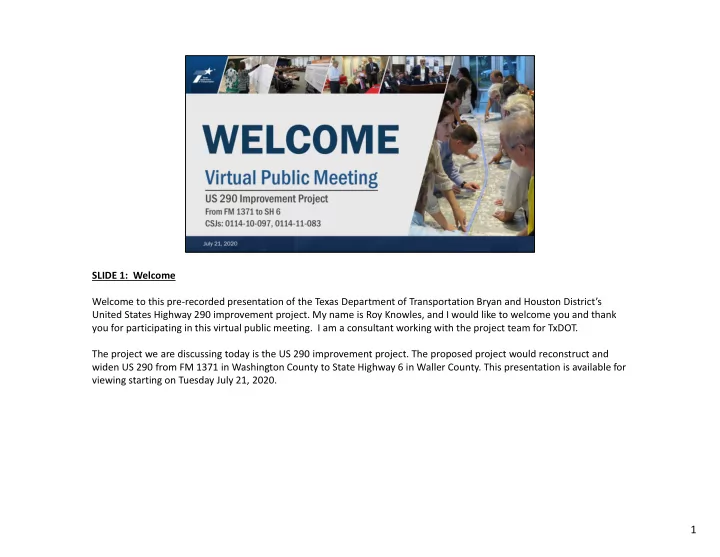
SLIDE 1: Welcome Welcome to this pre‐recorded presentation of the Texas Department of Transportation Bryan and Houston District’s United States Highway 290 improvement project. My name is Roy Knowles, and I would like to welcome you and thank you for participating in this virtual public meeting. I am a consultant working with the project team for TxDOT. The project we are discussing today is the US 290 improvement project. The proposed project would reconstruct and widen US 290 from FM 1371 in Washington County to State Highway 6 in Waller County. This presentation is available for viewing starting on Tuesday July 21, 2020.
1
SLIDE 2
SLIDE 2: Virtual Public Meeting Agenda In this presentation I will describe the proposed project, provide an overview of the environmental issues being studied, explain the next steps and schedule for the project, and provide the methods for submitting comments.
2
SLIDE 3
SLIDE 3: Virtual Public Meeting in Response to Public Health Given the unique circumstances of the COVID‐19 pandemic, along with TxDOT’s commitment to protecting public health during this national emergency, TxDOT is conducting this virtual public meeting to avoid in‐person contact. This online format is being conducted in‐lieu of an in‐person public meeting.
3
SLIDE 4
SLIDE 4: US 290 Project Website Information Project information can be found on the TxDOT web site at www.txdot.gov, Keyword search US 290 from FM 1371. This presentation and the other materials posted on the project web site cover the same information TxDOT would share at an in‐person public meeting. The comment process, however, will be different and will be explained shortly.
4
SLIDE 5 SLIDE 5 : Memorandum of Understanding Although the proposed project is not currently funded, it is anticipated to be programmed with both state and federal
- funds. The project is estimated to cost 123 million dollars. With any project receiving federal funds, TxDOT is required to
evaluate the environmental consequences of the proposed project. The process that is followed is called the National Environmental Policy Act process, otherwise known as NEPA. The NEPA process results in documentation that is provided to a decision maker so the decision maker may make an informed decision on whether or not to proceed with the project. On December 9, 2019, TxDOT received a signed Memorandum of Understanding from the Federal Highway Administration that permits TxDOT to assume responsibility from the Federal Highway Administration to review and approve certain assigned NEPA projects. This review and approval process applies to this project.
5
SLIDE 6
SLIDE 6: US 290 Outreach Methods This virtual public meeting was developed to provide project information for the public and elected officials. TxDOT encourages you to review the materials posted on the project meeting’s webpage and to provide comments on the proposed project. Notices for this meeting were published in the Houston Chronicle on 6/22/20 and 7/6/20, the Brenham Banner Press on 6/21/20 and 7/5/20 and in the Waller Times on 6/24/20 and 7/8/20. Notices were also posted on the TxDOT website, mailed to adjacent property owners and emailed to elected officials.
6
SLIDE 7
SLIDE 7: US 290 Project Overview The proposed project extends on US 290 from FM 1371 in Washington County to State Highway 6 in Waller County for a total of approximately 12 miles. Land along this portion of US 290 is predominately rural with some commercial and residential properties dispersed throughout. Within the project corridor, US 290 is not a controlled access facility, and intersecting roads are stop controlled with stop signs or traffic signal lights when approaching US 290.
7
SLIDE 8
SLIDE 8: US 290 Existing Typical Section In Washington County The existing US 290 in Washington County consists of two 12‐foot wide travel lanes in each direction with outside shoulders that vary from 4 to 12 feet in width. Drainage ditches are on the outside of the travel lanes. The grass median varies from 34 to 46 feet in width and the existing right‐of‐way varies from 210 to 346 feet in width.
8
SLIDE 9
SLIDE 9: US 290 Existing Typical Section In Waller County Existing US 290 in Waller County consists of two 12‐foot wide travel lanes in each direction with outside shoulders that vary from 4 to 10 feet in width. Drainage ditches are on the outside of the travel lanes. The grass median varies from 60 to 190 feet in width and the existing right‐of‐way varies from 200 to 556 feet in width.
9
SLIDE 10
SLIDE 10: US 290 Project Need and Purpose The proposed project is being developed to address two major needs along the project corridor. First, the current 4‐lane divided roadway does not provide adequate mobility to accommodate traffic. Second, crash rates on this segment of US 290 are higher than average crash rates on similar roadways in Texas. The purpose of the proposed project is to improve mobility and safety within the project corridor.
10
SLIDE 11 SLIDE 11: Level of Service Definitions Level of service is a measure of how congested a roadway is. A roadway level of service ranges from A, free flowing traffic to F, which is heavily congested. On the slide you can see the range in level of service, from blue, or free flowing on the left, to red, or heavily congested,
11
SLIDE 12
SLIDE 12: US 290 – 2052 Morning Traffic Volumes and Level of Service Traffic volumes in the project area are expected to increase by approximately 35% from now through 2052. For the No‐ Build alternative, which means the roadway would not be improved, in the year 2052 US 290 is projected to operate at levels of service B and C in the eastern portion of the project, and D and E in the western portion of the project during peak morning traffic. With the Build Alternative, the level of service for the project corridor is projected to operate a levels of service A, B and C respectively.
12
SLIDE 13
SLIDE 13: US 290 – 2052 Evening Traffic Volumes and Level of Service For the No‐Build alternative US 290 is projected to operate at levels of service B, C, D and E during the evening peak traffic in the year 2052. With the Build Alternative the project corridor is projected to operate at levels of service A, B and C during evening peak traffic.
13
SLIDE 14 SLIDE 14: US 290 Safety and Crash Analysis (Years 2014 – 2018) A crash analysis was conducted along the project corridor for the years 2014 through 2018. The map on the top of the slide shows crash density with the purple color indicating areas of low crash volumes and red and yellow colors indicating areas of higher crash volumes. The green X’s mark ten locations where fatal crashes have occurred. Crash hot spots are shown in yellow for locations where there is a high crash rate. These locations include FM 1155, FM 117, the Brazos River Bridge, FM 1736 and Urban Road. Between 2014 and 2018 there were 311 crashes along the project limits, with 9 percent, or 29 crashes occurring at FM
- 1155. The TxDOT statewide average crash rate for a similar roadway is shown by the orange line on the chart on the
bottom left‐side of the screen. Crash rates are measured per 100 million vehicle miles. Crash rates occurring along the project limits were higher than the statewide average crash rates during the years 2015, 2016 and 2018. For the year 2015 the crash rate was 72.86 as compared to the statewide average rate of 70.42, exceeding the state‐wide average by 2.44 per 100 million vehicle miles. For the year 2016 the rate was 87.67 as compared to the statewide average of 66.35, exceeding the state‐wide average by 21.32. For the year 2018 the rate was 74.25 as compared to the statewide average rate of 72.08, exceeding the state‐wide average by 2.17 per 100 million vehicle miles.
14
SLIDE 15
SLIDE 15: Proposed US 290 Project Description The proposed project is to widen US 290 from an existing four lane divided highway to a six‐lane divided highway. Twelve‐foot‐wide inside and outside shoulders would be constructed along with left‐turn lanes. We also propose to construct six detention ponds to accommodate drainage needs.
15
SLIDE 16 SLIDE 16: US 290 Proposed Typical Section in Washington County A typical section is a technical term for the roadway design. Three typical sections are proposed for the project. This slide shows the proposed typical section for the portion of the project in Washington County from FM 1371 to the Brazos
- River. This section would be a six‐lane roadway, which includes three 12‐foot‐wide travel lanes in each direction, 12‐foot‐
wide inside and outside shoulders, and a remaining median that varies from 20 to 28 feet wide. You can see by the blue shaded areas on the slide that the road widening would use existing right‐of‐way from both the median and the outside shoulder and ditch area. The drainage ditches would be improved to meet five‐year or ten‐year storm events as the project design allows.
16
SLIDE 17 SLIDE 17: US 290 Proposed Typical Section 1 in Waller County This slide shows the proposed typical section for the portion of the project in Waller County, from the Brazos River to SH
- 6. This part of the project would include a six‐lane roadway with three 12‐foot‐wide travel lanes in each direction, 12‐
foot‐wide inside and outside shoulders and outside ditches. As with the previous slide, the blue shaded area shows where the road would be widened. In this case widening would take place in the median. The remaining median would be reduced by approximately 48 feet and would then vary from 20 to 48 feet in width. The drainage ditches would be improved at their existing locations to meet either five‐year or ten‐year storm events as the project design allows.
17
SLIDE 18
SLIDE 18: US 290 Proposed Typical Section 2 in Waller County For the section in Waller County where the existing right‐of‐way is wider, a median of 12 to 48 feet in width would remain after adding the proposed lanes.
18
SLIDE 19
SLIDE 19 Proposed Typical Crossover Layout TxDOT realizes that by adding a travel lane in each direction the proposed project design could create a safety issue for vehicles crossing US 290 from a side street to the other side or from a side street wanting to turn left. A way to address this safety concern is to close crossovers or use an alternative intersection design. Although the draft schematic shows crossovers in their current or existing configuration, all crossovers are being evaluated for further safety improvements. These safety improvements may include the closing or removal of the crossover. The crossovers that remain may incorporate newer alternative intersection designs that reduce conflict points and improve safety by eliminating the crossing and left turn movements from side streets. This slide shows an example of a proposed alternative intersection design.
19
SLIDE 20
SLIDE 20: Proposed Detention Ponds Earlier I mentioned that detention ponds are proposed for the project. The project team anticipates that six detention ponds would be required to improve drainage. Four proposed detention ponds would be located on new right‐of‐way and two ponds would be located within existing right‐of‐way. The total amount of right‐of‐way needed for detention ponds is estimated at 18 acres. The next few slides show potential locations for detention ponds.
20
SLIDE 21
SLIDE 21: US 290 Potential Detention Pond #1 The first four detention ponds are proposed on new right‐of‐way. Detention pond number 1 is proposed to be located near the western project limit, north of FM 1371 and east of FM 1155. This pond is approximately 4.2 acres.
21
SLIDE 22
SLIDE 22: US 290 Potential Detention Pond #2 The second detention pond is proposed on the south side of US 290 and west of Marshall Road. This pond would need approximately 5 acres of new right‐of‐way.
22
SLIDE 23
SLIDE 23: US 290 Potential Detention Pond #3 Detention Pond number 3 is proposed to be located on the south side of US 290, east of Sorsby Road. This pond would need approximately 7.5 acres of new right‐of‐way.
23
SLIDE 24
SLIDE 24: US 290 Potential Detention Pond #4 Detention Pond number 4 is proposed to be located on the south side of US 290 just west of Blasingame Road. This pond would need approximately 1 acre of new right‐of‐way.
24
SLIDE 25
SLIDE 25: US 290 Potential Detention Ponds #5 and #6 Detention Ponds 5 and 6 are proposed to be located at the eastern project limit north of the intersection of US 290 and SH 6. These ponds total approximately three and a half acres and would be within existing right‐of‐way.
25
SLIDE 26
SLIDE 26: Environmental Studies The project team is in the process of identifying and evaluating potential environmental impacts that could occur from constructing the project. Areas being reviewed include wetlands, floodplains and floodways, hazardous materials, cultural resources, community impacts and environmental justice, air quality, traffic noise and threatened and endangered species. The project would be designed to avoid or minimize impacts to the greatest amount practicable. Results from each analysis will be documented and available for review once completed.
26
SLIDE 27 SLIDE 27: Right‐of‐Way Acquisition The project team estimates that approximately 18 acres of additional right‐of–way would be required for the proposed
- project. Residential or commercial structure displacements are not anticipated.
27
SLIDE 28 SLIDE 28: Next Steps This slide shows the continuing steps of the project development process. After the comment period closes on August 5, 2020, the project team will review the comments received, prepare responses to the comments, and produce a Virtual Public Meeting Summary report. This report will be available for your review on the meeting notice webpage approximately three months after the close of the comment period. In the next several months the project team will also complete environmental studies and refine the project design taking into consideration comments received. Additional public involvement will be scheduled once environmental analysis and the project design are further
- developed. The project would move into detailed design and right‐of‐way acquisition after an environmental clearance
decision has been made. As mentioned earlier, the project is not currently funded so dates for possible right‐of‐way acquisition, detailed design, and the start of construction are presently unknown. Construction is not currently anticipated to begin before 2030 unless funding is identified.
28
SLIDE 29
SLIDE 29: Public Meeting Materials The project meeting webpage includes all the materials presented tonight including this pre‐recorded presentation, exhibit boards, a fact sheet, an environmental constraints map, the draft schematic, a comment form and project contact information.
29
SLIDE 30
SLIDE 30: How to Submit Your Written Comments TxDOT encourages you to review the project materials posted on the meeting webpage and provide written comments. Given our current COVID‐19 situation, we ask you to provide comments in the following ways: Email to hou‐piowebmail@txdot.gov Mail to the TxDOT Houston District, Attention: Director of Advanced Project Development, P.O. Box 1386, Houston, Texas, 77251‐1386 Online by visiting www.TxDOT.gov and searching in the upper right‐hand search box for “US 290 from FM 1371.” Click on the comment form links on the website. A QR code is provided on the bottom right of this slide. You can be directed to the project web page by scanning the QR code with the camera function of your smart phone. The comment form can be downloaded from the meeting webpage. Please submit your comments by midnight August 5 to be included in the official public record.
30
SLIDE 31
SLIDE 31: Contact Information If you have questions please feel free to contact Ms. Zain Walkabout, TxDOT’s project manager at 713 569‐3540 at any time during the project development process.
31
SLIDE 32
32 SLIDE 32: Thank You Thank you for participating in this virtual public meeting for the US 290 Improvement Project.