
SLIDE 1
1
U.S. Department of Transportation
1 U.S. Department of Transportation Connected Vehicle Pilot - - PowerPoint PPT Presentation
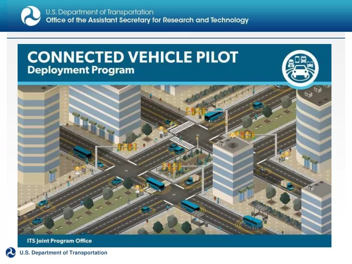
1 U.S. Department of Transportation Connected Vehicle Pilot Deployment Program U.S. Department of Transportation Announces up to $42 Million in Next Generation Connected Vehicle Technologies September 15, 2015 New York City Tampa, FL
1
U.S. Department of Transportation
2
U.S. Department of Transportation
Connected Vehicle Pilot Deployment Program
U.S. Department of Transportation Announces up to $42 Million in Next Generation Connected Vehicle Technologies September 15, 2015
3
U.S. Department of Transportation
□ Regional metro area □ Freight corridor □ Urban
□ Tampa □ Wyoming □ New York City
4
U.S. Department of Transportation
□ Regional metro area □ Freight corridor □ Urban
□ Tampa □ Wyoming □ New York City
2
U.S. Department of Transportation ITS Joint Program Office
The H.W. Halleck Expressway:
freeway
S-Curve
both minor (frequent) and major
□ Colfax S-curve is a natural bottleneck □ Multiple interchanges leads to merge/weave delays
□ Response to major incidents lack coordination among agencies □ Frequent minor incidents makes travel times unpredictable
□ Arterial diversion routes have limited capacity, easily overwhelmed □ Mass diversions lead to gridlock on local arterials
U.S. Department of Transportation ITS Joint Program Office
U.S. Department of Transportation ITS Joint Program Office
Goal Performance Measure Performance Target
Improve Colfax S- Curve throughput Peak period throughput Increase peak period throughput by 8% Reduce major incident delays Delays due to major incidents Cut delay from major incidents by 25% Manage diversions better Number of gridlock events “Zero tolerance” for arterial gridlock during freeway incidents
V2V Safety
Emergency Electronic Brake Lights (EEBL) Forward Collision Warning (FCW) Intersection Movement Assist (IMA) Left Turn Assist (LTA) Blind Spot/Lane Change Warning (BSW/LCW) Do Not Pass Warning (DNPW) Vehicle Turning Right in Front of Bus Queue Warning (Q-WARN) Cooperative Adaptive Cruise Control (CACC) Incident Scene Pre-Arrival Staging Guidance for Emergency Responders (RESP-STG) Incident Scene Work Zone Alerts for Drivers and Workers (INC-ZONE) Emergency Communications and Evacuation (EVAC) Connection Protection (T-CONNECT) Dynamic Transit Operations (T-DISP)
V2I Safety Environment Mobility
Advanced Traveler Information System Intelligent Traffic Signal System (I-SIG) Signal Priority (transit, freight) Mobile Accessible Pedestrian Signal System (PED-SIG) Emergency Vehicle Preemption (PREEMPT) Dynamic Speed Harmonization (SPD- HARM) Eco-Approach and Departure at Signalized Intersections Eco-Traffic Signal Timing Eco-Traffic Signal Priority Connected Eco-Driving Wireless Inductive/Resonance Charging Eco-Lanes Management Eco-Speed Harmonization Eco-Cooperative Adaptive Cruise Control Eco-Traveler Information Eco-Ramp Metering Low Emissions Zone Management AFV Charging / Fueling Information Eco-Smart Parking Dynamic Eco-Routing (light vehicle, transI it
m
, fp re
r
io gh
v
te ) Colfax S-Curve Eco-ICM Dec
T
is
h
ir
Sg uh pp
p
rt
tSystem
Agency Data
Probe-based Pavement Maintenance Probe-enabled Traffic Monitoring Vehicle Classification-based Traffic Studies CV-enabled Turning Movement & Intersection Analysis CV-enabled Origin-Destination Studies Work Zone Traveler Information Warning (Transit)
Road Weather
Dynamic Ridesharing (D-RIDE) Freight-Specific Dynamic Travel Planning and Performance Drayage OS pm timia za
r
tt ion
Roadside
Wireless Inspection Smart Truck Parking
U.S. Department of Transportation ITS Joint Program Office
Red Light Violation Warning Curve Speed Warning Stop Sign Gap Assist Spot Weather Impact Warning Reduced Speed/Work Zone Warning Pedestrian in Signalized Crosswalk Warning (Transit) Motorist Advisories and Warnings (MAW) Enhanced MDSS Vehicle Data Translator (VDT) Weather Response Traffic Information (WxTINFO)
Improve Throughput
V2V Safety V2I Safety Environment Mobility
Advanced Traveler Information System Intelligent Traffic Signal System (I-SIG) Signal Priority (transit, freight) Mobile Accessible Pedestrian Signal System (PED-SIG) Emergency Vehicle Preemption (PREEMPT) Dynamic Speed Harmonization (SPD-HARM) Queue Warning (Q-WARN) Cooperative Adaptive Cruise Control (CACC) Incident Scene Pre-Arrival Staging Guidance for Emergency Responders (RESP-STG) Incident Scene Work Zone Alerts for Drivers and Workers (INC-ZONE) Emergency Communications and Evacuation (EVAC) Connection Protection (T-CONNECT) Dynamic Transit Operations (T-DISP)
Agency Data
Eco-Approach and Departure at Signalized Intersections Eco-Traffic Signal Timing Eco-Traffic Signal Priority Connected Eco-Driving Wireless Inductive/Resonance Charging Eco-Lanes Management Eco-Speed Harmonization Eco-Cooperative Adaptive Cruise Control Eco-Traveler Information Eco-Ramp Metering Low Emissions Zone Management AFV Charging / Fueling Information Eco-Smart Parking Dynamic Eco-Routing (light vehicle, transit, freight) Eco-ICM Decision Support System
Reduce Incident Delay
Dynamic Ridesharing (D-RIDE) Freight-Specific Dynamic Travel Planning and Performance Drayage OS pm timia za
r
tt ion
Roadside
Wireless Inspection Smart Truck Parking
Road Weather
Probe-based Pavement Maintenance Probe-enabled Traffic Monitoring Vehicle Classification-based Traffic Studies CV-enabled Turning Movement & Intersection Analysis CV-enabled Origin-Destination Studies Work Zone Traveler Information
U.S. Department of Transportation ITS Joint Program Office
Red Light Violation Warning Curve Speed Warning Stop Sign Gap Assist Spot Weather Impact Warning Reduced Speed/Work Zone Warning Pedestrian in Signalized Crosswalk Warning (Transit) Emergency Electronic Brake Lights (EEBL) Forward Collision Warning (FCW) Intersection Movement Assist (IMA) Left Turn Assist (LTA) Blind Spot/Lane Change Warning (BSW/LCW) Do Not Pass Warning (DNPW) Vehicle Turning Right in Front of Bus Warning (Transit) Motorist Advisories and Warnings (MAW) Enhanced MDSS Vehicle Data Translator (VDT) Weather Response Traffic Information (WxTINFO)
V2V Safety V2I Safety Environment Mobility
Advanced Traveler Information System Intelligent Traffic Signal System (I-SIG) Signal Priority (transit, freight) Mobile Accessible Pedestrian Signal System (PED-SIG) Emergency Vehicle Preemption (PREEMPT) Dynamic Speed Harmonization (SPD-HARM) Queue Warning (Q-WARN) Cooperative Adaptive Cruise Control (CACC) Incident Scene Pre-Arrival Staging Guidance for Emergency Responders (RESP-STG) Incident Scene Work Zone Alerts for Drivers and Workers (INC-ZONE) Emergency Communications and Evacuation (EVAC) Connection Protection (T-CONNECT) Dynamic Transit Operations (T-DISP) Dynamic Ridesharing (D-RIDE) Freight-Specific Dynamic Travel Planning and
Agency Data
Eco-Approach and Departure at Signalized Intersections Eco-Traffic Signal Timing Eco-Traffic Signal Priority Connected Eco-Driving Wireless Inductive/Resonance Charging Eco-Lanes Management Eco-Spee
Z
d
eH ro
arT m
n
e
iz
ra at n
io
c
ne for Eco-C
A
p
e
er ri a
a
til ve
G
A
rd id
al p
ve
kC U
rn uid se
er
Control Eco-TraI v
n
ec lei rd In
efn
rm
C
a
ditions
Eco-Ramp Metering Low Emissions Zone Management AFV Charging / Fueling Information Eco-Smart Parking Dynamic Eco-Routing (light vehicle, transit, freight) Eco-ICM Decision Support System
Road Weather
Probe-based Pavement Maintenance Probe-enabled Traffic Monitoring Vehicle Classification-based Traffic Studies CV-enabled Turning Movement & Intersection Analysis CV-enabled Origin-Destination Studies Work Zone Traveler Information Performance Drayage Optimization
Smart Roadside
Wireless Inspection Smart Truck Parking
U.S. Department of Transportation ITS Joint Program Office
Red Light Violation Warning Curve Speed Warning Stop Sign Gap Assist Spot Weather Impact Warning Reduced Speed/Work Zone Warning Pedestrian in Signalized Crosswalk Warning (Transit) Emergency Electronic Brake Lights (EEBL) Forward Collision Warning (FCW) Intersection Movement Assist (IMA) Left Turn Assist (LTA) Blind Spot/Lane Change Warning (BSW/LCW) Do Not Pass Warning (DNPW) Vehicle Turning Right in Front of Bus Warning (Transit) Motorist Advisories and Warnings (MAW) Enhanced MDSS Vehicle Data Translator (VDT) Weather Response Traffic Information (WxTINFO)
Zero tolerance for Arterial Gridlock
U.S. Department of Transportation
Improve Bottleneck Throughput
Reduce Incident Delay
(RESP-STG)
Manage Diversions Better
ITS Joint Program Office
U.S. Department of Transportation
Projected Synergies and Impacts from Bottleneck Throughput Applications in the Deployment Concept
Bottleneck Throughput Apps:
Brake Lights
Projected Impacts:
reduces incidents and raises bottleneck throughput by 8%
assisted by in-vehicle warnings for crash avoidance
diversions
response
ITS Joint Program Office
Projected Synergies and Impacts from Incident Management Applications in the Deployment Concept
Incident Management Apps:
Emergency Responders (RESP-STG)
and Workers (INC-ZONE)
Projected Impacts:
management cuts major incident delay by 25%
bottleneck throughput
risk of over-diversion to arterials
U.S. Department of Transportation ITS Joint Program Office
U.S. Department of Transportation ITS Joint Program Office
Projected Synergies and Impacts from Diversion Management Applications in the Deployment Concept
Diversion Management Apps:
Projected Impacts:
alternatives
private) manages diversion rates
service providers allows for fine-tuning of signal control
Integrated Concept for H. W. Halleck Expressway
Signals Adapt to Prevent Gridlock Messages for V2V Safety Applications also Support Incident Zone Management Safety Vehicle Probe Data Integrated with Freeway Sensors to Harmonize Flow Coordinated Multi- Agency Response Planning Aggregated Data From Traveler Information Services Used T
17
U.S. Department of Transportation
□ Regional metro area □ Freight corridor □ Urban
□ Tampa □ Wyoming □ New York City
18
U.S. Department of Transportation
19
U.S. Department of Transportation
U.S. Department of Transportation ITS Joint Program Office
I-876 Productivity Corridor:
ports and intermodal facilities in Northeastern U.S.
centers and facilities
Eastern seaboard for travel reliability
20
U.S. Department of Transportation
U.S. Department of Transportation ITS Joint Program Office
□ Heavy congested freeways interferes with timely and reliable freight
movement and hinders economic development
□ Underutilized freight facilities, infrastructure, and mobile assets □ Frequent empty moves within the corridor create non-optimal utilization
□ Port, airport and inter-modal access subject to surge demand and long
waits
□ Truck-vehicle conflicts in hilly merge/weave sections near interchanges □ Truck-involved crashes caused by lane changing and blind spots
21
U.S. Department of Transportation
U.S. Department of Transportation ITS Joint Program Office
Goal Performance Measure Performance Target
Improve Truck Travel Times Freight travel times Reduce freight vehicles travel times by 17% Reduce Number of Wasted Trips Number of wasted truck trips Reduce the number
15% Improve truck safety Number of truck related conflicts Reduce truck- related conflicts by 30%
22
U.S. Department of Transportation
U.S. Department of Transportation ITS Joint Program Office
V2V Safety V2I Safety Environment
Probe-based Pavement Maintenance Probe-enabled Traffic Monitoring Vehicle Classification-based Traffic Studies CV-enabled Turning Movement & Intersection Analysis CV-enabled Origin-Destination Studies Work Zone Traveler Information Advanced Traveler Information System Intelligent Traffic Signal System (I-SIG) Signal Priority (transit, freight) Mobile Accessible Pedestrian Signal System (PED-SIG) Emergency Vehicle Preemption (PREEMPT) Dynamic Speed Harmonization (SPD-HARM) Queue Warning (Q-WARN) Cooperative Adaptive Cruise Control (CACC) Incident Scene Pre-Arrival Staging Guidance for Emergency Responders (RESP-STG) Incident Scene Work Zone Alerts for Drivers and Workers (INC-ZONE) Emergency Communications and Evacuation (EVAC) Connection Protection (T-CONNECT) Dynamic Transit Operations (T-DISP) Dynamic Ridesharing (D-RIDE) Freight-Specific Dynamic Travel Planning and Performance Drayage Optimization
Mobility Agency Data
Eco-Approach and Departure at Signalized Intersections Eco-Traffic Signal Timing Eco-Traffic Signal Priority Connected Eco-Driving Wireless Inductive/Resonance Charging Eco-Lanes Management Eco-Speed Harmonization Eco-Cooperative Adaptive Cruise Control Eco-Traveler Information Eco-Ramp Metering Low Emissions Zone Management AFV Charging / Fueling Information Eco-Smart Parking Dynamic Eco-Routing (light vehicle, transit, freight) Eco-ICM Decision Support System
Road Weather Smart Roadside
Red Light Violation Warning Curve Speed Warning Stop Sign Gap Assist Spot Weather Impact Warning Reduced Speed/Work Zone Warning Pedestrian in Signalized Crosswalk Warning (Transit) Wireless Inspection Emergency Electronic Brake Lights (EEBL) Forward Collision Warning (FCW) Intersection Movement Assist (IMA) Left Turn Assist (LTA) Blind Spot/Lane Change Warning (BSW/LCW) Do Not Pass Warning (DNPW) Vehicle Turning Right in Front of Bus Warning (Transit) Smart Truck Parking
Improve Reliability
Motorist Advisories and Warnings (MAW) Enhanced MDSS Vehicle Data Translator (VDT) Weather Response Traffic Information (WxTINFO)
23
U.S. Department of Transportation
U.S. Department of Transportation ITS Joint Program Office
V2V Safety
Left Turn Assist (LTA) Blind Spot/Lane Change Warning (BSW/LCW) Do Not Pass Warning (DNPW)
V2I Safety Environment Mobility
Emergency Electronic Brake Lights (EEBL) Forward Collision Warning (FCW) Intersection Movement Assist (IMA) Vehicle Turning Right in Front of Bus Warning (Transit)
Road Weather
Probe-based Pavement Maintenance Probe-enabled Traffic Monitoring Vehicle Classification-based Traffic Studies CV-enabled Turning Movement & Intersection Analysis CV-enabled Origin-Destination Studies Work Zone Traveler Information Advanced Traveler Information System Intelligent Traffic Signal System (I-SIG) Signal Priority (transit, freight) Mobile Accessible Pedestrian Signal System (PED-SIG) Emergency Vehicle Preemption (PREEMPT) Dynamic Speed Harmonization (SPD-HARM) Queue Warning (Q-WARN) Cooperative Adaptive Cruise Control (CACC) Incident Scene Pre-Arrival Staging Guidance for Emergency Responders (RESP-STG) Incident Scene Work Zone Alerts for Drivers and Workers (INC-ZONE) Emergency Communications and Evacuation (EVAC) Connection Protection (T-CONNECT) Dynamic Transit Operations (T-DISP) Dynamic Ridesharing (D-RIDE) Freight-Specific Dynamic Travel Planning and Performance Drayage Optimization
Agency Data
Eco-Approach and Departure at Signalized Intersections Eco-Traffic Signal Timing Eco-Traffic Signal Priority Connected Eco-Driving AFV Charging / Fueling Information Eco-Smart Parking Dynamic Eco-Routing (light vehicle, transit, freight) Eco-ICM Decision Support System
Smart Roadside
Wireless Inspection Smart Truck Parking WirelesI s
m
In
p
dr u
tiv
e
e/
T
R
re u
s
c
na
S
na ce
fe
C
ty
harging Eco-Lanes Management Eco-Speed Harmonization Eco-Cooperative Adaptive Cruise Control Eco-Traveler Information Eco-Ramp Metering Low Emissions Zone Management Red Light Violation Warning Curve Speed Warning Stop Sign Gap Assist Spot Weather Impact Warning Reduced Speed/Work Zone Warning Pedestrian in Signalized Crosswalk Warning (Transit) Motorist Advisories and Warnings (MAW) Enhanced MDSS Vehicle Data Translator (VDT) Weather Response Traffic Information (WxTINFO)
Improve Truck Safety
24
U.S. Department of Transportation
U.S. Department of Transportation ITS Joint Program Office
Improve Freight Productivity
Improve Truck Safety
25
U.S. Department of Transportation
U.S. Department of Transportation ITS Joint Program Office
/Lane Change Warning (LCW)
Truck Safety Apps Projected Impacts:
conflicts and crashes
reliability , particularly around hilly interchanges
26
U.S. Department of Transportation
U.S. Department of Transportation ITS Joint Program Office
Projected Synergies and Impacts from Freight Reliability Applications in the Deployment Concept
Information System (FRA TIS)
Freight Reliability Apps Projected Impacts:
cargo need
intermodal facilities when wait times are short
27
U.S. Department of Transportation
Drayage Movements Dynamically Optimized
Integrated Concept for I-876 Corridor
Intermodal Facility Wait Times Measured and Shared Roadside infrastructure used for both electronic inspections and safety applications In-Vehicle Truck T echnologies Support Both V2V and V2I Applications Signals Timed to Prioritize for Gate Demand at Intermodal Facilities
28
U.S. Department of Transportation
□ Regional metro area □ Freight corridor □ Urban
□ Tampa □ Wyoming □ New York City
U.S. Department of Transportation ITS Joint Program Office
Sunnyside’s central business district :
□ Heavy congestion at peak times □ Transit vehicles schedule reliability
□ Pedestrian-vehicle conflicts □ Crashes in unprotected left hand
turns
□ Emissions/Air Quality hot spots □ Poor progression results in wasted
fuel
U.S. Department of Transportation ITS Joint Program Office
U.S. Department of Transportation ITS Joint Program Office
Goal Performance Measure Performance Target
Increase transit reliability Transit schedule adherence Transit vehicles on schedule 90% of the time Improve pedestrian safety Pedestrian-vehicle conflicts Reduce pedestrian- vehicle conflicts by 50% Improve hot spot air quality Emissions Reduce emissions by 20%
V2V Safety V2I Safety Environment
Advanced Traveler Information System Intelligent Traffic Signal System (I-SIG) Signal Priority (transit, freight) Mobile Accessible Pedestrian Signal System (PED-SIG) Emergency Vehicle Preemption (PREEMPT) Dynamic Speed Harmonization (SPD-HARM) Queue Warning (Q-WARN) Cooperative Adaptive Cruise Control (CACC) Incident Scene Pre-Arrival Staging Guidance for Emergency Responders (RESP-STG) Incident Scene Work Zone Alerts for Drivers and Workers (INC-ZONE) Emergency Communications and Evacuation (EVAC) Connection Protection (T-CONNECT) Dynamic Transit Operations (T-DISP) Dynamic Ridesharing (D-RIDE) Freight-Specific Dynamic Travel Planning and
Mobility Agency Data
Eco-Approach and Departure at Signalized Intersections Eco-Traffic Signal Timing Eco-Traffic Signal Priority Connected Eco-Driving Wireless Inductive/Resonance Charging Eco-Lanes Management Eco-Speed Harmonization Eco-Cooperative Adaptive Cruise Control Eco-Traveler Information Eco-Ramp Metering Low Emissions Zone Management AFV Charging / Fueling Information Eco-Smart Parking Dynamic Eco-Routing (light vehicle, transit, freight) Eco-ICM Decision Support System Red Light Violation Warning Curve Speed Warning Stop Sign Gap Assist Spot Weather Impact Warning Reduced Speed/Work Zone Warning Pedestrian in Signalized Crosswalk Warning (Transit) Emergency Electronic Brake Lights (EEBL) Forward Collision Warning (FCW) Intersection Movement Assist (IMA) Left Turn Assist (LTA) Blind Spot/Lane Change Warning (BSW/LCW) Do Not Pass Warning (DNPW) Vehicle Turning Right in Front of Bus Warning (Transit)
Transit Reliability
Road Weather
Probe-based Pavement Maintenance Probe-enabled Traffic Monitoring Vehicle Classification-based Traffic Studies CV-enabled Turning Movement & Intersection Analysis CV-enabled Origin-Destination Studies Work Zone Traveler Information Performance Drayage Optimization
Smart Roadside
Wireless Inspection Smart Truck Parking
U.S. Department of Transportation ITS Joint Program Office
Motorist Advisories and Warnings (MAW) Enhanced MDSS Vehicle Data Translator (VDT) Weather Response Traffic Information (WxTINFO)
V2V Safety
Freight-Specific Dynamic Travel Planning and
V2I Safety Environment
Advanced Traveler Information System Intelligent Traffic Signal System (I-SIG) Signal Priority (transit, freight) Mobile Accessible Pedestrian Signal System (PED-SIG) Emergency Vehicle Preemption (PREEMPT) Dynamic Speed Harmonization (SPD-HARM) Queue Warning (Q-WARN) Cooperative Adaptive Cruise Control (CACC) Incident Scene Pre-Arrival Staging Guidance for Emergency Responders (RESP-STG) Incident Scene Work Zone Alerts for Drivers and Workers (INC-ZONE) Emergency Communications and Evacuation (EVAC) Connection Protection (T-CONNECT) Dynamic Transit Operations (T-DISP) Dynamic Ridesharing (D-RIDE)
Mobility Agency Data
Eco-Approach and Departure at Signalized Intersections Eco-Traffic Signal Timing Eco-Traffic Signal Priority Connected Eco-Driving Wireless Inductive/Resonance Charging Eco-Lanes Management Eco-Speed Harmonization Eco-Cooperative Adaptive Cruise Control Eco-Traveler Information Eco-Ramp Metering Low Emissions Zone Management AFV Charging / Fueling Information Eco-Smart Parking Dynamic Eco-Routing (light vehicle, transit, freight) Eco-ICM Decision Support System
Pedestrian Vehicle Conflicts
Road Weather
Probe-based Pavement Maintenance Probe-enabled Traffic Monitoring Vehicle Classification-based Traffic Studies CV-enabled Turning Movement & Intersection Analysis CV-enabled Origin-Destination Studies Work Zone Traveler Information Performance Drayage Optimization
Smart Roadside
Wireless Inspection Smart Truck Parking
U.S. Department of Transportation ITS Joint Program Office
Red Light Violation Warning Curve Speed Warning Stop Sign Gap Assist Spot Weather Impact Warning Reduced Speed/Work Zone Warning Pedestrian in Signalized Crosswalk Warning (Transit) Emergency Electronic Brake Lights (EEBL) Forward Collision Warning (FCW) Intersection Movement Assist (IMA) Left Turn Assist (LTA) Blind Spot/Lane Change Warning (BSW/LCW) Do Not Pass Warning (DNPW) Vehicle Turning Right in Front of Bus Warning (Transit) Motorist Advisories and Warnings (MAW) Enhanced MDSS Vehicle Data Translator (VDT) Weather Response Traffic Information (WxTINFO)
V2V Safety V2I Safety Environment
Advanced Traveler Information System Intelligent Traffic Signal System (I-SIG) Signal Priority (transit, freight) Mobile Accessible Pedestrian Signal System (PED-SIG) Emergency Vehicle Preemption (PREEMPT) Dynamic Speed Harmonization (SPD-HARM) Queue Warning (Q-WARN) for Emergency Responders (RESP-STG) Incident Scene Work Zone Alerts for Drivers and Workers (INC-ZONE) Emergency Communications and Evacuation (EVAC) Connection Protection (T-CONNECT) Dynamic Transit Operations (T-DISP) Dynamic Ridesharing (D-RIDE) Freight-Specific Dynamic Travel Planning and
Mobility Agency Data
Eco-Approach and Departure at Signalized Intersections Eco-Traffic Signal Timing Eco-Traffic Signal Priority Connected Eco-Driving Wireless Inductive/Resonance Charging Eco-Lanes Management Eco-Speed Harmonization Eco-Cooperative Adaptive Cruise Control Eco-Traveler Information Eco-Ramp Metering Low Emissions Zone Management AFV Charging / Fueling Information Eco-Smart Parking Dynamic Eco-Routing (light vehicle, transit, freight) Eco-ICM Decision Support System
Road Weather
Probe-based Pavement Maintenance Probe-enabled Traffic Monitoring Vehicle Classification-based Traffic Studies CV-enabled Turning Movement & Intersection Analysis CV-enabled Origin-Destination Studies Work Zone Traveler Information Performance Drayage Optimization
Smart Roadside
Wireless Inspection Smart Truck Parking
U.S. Department of Transportation ITS Joint Program Office
Red Light Violation Warning Curve Speed Warning Stop Sign Gap Assist Spot Weather Impact Warning Reduced Speed/Work Zone Warning Pedestrian in Signalized Crosswalk Warning (Transit) Emergency Electronic Brake Lights (EEBL) Forward Collision Warning (FCW) Intersection Movement Assist (IMA) Left Turn Assist (LTA) Blind Spot/Lane Change Warning (BSW/LCW) Do Not Pass Warning (DNPW) Vehicle Turning Right in Front of Bus Warning (Transit) Motorist Advisories and Warnings (MAW) Enhanced MDSS Vehicle Data Translator (VDT) Weather Response Traffic Information (WxTINFO) Cooperative Adaptive Cruise Control (CACC) Incident ScE en
m
e i P
s
rs ei
rri
s
val Staging Guidance
Emissions
U.S. Department of Transportation ITS Joint Program Office
Improve Transit Reliability
Improve Pedestrian Safety
Improve Hot Spot Air Quality
U.S. Department of Transportation ITS Joint Program Office
Addition of Transit Apps
(T-CONNECT)
Projected Impacts:
time; better transit reliability
U.S. Department of Transportation ITS Joint Program Office
Accessible Pedestrian Signal System (PED-SIG)
Crosswalk Warning
Assist (IMA)
Addition of Pedestrian Safety Apps Projected Impacts:
vehicle conflicts
pedestrians and vehicles
better traffic flow
U.S. Department of Transportation ITS Joint Program Office
Addition of Environmental Apps
Signalized Intersections
Intelligent Traffic Signal System (I- SIG)
Project Impacts
throughput
U.S. Department of Transportation ITS Joint Program Office
Integrated Concept for Downtown Sunnyside
Integration of a suite of applications results in additional benefits Integrated data from sensors and new technologies Information from BSM generating devices and
Messages support several applications
41
U.S. Department of Transportation
□ Regional metro area □ Freight corridor □ Urban
□ Tampa □ Wyoming □ New York City
U.S. Department of Transportation
4
CONNECTED VEHICLE PILOT DEPLOYMENT PROGRAM
PROGRAM GOALS PILOT SITES
ICF/Wyoming DOT NYCDOT Tampa (THEA)
http://www.its.dot.gov/pilots
Kate.hartman@dot.gov
STA Y CONNECTED
In Progress Follow-On Cooperative Agreement
Sites are wrapping up Phase 1; projected Phase 2 Start in September 2016
□
Creates the foundational plan to enable further design and deployment
□
Progress Gate: Is the concept ready for deployment?
□
Detailed design and deployment followed by testing to ensure deployment functions as intended (both technically and institutionally)
□
Progress Gate: Does the system function as planned?
□
Focus is on assessing the performance of the deployed system
U.S. Department of Transportation
U.S. Department of Transportation
Extended Stakeholder Impact Area
U.S. Department of Transportation
U.S. Department of Transportation
improving Mobility, Safety, Environment and Agency Efficiency through CV technology.
□ Goal 1: Develop and Deploy CV Infrastructure and Applications to Evaluate
Effectiveness in Addressing the Identified Issues/Needs
□ Goal 2: Improve Mobility in the Central Business District (CBD) □ Goal 3: Reduce the Number of Safety Incidents within the Pilot Area □ Goal 4: Reduce Environmental Impacts within the Pilot Area □ Goal 5: Improve Agency Efficiency □ Goal 6: Develop Business Environment for Sustainability
U.S. Department of Transportation
□ 10 HART Buses □ 10 HART (TECO Line) Trolley Cars □ 1500 privately owned cars and light trucks □ TBD number of nomadic devices, (smart phones, tablets, wearable bluetooth
devices etc.) ▪ Primary cost here is for application. Number of participants thereafter is only limited by enrollment. ▪ Targets for recruiting in this segment are downtown condo associations and major office building tenant groups.
U.S. Department of Transportation
30
30
Source HNTB/Siemens
U.S. Department of Transportation
□ Mobility □ Environmental □ Safety □ Agency Efficiency
Designs
Measures
U.S. Department of Transportation
Performance Pillars Performance Measures UC1 M
Peak Hour Queues UC2 Wrong Way Entries UC3 Pedestrian Safety UC4 BRT Signal Priority UC5 Trolley Conflicts UC6 Enhanced Signal Coordination Progression
Mobility
Travel time Travel time reliability Queue length Vehicle delay Throughput Percent (%) arrival on green Bus travel time Bus route travel time reliability Percent (%) arrival on schedule Signal priority:
requested and granted
requested and denied
requested, granted and then denied due to a higher priority (i.e. EMS vehicle) Environmental Emissions reductions in idle Emissions reductions in running
U.S. Department of Transportation
□ Mobility □ Environmental □ Safety □ Agency Efficiency
Designs
Measures
Performance Pillars Performance Measures UC1 Morning Peak Hour Queues UC2 Wrong Way Entries UC3 Pedestrian Safety UC4 BRT Signal Priority UC5 Trolley Conflicts UC6 Enhanced Signal Coordination Progression Safety Crash reduction Crash rate Type of conflicts / near misses Severity of conflicts / near misses Percent (% ) red light violation/running Approaching vehicle speed Number of wrong way entries and frequency Agency Efficiency Mobility improvements through the mobility pillar analysis Safety improvements through the safety pillar analysis Customer satisfaction through
feedback
ALUA TION APPROACHES
Random Design – Treatment and Control groups, random assignment, compare average treatment effect, desirable but always achievable Quasi-Experimental – Used when random assignment not possible, selection bias reduced by using methods like propensity score matching, matching algorithm, difference in difference Before/After – Time series analysis, no control and treatment groups, confounding factor identification, baseline data required
U.S. Department of Transportation
U.S. Department of Transportation
development
U.S. Department of Transportation
Challenges
A.
Distributed Team Locations – Logistics
B.
Aggressive Delivery Schedules
PM
Lessons Learned
A.
Importance of face to face progress meetings followed by breakout sessions
a) Each progressive document must be reconciled with prior documents b) QC/QA should include dedicated staff having no other project involvement c) Reconciliation document for tracking these connected changes
maintaining centralized program management to keep all teams informed and connected
program and why their participation is key to success.
ALUA TION
U.S. Department of Transportation
Challenges
A.
Deployment in an area undergoing significant redevelopment will likely complicate dealing with confounding factors
B.
Identification of performance targets more difficult than developing measures and methods. Lessons Learned
A.
Cross functional coordination is absolutely critical
B.
Early involvement in activities such as System Requirements helps facilitate meaningful measurement
C.
Early definition of needs and role of Independent Evaluator would be helpful
U.S. Department of Transportation
Source: WYDOT (Dec 17, 2015)
Heavy Freight Traffic Severe Weather Conditions Adverse Impacts on Truckers
U.S. Department of Transportation
CV Environment
75 Roadside Units on I-80 400 Vehicles with DSRC Connectivity
V2V Applications
Forward Collision Warning Distress Notification
V2I Applications
Situational Awareness Spot Weather Work Zone Warning
U.S. Department of Transportation
CV Trucks
~150-200 large trucks ~100 small/medium trucks
Fleet Partners
National and Local Truck Companies
Freight Partners
CVOP Users (800 firms) Wyoming Trucking Association Third Party Intermediaries
U.S. Department of Transportation
Supports I-80 Traveler Information Supports VSL and other traffic mgmt. strategies Integrated with TMC Management Systems
WYDOT’s VSL, 51 1 and other services will rely on CV data
U.S. Department of Transportation
Environmental Probe Data Collection Leverage existing technology ~100 DSRC-enabled snow plows and highway patrol vehicles
WYDOT’s use of its own fleets in the CV pilot will allow for continued
U.S. Department of Transportation
On-Board Applications
available to equipped vehicles
TMC Ops Applications
Traveler Information and Traffic Management
U.S. Department of Transportation
Be prepared for concept evolution – must meet real needs! Leverage existing resources but understand limitations with respect to pilot Developing verifiable system requirements is challenging in the CV arena Develop an approach to integrate CV pilot with existing transportation systems management and operations
U.S. Department of Transportation
Address commercial operator’s priorities and concerns (privacy , liability , flexibility) Once initial concept and user needs are stable, engage with vendors Plan with post-pilot operation in mind Balance data needs (privacy/security vs. performance measurement)
U.S. Department of Transportation
Formalized agreements with private partners take time. Start with initial letters of support Engage procurement and contracting personnel early Leverage local stakeholders and champions. Engage leadership early Be opportunistic. Take advantage of evolving trends and interest
U.S. Department of Transportation
U.S. Department of Transportation
U.S. Department of Transportation
Source: USDOT Source: USDOT
U.S. Department of Transportation
V2V Safety Applications
Warning
V2V applications based on existing demonstrations and prior developments and documentation
U.S. Department of Transportation
□ Prohibited Vehicle (Parkways) □ Overheight
the traveler information features)
U.S. Department of Transportation
Other Applications
Operations, Maintenance, and Performance Analysis
□ Up to 8,000 fleet vehicles with After Market Safety Devices (ASDs):
▪ ~5,850 Taxis (Yellow Cabs) ▪ ~1,250 MTA Buses ▪ ~ 500 Sanitation & DOT vehicles ▪ ~ 400 UPS vehicles
□ Pedestrian ~100 units □ Roadside Units (RSU) at
▪ ~371 Locations ▪ ~ 8 on FDR ▪ ~ 28 on Flatbush Ave ▪ ~202 Manhattan Ave ▪ ~ 97 Manhattan Cross ▪ ~ 36 Support locations (airports, river crossings, terminal facilities)
Source: USDOT U.S. Department of Transportation
U.S. Department of Transportation
Other questions for evaluation (see Performance Measures webinar for others):
decrease?
study roadway segment for a given time period (cycle length basis) decrease?
speed?
decrease?
segment decrease?
U.S. Department of Transportation
□ Basic system premise: protect privacy □ Performance measurement compromises privacy because it requires knowing
vehicle identity
□ Protect privacy vs data collection needs of IE □ FFP contract became open ended data collection □ Scalable data collection – remember assumptions
□ Visually challenged pedestrians □ User need: notify about ALL vehicles □ Resolution: notify vehicles only
□ Integrating with existing security systems/policies can be a time consuming
challenge
□ Effects existing infrastructure – IT networks and equipment
working this issue)
U.S. Department of Transportation Source: USDOT
U.S. Department of Transportation
Joh
n M M Br Broe
mmelsiek ek, PE PE FHWA FHWA – Lo Louisiana uisiana Divis Division
john john.br .broe
melsi siek ek@do dot. t.go gov