
SLIDE 1
1
1 AGENDA Safety minute Introductions Introductions PEL - - PowerPoint PPT Presentation
1 AGENDA Safety minute Introductions Introductions PEL definition, goals, and process What has been completed so far? h h b l d f ? Conceptual improvements to mitigate congestion issues Gather input on
1
2
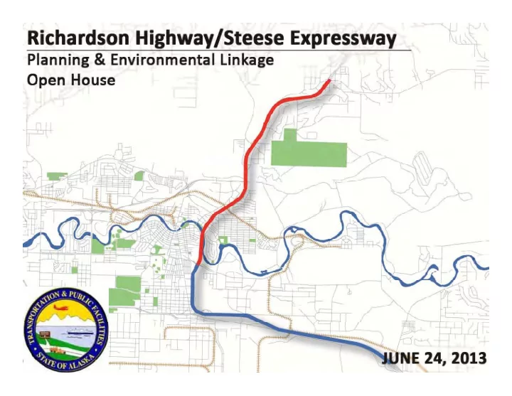
Richardson Highway/Steese Expressway Corridor Study
Planning & Environmental Linkage Open House
Richardson Highway/Steese Expressway Corridor Study
3
Planning & Environmental Linkage Open House
goals early in the planning stage; goals early in the planning stage;
development, design, and construction;
y p j p
4
Richardson Highway/Steese Expressway Corridor Study
Planning & Environmental Linkage Open House
5
Richardson Highway/Steese Expressway Corridor Study
Planning & Environmental Linkage Open House
We are here
p p j p
‐Feasibility ‐Land use ‐Logical termini ‐Freight movement ‐Cost ‐ROW impacts ‐Air quality ‐Environmental impacts ‐Multi‐modal traffic ‐and more…
the preliminary class of action determination; and
d l t development.
6
Richardson Highway/Steese Expressway Corridor Study
Planning & Environmental Linkage Open House
7
Richardson Highway/Steese Expressway Corridor Study
Planning & Environmental Linkage Open House
8
Richardson Highway/Steese Expressway Corridor Study
Planning & Environmental Linkage Open House
9
Richardson Highway/Steese Expressway Corridor Study
Planning & Environmental Linkage Open House
parallel multi modal access but are often parallel multi‐modal access, but are often barriers for cross movements—particularly where controlled access exists.
movements were conducted in this project.
in the corridor is noted in previous projects.
p j p q detailed evaluation of multi‐modal access and compatibility with the Fairbanks Non‐ Motorized Transportation Plan (NMTP) Motorized Transportation Plan (NMTP).
10
Richardson Highway/Steese Expressway Corridor Study
Planning & Environmental Linkage Open House
Intersection and segment capacity analysis
11
Richardson Highway/Steese Expressway Corridor Study
Planning & Environmental Linkage Open House
12
Richardson Highway/Steese Expressway Corridor Study
Planning & Environmental Linkage Open House
Proposed single lane roundabouts reach capacity by 2030
Planning & Environmental Linkage Open House
Richardson Highway/Steese Expressway Corridor Study
13
Planning & Environmental Linkage Open House
Richardson Highway/Steese Expressway Corridor Study
14
Zone 2
15
Richardson Highway/Steese Expressway Corridor Study
Planning & Environmental Linkage Open House Zone 3
16
Richardson Highway/Steese Expressway Corridor Study
Planning & Environmental Linkage Open House
Planning & Environmental Linkage Open House
Richardson Highway/Steese Expressway Corridor Study
17
Planning & Environmental Linkage Open House
Richardson Highway/Steese Expressway Corridor Study
18
19
Richardson Highway/Steese Expressway Corridor Study
Planning & Environmental Linkage Open House
( hb d i i l) (southbound critical)
Steese Expressway
efficiency
20
Richardson Highway/Steese Expressway Corridor Study
Planning & Environmental Linkage Open House
Planning & Environmental Linkage Open House
Richardson Highway/Steese Expressway Corridor Study
21
22
Richardson Highway/Steese Expressway Corridor Study
Planning & Environmental Linkage Open House
23
Richardson Highway/Steese Expressway Corridor Study
Planning & Environmental Linkage Open House
Planning & Environmental Linkage Open House
Richardson Highway/Steese Expressway Corridor Study
24
25
Richardson Highway/Steese Expressway Corridor Study
Planning & Environmental Linkage Open House
26
Richardson Highway/Steese Expressway Corridor Study
Planning & Environmental Linkage Open House
We are here
27
Richardson Highway/Steese Expressway Corridor Study
Planning & Environmental Linkage Open House
28
Richardson Highway/Steese Expressway Corridor Study
Planning & Environmental Linkage Open House