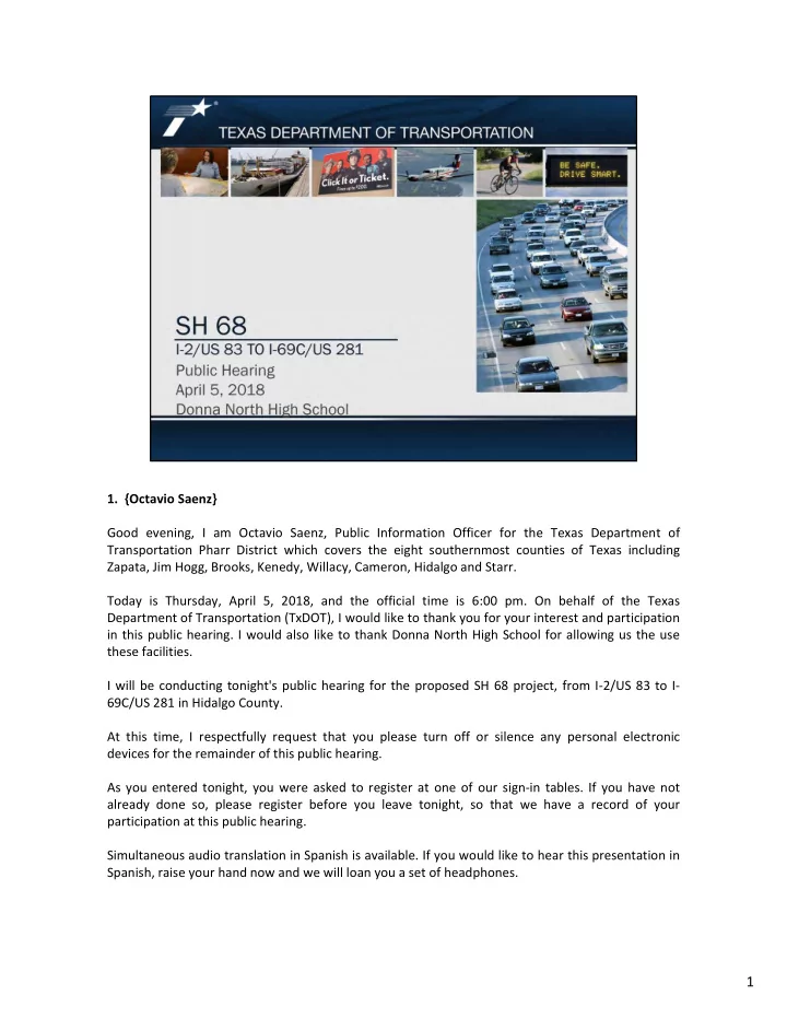
1 2. {Octavio Saenz} Buenas noches, soy Octavio Saenz, oficial de - - PDF document

1 2 octavio saenz buenas noches soy octavio saenz oficial
SMART_READER_LITE
LIVE PREVIEW

1 2. {Octavio Saenz} Buenas noches, soy Octavio Saenz, oficial de - - PDF document

1. {Octavio Saenz} Good evening, I am Octavio Saenz, Public Information Officer for the Texas Department of Transportation Pharr District which covers the eight southernmost counties of Texas including Zapata, Jim Hogg, Brooks, Kenedy, Willacy,


slide-1
SLIDE 1
  • 1. {Octavio Saenz}

Good evening, I am Octavio Saenz, Public Information Officer for the Texas Department of Transportation Pharr District which covers the eight southernmost counties of Texas including Zapata, Jim Hogg, Brooks, Kenedy, Willacy, Cameron, Hidalgo and Starr. Today is Thursday, April 5, 2018, and the official time is 6:00 pm. On behalf of the Texas Department of Transportation (TxDOT), I would like to thank you for your interest and participation in this public hearing. I would also like to thank Donna North High School for allowing us the use these facilities. I will be conducting tonight's public hearing for the proposed SH 68 project, from I‐2/US 83 to I‐ 69C/US 281 in Hidalgo County. At this time, I respectfully request that you please turn off or silence any personal electronic devices for the remainder of this public hearing. As you entered tonight, you were asked to register at one of our sign‐in tables. If you have not already done so, please register before you leave tonight, so that we have a record of your participation at this public hearing. Simultaneous audio translation in Spanish is available. If you would like to hear this presentation in Spanish, raise your hand now and we will loan you a set of headphones.

1

slide-2
SLIDE 2
  • 2. {Octavio Saenz}

Buenas noches, soy Octavio Saenz, oficial de información pública del distrito de Pharr del Departamento de Transporte de Texas, que abarca los ocho condados de Texas, Zapata, Jim Hogg, Brooks, Kenedy, Willacy, Cameron, Hidalgo y Starr. Hoy es jueves, 5 de abril de 2018, y la hora oficial es a las 6:00 pm. En nombre de el Departamento de Transporte de Texas, me gustaría agradecerle su interés y participación en esta audiencia pública. También me gustaría agradecer a Donna North High School por permitirnos el uso de estas instalaciones. Realizaré la audiencia pública de esta noche para el proyecto SH 68 propuesto, desde la I‐ 2/US 83 hasta la I‐69C/US 281 en el Condado de Hidalgo. En este momento, le solicito respetuosamente que apague o silencie cualquier dispositivo electrónico personal por el resto de esta audiencia pública. Al ingresar esta noche, se le solicitó que se registrara en una de nuestras mesas sde inicio de sesión. Si aún no lo ha hecho, regístrese antes de irse esta noche, para que podamos tener un registro de su participación en esta audiencia pública. Los eventos de esta noche se llevaran acabo en Ingles; sin embargo, tenemos servicio de traducción al español. Si alguna persona requiere este servicio, por favor levante su mano para asistirles. Tenemos un traductor que estará llevando a cabo la traducción instantánea. 2

slide-3
SLIDE 3
  • 3. {Octavio Saenz}

In case of a fire or other emergency that requires all occupants to immediately leave the building, evacuation will be signaled by the internal building alarm or by the direction of emergency personnel. Should the evacuation signal sound off please leave the building immediately through the nearest exit. Evacuation is REQUIRED when the alarm is sounding, for every individual in the building. Do not use elevators during the evacuation. Exit in an orderly fashion. Do not run or push. Running can lead to falls and injuries. Gather at the side parking lot south of the school at a safe distance from the building, taking care not to block entrances and

  • exits. Emergency personnel will need a clear path into and out of the building or area.

Stay together. Assess who is present. Staff at the registration table will bring the sign‐in sheets to ensure that all that signed in are accounted for. Report the condition and location of any persons unable to leave the building or area or who need assistance to emergency personnel. Wait for the all‐clear from emergency personnel before attempting to re‐enter the building. If a fire or

  • ther incident makes a building or area unsafe to enter, the public hearing will be re‐rescheduled for a

later date.

3

slide-4
SLIDE 4
  • 4. {Octavio Saenz}

The purpose of a public hearing is as follows Inform the public on the status of the proposed project and present the recommended preferred alternative based on environmental studies performed to date. Present the Draft Environmental Impact Statement (DEIS) describing the reasonable alternatives that were considered and the preferred alternative, location and potential impacts. Provide the public an opportunity to provide comments. And finally, to develop a record of public comments and participation to accompany recommendations for subsequent decisions. All comments will be reviewed and analyzed by TxDOT before a Record of Decision is made for the project. The Public Hearing is being held in compliance with both federal and state laws. As such, a formal presentation will be made. TxDOT welcomes comments from any and all interested persons; however, TxDOT will not respond to questions from the floor tonight. All questions will be addressed in writing, in the comment/response matrix. A court reporter will develop an official transcript of this hearing. For this reason, we ask that all comments made during the public comment portion of the hearing be made from the microphone. During this time we will ask that you please state your name before your comment. To allow all to provide their input we ask that you speak for a maximum of three minutes. Following this hearing, the TxDOT will consider public comments and proceed with the preparation of the combined Final Environmental Impact Statement (FEIS) and Record of Decision (ROD), which will include TxDOT’s decision with respect to this project.

4

slide-5
SLIDE 5
  • 5. {Octavio Saenz}

The Notice of Availability of the DEIS and this public hearing were advertised on the TxDOT website and local newspapers as shown on this slide. The Notice of Availability was also listed in the Federal Register. Additional notification postcards were mailed to 3,663 property owners, organizations, agencies and others on the project mailing list and were emailed to 38 email addresses. Two Changeable Message Signs were placed throughout the study area from March 19 through today. Our staff called over 850 stakeholders from our database advising them of the scheduled public hearing and availability of the DEIS.

5

slide-6
SLIDE 6
  • 6. {Octavio Saenz}

Here is the agenda that is included in the packet you received tonight. In a few minutes, Mr. Dean Tesmer, our environmental consultant project manager will provide an overview of the SH 68 project and provide a summary of the project’s history as well as an overview of the DEIS. A copy of the DEIS is available here tonight for your review and inspection. After Mr. Tesmer’s presentation, Mr. Rudy Rivera, the Engineering Consultant , will provide a Technical Overview of the project. You will then hear from me again regarding the project schedule. Lastly, I will also be moderating the public comment session. At this time, I would like to ask our District Engineer, Mr. Pedro Alvarez, to provide us some opening remarks. Mr. Alvarez .. {Pedro Alvarez} Thank you Mr. Saenz. Thank you all for participating in this public hearing. We have conducted several meetings to allow for public participation and input which is very important in the transportation planning process and I appreciate you taking time again from your schedule to be here and

  • ffer your comments.

Before you leave tonight, we would appreciate you registering with the staff at the entrance if you have not already done so. This will allow us to keep you updated on the project and inform you about findings in the future as the planning process is finalized. If you would like to provide comments please complete a comment sheet, that is included in the handouts you received at the registration table. You can also leave comments with the court reporter. At this time, I would like to recognize the local government officials who are present tonight Thank you. We look forward to your comments as well at the end of this presentation. I will turn it over again to Mr. Saenz. Thank you Mr. Alvarez Upon completion of the formal presentation, you will then have the opportunity to provide us with your verbal comments during the public comment period of the hearing. You may also leave comments with the court reporter after the hearing. Adhering to TxDOT regulations governing the conduct of public hearings, no questions can be answered during the public comment period. However, all comments and questions will be responded to in written form and will be part of the project record.

6

slide-7
SLIDE 7
  • 7. {Octavio Saenz}

After today the public may view all the documents shown tonight at the TxDOT Pharr District office, the SH 68 project office or on‐line as shown on this slide. Our project office, will continue to have extended office hours, 9:00 am to 6:00 pm Monday through Friday and until 8:00 pm Tuesdays and Wednesdays through April 19th, 2018 should any interested citizen like to view project information and ask questions. After that they will resume normal hours, Tuesdays and Wednesdays from 11:00 am to 8:00 pm.

7

slide-8
SLIDE 8
  • 8. {Octavio Saenz}

Written comments can either be left here with us tonight, mailed, faxed, or submitted via email to the address shown here and included in your agenda packets. Your agenda packet includes a comment form that can be used for written comments.

8

slide-9
SLIDE 9
  • 9. {Octavio Saenz}

After tonight’s public hearing you may submit your written comments so that they may be included in the official record. The deadline to receive comments is close of business on, or postmarked by Tuesday May 15, 2018. The same material presented tonight will be available at the TxDOT District Office and the SH 68 project office after the public hearing. Please schedule an appointment to view the materials by contacting the TxDOT Project Manager or the SH 68 Project Office At This time I will call Mr. Dean Tesmer to continue with the presentation. Mr. Tesmer,

9

slide-10
SLIDE 10
  • 10. {Dean Tesmer}

A purpose and need statement explains why a project is being developed and provides a basis for the development and evaluation of project alternatives. TxDOT has determined that SH 68 is needed because there are limited current north‐south roadways in the area and population is projected to increase substantially in the future, which will substantially increase traffic volume on current north‐south roadways in the area. SH 68 is also needed to improve the emergency evacuation capacity of the state highway system in the south Texas region. The purpose of the SH 68 project is to accommodate population growth and higher traffic volumes, while relieving the burden on the limited number of existing north‐south roadways, and provide an alternate north‐south evacuation route during emergency events. Additional supporting information regarding the Purpose and Need Statement for SH 68 can be found in the DEIS. The draft document is available here tonight for your review and comments and can also be found on TxDOT’s website.

10

slide-11
SLIDE 11
  • 11. {Dean Tesmer}

Hidalgo County continues to be one of the fastest growing counties in Texas and is currently the 7th most populous county in the state. Population has increased from a little over 200,000 in the early 1970s to over 860,000 today. TxDOT, Hidalgo County, and the Hidalgo County Regional Mobility Authority (HCRMA) over the last decade have worked with the community to identify ways to address the ever increasing strain on the existing transportation infrastructure. On February 28, 2013, the Texas Transportation Commission approved Minute Order 113515

  • fficially designating SH 68 along a new location extending from US 281 to I‐2/US 83. The Purpose

and Need Statement of the SH 68 project is consistent with goals of the Minute Order, where the Commission designated SH 68 for the purpose of facilitating the flow of traffic, promoting public safety, maintaining the continuity of the state highway system and necessary for the proper development and operation of the system. The proposed project is described in the 2015 through 2040 Metropolitan Transportation Plan and the 2017 through 2020 Statewide Transportation Improvement Program as a proposed four‐lane divided rural highway facility with future mainlanes and overpasses. Now I will discuss the project’s history. In 2014 the TxDOT Pharr District initiated an environmental assessment study to assess the level of impacts the SH 68 would have on the human and natural

  • environment. Based on the initial studies and input received from the public at a meeting held in

September 2014, TxDOT concluded that the SH 68 project should be continued and developed as an Environmental Impact Statement (EIS). In March 2016, TxDOT conducted a Public Scoping Meeting and an Agency Scoping Meeting as required by the National Environmental Policy Act (NEPA). As many as 12 alternative routes were developed and evaluated between 2014 and 2016.

11

slide-12
SLIDE 12
  • 12. {Dean Tesmer}

In January 2017, TxDOT conducted a public meeting to present the three reasonable alternatives that would be advanced and studied to a higher level of detail in the DEIS. Tonight we will present the findings of the DEIS and TxDOT’s recommended preferred alternative known as the 2014 Modified 2 Alternative, the light purple route. The proposed project is being pursued as a non‐toll facility based on the availability of state and federal funds. 12

slide-13
SLIDE 13
  • 13. {Dean Tesmer}

What is an Environmental Impact Statement (EIS)? An Environmental Impact Statement is a full disclosure document that details the process through which the transportation project was developed. It includes consideration of a range of reasonable alternatives, analyzes the potential impacts resulting from the alternatives, and demonstrates compliance with other applicable environmental laws and executive orders. 13

slide-14
SLIDE 14
  • 14. {Dean Tesmer}

For SH 68, three reasonable alternatives and the No‐Build Alternative were evaluated to an equal level of detail in the DEIS. All reasonable alternatives extend from I‐2/US 83 to I‐ 69C/US 281. The three reasonable alternatives are:

  • 2014 Modified 2 Alternative (the light purple route)
  • 2014 Public Scoping Meeting (PSM) Alternative (the orange route)
  • FM 1423 Alternative (the dark pink route)

The No‐Build alternative was also carried forward and analyzed in the DEIS. The No‐Build Alternative means that the construction of SH 68 would not occur. Under this Alternative, existing roadways would continue to operate as they currently do and there would be no conversion of land to transportation uses and no substantial adverse environmental impacts. 14

slide-15
SLIDE 15
  • 15. {Dean Tesmer}
  • The 2014 Modified 2 Alternative (light purple route) is approximately 21.7 miles in

length, is almost entirely on new location, and would require an estimated 1,057 acres of right-of-way (ROW). This reasonable alternative connects to I-2 also known as US 83 approximately seven miles east of I-69C also known as US 281. From I-2, the 2014 Modified 2 Alternative would travel northwest on new location for approximately three miles to near Minnesota Road before turning generally northward for approximately seven miles through the communities of Muniz and San Carlos to north of SH 107. Approximately one mile north of SH 107, near Mile 17 ½ Road, the 2014 Modified 2 Alternative would curve to the west for approximately two miles, crossing FM 1925 also known as Monte Cristo Road and Davis Road. North of Davis Road, the 2014 Modified 2 route would run parallel to the west side of Brushline Road for approximately five miles. The proposed roadway would then curve to the northwest for approximately two miles before running along the north side of the existing FM 490 for approximately three miles and connect to I-69C near the South Texas International Airport at Edinburg. 15

slide-16
SLIDE 16
  • 16. {Dean Tesmer}
  • The 2014 Public Scoping Meeting (PSM) Alternative (orange route) is approximately 22.4

miles in length, is almost entirely on new location and would require approximately 1,076 acres of ROW. The 2014 PSM Alternative follows the same route as the 2014 Modified 2 Alternative from its intersection with I‐2 to SH 107, a distance of approximately eight miles, and continues generally northward for another two miles to cross FM 1925. North of FM 1925, the 2014 PSM corridor would curve to the east for approximately one mile, approaching Mile 19 N Road, where it would then run parallel to the west side of FM 1423 for approximately four miles. The corridor would then curve to the northwest for approximately four miles before running along the north side of the existing FM 490 for approximately three miles and connect to I‐69C/US 281 near the South Texas International Airport at Edinburg. This alternative would also pass through the communities of Muniz and San Carlos. 16

slide-17
SLIDE 17
  • 17. {Dean Tesmer}
  • The FM 1423 PSM Alternative (dark pink route) is approximately 21.6 miles in length

and would require approximately 1,061 acres of ROW. This alternative would connect to I-2 approximately six miles east of I-69C and would generally follow FM 1423 northward for approximately 7.5 miles from the intersection with I-2 to SH 107 in the community of San Carlos. From SH 107, the alternative would continue northward along Val Verde Road approximately two miles to FM 1925. Approximately 1.5 miles north of FM 1925, between Mile 19 Road and Davis Road, the route would then follow the 2014 PSM Alternative route for approximately 11 miles north and west to I- 69C near the South Texas International Airport at Edinburg. This alternative would pass through the City of Donna and the community of San Carlos. 17

slide-18
SLIDE 18
  • 18. {Dean Tesmer}

After our January 3, 2017 public meeting, the three reasonable alternatives were further analyzed for potential impacts. I will now provide a summary of the potential impacts. Detailed information regarding the anticipated impacts for the reasonable alternatives and the No‐Build Alternative can be found in the DEIS and the technical reports. Each of the three reasonable alternatives would involve the acquisition of new ROW and would result in similar impacts regarding residential and commercial displacements; It is estimated that 2014 Modified 2 Alternative would displace 102 homes and 8 businesses, the 2014 PSM Alternative would displace 90 homes and 5 businesses and the FM 1423 PSM Alternative would displace 119 homes and 29 businesses. Each of the three reasonable alternatives would result in community impacts, including impacts to minority and low‐income communities; changes to access; and conversion of existing land use to transportation uses. 18

slide-19
SLIDE 19
  • 19. {Dean Tesmer}

Each of the three reasonable alternatives would result in potential impacts to floodplains. The 2014 Modified 2 Alternative would cross the least amount of mapped floodplains; while the FM 1423 PSM Alternative would result in the highest impacts to mapped floodplains. Each of the reasonable alternatives may impact potential waters of the US and may require one or more permits under Section 404 of the Clean Water Act. It is anticipated that impacts will be covered under the US Army Corps of Engineer’s Nationwide Permit Program. All of the reasonable alternatives would impact cultivated croplands, orchards, brush and shrublands and large trees. However, the 2014 Modified 2 Alternative would impact the least amount of undeveloped property compared to the other two reasonable alternatives. Suitable habitat for three federally listed endangered species (the ocelot, and two plants, Texas ayenia, and Walker’s manioc) and one federal candidate species (red‐crowned parrot) was identified in or adjacent to the three reasonable alternatives. No designated critical habitat for any federal listed species within or adjacent to the three reasonable alternatives would be affected. The reasonable alternatives all have potential to encounter hazardous materials sites. The FM 1423 PSM Alternative would potentially impact 7 hazardous materials site within the proposed ROW while the 2014 PSM Alternative and the 2014 Modified 2 alternative may potentially impact 2 hazardous material sites within the proposed ROW. Each reasonable alternative would result in traffic noise impacts.

19

slide-20
SLIDE 20
  • 20. {Dean Tesmer}

As part of the study, TxDOT completed a detailed desktop analysis to determine the probability of historic properties being impacted by the reasonable alternatives. Specifically, TxDOT looked for buildings, structures, landscapes, or objects that are listed on or eligible for listing on the National Register of Historic Places. The National Register of Historic Places is the federal government’s official list of historically significant buildings, sites, structures, and historic districts. TxDOT identified that there are three old irrigation districts within reasonable alternatives. One of the districts within the reasonable alternatives ‐ the Louisiana Rio Grande Canal Company System, also known as Hidalgo County Irrigation District #2 ‐ is listed on the National Register. The two other old irrigation districts within the reasonable alternatives are the Donna Irrigation District and the Engleman Irrigation District. These two irrigation districts may be eligible for the National Register. All of the reasonable alternatives have the potential to require ROW from the old irrigation districts that are listed or may be eligible for listing on the National Register and because of that, compliance under two laws is required. The first is a federal law called Section 4(f) of the U.S. Department of Transportation Act and the second is a state law called Chapter 26 of the Texas Parks and Wildlife Code. There are certain types of properties that are protected under these laws and to date, TxDOT has only found that the old irrigation districts are the only properties protected by these laws. Under the Section 4(f) federal regulation, TxDOT is required to consider historic properties, like the irrigation districts, as part of the planning process. Under this law, TxDOT must determine if there is a feasible and prudent alternative that avoids the use of historic properties. For the SH 68 project, it is anticipated that the reasonable alternatives would require new ROW from or use part of the National Register‐listed Hidalgo County Irrigation District #2, as well as two irrigation districts that may be eligible for the Nation Register – the Donna Irrigation District and the Engleman Irrigation District. The Chapter 26 state regulation is similar to the Section 4(f) federal law, in that TxDOT must evaluate whether there is a feasible and prudent way to avoid impacting historic properties. Chapter 26 only applies to officially designated historic properties (like those listed on the National Register), and in the case of SH 68, Chapter 26 would only apply to the National Register‐listed HCID #2 Irrigation District. The other two irrigation districts would not be considered under Chapter 26 because they are not listed on the National Register. Additional information and details regarding the anticipated impacts for the reasonable alternatives and the No‐Build Alternative can be found in the DEIS.

20

slide-21
SLIDE 21
  • 21. {Dean Tesmer}

All reasonable alternatives and the No‐Build Alternative were analyzed to an equal level of detail in the DEIS. The variance in potential impacts between the three reasonable alternatives was minimal; however, some key potential impacts were deemed less desirable for the FM 1423 PSM Alternative. These potential impacts included: a higher number of residential displacements; higher impacts to 100‐year floodplains, and greater potential to impact Section 4(f) properties, due to historic irrigation features. The 2014 PSM Alternative and 2014 Modified 2 Alternative share approximately 65 percent of the same route and the

  • verall scale and magnitude of impacts from the two alternatives were relatively similar based on the same general

alignment; therefore, the total project cost became a factor in the determination of a recommended preferred

  • alignment. The estimated total project cost of the 2014 PSM Alternative is $797 million compared to the 2014 Modified 2

Alternative at $768 million, which is a 29 million dollar difference. Additionally, the design of the 2014 PSM Alternative would require the construction of approximately 63 bridge class structures over the old irrigation district canal crossings

  • r potential waters of the U.S.

In comparison, the 2014 Modified 2 Alternative would require the construction of approximately 26 bridge class

  • structures. Although efforts would be made to span crossings during final design; the increased number of crossings

along the 2014 PSM Alternative introduces a higher risk of impacting a historic irrigation feature that may result in additional Section 4(f) impacts or potentially impacting waters of the U.S. The 2014 Modified 2 Alternative would displace an estimated 102 homes and 8 businesses. It would impact the least amount of undeveloped lands, would require the lowest number of bridge class structures, impact the lowest amount of floodplains (140 acres), and present a lower risk of potential impacts to Section 4(f) properties. The 2014 Modified 2 Alternative would also impact 2 potential hazardous material sites. Based on the analysis, the lower risk of Section 4(f) impacts to historic irrigation features, and the lower estimated total cost of $768 million, the 2014 Modified 2 Alternative was identified as TxDOT’s recommended preferred alternative. Section 4 of the DEIS provides a summary of anticipated impacts associated with the three reasonable alternatives as well as the No‐Build Alternative. Detailed information can also be found in the technical reports available for your review and inspection tonight and on TxDOT’s website. I would now like to introduce you to Mr. Rudy Rivera, our consultant project manager who will provide a technical presentation for the SH 68 roadway design.

21

slide-22
SLIDE 22
  • 22. {Rudy Rivera}

Thank you Mr. Tesmer, The recommended preferred alternative for SH 68 would include frontage roads and mainlanes shown as black lines which would be separated by grassy medians shown in

  • green. The facility would be contained within a 350‐foot typical ROW width, with up to 400

feet of ROW needed at proposed overpass locations. The proposed frontage roads would consist of two 12‐foot wide lanes in each direction, with 4‐foot wide inside shoulders and 8‐foot wide outside shoulders. The frontage roads would include curb and gutter to accommodate drainage requirements. The mainlanes would consist of two 12‐foot wide lanes in each direction, with 4‐foot wide inside shoulders and 10‐foot wide outside shoulders. 22

slide-23
SLIDE 23
  • 23. {Rudy Rivera}

If constructed, the recommended preferred alternative would ultimately provide for a controlled access non‐toll freeway with two northbound and two southbound mainlanes, two northbound and two southbound frontage roads, entrance and exit ramps, and

  • verpasses with turnarounds. The termini at I‐2/US 83 and I‐69C/US 281 would include

proposed connections to existing frontage roads and proposed direct connector ramps to and from existing mainlanes. Proposed entrance and exit ramps would consist of 14‐foot wide lanes, with 2‐foot wide inside shoulders and 8‐foot wide outside shoulders. SH 68 would be designed to accommodate a 70 mph design speed for the mainlanes and 50 mph design speed for the frontage roads. Culverts and other bridge class structures would be constructed over existing drainage and irrigation canal crossings. Drainage outfalls would be constructed in accordance with and in coordination with the Hidalgo County Regional Drainage Master Plan and to TxDOT design standards and other applicable regulations. It is anticipated that mainlane overpasses would be located at major roadway crossings including; Ferguson Road, Sioux Road, East Nolana Loop/Earling Road, Owassa Road, Alberta Road, Trenton Road, Wisconsin Road, Canton Road, SH 107, FM 1925/Monte Cristo Road, FM 2812, CR 2050/Brushline Road and Air Cargo Drive 23

slide-24
SLIDE 24
  • 24. {Rudy Rivera}

ROW acquisition, the property to be purchased for the construction of the highway, would be done in accordance with Titles II and III of the Uniform Relocation Assistance and Real Property Acquisition Policies Act of 1970 commonly referred to as the Uniform Act. We have TxDOT ROW Agents present tonight in case anyone has specific questions regarding the ROW acquisition process and Relocation Assistance program I will now provide you with information on the ROW acquisition process to be followed by the TxDOT. Acquisitions would be made in accordance with federal and state statutes and guidelines. The primary federal law that sets the guidelines for ROW acquisition and relocation assistance program is the Uniform Act. This law sets the standards for appraisal, negotiations, and relocations and has also been incorporated into state law as set out in the Texas Transportation Code and the Texas Property Code. For a basic review of your rights, I would recommend that you pick up one of the brochures at the R.O.W. table. A detailed definition of Titles II and Ill of the Uniform Act is included in the brochures describing your rights as a property owner. Independent fee appraisers will be contracted to appraise all necessary property. Affected property owners would receive written notification of the pending appraisal inspection. Appraisers would request permission to enter a property for inspection and offer the property owner, or their representative, the right to accompany them on the inspection. The appraiser would be asked to determine the value of the land to be acquired, real property improvements within the area to be acquired, and damages (if any) to the remaining property. The written appraisal would be provided to the landowner at the time the offer is made. If the environmental Record of Decision determines a build alternative is selected, and the project has been fully authorized, the TxDOT would commence the acquisition process. The agent would send each property owner an offer letter along with a copy of the appraisal. That letter, together with the appraisal, would advise each affected owner as to the value of the land to be acquired, the value of any improvements within the acquisition of the area, and damages (if any) to the remaining property. Each property owner could accept the offer based on the appraisal or make a counter offer based upon additional information that may affect the value of the land under consideration. If no agreement can be reached, the TxDOT would obtain authorization to proceed with eminent domain proceedings. The initial stage of an eminent domain proceeding is what is known as a Special Commissioner's hearing. In the Special Commissioner's hearing, a judge with jurisdiction over such proceedings would appoint three special commissioners to hear the evidence of both the landowner and the TxDOT. The Special Commissioners hearing is generally informal and usually not in a court room, but rather in a public meeting room. A property owner may hire an attorney to represent them in this proceeding or appear on their own behalf. Based upon the testimony given, the Special Commissioners issue an award, which would be their determination

  • f value. Once the TxDOT has deposited the amount of this award in the registry of the court, it would have a right of possession to the property. Either the

landowner or the TxDOT can appeal the award of the Special Commissioners, and a court proceeding would then be scheduled to resolve the issue of value. In all cases, the property owner would be reimbursed for any reasonable, incidental expenses necessarily incurred in transferring title of the acquired property to the State. Expenses eligible for reimbursement generally include recording fees and similar required expenses to convey the real property along with any penalties that are required for prepayment of any pre‐existing recorded mortgage entered into in a good faith encumbering the property. The State of Texas is required, through the Uniform Act that was previously mentioned, to assist persons being displaced from their homes and business because of highway projects. Relocation booklets, which provide a general overview of the Relocation Assistance Program and outline the services offered and any payments for which displaced individuals, families, business and nonprofit organizations may be eligible to receive are available at the ROW table tonight. If you have an interest

  • r feel that you might be affected by this proposed project, I encourage you to pick up one of these brochures before leaving tonight.

24

slide-25
SLIDE 25
  • 25. {Rudy Rivera}

Once the ROW is purchased and utilities are adjusted, the construction process would begin. Construction would be accomplished in several phases with Phase I consisting of frontage roads from the I‐2/US 83 intersection to the intersection with FM 1925/Monte Cristo Road. TxDOT currently has approved funding for ROW acquisition and construction of this project for phase 1 only. Construction would be anticipated to begin in late 2022. Phase II construction of the frontage roads from FM 1925/Monte Cristo Road to I‐69C/US 281 would be in the future, whenever funding is identified for this phase. 25

slide-26
SLIDE 26
  • 26. {Rudy Rivera}

The main‐lanes, between the frontage roads would be constructed in the future, when traffic increases to the point that they are warranted and when funding is available. This ultimate expressway facility would look similar to the existing I‐2/US 83 expressway throughout the Valley. This concludes the technical portion of this presentation. I will now turn the presentation back to Octavio Saenz. Thank you. 26

slide-27
SLIDE 27
  • 27. {Octavio Saenz}

Thank you, Mr. Rivera. After tonight’s hearing, the next step is to consider and address all the comments received. TxDOT will prepare a combined FEIS and ROD which will include TxDOT’s decision with respect to this project. We anticipate to issue the combined FEIS and ROD by early 2019. If a build alternative is selected, TXDOT would begin the ROW Acquisition process. It is estimated that this process will be finalized in Late 2022. At this time, construction for the phase I project, the frontage roads from I‐2/US 83 to FM 1925/Monte Cristo is anticipated for late 2022 at an estimated cost of $55 million. The environmental review, consultation, and other actions required by applicable Federal environmental laws for this project are being, or have been, carried‐out by TxDOT pursuant to 23 U.S.C. 327 and a Memorandum of Understanding dated December 16th 2014, and executed by FHWA and TxDOT. 27

slide-28
SLIDE 28
  • 28. {Octavio Saenz}

At this time I would like to ask any elected official that would like to provide his or her comment on the project to please step up to the microphone. 28

slide-29
SLIDE 29
  • 29. {Octavio Saenz}

At this time, we will now begin the public comment period of the hearing. Please keep in mind, this is a Public Hearing. In adhering to public hearing rules, we are not allowed to answer questions or respond to your comments during the public comment period. Responses to questions or comments will be provided in writing after the hearing and be included in the proposed project record. The final environmental review document will then be made available for public review at the Pharr District Office and the SH 68 Project Office. When you step to the microphone to make a comment, state your full name, make your comment and please limit it to 3 minutes to allow time for others to make comments of their own. Now, I will call upon those members of the public that registered to participate during this comment period. The microphone is now open to anyone else from the public that would like to provide a comment at this point. Please remember that all of your comments and inquiries will be given careful consideration before final design features are determined. The deadline to receive comments is May 15, 2018. A written comment/response matrix will be prepared after this hearing. The public comment part of this hearing is now closed.

29

slide-30
SLIDE 30
  • 30. {Octavio Saenz}

Again we would like to remind you that if you have not chosen to speak, written comments can either be left here with us tonight, mailed, faxed, or submitted via email to the address shown here and included in your agenda packets. You can approach the court reporter when I finish speaking and make a comment which will be recorded in the transcript of this hearing. You can also view the materials seen tonight and make a comment online by going to our website www.txdot.gov and placing in the search bar “SH68”. 30

slide-31
SLIDE 31
  • 31. {Octavio Saenz}

The next steps for completing the environmental process is to

  • compile and consider community input from tonight’s public hearing and commenting

period.

  • The FEIS incorporates the DEIS with revisions made as appropriate throughout the
  • document. The revisions will reflect any modifications to the project, updated

information on the affected environment, changes in the assessment of impacts, the identification of mitigation measures, the results of coordination, comments received on the DEIS and responses to these comments. TxDOT will issue a combined FEIS and ROD

  • document. If a construction alternative is selected as the preferred alternative in the

FEIS then it may be developed to a higher level of detail as appropriate under the FHWA guidance. 31

slide-32
SLIDE 32
  • 32. {Octavio Saenz}

Ladies and gentlemen, we sincerely appreciate your attendance and interest concerning the proposed project. All of your questions, comments and concerns will receive careful consideration subsequent to tonight’s public hearing. Thank You for your participation and I want to again thank Donna ISD for allowing us the use their facilities. 32