WESTERN- -SIBERIAN PEATLANDS AS INDICATOR SIBERIAN PEATLANDS AS - - PowerPoint PPT Presentation

western siberian peatlands as indicator siberian
SMART_READER_LITE
LIVE PREVIEW

WESTERN- -SIBERIAN PEATLANDS AS INDICATOR SIBERIAN PEATLANDS AS - - PowerPoint PPT Presentation

WESTERN- -SIBERIAN PEATLANDS AS INDICATOR SIBERIAN PEATLANDS AS INDICATOR AND AND WESTERN REGULATOR OF CLIMATIC CHANGES OF CLIMATIC CHANGES REGULATOR S. Kirpotin Tomsk State University, Tomsk, Russia e-mail: kirp@ ums.tsu.ru; phone: +7


slide-1
SLIDE 1

WESTERN WESTERN-

  • SIBERIAN PEATLANDS AS INDICATOR

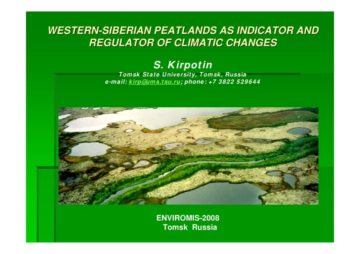
SIBERIAN PEATLANDS AS INDICATOR AND AND REGULATOR REGULATOR OF CLIMATIC CHANGES OF CLIMATIC CHANGES

  • S. Kirpotin

Tomsk State University, Tomsk, Russia e-mail: kirp@ ums.tsu.ru; phone: +7 3822 529644

ENVIROMIS-2008 Tomsk Russia

slide-2
SLIDE 2

Western Siberia is a unique bog region in the World. About 104 Western Siberia is a unique bog region in the World. About 104 Mha Mha

  • f Russian
  • f Russian peatlands

peatlands are located in Western Siberia, which are located in Western Siberia, which consists almost completely of pristine consists almost completely of pristine peatland peatland ecosystems ecosystems (photographer S. Kirpotin) (photographer S. Kirpotin). .

slide-3
SLIDE 3

The biggest at the World The biggest at the World – – Great Great Vasiugan Vasiugan Mire (total area Mire (total area – – 6.78 million 6.78 million hectare [ hectare [Vaganov Vaganov etc., 2005] is situated its territory. This unique mire etc., 2005] is situated its territory. This unique mire representing the object of a nature of the w orld value, comparab representing the object of a nature of the w orld value, comparable on the le on the importance and a rank w ith the lake Baikal. Stocks of peat depos importance and a rank w ith the lake Baikal. Stocks of peat deposited by ited by this largest bog pool in recalculation on absolutely dry organic this largest bog pool in recalculation on absolutely dry organic substance substance make almost 18 billion make almost 18 billion т т, and it is not a lot of a little , and it is not a lot of a little -

  • 16,5 % of stocks of

16,5 % of stocks of peat of all Western Siberia [ peat of all Western Siberia [Vaganov Vaganov etc., 2005]. etc., 2005].

slide-4
SLIDE 4

Siberian Siberian peatlands peatlands have been a major sink of atmospheric carbon have been a major sink of atmospheric carbon since the last since the last deglaciation deglaciation, , but their precise role in the global but their precise role in the global carbon balance has not yet been quantified carbon balance has not yet been quantified (photographer S. Kirpotin) (photographer S. Kirpotin)

slide-5
SLIDE 5

§ § Yefremov Yefremov and and Yefremova Yefremova (2001) (2001) estimated that in total estimated that in total 51.7 Pg carbon is stored 51.7 Pg carbon is stored in all Western Siberian in all Western Siberian

  • peat. Smith et al. (2004)
  • peat. Smith et al. (2004)

found a total of 70.2 Pg found a total of 70.2 Pg carbon (=70.2 billion carbon (=70.2 billion tonnes tonnes) which is ) which is according to highest according to highest estimation about 26% of estimation about 26% of global terrestrial carbon. global terrestrial carbon.

slide-6
SLIDE 6

Scheme of West Scheme of West-

  • Siberian plain

Siberian plain

slide-7
SLIDE 7

The South part of the West Siberian Plain is a typical The South part of the West Siberian Plain is a typical Siberian taiga with different types of bogs Siberian taiga with different types of bogs § § Siberian taiga on the Siberian taiga on the left left § § ridge ridge-

  • hollow mire on

hollow mire on the right the right

slide-8
SLIDE 8

According to investigations carried out by Tomsk According to investigations carried out by Tomsk University in the Western Siberian Plain, contrasting University in the Western Siberian Plain, contrasting processes are occurring in the Southern and processes are occurring in the Southern and Northern parts of the region Northern parts of the region

§ § In the south, bogs are expanding in the taiga zone and In the south, bogs are expanding in the taiga zone and there is progressive swamping which leads to forest there is progressive swamping which leads to forest

  • death. As a result, in this part of Western Siberia bogs
  • death. As a result, in this part of Western Siberia bogs

act as a kind of act as a kind of “ “global refrigerant global refrigerant” ” due to carbon due to carbon sequestration in their peat layers. sequestration in their peat layers.

slide-9
SLIDE 9

Northern Northern-

  • taiga and forest

taiga and forest-

  • tundra from the helicopter

tundra from the helicopter (photographer S. Kirpotin) (photographer S. Kirpotin)

slide-10
SLIDE 10

How ever, the situation in the northern How ever, the situation in the northern part of the Western Siberian Plain is part of the Western Siberian Plain is completely opposite completely opposite

§ § The bogs there are reducing their area and the forest The bogs there are reducing their area and the forest-

  • tundra zone is being subjected to

tundra zone is being subjected to thermokarst thermokarst activity activity and colonisation of bogs by trees [Kirpotin, 1997]. Due and colonisation of bogs by trees [Kirpotin, 1997]. Due to increased to increased thermokarst thermokarst activity, two contrast activity, two contrast processes are observed here processes are observed here -

  • a) increase of lake

a) increase of lake surface due to melting of lakes' coasts, and surface due to melting of lakes' coasts, and -

  • a much

a much more important one more important one -

  • b) decrease of surface area or

b) decrease of surface area or disappearance of lakes due to water escape disappearance of lakes due to water escape downstream the hydrological network [Smith et al. downstream the hydrological network [Smith et al. 2005; Kirpotin et al. 2006, 2005; Kirpotin et al. 2006, Grippa Grippa et al., 2007]. This is et al., 2007]. This is likely to be connected with the recent climatic changes likely to be connected with the recent climatic changes and, undoubtedly, with global warming. and, undoubtedly, with global warming.

slide-11
SLIDE 11

Global warming is a major environmental issue and is expected to Global warming is a major environmental issue and is expected to be greatest at high latitudes. Moreover, arctic and sub be greatest at high latitudes. Moreover, arctic and sub-

  • arctic

arctic landscapes are particularly sensitive to temperature change landscapes are particularly sensitive to temperature change because of the thawing of the permafrost because of the thawing of the permafrost (photographer S. Kirpotin). (photographer S. Kirpotin).

slide-12
SLIDE 12

The process of permafrost melting ( The process of permafrost melting (thermokarst thermokarst) of the edge of ) of the edge of plateaux plateaux palsa palsa at the North of Western Siberia at the North of Western Siberia (photographer S. Kirpotin (photographer S. Kirpotin)

)

slide-13
SLIDE 13

Vast areas of Vast areas of palsa palsa bogs with great number of lakes on watershed bogs with great number of lakes on watershed surface in northern taiga and forest surface in northern taiga and forest-

  • tundra zones (photographer S.

tundra zones (photographer S. Kirpotin) Kirpotin)

slide-14
SLIDE 14

Colonisation of bogs by trees (photographer S. Kirpotin) Colonisation of bogs by trees (photographer S. Kirpotin)

slide-15
SLIDE 15
  • S. Kirpotin1, Yu. Polishchuk2,3, N. Bryksina 4

1Tomsk State University, Tomsk, Russia e-mail: kirp@ ums.tsu.ru; phone: +7 3822 529644 2Ugra State University, Khanty-Mansiysk, Russia e-mail: Yu_Polishchuk@ ugrasu.ru; phone: +7 34671 57669 3Institute of Petroleum Chemistry, SB RAS, Tomsk, Russia 4Ugra Research Institute of Information Technologies, Khanty-Mansiysk, Russia

Disturbance of endogen cyclic succession development on flat palsa- bog complex as a result of thermokarst in the Subarctic region of Siberia using satellite images

ENVIROMIS-2008 Tomsk Russia

slide-16
SLIDE 16

The first stage of permafrost melting ( The first stage of permafrost melting (thermokarst thermokarst) on the ) on the palsa palsa bog surface (photographer S. Kirpotin bog surface (photographer S. Kirpotin)

)

slide-17
SLIDE 17

The second stage of permafrost melting ( The second stage of permafrost melting (thermokarst thermokarst) on the ) on the palsa palsa bog surface (photographer S. Kirpotin bog surface (photographer S. Kirpotin)

)

slide-18
SLIDE 18

The third stage of permafrost melting ( The third stage of permafrost melting (thermokarst thermokarst) on the ) on the palsa palsa bog surface (photographer S. Kirpotin bog surface (photographer S. Kirpotin)

)

slide-19
SLIDE 19

Round lakes as a fourths stage of circle succession of permafros Round lakes as a fourths stage of circle succession of permafrost t degradation (photographer S. Kirpotin degradation (photographer S. Kirpotin)

)

slide-20
SLIDE 20

Khasyrei Khasyrei -

  • dumped lake, which throw down it

dumped lake, which throw down it’ ’s water to another reservoir, s water to another reservoir, as a fifth stage of circle succession of permafrost degradation as a fifth stage of circle succession of permafrost degradation ( (photographer

photographer

  • S. Kirpotin)
  • S. Kirpotin)
slide-21
SLIDE 21

§ § Mature Mature khasyrei khasyrei with yang with yang frozen peat mounds, as a last frozen peat mounds, as a last stage of circle succession of stage of circle succession of palsa palsa’ ’s s dynamics (aerial photo) dynamics (aerial photo) § § Old Old khasyrei khasyrei with recovered with recovered plateaux peat mounds, as a plateaux peat mounds, as a last stage of circle succession last stage of circle succession

  • f
  • f palsa

palsa’ ’s s dynamics (aerial dynamics (aerial photo) photo)

slide-22
SLIDE 22

The scheme of the circle The scheme of the circle palsa palsa’ ’s s succession succession

slide-23
SLIDE 23

Fresh Fresh thermokarst thermokarst subsidence. You can see the dwarf shrubs go

  • subsidence. You can see the dwarf shrubs go

under water under water (

(photographer

photographer S. Kirpotin, 2004)

  • S. Kirpotin, 2004)
slide-24
SLIDE 24

Edges of the big (1 km) lakes Edges of the big (1 km) lakes (

(photographer

photographer S. Kirpotin, 2004)

  • S. Kirpotin, 2004)
slide-25
SLIDE 25

Edge (shore Edge (shore-

  • line) of the small

line) of the small thermokarst thermokarst lake.

  • lake. You can see the

You can see the dwarf shrubs which go under the water dwarf shrubs which go under the water, , some of them are still alive some of them are still alive

( (photographer

photographer S. Kirpotin, 2004)

  • S. Kirpotin, 2004)
slide-26
SLIDE 26

Thermokarst Thermokarst processes increase methane emission, especially from processes increase methane emission, especially from yedomas yedomas (ice (ice-

  • rich Pleistocene soils with a high labile carbon content).

rich Pleistocene soils with a high labile carbon content). Recent discovery of hot spots of methane emission (bubbling) in Recent discovery of hot spots of methane emission (bubbling) in Siberian lakes is a strong evidence of this possibility [ Siberian lakes is a strong evidence of this possibility [Walter et al., 2006] Walter et al., 2006]. . § § Methane bubbles in lake ice Methane bubbles in lake ice

  • n the Siberian North
  • n the Siberian North (

(AP AP Photo Photo/ /Nature Nature, , Katey Katey Walter Walter) )

slide-27
SLIDE 27

Prompt w arming of a climate in Western Prompt w arming of a climate in Western Siberia already today has appreciable Siberia already today has appreciable economic consequences economic consequences § § Pylons Pylons holding holding electric electric wires wires are are being being moved moved from from tilting tilting piles piles driven driven into into the the melting melting permafrost permafrost 30 30 years years ago ago onto

  • nto more

more stable stable horizontal horizontal concrete concrete ties ties. . § §

slide-28
SLIDE 28

Fragment of space images Landsat-7 (07.08.1999г.), central part of PT-5 Simbols: 1 – thermokarst lakes; 2 – dried lakes

slide-29
SLIDE 29

Space Space image Landsat image Landsat-

  • 1 (10.08.1973)

1 (10.08.1973) with indicated thermokarst lakes with indicated thermokarst lakes

slide-30
SLIDE 30

Fragment of space image Spot Fragment of space image Spot-

  • 5

5 ( ( 2 20.0 0.07 7. .2005 2005) )

slide-31
SLIDE 31

Comparison of space images Comparison of space images Landsat Landsat-

  • 1 (10.08.1973) and Spot

1 (10.08.1973) and Spot-

  • 5

5 ( ( 2 20.0 0.07 7. .2005 2005) )

slide-32
SLIDE 32

1973 1973 (a) (a) 1993 1993 (b) (b) 2002 2002 (c) (c) 2005 2005 (d) (d) 112 ha 112 ha 65 65 ha ha 5 52 2 ha ha 47 ha 47 ha Landsat Landsat-

  • 1

1 ( (57 57 m) m) Resurs Resurs -

  • F2

F2 ( (10 10 m) m) Landsat Landsat-

  • 7

7 ( (30 30 m) m) Spot Spot-

  • 5 (

5 (5 5 m) m)

a b c d

Consequent stages of decrease of lake 9 area Consequent stages of decrease of lake 9 area

Changes of area of thermokarst lake 9 Changes of area of thermokarst lake 9

slide-33
SLIDE 33

a b c d

1973 ( 1973 (a a) ) 1988 ( 1988 (b b) ) 1993 ( 1993 (c c) ) 2005 2005 ( (d d) ) 151 151 ha ha 27 27 ha ha 3 3 ha ha Landsat Landsat-

  • 1 (

1 (57 57m) m) Landsat Landsat-

  • 5

5 ( (30 30 m) m) Resurs Resurs -

  • F2

F2 ( (10 10 m) m) Spot Spot-

  • 5

5 ( (5 5 m) m)

Consequent stages of decrease of lake 7 area Consequent stages of decrease of lake 7 area

Thermokarst lake 7 areas (red) changes

slide-34
SLIDE 34

S= 5625,0 S= 552,0

LANDSAT -1 (1973) ALOS (2006)

Thermokarst lakes

Озеро Озеро Сихтынэмтор Сихтынэмтор сократилось сократилось на на 9 90% 0%

slide-35
SLIDE 35

Selection pilot territories Selection pilot territories

slide-36
SLIDE 36

Location of pilot territories in West Location of pilot territories in West-

  • Siberian permafrost

Siberian permafrost

slide-37
SLIDE 37

Landsat Landsat -

  • 1 (

1 (сканер сканер MSS), 10.08.1973 MSS), 10.08.1973 Landsat Landsat -

  • 5 (

5 (сканер сканер MSS MSS), 27.07.1984 ), 27.07.1984 Landsat Landsat -

  • 5 (

5 (сканер сканер MSS), 26.06.1988 MSS), 26.06.1988 Landsat Landsat -

  • 4 (

4 (сканер сканер Т ТM M), 01.08.1988 ), 01.08.1988 Landsat Landsat -

  • 5 (

5 (сканер сканер Т ТM M), 20.09.1989 ), 20.09.1989 Resurs Resurs -

  • F2 (

F2 (сканер сканер МК МК 4), 14.06.1993 4), 14.06.1993 Landsat Landsat -

  • 7 (

7 (сканер сканер ETM ETM), 07.08.1999 ), 07.08.1999 Landsat Landsat -

  • 7 (

7 (сканер сканер ETM), ETM), 03 03.0 .08 8.2001 .2001 Landsat Landsat -

  • 7 (

7 (сканер сканер ETM), 03.07.2002 ETM), 03.07.2002 Spot Spot -

  • 5 (

5 (сканер сканер HRV), 20.07.2005 HRV), 20.07.2005 ERS ERS -

  • 2 (

2 (сканер сканер SAR) SAR), 2005 , 2005-

  • 2008

2008 ALOS (AVNIR ALOS (AVNIR-

  • 2) 2006

2) 2006-

  • 2007

2007

REMOTE SENSING DATA REMOTE SENSING DATA

slide-38
SLIDE 38

Results of Research Results of Research

slide-39
SLIDE 39

Изменение Изменение суммарной суммарной площади площади термокарстовых термокарстовых озер озер ( (га га) ) в в прерывистой прерывистой криолитозоне криолитозоне

40 40 40 40 118 118 40 40 40 40

Volume of sample Volume of sample

  • 22

22

  • 12

12

  • 21

21

  • 29

29

  • 2

22,6 2,6

R R, % , %

  • 469,6

469,6

  • 438,4

438,4

  • 917,1

917,1

  • 1104,6

1104,6

  • 855,3

855,3

Total area decrease Total area decrease

  • f lakes
  • f lakes,

, ha ha

1685,5 1685,5 3234,8 3234,8 3453,7 3453,7 2759,6 2759,6 2921,7 2921,7 2000 2000 2005 2005 2155,1 2155,1 3673,2 3673,2 4370,8 4370,8 3864,2 3864,2 3777,0 3777,0 1973 1973 1984 1984 1988 1988

Total area of Total area of lakes lakes, , ha ha

PT PT-

  • 10

10

PT PT-

  • 9

9

PT PT-

  • 8

8

PT PT-

  • 7

7

PT PT-

  • 6

6 Pilot Pilot territories territories R - относительное изменение суммарной площади озер

slide-40
SLIDE 40

Изменение Изменение суммарной суммарной площади площади термокарстовых термокарстовых озер озер ( (га га) ) в в сплошной сплошной криолитозоне криолитозоне

60 60 40 40 30 30 40 40 80 80

Volume of sample Volume of sample

10 10 12 12 7 7 1 10 10,7 10,7 R R, % , %

364 364, ,05 05 432,0 432,0 135,9 135,9 344,1 344,1 672,8 672,8

Total area decrease of Total area decrease of lakes lakes, , ha ha

3975,9 3975,9 3998,9 3998,9 2035,0 2035,0 3765,3 3765,3 6965,5 6965,5 2 2006 006 3611,85 3611,85 3566,9 3566,9 1899,1 1899,1 3421,2 3421,2 6292 6292,7 ,7 1973 1973 1984 1984

Total area of Total area of lakes lakes, , ha ha

PT PT-

  • 5

5 PT PT-

  • 4

4 PT PT-

  • 3

3 PT PT-

  • 2

2 PT PT-

  • 1

1

Pilot Pilot territories territories

slide-41
SLIDE 41

Относительные Относительные значения значения термокарстовых термокарстовых озер озер в в зависимости зависимости от от широты широты

slide-42
SLIDE 42

Summary and Conclusion

1.Bog landscapes spreading in the permafrost area are most

sensitive to temperature alterations because of permafrost

  • melting. Thermokarst lakes are the most convenient object for

distant monitoring of the global warming influence on the permafrost rocks state.

2.Study of thermokarst lake’s areas changes in time makes it

possible to assess dynamics of kryogenic processes on the basis of space images.

  • 3. The results of investigations carried out may be used for Risk-

analysis of oil-gas industry state in northern territory of Siberia as a main oil-gas producing region of Russia.

slide-43
SLIDE 43

§ § Started in 2007 joint French Started in 2007 joint French-

  • Russian

Russian GDRI project GDRI project “ “CAR CAR-

  • WET

WET-

  • SIB Biogeochemical cycle of carbon in

SIB Biogeochemical cycle of carbon in wetlands of Western Siberia wetlands of Western Siberia” ” is centered on is centered on Carbon in Carbon in Wetlands of Western Siberia Wetlands of Western Siberia and will deal with and will deal with numerous aspects of carbon biogeochemistry of this numerous aspects of carbon biogeochemistry of this region, from hydrological regime of wetlands and region, from hydrological regime of wetlands and flooded zones, vegetation production/degradation and flooded zones, vegetation production/degradation and dissolved organic matter, to permafrost dissolved organic matter, to permafrost-

  • affected fluxes

affected fluxes and mechanisms of carbon dioxide, methane and and mechanisms of carbon dioxide, methane and metal migration. One of the ultimate goals of this metal migration. One of the ultimate goals of this partnership could be creation of multi partnership could be creation of multi-

  • level

level biogeochemical model of carbon dioxide and methane biogeochemical model of carbon dioxide and methane in natural and in natural and anthropogenically anthropogenically-

  • affected landscapes of

affected landscapes of Western Siberia. Western Siberia. § § The approach will be based on: The approach will be based on: § § Combination of Combination of “ “terrestrial terrestrial” ”(fieldwork (fieldwork), ), “ “spatial spatial” ” (remote (remote sensing) techniques and numerical sensing) techniques and numerical modelling modelling approaches to the same objects. approaches to the same objects. § § Simultaneous study, using the same set of techniques, Simultaneous study, using the same set of techniques,

  • f southern (permafrost
  • f southern (permafrost-
  • free,

free, Vasugan Vasugan’ ’s s plain) and plain) and northern (permafrost northern (permafrost-

  • affected, thermo

affected, thermo-

  • karst

karst lakes lakes region) territories of Western Siberia. region) territories of Western Siberia.

slide-44
SLIDE 44

The scientific research of the GDRI will focus on: The scientific research of the GDRI will focus on:

§ § study of variability of hydrological and study of variability of hydrological and hydrochemical hydrochemical processes in the wetlands and flooded processes in the wetlands and flooded zones of Western Siberia region at different temporal (from mult zones of Western Siberia region at different temporal (from multi i-

  • year to seasonal) and spatial

year to seasonal) and spatial (from local, experimental plot level (m (from local, experimental plot level (m² ²) to regional, watershed and river basin level) scales ) to regional, watershed and river basin level) scales through a multidisciplinary approach based on in situ, remote se through a multidisciplinary approach based on in situ, remote sensing data and numerical nsing data and numerical modelling; modelling; § § investigation of dynamics of pristine and disturbed ecosystems i investigation of dynamics of pristine and disturbed ecosystems in connection with past, present n connection with past, present and future global climatic changes; and future global climatic changes; § § creation a spatial distributed database of Western Siberia Regio creation a spatial distributed database of Western Siberia Region in the field of environmental n in the field of environmental dynamics and climatic change for scientific dynamics and climatic change for scientific-

  • educational use;

educational use; § § application of existing satellite remote sensing and numerical m application of existing satellite remote sensing and numerical modelling techniques, analytical

  • delling techniques, analytical
  • bservations, GIS technologies. Their validation, parameterisati
  • bservations, GIS technologies. Their validation, parameterisation and development of new
  • n and development of new
  • nes for studies and monitoring of environmental conditions of t
  • nes for studies and monitoring of environmental conditions of the chosen natural objects;

he chosen natural objects; § § effects of climate change on carbon balance, CO2 and methane emi effects of climate change on carbon balance, CO2 and methane emissions and biogeochemical ssions and biogeochemical cycles of elements at the land cycles of elements at the land – – hydrosphere hydrosphere -

  • atmosphere interface;

atmosphere interface; § § analyses and modelling of the primary production processes in di analyses and modelling of the primary production processes in different ecosystems in a fferent ecosystems in a changing environment; changing environment; § § analyses and modelling of vegetation pattern and biodiversity at analyses and modelling of vegetation pattern and biodiversity at site, local and regional scales site, local and regional scales within a changing environment; within a changing environment; § § development and use of spatial recording techniques to observe, development and use of spatial recording techniques to observe, monitor and survey a range of monitor and survey a range of physical and biological parameters of freshwater ecosystems, bot physical and biological parameters of freshwater ecosystems, both under laboratory conditions h under laboratory conditions and in situ; and in situ; § § identification, enumeration and observation of aquatic identification, enumeration and observation of aquatic microorganisms microorganisms, their interactions and , their interactions and functional roles within the freshwater ecosystems; functional roles within the freshwater ecosystems; § § development of mathematical and computer simulation of environme development of mathematical and computer simulation of environmental and climatic ntal and climatic dynamics; dynamics; § § methodical support for sustainable and environmental methodical support for sustainable and environmental-

  • friendly development of extractive

friendly development of extractive industries: oil industries: oil-

  • gas complex, forestry, hunting, fishing;

gas complex, forestry, hunting, fishing; § § studying and preservation of culture and national features of Si studying and preservation of culture and national features of Siberian indigenous and old berian indigenous and old believer people; believer people; § § protection of natural and semi protection of natural and semi-

  • natural environments within Western Siberia.

natural environments within Western Siberia.

slide-45
SLIDE 45

Thank you!