SLIDE 1
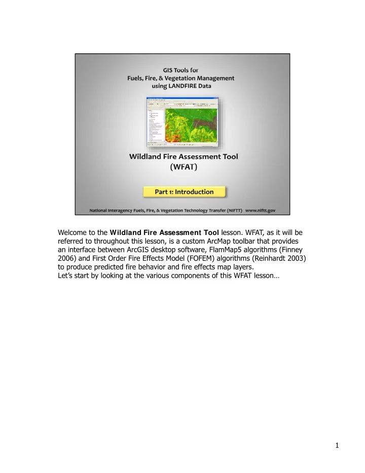
Welcome to the Wildland Fire Assessment Tool lesson. WFAT, as it will be referred to throughout this lesson, is a custom ArcMap toolbar that provides an interface between ArcGIS desktop software, FlamMap5 algorithms (Finney 2006) and First Order Fire Effects Model (FOFEM) algorithms (Reinhardt 2003) to produce predicted fire behavior and fire effects map layers. Let’s start by looking at the various components of this WFAT lesson… 1
SLIDE 2
Now that you understand the flow of the lesson as a whole, let’s look more closely at what Part 1 of the lesson entails. You’ll learn about fire behavior and fire effects. Then you’ll be introduced to WFAT. Next, you’ll read Chapter 3 of the WFAT User’s Guide for a general overview of the tool inputs. After that you’ll read Chapter 4 of the User’s Guide for an overview of the tool outputs. And finally, you’ll work through a short comprehension check (short quiz). So, let’s get started with Part 1. This section will take approximately two hours , g pp y to complete. 2
SLIDE 3
Fire behavior refers to the way that fire reacts to the three parts of the fire behavior triangle; Fuel, Weather, and Topography. Examples of fire behavior characteristics are fire rate of spread, flame length, fireline intensity. 3
SLIDE 4
First order fire effects are the direct and immediate environmental consequences of a fire. These are outcomes that are directly linked to the combustion process and include plant mortality and seed bank reduction, soil heating and exposure, water repellant soil conditions, smoke production, and fuel consumption. 4
SLIDE 5 Longer-term ecosystem responses are often referred to as second
- rder fire effects and usually involve interaction with other agents.
These include soil erosion and stream sedimentation, regeneration by existing vegetation and colonization by new plant species, changes in the fuel matrix including arrangement and amounts of fine and coarse woody debris, and vegetation mortality from insects and disease drawn to fire-weakened plants. These effects t k f f d t t b t may take from a few days to years to become apparent. First order fire effects form the basis for second order fire effects, but second order fire effects are not predicted in WFAT and so will not be discussed further in this lesson. For more information on fire ecology and effects, see “Fire Ecology
- f Pacific Northwest Forests” by James K. Agee (1993).
y g ( ) 5
SLIDE 6
WFAT is a custom ArcMap toolbar that integrates and runs FOFEM (predicting fire effects) and FlamMap (predicting fire behavior) from the ArcMap platform to model and portray fire behavior and fire effects outputs spatially. We will discuss the FOFEM and FlamMap software in more detail later. These predicted spatial fire effects and fire behavior data support land management planning, including potential fire behavior map g p g, g p p layers, such as flame length and rate of spread, and fire effects layers, such as fuel consumption, smoke emissions, soil heating and tree mortality. WFAT helps answer the question ―Where on a landscape are fire behavior and effects likely to be most problematic in regards to specific land management objectives? 6
SLIDE 7 WFAT incorporates three main data processing steps. First, the tool builds the landscape file (.lcp) from LANDFIRE input data, required to run FlamMap. WFAT can also utilize an existing user- specified .lcp file. Next, WFAT runs FlamMap to condition fuel moistures – if the user has opted to do so – and to predict potential crown fire activity and scorch height. Lastly, WFAT runs FOFEM and FlamMap for each unique combination of inputs to di t t ti l fi b h i h t i ti d t ti l fi t predict potential fire behavior characteristics and potential first
7
SLIDE 8 Lets take a moment to become more familiar with FlamMap and FOFEM so that we can better understand how WFAT works. FlamMap is a fire behavior mapping and analysis program that computes potential fire behavior characteristics (flame length, rate
- f spread, fire type or crown fire activity (CFA), and fireline
intensity) at a pixel level over an entire assessment area. There is no temporal component in FlamMap. It uses spatial information on t h d f l t l l t fi b h i h t i ti t topography and fuel to calculate fire behavior characteristics at one instant. WFAT uses an Arc GRID format and consequently there is no longer any need to convert files back and forth between ASCII and Arc GRID formats as required by FlamMap. 8
SLIDE 9 FOFEM is a non-spatial fire effects analysis program that computes potential first order fire effects (fuel consumption, smoke emissions, soil heating, and tree mortality). WFAT enhances non-spatial FOFEM by modeling and portraying fire effects outputs spatially and by simplifying the analysis of heterogeneous landscapes or multiple planning units through spatial analysis. The development and function of FOFEM are described in: Reinhardt, E.D.; Keane, R.E.; Brown, J.K. 1997. First Order Fire Effects Model: FOFEM 4.0, User's Guide. Gen. Tech. Rep. INT-GTR-
- 344. Ogden, UT: U.S. Department of Agriculture, Forest Service,
Intermountain Research Station. This document is available in the resources section for REM407 resources section for REM407. 9
SLIDE 10
Now that you know a little more about how WFAT works, lets discuss some general benefits of using WFAT. The integration of spatial data that describe the fire environment allows managers to visualize the spatial relationships of these fire behavior and fire effects by viewing them adjacent to or near each other on a map. The example on this slide shows post-fire 100-hour fuel loads across a landscape. 10
SLIDE 11 Managers can also overlay other map layers onto the individual fire effects layers to observe and analyze other spatial
- relationships. For example, you can overlay a soil type layer onto
soil surface temperature to see how each soil type is affected, as shown here. 11
SLIDE 12 Let’s consider why assessments with WFAT are useful to land managers…or what it can help you do. WFAT can be used to
- 1. identify the location of hazardous fuels
- 2. Prioritize, evaluate, and design fuel treatment projects
- 3. Develop burn plans for prescribed fire
- 4. Predict fire behavior and effects for planning and monitoring
documents
- 5. Assess appropriate management response to wildland fire
- 6. Calibrate fuel data layers based upon observed fire behavior. We
will be covering each of these points in more detail in the next section of the course. 12
SLIDE 13
WFAT requires two kinds of input data: 1) Spatial data layers and 2) Model inputs The SPATIAL data can be provided in the form of ArcGIS rasters (grids). The following grids are required inputs: Elevation, slope, aspect, fire behavior fuel models, canopy cover, canopy height, canopy base height, canopy bulk density, fire effects fuel model, and a tree list. These data layers can be obtained from the y LANDFIRE data access web site (www.landfire.gov). NOTE: The tree list grids are not yet available via LANDFIRE. Please contact your instructor of REM407 to obtain a treelist grid for a specific area!!! 13
SLIDE 14 The MODEL inputs include a Fuel Moisture File (which will be described in more detail on the next slide), wind speed, wind direction, and foliar moisture of the live leaves and needles. Two fuel moisture settings are available: 1) Fixed fuel moistures from the fuel moisture file, and 2) Conditioning of the fuel moisture based on weather and wind. If fuel moisture conditioning is requested, input files describing the weather and wind are i d Th iti f th fil d ib d i th WFAT
- required. The composition of these files are described in the WFAT
User’s Guide. Soil moisture is another input in WFAT. Typical soil moisture values range from 5% (very dry) to 25% (wet). Wet soils tend to conduct heat more rapidly than drier soils due to the conductive properties f il i h hi h i h i l h
- f water. A soil with higher moisture has potential to heat up more
rapidly and to a greater depth than a drier soil assuming the same amount and duration of heat. 14
SLIDE 15
WFAT allows the user to specify the crown fire calculation method to be used - Finney (1998) or Scott and Reinhardt (2001). The choice is largely dependent on the source of the canopy bulk density (CBD) data. If the source of the CBD data is based on a method that uses biomass equations (running mean methods), the Scott and Reinhardt method (2001) should produce the best results, whereas the Finney (1998) method would be expected to d di t ti fi t ti l S tt/R i h dt h ld under-predict active crown fire potential. Scott/Reinhardt should be used with LANDFIRE National data while Finney should be used with LANDFIRE Rapid Refresh data (see the WDAT User Guide for more information). Finally the user will specify the Region and the Season using the drop down menus drop-down menus. 15
SLIDE 16 Like FlamMap, WFAT requires a text file (.fms) that specifies the initial fuel moisture l f th 1 h 10 h 100 h li h b d li d f l t values of the 1-hr, 10-hr, 100-hr, live herbaceous, and live woody fuel components for each of the fire behavior fuel models. The most important step in selecting appropriate fuel moisture values is to describe the type of fire weather and fuel moisture scenario to be simulated. For example, simulations designed for fire use or prescribed fire applications would likely have higher fuel moistures than those used for simulating rare event large wildfires in the extremes of the wildfire season. We recommend using data provided by using the Weather Information Management System (WIMS) and FireFamily Plus to identify appropriate fuel moisture values for System (WIMS) and FireFamily Plus to identify appropriate fuel moisture values for specific simulation scenarios. The fuel moisture file used by WFAT is a space-delimited text file that has an .fms
- extension. A column header is not included in the file; it is therefore very important
that users understand the format. There are six columns in the .fms file that denote fire behavior fuel model, 1-hour dead fuel moisture (1-hr), 10-hour dead fuel moisture (10-hr), 100-hour dead fuel moisture (100-hr), live-herbaceous fuel moisture (LH), and live-woody fuel moisture (LW), respectively (see fig. 3-13). The values representing fire behavior fuel models (FBFM) correspond to the numeric values representing fire behavior fuel models (FBFM) correspond to the numeric codes used by Anderson (1982) or Scott and Burgan (2005). Fuel moisture values represent percent moisture and must be integers (no decimals). (See Appendix D in the WFAT UG for additional information on fuel moisture values). If you would like to improve your understanding of fuels and fire behavior fuel models in general, we recommend that you take the free online lesson “I ntroduction to the 40 Fire Behavior Fuel Models” available via NIFTT at http://www. niftt. gov
16
SLIDE 17
Now please read the document titled “WFAT User’s Guide Chapter 3,” which is an excerpt from the WFAT User’s Guide that describes the four types of tool inputs: spatial layers, model inputs, coarse woody debris profile, and custom Fire Effects Fuel Models (FEFM). This chapter describes in more detail the inputs necessary to run WFAT. Please return to this presentation when you’ve finished reading… 17
SLIDE 18
Welcome back. You’ve now gained insight on WFAT inputs, including spatial layers, model inputs, the coarse woody debris profile, and custom fire effects fuel models (FEFM). 18
SLIDE 19
WFAT produces output data in ArcGIS raster (GRID) format. 19
SLIDE 20
Output layers are produced for fire behavior and fire effects. The user can specify what outputs are desired. It is not recommended to check all, unless all data outputs are needed for your analysis, because you will end up with large amounts of data. The user also specifies the output location on the computer and the name of an output folder. It is recommended to create a new output folder for each WFAT WFAT run. 20
SLIDE 21 WFAT predicts many of the same fire behavior outputs as other operational fire behavior prediction software (such as Behave Plus and FlamMap). These fire behavior characteristics include flame length, fire rate of spread, fire type, fireline intensity, wildland fire intensity, scorch height, and mid-flame wind
- speed. Each of the outputs are described in more detail in the WFAT User’s
Guide Chapter 4, which you will be requested to read soon. 21
SLIDE 22
WFAT allows the user to specify which fuel component layers are generated and whether to generate these layers for post-burn fuel load, consumed fuel load, or both. Post burn load plus consumed load equals pre-burn fuel load for all fuel components. Fuel components include duff, litter, 1-hr, 10-hr, 100-hr, sound and rotten CWD (1000-hr, or 3 inches (7.6 cm) and greater), herbaceous, shrub, and canopy fuel affected by crown fire. 22
SLIDE 23 The Clean Air Act requires the Environmental Protection Agency to set standards for common air pollutants that may impact the health of people, especially the young, elderly and those with respiratory illness (EPA). WFAT includes output layers for five of these pollutants: PM2.5, PM10, CO, NOX and
- SO2. It also produces outputs for CH4 and CO2.
WFAT includes both flaming and smoldering combustion in the calculations and use the following general formula: T t l i i b ti ffi i i i f t Total emission = mass x combustion efficiency x emission factor 23
SLIDE 24
High temperatures deep into the soil profile break down organic material and can change soil chemical and physical composition. Predicting first order fire effects can aid managers in determining possible second order fire effects such as erosion and nutrient release due to loss of the vegetation layer and changes in soil characteristics. The deepest depth at which soil temperature reaches 60 degrees Celsius – the t t t hi h t t d l t ti d th b i t temperature at which unprotected plant tissue death begins to occur. The deepest depth at which soil temperature reaches 275 degrees Celsius – the temperature at which hydrophobic soil characteristics begin to break down. 24
SLIDE 25
NOTE: A treelist grid necessary for calculation of tree mortality outputs. Percent tree mortality is the number of dead trees post-fire divided by total number of pre-fire trees in the original stand, expressed as a percent. In WFAT, tree mortality is determined using predicted fireline intensity and midflame wind speed along with species-specific mortality models listed in the tree species list assigned to the pixel. Percent basal area mortality is the percentage of basal area of the original pre-fire stand that was killed as a result of the fire. For example, if the original stand had 33.29 ft2 basal area and 28.92 ft2 was killed, then percent basal area mortality would be 28.92/33.29*100 or 87% The average diameter of fire killed trees is calculated for each pixel in The average diameter of fire-killed trees is calculated for each pixel in the map layer by averaging the diameter (found in the tree species list) of post-fire dead trees. This output can be especially useful when simulating a prescribed fire that has specific size allowances for fire-killed trees - for instance, when you are trying to remove small understory trees and retain larger overstory trees. 25
SLIDE 26
Another output is the Keane Fire Severity I ndex which averages the following three records and derives an index: % basal area mortality 20/70 % non-canopy fuel consumption 20/50 Soil Heating (60 o C) 2/6 The index is a value of 1, 2 or 3, and is calculated as follows: < 20 = 1 , 20- 70 2 70 3 70 = 2 , >70 = 3 26
SLIDE 27
Now please read the document titled “WFAT User’s Guide Chapter 4,” which is an excerpt from the WFAT User’s Guide that describes the four types of tool inputs: spatial layers, model inputs, coarse woody debris profile, and custom Fire Effects Fuel Models (FEFM). This chapter describes in more detail the inputs necessary to run WFAT. Please return to this presentation when you’ve finished reading… 27
SLIDE 28
Again, welcome back. You’ve now acquired knowledge regarding the WFAT outputs. Let’s once more do a quick review of the important points… You are now ready to take the online comprehension check in Blackboard. 28