Vagaries and Efficiencies of our Knowledge Ecosystem Presenting: - - PowerPoint PPT Presentation

vagaries and efficiencies of our knowledge ecosystem
SMART_READER_LITE
LIVE PREVIEW

Vagaries and Efficiencies of our Knowledge Ecosystem Presenting: - - PowerPoint PPT Presentation

Vagaries and Efficiencies of our Knowledge Ecosystem Presenting: Sean C. Ahearn, Director & Professor Center for Advanced Research of Spatial Information (CARSI) Hunter College City University of New York University of California at


slide-1
SLIDE 1

Vagaries and Efficiencies of our Knowledge Ecosystem

Presenting: Sean C. Ahearn, Director & Professor Center for Advanced Research of Spatial Information (CARSI) Hunter College – City University of New York

University of California at Santa Barbara

December 11, 2013

slide-2
SLIDE 2

If knowledge is what we do how are we doing?

slide-3
SLIDE 3

If our product were a car would it be the ultimate driving machine

  • r a Yugo?
slide-4
SLIDE 4

Or would it even drive?

slide-5
SLIDE 5

What we do as educator and researchers

How current? How efficient? How complete? How relevant? How do we know?

slide-6
SLIDE 6

From BoK to Ecosystem

Ahearn, Skupin, Plewe

Knowledge ecosystem

Gao et al., 2006; Ciccarese et al., 2008

BoK

DiBiase et al. 2006, ACM/IEEE-CS, 2013 knowledge Dynamic, interconnected environment Ciccarese et al. 2008, Biomedical Discourse Ontology

slide-7
SLIDE 7

One “Place”?

Ahearn, Skupin, Plewe,

Educator

What does this concept mean? How does it intersect with another concept? Does my course cover this set of concepts? How best to visualize this concept? How does my course compare with other comparable courses?

slide-8
SLIDE 8

Manag mentne

Conceptual Model of the Knowledge Ecosystem

Visual Wiki VPE BoKScorecard BoKVis

Text Mining Interface

Course P Course Page age Job Post Job Posting ing Article Article

External Applications

BoKOnto

  • Taxonomy
  • Instances
  • Inferences
  • Mappings

Rest Services WEB SERVCIES LAYER SERVER

BOKONTO

Ahearn, Skupin, Plewe

SPARQL endpoint Content Management

slide-9
SLIDE 9

Visual Wiki

http://carto.byu.edu/bokviswiki/bokwiki.html

GIS & T BoK2: Ahearn, Skupin, Plewe, DeMer

slide-10
SLIDE 10

Update Process flow & Version Access

Ahearn, Skupin, Plewe

New Concept Visual Wiki Data mining New Concept V1.5b Approval Process New Concept V1.6 A P P L I C A T I O N S

slide-11
SLIDE 11

Intro GIS Courses

slide-12
SLIDE 12

Advanced GIS Course

slide-13
SLIDE 13

Intro vs Advanced GIS Course (KA)

slide-14
SLIDE 14

Intro GIS (blue) vs Adv GIS (red) Course

slide-15
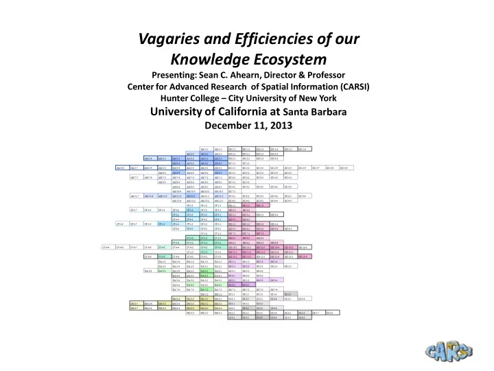
SLIDE 15

Geographic Information Science & Technology Body of Knowledge – Foundational Research

  • Ahearn, S., I. Icke, R. Datta, B. Plewe, M. DeMere, A. Skupin. (2013) . “Re-

engineering the Geographic Information System Body of Knowledge” Special Issue

  • n GIS-Cyber-Infrastructure. International Journal for Geographic Information

Science Vol. 27 Issue 11.

  • DeMeres, M., A. Klimaszewski-Patterson, R. Richman, S.C. Ahearn, B. Plewe, A.

Skupin, (2013) in press. "Toward an Immersive 3D Virtual BoK Exploratorium: A Proof of Concept". Transactions on GI, 2013, 17(3):335-352.

  • Links

– NSF Project:

  • http://gistbok.org/

– BoK Web Services examples:

  • http://www.gistbok.org/gistbok/services/gistbok1hierarchy
  • http://www.gistbok.org/gistbok/services/conceptmap?concept=Data+mining

– BoKVis:

  • https://trac.devzing.com/space/BoKVis/wiki

– BoKWiki:

slide-16
SLIDE 16

Enabling Spatial-temporal Research Across the Campus

A “Smart” Data Laboratory for Collaboration and Sharing

Sean C. Ahearn, Professor and Director Taylor Oshan, MA Center for Advanced Research of Spatial Information, Hunter College – CUNY December 10, 2013

slide-17
SLIDE 17

Geo-spatial Platform

  • Goals

– Create a “geo-spatial platform” to bridge different research disciplines and the communities in which they operate. Space is the common attribute. – Facilitate the research process by providing a spatially aware smart data system. – Build a network of data repositories which can be utilized for comparative studies.

  • Context

– Sharing data and methods within campuses and across campuses. – Increasing scale of available data:

  • Neighborhoods  Cities  Regions
slide-18
SLIDE 18

Current Data Ecosystem

  • Inefficient
  • Can lack documentation
  • Often lacks spatial component
  • Multiple researchers re-format the same data for

similar applications

  • Disconnect between publications, models, and data.
slide-19
SLIDE 19

Network Characteristics

  • Higher Accessibility, Higher Infrastructure Costs?
  • Lower Accessibility, Lower Infrastructure Costs

Goal: Highest accessibility with lowest infrastructure costs

slide-20
SLIDE 20

Our Proposal…More Than Just Data

  • Use ArcGIS online to construct a low cost

research eco-system which will:

– Eliminate inefficiencies and repetition in the data analysis process. – Promote spatial principles which are sometimes

  • verlooked, though crucial.

– Minimize effort necessary to get data “GIS ready”. – Create a larger network of data repository nodes. – Integrate connections between data, methods, and models for sharing research.

slide-21
SLIDE 21

Optimal - A Central Yet Distributed Node

The platform acts as a central node but also provides the technology to bring the associated accessibility directly to all users.

Spatial Lab ArcGIS Online

Anthropology

Public Health

Sociology/ Psychology Geography

slide-22
SLIDE 22

Increase Efficiency

  • Data Suggestions – those who used this data also used…

– Additional Scales – New Data sets

  • Analysis Suggestions – how has this data been used in the

past?

  • Data requests – who else is looking to pursue similar data

collection?

  • Automate - data aggregation/de-aggregations (Privacy)
slide-23
SLIDE 23

Dasymetric Maps: “de-aggregating” data

More accurately visualize aggregate data by distributing its density to

  • nly pertinent space. (ie. Census tract population to buildings)
slide-24
SLIDE 24

M.A.U.P. - far different stories…

Population Density

slide-25
SLIDE 25

Linking Concepts With Ontology

  • Forge a common language among

disciplines working with spatial data

  • Build on top of ArcGIS “tag” feature to build

descriptors.

  • Customize an existing ontology to more

closely model research projects occurring within and between urban environments.

slide-26
SLIDE 26

Tagging Content Within ArcGIS Online

slide-27
SLIDE 27

Spatial Laboratory Functions

  • Display base layer – data displayed from tiled web

mapping services.

  • Store and serve domain and project data – local and

remote data made available via web service.

  • Select and query – simple spatial and attribute-based

queries that return tabular and geometry results.

  • Add/edit/delete – web-based tools to create and

modify tabular or vector-based user-contributed data.

  • Pre-defined analysis – commonly-used spatial and

non-spatial analysis functions.

  • Custom analysis – user-contributed modules.
slide-28
SLIDE 28

Access Spatial Lab right from ArcMap

slide-29
SLIDE 29

Data added directly to ArcMap- no downloading, no fuss

slide-30
SLIDE 30

Create Custom Apps

slide-31
SLIDE 31

Create Custom Apps

Community resource navigator created from data submitted by public health researchers and spatially formatted by geographers.

slide-32
SLIDE 32

Spatial Laboratory

Long term Neighborhood research and Community engagement

http://carsilab.org/spatial_lab/

education socia l cultural economy health environmental parcels transportation demographics

  • rtho-photography

buildings 311

Base layers

Domain layers

Project layers

GIS Services Community Researchers

LBW Unwanted pregnancy incarceration HS-dropout

Community layers

Gathering points After school activities Health foods Troubled area

slide-33
SLIDE 33

?