UN-GGIM: Making a difference CheeHai TEO Global Geospatial - - PDF document

un ggim making a difference
SMART_READER_LITE
LIVE PREVIEW

UN-GGIM: Making a difference CheeHai TEO Global Geospatial - - PDF document

21/02/17 4th UN-GGIM: Arab States Plenary Mee7ng Doha, Qatar, 21 23 February 2017 UN-GGIM: Making a difference CheeHai TEO Global Geospatial Information Management Statistics Division | Department of Economic and Social Affairs United


slide-1
SLIDE 1

21/02/17 1

CheeHai TEO Global Geospatial Information Management Statistics Division | Department of Economic and Social Affairs United Nations | 2 UN Plaza http://ggim.un.org | http://unstats.un.org Email: teo@un.org

4th UN-GGIM: Arab States Plenary Mee7ng Doha, Qatar, 21 – 23 February 2017

UN-GGIM: Making a difference

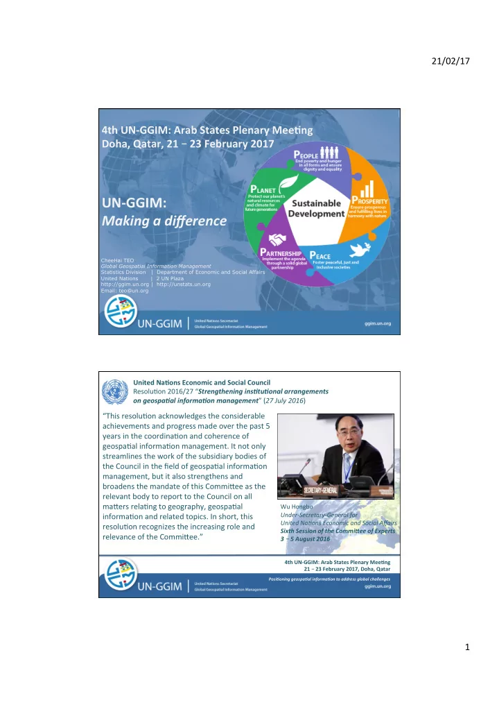
“This resolu1on acknowledges the considerable achievements and progress made over the past 5 years in the coordina1on and coherence of geospa1al informa1on management. It not only streamlines the work of the subsidiary bodies of the Council in the field of geospa1al informa1on management, but it also strengthens and broadens the mandate of this CommiFee as the relevant body to report to the Council on all maFers rela1ng to geography, geospa1al informa1on and related topics. In short, this resolu1on recognizes the increasing role and relevance of the CommiFee.”

Wu Hongbo Under-Secretary-General for United Na3ons Economic and Social Affairs Sixth Session of the Commi6ee of Experts 3 – 5 August 2016

United Na7ons Economic and Social Council Resolu1on 2016/27 “Strengthening insAtuAonal arrangements

  • n geospaAal informaAon management” (27 July 2016)

PosiAoning geospaAal informaAon to address global challenges

4th UN-GGIM: Arab States Plenary Mee7ng 21 – 23 February 2017, Doha, Qatar

slide-2
SLIDE 2

21/02/17 2

  • It strengthens and broadens the mandate of the

CommiFee as the relevant body to report to the Council on all maFers rela1ng to geography, geospa1al informa1on and related topics.

  • It stresses the need to strengthen the coordina1on

and coherence of global geospa1al informa1on management, through appropriate coordina1on mechanisms, including in the broader UN system, building on the work of the CommiFee

  • It explicitly recognizes the relevance of geospa1al

informa1on for the UN global development agendas.

  • It provides an excellent basis to liR our work to the

next level. United Na7ons Economic and Social Council Resolu1on 2016/27 “Strengthening insAtuAonal arrangements on geospaAal informaAon management” (27 July 2016)

PosiAoning geospaAal informaAon to address global challenges

4th UN-GGIM: Arab States Plenary Mee7ng 21 – 23 February 2017, Doha, Qatar

PosiAoning geospaAal informaAon to address global challenges

United Na7ons CommiJee of Experts on Global Geospa7al Informa7on Management (UN-GGIM) A formal inter-governmental UN CommiJee of Experts to:

  • Discuss, enhance and coordinate Global Geospa1al

Informa1on Management ac1vi1es by involving Member States at the highest level;

  • Work with Governments to make joint decisions and set

direc1ons on the use of geospa1al informa1on within na1onal and global policy frameworks;

  • Address global issues and contribute collec1ve knowledge as

a community with shared interests and concerns;

  • Develop effec1ve strategies to raise geospa1al awareness

and usefulness; to develop capacity par1cularly in developing countries;

  • To make 1mely, reliable and authorita1ve geospa1al

informa1on consistently and readily available to support na1onal, regional and global development.

4th UN-GGIM: Arab States Plenary Mee7ng 21 – 23 February 2017, Doha, Qatar

slide-3
SLIDE 3

21/02/17 3

UN-GGIM Bureau:

Co-Chairs: Mexico, China and USA Rapporteur: Burkina Faso

UN-GGIM Regional CommiJees & Chairs:

  • Asia-Pacific: Japan
  • Americas: Mexico
  • Europe: Sweden
  • Africa: Ethiopia
  • Arab States: Saudi Arabia

UN-GGIM Interna7onal Networks:

  • JBGIS, Academic Network, Private Sector Network

United Na7ons CommiJee of Experts on Global Geospa7al Informa7on Management (UN-GGIM)

PosiAoning geospaAal informaAon to address global challenges

4th UN-GGIM: Arab States Plenary Mee7ng 21 – 23 February 2017, Doha, Qatar Geospa1al Informa1on for Sustainable development Global geode1c reference frame Global fundamental geospa1al data themes Integra1on of sta1s1cal and geospa1al informa1on Informa1on, Data, Standards and technical specifica1ons Policy and Legal Frameworks Ins1tu1onal arrangements; Shared guiding principles Land administra1on and management Disaster risk reduc1on

United Na7ons CommiJee of Experts on Global Geospa7al Informa7on Management (UN-GGIM)

PosiAoning geospaAal informaAon to address global challenges

4th UN-GGIM: Arab States Plenary Mee7ng 21 – 23 February 2017, Doha, Qatar

slide-4
SLIDE 4

21/02/17 4

The peak inter-governmental mechanism for Member States to make joint decisions and set direc1ons on the produc1on and use of geospa1al informa1on within na1onal and global policy frameworks, UN-GGIM also provides a forum for Member States to strengthen na1onal geospa1al informa1on management capaci1es for beFer policy making and addressing developmental challenges at na1onal, regional and global levels.

Sub-commiJee

  • 1. Geodesy

Expert Groups

  • 1. Integra1on of Sta1s1cal and Geospa1al Informa1on (UN-GGIM: ISGI)
  • 2. Land Administra1on and Management (UN-GGIM: EG-LAM)

Working Groups

  • 1. Trends in Na1onal Ins1tu1onal Arrangements in Geospa1al Informa1on Management
  • 2. Fundamental Geospa1al Data Themes
  • 3. Geospa1al Informa1on and Services for Disasters

IAEG-SDGs

  • 1. Working Group on Geospa1al Informa1on

United Na7ons CommiJee of Experts on Global Geospa7al Informa7on Management (UN-GGIM)

PosiAoning geospaAal informaAon to address global challenges

4th UN-GGIM: Arab States Plenary Mee7ng 21 – 23 February 2017, Doha, Qatar

United Na7ons CommiJee of Experts on Global Geospa7al Informa7on Management (UN-GGIM)

Sub-commiJee on Geodesy q Preparing its transi1onal arrangement including terms of reference and governance structure; roadmap and workplan. q Expec1ng representa1ves from each of the 5 Regional CommiFees q Desiring beFer co-ordina1on with relevant WG of Regional CommiFees EG on Integra7on of Sta7s7cal and Geospa7al Informa7on q Five guiding principles of the Global Sta1s1cal and Geospa1al Framework adopted by UN-GGIM will be presented to the UN Sta1s1cal Commission for endorsement (March 2017) q Framework being consulted and reviewed, responses being consolidated q EG expected to provide overall coordina1on and oversight of the Framework and also develop guidance materials.

PosiAoning geospaAal informaAon to address global challenges

4th UN-GGIM: Arab States Plenary Mee7ng 21 – 23 February 2017, Doha, Qatar

slide-5
SLIDE 5

21/02/17 5

Positioning geospatial information to address global challenges Positioning geospatial information to address global challenges

Bridging 3 development domains

Global Statistical Geospatial Framework: 5 Principles

PosiAoning geospaAal informaAon to address global challenges

4th UN-GGIM: Arab States Plenary Mee7ng 21 – 23 February 2017, Doha, Qatar

United Na7ons CommiJee of Experts on Global Geospa7al Informa7on Management (UN-GGIM)

EG on Land Administra7on and Management q Concentra1ng on delivering its Expert Group Mee1ng in DelR, The Netherlands (Mar 2017) q Considering the demand for land and tenure data for the SDGs; q Focusing on developing and use of globally comparable methodology, domain standards and tools exploi1ng partnerships and innova1ve technologies to meet the demands for land and tenure data WG on Fundamental Geospa7al Data Themes q Led by UN-GGIM: Europe and drawing upon exis1ng work of Regional CommiFees to produce a minimum list of global fundamental geospa1al data themes. q DraR was commented and a high-level proposal including descrip1on of the themes developed and WG members, Regional CommiFees and other UN-GGIM EG & WG will be consulted (invited to review and comment) q Plan to develop the short ‘one pager’ summaries of the scope of each theme and WG members and Regional CommiFees encouraged to contribute to this task

PosiAoning geospaAal informaAon to address global challenges

4th UN-GGIM: Arab States Plenary Mee7ng 21 – 23 February 2017, Doha, Qatar

slide-6
SLIDE 6

21/02/17 6

Where does SALB stand today ?

SALB data SALB contact/ongoing No SALB

The UN Geospa1al Informa1on Sec1on Second AdministraAve Level Boundaries (SALB) ini1a1ve aims to avail authorita1ve administra1ve boundaries and names; as a public good available to Members States, interna1onal organiza1ons, humanitarian opera1ons, general public, researchers . .. …

PosiAoning geospaAal informaAon to address global challenges

4th UN-GGIM: Arab States Plenary Mee7ng 21 – 23 February 2017, Doha, Qatar

United Na7ons CommiJee of Experts on Global Geospa7al Informa7on Management (UN-GGIM)

WG on Trends in Na7onal Ins7tu7onal Arrangements in Geospa7al informa7on Management q Consolida1ng the considerable body of work achieved to date q Focus on developing a high level framework and/or principles that could support na1onal and strategic considera1ons of na1onal ins1tu1onal arrangement issues WG on Geospa7al Informa7on and Services for Disasters q “DraR Strategic Framework on Geospa1al Informa1on and Services for Disasters 2016-2030” reviewed and updated q Consulta1on being conducted with a view to further refine the draR including as a means to engage and inform Member States q WG requested to focus on geospa1al informa1on policy, management and issues of interoperable geospa1al data that can be readily integrated during the various stages of the disaster cycle. 7th Session of CommiBee of Experts to consider – § Working Group on Legal and Policy Frameworks for Geospa7al Informa7on § Working Group on Marine Geospa7al Informa7on

PosiAoning geospaAal informaAon to address global challenges

4th UN-GGIM: Arab States Plenary Mee7ng 21 – 23 February 2017, Doha, Qatar

slide-7
SLIDE 7

21/02/17 7

PosiAoning geospaAal informaAon to address global challenges

4th UN-GGIM: Arab States Plenary Mee7ng 21 – 23 February 2017, Doha, Qatar

1. Maturity: Moving from “GGIM 1.0 to GGIM 2.0” – determining our value proposi1on to ECOSOC and Global Development Agenda within the next 2-3 year horizon. 2. Strategy and roadmap on the ECOSOC resolu1on and how we implement the new and strengthened mandate. 3. A new strategic plan for UN-GGIM that considers 2021 and beyond in 5 yearly 1me steps. 4. Raising more awareness, including poli1cal, of UN-GGIM and connec1ng the poli1cal - technical – scien1fic levels within Member States. 5. Connec1ng more to the ac1vi1es of the regional commiFees, regional sta1s1cal bodies and regional commissions. 6. Ensuring effec1ve coordina1on and linkages across Sub-commiFee, Expert & Working Groups. 7. Extra-budgetary and funding op1ons, including ways of implementa1on. 8. More capacity development for countries in next 5 years – developing interna1onally agreed norms, guides, standards and methods.

UN-GGIM: Main areas of consolida7on

PosiAoning geospaAal informaAon to address global challenges

4th UN-GGIM: Arab States Plenary Mee7ng 21 – 23 February 2017, Doha, Qatar

slide-8
SLIDE 8

21/02/17 8

The 7th session of the United Na1ons CommiFee

  • f Experts on Global

Geospa1al Informa1on Management, is scheduled to be held from 2 – 4 August 2017

United Na7ons CommiJee of Experts on Global Geospa7al Informa7on Management (UN-GGIM) Addi1onally, also need to consider capacity development – to improve and strengthen na3onal capacity to produce and use of reliable, 3mely and official geospa3al data and informa3on that meet the needs of na3onal implementa3ons, regional ini3a3ves and global development agendas; and provide decision makers, users and researchers with data, tools and methods to make appropriate and evidence-based decisions.

PosiAoning geospaAal informaAon to address global challenges

4th UN-GGIM: Arab States Plenary Mee7ng 21 – 23 February 2017, Doha, Qatar

PosiAoning geospaAal informaAon to address global challenges

4th UN-GGIM: Arab States Plenary Mee7ng 21 – 23 February 2017, Doha, Qatar

TRANSFORMING OUR WORLD: THE 2030 AGENDA FOR SUSTAINABLE DEVELOPMENT General Assembly Resolu7on A/RES/70/1 Target 17:18; Data, monitoring and accountability By 2020, enhance capacity-building support to developing countries, including for least developed countries and small island developing States, to increase significantly the availability of high-quality, 1mely and reliable data disaggregated by income, gender, age, race, ethnicity, migratory status, disability, geographic locaAon and other characteris1cs relevant in na1onal contexts.

slide-9
SLIDE 9

21/02/17 9

The 7th session of the United Na1ons CommiFee

  • f Experts on Global

Geospa1al Informa1on Management, is scheduled to be held from 2 – 4 August 2017

Thank You

hJp://ggim.un.org

Global GeospaAal InformaAon Management United Na1ons Sta1s1cs Division Department of Economic and Social Affairs

PosiAoning geospaAal informaAon to address global challenges

4th UN-GGIM: Arab States Plenary Mee7ng 21 – 23 February 2017, Doha, Qatar