SLIDE 1
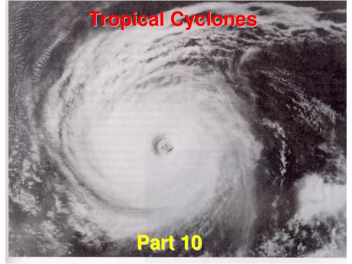
Tropical Cyclones Tropical Cyclones Part 10 Part 10
SLIDE 2 W hat is a Tropical Cyclone?
A tropical cyclone is the general term for all rotating weather systems that originate over warm tropical waters. Tropical cyclones are classified as follows:
- Tropical Depression: Maximum sustained
winds of 38 mph (33 knots) or less.
- Tropical Storm : Maximum sustained winds of
39 to 73 mph (34-63 knots).
- Hurricane: Maximum sustained winds of 74 mph
(64 knots) or higher. In the northwestern Pacific, hurricanes are called "typhoons," and similar storms in the Indian Ocean and southwestern Pacific are called "cyclones."
SLIDE 3
Stages of Hurricane Growth Stages of Hurricane Growth
SLIDE 4 General Characteristics General Characteristics
- Approximate average diameter of hurricanes is 500 km –
circulation of largest systems extend for thousands of kilometers
- The overall lifecycle of tropical cyclone growth from
tropical depression to hurricane and subsequent dissipation is on the order of days
- Generally classified as very large mesoscale systems
(meso-α) that are inertially stable vortices at maturity
- Most tropical cyclones form between 5° and 20° latitude
(more form poleward in NH)
- The majority of tropical storms form in the summer
hemisphere
– North Atlantic hurricane season is June through November with a peak around September 10
SLIDE 5 General Characteristics General Characteristics
lows
– Low pressure at the surface – High pressure aloft – Decreasing intensity with height
exists
waters
- Latent heat of condensation
very important to the formation and maintenance
SLIDE 6
Tropical Storm Circulation Tropical Storm Circulation
High Low warm
SLIDE 7
Vertical Cross Sections Vertical Cross Sections
SLIDE 8 Infrared Satellite Pictures of Hurricane Mitch Infrared Satellite Pictures of Hurricane Mitch October 26 October 26 -
27, 1998
SLIDE 9 Differences between Hurricanes and Extratropical Cyclones:
Energy Source Vertical Structure Horizontal Structure Hurricane Hurricane
warm ocean/latent heat release warm core/decays with height smaller size/just maritime Tropical air mass Extratropical Cyclone Extratropical Cyclone temp difference between air masses cold core/strengthens & slopes with height larger size/fronts (boundaries between 2 different air masses)
SLIDE 10 Parameters Important for Parameters Important for Tropical Cyclone Formation Tropical Cyclone Formation
- Large values of low-level vorticity (ζ) –
likely from a pre-existing tropical disturbance
- Large values of Coriolis parameter (f)
- Minimum of vertical wind shear
- Sea surface temperatures >26°C to a depth of
50 m
- Large values of moist lapse rate instability
- Large values of mid-troposphere (500-700
mb) relative humidity
SLIDE 11
SLIDE 12 Organized Convection Theory of Organized Convection Theory of Tropical Cyclone Development Tropical Cyclone Development
- 1 - surface convergence leads to rising motion / increase in
moisture content.
- 2 - rising air condenses, releases large amount of latent
heat.
- 3 - latent heating aloft leads to high pressure and
divergence aloft (organizes the large scale circulation)
- 4 - divergence aloft leads to lower surface pressure.
- 5 - lower surface pressure increases surface convergence.
- 6- stronger surface winds increase wave height; increase
friction and convergence; also increase ocean-air moisture flux.
- 7 - rotation serves to organize flow.
SLIDE 13 Easterly Wave Easterly Wave
Atlantic hurricane development initiated by the passage
- f a wave disturbance in the tropics/subtropics (e.g.,
easterly waves).
SLIDE 14 Easterly Wave Easterly Wave
[From Gray (2000)]
- Top panel (a): Conditions favorable for an easterly wave
to develop into a hurricane
- Bottom panel (b): Conditions unfavorable for hurricane
development
SLIDE 15
Typical Tropical Cyclone Tracks
SLIDE 16 World World-
Wide Tropical Cyclone Frequency Frequency
SLIDE 17
Tropical Cyclones by Basin Tropical Cyclones by Basin
Tropical Storms Hurricanes Average % of Total Average % of Total Atlantic 9.8 11.4 5.7 12.1 NE Pacific 17.0 19.7 9.8 20.7 NW Pacific 26.9 32.1 16.8 35.5 N Indian 5.4 6.3 2.2 4.6 SW Indian 10.3 12.0 4.9 10.4 SE Indian 6.5 7.5 3.3 7.0 SW Pacific 10.2 11.8 4.6 9.7 Global 86.1 47.3
SLIDE 18
SLIDE 19
SLIDE 20 NHC Track Forecast Error 1954 NHC Track Forecast Error 1954-
2001
100 200 300 400 500 600 700 1 9 5 4 1 9 5 7 1 9 6 1 9 6 3 1 9 6 6 1 9 6 9 1 9 7 3 1 9 7 6 1 9 7 9 1 9 8 2 1 9 8 5 1 9 8 8 1 9 9 1 1 9 9 4 1 9 9 7 2
Year Track Error (nm)
24 h OFCL 48 h OFCL 72 h OFCL
SLIDE 21 Hazards from Tropical Cyclones Hazards from Tropical Cyclones
– Ocean can rise up to 25 feet
– Gusts up to 200 mph
– Up to 40 inches of rain
– Spawned by the hurricane up to 1000 miles inland
SLIDE 22
SLIDE 23
U.S. U.S. Landfalling Landfalling Hurricanes Hurricanes
SLIDE 24
SLIDE 25 Atlantic Hurricane Names Atlantic Hurricane Names
2000 2001 2002 2003 2004 2005 Alberto Allison Arthur Ana Alex Arlene Beryl Barry Bertha Bill Bonnie Bret Chris Chantal Cristobal Claudette Charley Cindy Debby Dean Dolly Danny Danielle Dennis Ernesto Erin Edouard Erika Earl Emily Florence Felix Fay Fabian Frances Franklin Gordon Gabrielle Gustav Grace Gaston Gert Helene Humberto Hanna Henri Hermine Harvey Isaac Iris Isidore Isabel Ivan Irene Joyce Jerry Josephine Juan Jeanne Jose Keith Karen Kyle Kate Karl Katrina Leslie Lorenzo Lili Larry Lisa Lee Michael Michelle Marco Mindy Matthew Maria Nadine Noel Nana Nicholas Nicole Nate Oscar Olga Omar Odette Otto Ophelia Patty Pablo Paloma Peter Paula Philippe Rafael Rebekah Rene Rose Richard Rita Sandy Sebastien Sally Sam Shary Stan Tony Tanya Teddy Teresa Tomas Tammy Valerie Van Vicky Victor Virginie Vince William Wendy Wilfred Wanda Walter Wilma
Typical Year: 10 Named Storms 6 Hurricanes 2 Major Hurricanes
SLIDE 26 Where are the winds likely to be strongest?
Prevailing wind
SLIDE 27
The Coriolis Force The Coriolis Force Affects Ocean Currents Too Affects Ocean Currents Too
Rotation of the Earth deflects ocean currents to the right of the wind in the Northern Hemisphere wind Current (N.H.)
SLIDE 28 Storm Surge Storm Surge
- Surface wind converges
- Surface water diverges
- Makes a huge pile of water
- Causes terrible damage
and loss of life!
SLIDE 29 Hurricane Storm Surge Makes the Ocean Level Rise
DUNE STORM SURGE STORM SURGE DUNE
HIGH TIDE
STORM SURGE
MEAN TIDE (MSL) LOW TIDE
SLIDE 30
Folly Beach, South Carolina (Before Hugo)
SLIDE 31
Folly Beach, South Carolina (After Hugo)
SLIDE 32
x
SLIDE 33
Hurricane Andrew 1992 Wind Damage Hurricane Andrew 1992 Wind Damage
SLIDE 34
Hurricane Andrew 1992 Wind Damage Hurricane Andrew 1992 Wind Damage
SLIDE 35
Hurricane Floyd 1999 Rainfall Damage Hurricane Floyd 1999 Rainfall Damage
SLIDE 36
North Carolina Rainfall Damage North Carolina Rainfall Damage from Hurricane Floyd 1999 from Hurricane Floyd 1999
SLIDE 37
SLIDE 38 U.S. Loss of Life from Tropical Cyclones 1970-98 (517 Total)
53% 14% 13% 13% 4% 1% 2% Freshwater Shoreline Offshore Wind Tornado Stormsurge Other
(Rappaport, Fuchs and Lorentson, 1999)
SLIDE 39 Summary Summary
- Tropical Cyclones are “warm core” rotating weather
systems that derive their energy from the warm ocean
– Counter-clockwise in N. hemisphere, clockwise in S. hemisphere – Tropical storm winds > 39 mph, Hurricane winds > 74 mph
- Formation requires warm ocean, weak upper level winds,
moist mid-troposphere, moist lapse rate instability, earth’s rotation, and pre-existing disturbance
- They occur in most tropical and sub-tropical ocean basins
- Motion is usually east to west in tropics, west to east in
higher latitudes
- Track forecasting has greatly improved in last few decades
- Hazards include storm surge, wind, rainfall and tornadoes