SLIDE 1
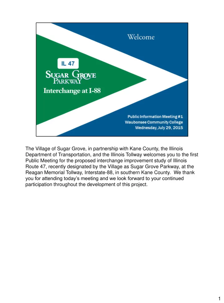
The Village of Sugar Grove, in partnership with Kane County, the Illinois Department of Transportation, and the Illinois Tollway welcomes you to the first Public Meeting for the proposed interchange improvement study of Illinois Route 47, recently designated by the Village as Sugar Grove Parkway, at the Reagan Memorial Tollway, Interstate-88, in southern Kane County. We thank you for attending today’s meeting and we look forward to your continued participation throughout the development of this project. 1
SLIDE 2 The purpose of today’s meeting is to provide you information about the project’s planning process and the public involvement opportunities for this
- study. We are seeking your input regarding any issues and concerns, such as
drainage, the environment, or safety concerns, within the project study area. Your input is a valuable part of the study planning process using context sensitive solutions, which will be detailed in this presentation. This presentation will also show you many opportunities to become involved in the
- project. You will also find project information in the adjoining room.
2
SLIDE 3 The routes under study have both regional and interstate significance. IL 47 is primarily a rural north–south state highway that runs from central Illinois to Wisconsin for a distance of approximately 170 miles. Within the metropolitan Chicago area, IL 47 has been designated a Strategic Regional Arterial (SRA). The SRA network is designed to carry high volumes
- f long-distance traffic. The SRA network supplements the regional
expressway system. I-88 is an interstate that runs from western Illinois to metropolitan Chicago for a distance of approximately 140 miles. This section of I-88 is under the jurisdiction of the Illinois Tollway and is designated the Reagan Memorial
- Tollway. Since 2010, all of I-88 has been part of the Chicago–Kansas City
Expressway (CKC) and designated Illinois Route 110. The study area includes the Village of Sugar Grove and unincorporated Blackberry and Sugar Grove Townships. 3
SLIDE 4
This project is located along Illinois Route 47 from approximately 1.3 miles south of I-88 at Old Oaks Road and College Drive (the northern entrance to Waubonsee Community College) to approximately 0.9 miles north of I-88 at Green Road. The study limits on I-88 extend approximately one-half mile east and west of IL 47 for a length of approximately 1 mile. 4
SLIDE 5 The interchange and this stretch of IL 47 has been the subject of multiple planning documents and studies by a number agencies over the past few
◾the 1994 Illinois Tollway Interchange Plans ◾the 1995 IDOT Strategic Regional Arterial Study ◾the 2005 Village of Sugar Grove Comprehensive Plan ◾the 2010 Kane and McHenry County IL 47 Corridor Planning Study ◾the 2010 Village of Sugar Grove Feasibility Study ◾and the 2012 Kane County 2040 Long Range Transportation Plan All of these planning documents have led to this joint Phase I study by Sugar Grove, Kane County, IDOT and the Illinois Tollway. This study could qualify the project to use federal funds for construction, if a build alternative is selected. 5
SLIDE 6
The Village initiated this Phase I study as a step toward providing a full access interchange improvement that will improve connectivity to the interstate network while also meeting the development goals of the adjacent communities. Planning documents from the Village of Sugar Grove, Village of Elburn, and the Chicago Metropolitan Agency for Planning (CMAP) indicate a significant increase of residential, commercial, and industrial development with associated traffic growth in the project area by the year 2040. 6
SLIDE 7 Roadway projects are typically implemented in three distinct phases. Phase
- ne includes preliminary engineering & environmental studies. During this
phase, issues and concerns are identified; solutions are proposed; and the public is engaged. Phase one typically takes 3-5 years to complete. Phase two includes contract plan preparation and land acquisition. Phase two typically takes two years to complete. Phase three is the construction phase, which is most visible to the public. Phase three typically takes two to three years to complete and is subject to funding availaibility. This project is currently in phase one. 7
SLIDE 8 Many elements are considered throughout the development of the project including roadway, geometrics and traffic; vehicular and pedestrian safety; hydraulics, drainage and bridge structures; and the human & natural environment. This timeline illustrates the basic steps
This project is currently in the Data Collection stage. This project will continue into the purpose and need, alternative analysis and preferred alternative stages before phase I completion. Stakeholder outreach will occur throughout this phase. 8
SLIDE 9
This data collection stage gathers all necessary information to identify transportation issues and concerns. The types of technical information gathered includes: roadway and land use plans; traffic, crash, bicycle and pedestrian data; population and employment forecasts; and local and regional comprehensive plans. Existing roadway and land use plans will indicate how the land use interacts with the associated roadway network. Traffic, crash, bicycle and pedestrian data will be used to quantify the performance of the existing system. Population and employment forecasts, along with local and regional comprehensive plans, will be used to project future demands on the existing system. Finally, input is also sought from the stakeholders to blend the project into its surrounding environment and natural conditions. 9
SLIDE 10
The area adjacent to the twenty mile stretch between Dekalb and Aurora on I- 88 has very limited access to I-88. The existing IL 47 at I-88 partial access interchange only provides access to and from the west. The next full access interchange to the west is located approximately 15 miles away at Peace Road in Dekalb. To the east, the next interchange is located approximately 4 miles away at IL 56 and only provides partial access to and from the east. The next full access interchange to the east is located approximately 5 miles away at Orchard Road in Aurora. 10
SLIDE 11
The existing land uses along the frontages of IL 47 and I-88 within the study limits are predominantly agriculture, residential, forest preserve and open space with a small amount of institutional. The Village of Sugar Grove has planned for the agricultural land use to be used as corporate campus, commercial, and residential uses in the future. 11
SLIDE 12
Based upon the latest available demographic information from the Chicago Metropolitan Agency For Planning (CMAP), the population of Sugar Grove and Elburn is expected to triple from 2010 to 2040. Sugar Grove is expected to grow from approximately 10,000 to 30,000 and Elburn is expected to grow from approximately 6,000 to 18,000. 12
SLIDE 13
With an increase in population comes an increase in traffic. The existing traffic volumes and traffic projections for the no-build condition in year 2040 have been obtained from CMAP. The no-build condition is the scenario in which an interchange improvement is not pursued and the additional access is not attained. Traffic on IL 47 south and north of the interchange is expected to grow by approximately 36 and 60%, respectively, over the next 25 years. Traffic on the ramps is expected to grow by approximately 67%. Traffic on I-88 is expected to grow by approximately 10%. 13
SLIDE 14 A crash analysis is a key study element that includes the collection and evaluation of crash reports within the study limits. The three most recent years
- f available crash data, years 2011 thru 2013, has been collected and
quantified. There were a total of 40 crashes reported on Illinois Route 47 in this time
- period. The predominant collision types were rear-end, turning, fixed object
and animal. There is one known fatal crash that occurred more recently than the available
- data. It occurred in 2014 at the intersection of IL 47 and the I-88 eastbound
exit ramp. 14
SLIDE 15 Data collected in the study, including input received from this meeting, will be used to develop the project’s problem statement and to guide technical
- evaluations. The information from the problem statement and technical
evaluations will then be used to formulate the project’s purpose and need. Finally, the purpose and need will describe the transportation problems, which this project will seek to address. 15
SLIDE 16
The public involvement program for this project will follow the principles of Context Sensitive Solutions (CSS). CSS involves stakeholders in the project development process. CSS reflects the project surroundings, its “context”. CSS addresses all aspects of a project including: Safety and Mobility, Community, Environment, Usability, and Multimodalism. 16
SLIDE 17 The Context Sensitive Solutions process aims to achieve the following:
- Understand stakeholder’s key issues and concerns as they are affected by
the project.
- Involve stakeholders in the decision making process through meetings,
advisory groups, and other means.
- Apply flexibility in design to address stakeholder concerns.
- And, achieve consensus among the stakeholders
17
SLIDE 18 Stakeholder involvement is critical to the success of this project. As part of the
- verall Context Sensitive Solutions process, a Stakeholder Involvement Plan,
- ften referred to as the SIP, has been developed to: outline the framework for
stakeholder participation in this study, identify the roles and responsibilities of all participants, and establish the timing for stakeholder activities such as workshops and public meetings. The SIP is a living document continuously evolving with additional information gained from stakeholders throughout the
- study. Copies of the current version of the SIP is available in the adjoining
room or on the project website for your review. 18
SLIDE 19
The Project Study Group, often referred to as the P-S-G, for this project includes the Village of Sugar Grove, Kane County, the Illinois Department of Transportation, Illinois Tollway and the Federal Highway Administration. The P- S-G collects and analyzes data, promotes partnership, ensures requirements are met, and renders the final decisions. 19
SLIDE 20 Anyone that uses, resides within or has an interest in the project area, is a project stakeholder. These include: property owners, residents, businesses, non-profit organizations, elected officials, regulatory agencies, policy advocates, travelers and the general public. The role of stakeholders is to advise the P-S-G on issues related to the design, throughout the entire study
- process. All input from all participants in this process is valued and will be
considered. 20
SLIDE 21
The Community Advisory Group, often referred to as the CAG, is comprised of entities directly affected by the study. The CAG provides insight to issues and concerns, and identifies potential solutions. The CAG meets in a workshop format several times throughout the study usually during regular business hours. One of the purposes of the meeting is to solicit membership in the CAG. CAG applications can be found at the reception area and on the project website. The first CAG meeting is tentatively scheduled for September 1 and will be held here at the Academic and Professional Center. The project problem statement will be developed from tonight’s public meeting and the first CAG meeting. 21
SLIDE 22 Following this meeting, the next steps of the study will be to: Form the Community Advisory Group. Analyze existing conditions and deficiencies. Review issues and concerns identified through data collection and public
- involvement. Begin integrating the technical analysis with the community
context evaluation. And, define a formal problem statement and purpose and need for the project study. 22
SLIDE 23
We want to hear from you. Please view the exhibits in the adjoining room and meet the project study team. If you have specific issues or areas of concern, then you may post your comments directly on the aerial exhibits. 23
SLIDE 24 If you would like to provide written input regarding this meeting, you may complete the Comment Form and/or fill out a Community Context Audit Form, which allows you to rate the importance of specific issues. You may also apply to become a member of the Community Advisory Group. Forms may be completed and dropped in the box today, taken home and mailed, or sent to the email address provided. A postal and email address are included on each
- form. Comment Forms, Community Advisory Group Applications and
Community Context Audit Forms must be submitted by the Wednesday, August 12th deadline. 24
SLIDE 25
Through Context Sensitive Solutions, the PSG reaches a wide audience through many means of communication. This includes public meetings and hearings, such as the meeting tonight. It also involves agency meetings, community advisory group workshops, and small group presentations. The PSG also reaches out to the media and broadcasts to the stakeholder’s and project websites. The website address is included on all of the handouts available this evening. If you did not sign in, please do so at this time. 25
SLIDE 26 Thank you for attending today’s public information meeting and taking an active role in the planning process. Please continue your visit in the adjoining
- room. This presentation will begin again in 3 minutes.
26
SLIDE 27
Thank you for attending today’s public information meeting and taking an active role in the planning process. This presentation will begin again in 2 minutes. 27
SLIDE 28
Thank you for attending today’s public information meeting and taking an active role in the planning process. This presentation will begin again in 1 minute. 28