
SLIDE 1
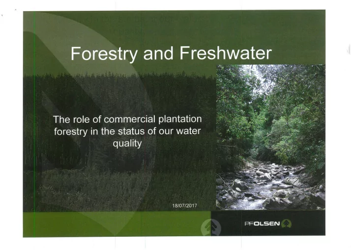
The role of commercial plantation forestry in the status of our - - PowerPoint PPT Presentation
The role of commercial plantation forestry in the status of our water quality What does the data tell us Water clarity by dominant land cover 2009-13 Metres (Max value: 12.3m) ANZECC 2000 guideline Urban Indigenous Exotic forest
Water clarity by dominant land cover 2009-13
Metres (Max value: 12.3m) ANZECC 2000 guideline Urban Pastoral Indigenous Exotic forest Dominant land cover Source: NIWA; regional councils
Dissolved phosphorus by dominant land cover
2009-13
100 90 80 70 60 50 40 30 20 10 mg/m3 (Max value: 270 mg/m3)
Dissolved phosphorus threshold (Max value: 290 mg/m3) Urban Pastoral Indigenous Exotic forest Dominant land cover Source: NIWA: regional councils
Nitrate-nitrogen by dominant land cover
2009-13
mg/ m3 2,500
NPS-FM nitrate- 2,250 nitrogen guideline B 2,000 (Max value: 131500 mgim3) 1,750 1,500 1,250 1,000 750 500 250 Urban zyxwvutsrqponmlkjihgfedcbaZYXWVUTSRQPONMLKJIHGFEDCBA
I ndigenous Exotic forest Dominant land cover Source: NI WA; regional councils
E.coli concentration by dominant land cover 2009-13
E.coli per 100mL 1,100 1,000 NPS-FM guideline 900 (Max value; (Max value: 800 1,750 E.co/i/100mL) 2,300 E.coii/100mL) 700 600 500 400 300 200 100 Urban Pastoral Indigenous Exotic forest Dominant land cover Source: NIWA; regional councils
Water Quality Index Water Quality
Class
91.7 Excellent Rural 66.7
WNW
Fair
Fair 54,3 Urban
5
Nathe Urban Exotic Forest Rural
Land Cover
But pure forest sites underrepresented.
Other regions Auckland 6% of sam ple
generally indicates plantation forests maintain an average status a bit below undisturbed native forest but above pastoral farming and urban.
PFOLSEN
Land cover
Native Exotic Forest 81.9 Good
160 140 120 100 80 60 40 20
2001-02 zyxwvutsrqponmlkjihgfedcbaZYXWVUTSRQPONMLKJIHGFEDCBA
2002-03 131.1111 2003-04 100 2004-05 136.3636
2005-06 135.4545
2007-08 141.1111 2008-09 131.25 2012-13 123.8095
2013 MCI results
Location
Sunday Creek Austrians Ck Redjacks Creek Ongionui (12 Mile) Blackmum s Ck Moores Creek Palmers Creek German Gully Stream
MCI
136 127 146 139 130 114 116 145
QMCI
6 6 8 8 6 7 8 8
Sunday Creek Estimated fishing area = 220m2 Fish abundance (fish/m2) 2003 2006 2008 2010 Longfin eel 0.073 0.095 0.005 Shortfin eel 0.009 0.005 Inanga Koaro 0.16 0.06 0.01 Shortjaw kokopu Banded Kokopu 0.28 0.36 0.11 0.02 Brown trout
Upland bully Redfin bully 0.04 0.03 0.05 Dwarf galaxias Lamprey 0.015
MCI
3 . ( 1 . Toreturba exits Exotic Forest) 3 . ( 3 .Zittel Jm n Exotic/ Native Forest> 3 . ( S. Trubutery Ex forst a Pierce Rd)
) • zyxwvutsrqponmlkjihgfedcbaZYXWVUTSRQPONMLKJIHGFEDCBA(7. Native Forest)
nog bras°
forest)
5 per. Moo. Av 5 pen Mov. As
Measured from a long term in-forest monitoring site during harvest.
Native fish have m axim um tem perature acceptability of approxim ately 2 5°C ( shortfin and longfin eels) and about 2 0°C for m any bully species and below 2 0°C for trout and galaxid species. I ntroduced sport fish ( salm on and trout) are stressed w hen tem peratures exceed 2 0°C ( Quinn, Hickey, 1 9 9 0 ) . W hen considering m acroinvertebrates w ater tem perature is a key determ inant of
less com m on in rivers w ith m axim um tem peratures greater than 2 1 .5°C ( Quinn, Hickey, 1 9 9 0 ) .
. At time of harvest and
particularly earthworks.
. Predominantly in small
headwaters streams.
II Exacerbated by historic
plantings right to stream edge and or poor establishment layout relative to harvesting needs.
. Second rotations
should be better.
S.Sediment Ratio% of Forest yield relative to Farm yield.
350% 300% 250% 200% 150% 100% 50% 0%
1995 1996 1997 1998 1999 2000 2001 2002 2003 2004 2005
—0—Ratio%
formations.
grazing (sheep) and plantation.
more specifically roading earthworks.
well down on pastoral landuse.
Pakuratahi Study — Hawkes Bay
NZ FOREST OW NERS ASSOCI ATI ON I NC
— 5m streams up to 3.0 wide. — 10m all larger streams. — Sediment controls.
NEW ZEALAND FOREST ROAD ENGINEERING MANUAL
New Zealand Environmental Code of Practice for Plantation Forestry
Vi Tr Trrar• tC• I thr,FOREST
moms
ASSOCI ATI ON
_
— Canopies intercept about 20%
rainfall events.
— Root systems and low
compaction allow rain infiltration.
— Below about 30% clearance in
an individual catchment, hydrological effects unlikely.
— In very intense storms —
moderation effect reduced.
— Dryland environments or over-
allocated water demand, plantations may reduce peak yield.
PFOLSEN
Fauna
r zyxwvutsrqponmlkjihgfedcbaZYXWVUTSRQPONMLKJIHGFEDCBA1,1 le Gott.
11C.I .VE0M'S FC5 Prostrate KanAs 14.4 MedPhu.. * us
YhXw o
Far.
▪
t.
PF Olsen FSC Group Scheme Certified Forests Map 1
Terrestrial/ wetland reserves
▪ Leptospermum/shrub HW/kowhai/podocarp
Beech/Tawa/podocarp/harwood
Uncosolidated foredunes Warm lowland softwoods hardwoods
Lake /surface water wetland
▪ Geothermal sinter terraces
1 0,600ha reserves = 19%
Table 3. zyxwvutsrqponmlkjihgfedcbaZYXWVUTSRQPONMLKJIHGFEDCBA Indicative values (in $ per ha per year) of key ecosystem services in the ohiwa catchment.
Ecosystem service Land usei Total Type Details Productive Natural Dry stock Exotic Dairy forestry Horticui- ture indigenous Scrub forest W etlands and m angroves Provisioning Food, wool, wood, pulp 158 483 1,686 8,810 11,137 Regulating Carbon sequestration/ emission and GHG regulation
48
Avoided erosion and flood/ disturbance regulation 121 166 166 12,737 13,190 Regulating nutrient (nitrogen) supply (e.g. avoided leaching)
2,800
10,000 2,800 2,800
Pollination 69 206 69 233 206 206 989 Water regulation 2 8 6 8 6 6 42 76 Waste treatment 244 244 244 11,721 12,453 Pest and disease regulation/ Biological control 164 11 105 65 11 11 367 Water supply 8
8 8
10,664 Social Recreation 900 1,800 1,978 4,678 Species conservation 257 414 494 1,165 Supporting Nutrient cycling 994 994 994 2,982 Soil formation
3
14
3 6 28 28
82
Net ES Value ( $/ ha/ yr)
6,092
6,677 4,463 37,636 40,990 Area (ha) 4,914 3,201
2,854 51 3,576 2,380 316 17,292 TOTAL VALUE ( S per land use per year)
19,500,492
23,876,952 10,621,940 11,892,976 22,993,580 Blank cells indicate that there were no appropriate data found to represent those values. A blank space does not necessarily mean that the ecosystem service has no value. It is very likely the non- market of that particular ecosystem service can be estimated because that value had already been estimated for other land uses.
2
Water regulation is defined in the MEA (2005) as The thing and magnitude of runoff, flooding, and aquifer recharge can be strongly influenced by changes in land cover, including, in particular, alterations that change the water storage potential of the system, such as the conversion of wetlands or the replacement of forests with croplands or croplands with urban areas."