The potential for public-transit based atmospheric monitoring to - - PowerPoint PPT Presentation
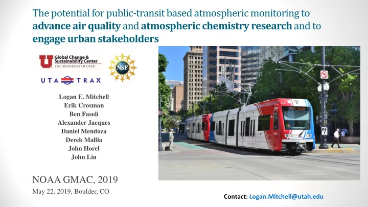
The potential for public-transit based atmospheric monitoring to advance air quality and atmospheric chemistry research and to engage urban stakeholders Logan E. Mitchell Erik Crosman Ben Fasoli Alexander Jacques Daniel Mendoza Derek Mallia
The Big Picture…
Policy Emissions Climate
- Sea level rise
- Extreme
weather
- Ecosystem
impacts
- Human
health
- Etc…
Ambient air quality Exposure/ dose Human health
Global Local
Atmospheric composition
- What monitoring networks & strategies are needed to understand
emissions, chemistry, transport & trend detection?
- How can we make research findings applicable to stakeholders & policy
makers?
- Progress towards emission reduction goals
- Sector based emissions
Simultaneous GHG & Air Quality Monitoring
Salt Lake City’s GHG targets:
- CO2, CH4, O3, PM2.5, NO2
- Inlets 4m (~13’) above ground.
- Post data in real time on the web:
- http://utahaq.chpc.utah.edu/
- http://air.utah.edu
https://doi.org/10.1016/j.atmosenv.2018.05.044
O3 Seasonal average CH4 Annual average CO2 Annual average Landfill Brick factory Natural gas power plant Higher O3 on urban periphery PM2.5 Case studies Typical patterns during inversions, thermal/terrain circulations, etc. Lower CO2 on urban periphery Titration of O3 by NOx along the I-15 freeway. Higher CO2 along roads
- CO2 averages across different time ranges.
- Seasonal
- Day of week
- Time of day
- Illustrates the rich temporal structure of
the data.
- Using TRAX data with STILT required updating the
hyper-near field mixing parameterization.
- Ongoing work to develop hyper local source
apportionment using mobile observations & STILT.
Hot off the press: TRAX footprints & inversion uncertainty reduction.
Annual average Hours: 0500-2400 Lower NO2 on urban periphery
- NO2 is a criteria pollutant w/ health
impacts.
- NOx contributes to poor air quality in
summer & winter.
- Ammonium nitrate (NH4NO3) accounts
for ~70% of the PM2.5 mass during winter inversions along the Wasatch Front (Kuprov et al., 2014)
- NO2 and CO2 are related through fossil
fuel combustion.
- Strong correlation (r = 0.83)
- NO2 and O3 are related through
atmospheric photochemistry.
- Strong correlation (r = -0.96)
- Illustrates the complex signature of fossil
fuel combustion on urban atmospheric composition and air quality.
NO2 Relationships
- The excess NO2/CO2 ratio
(NO2/CO2 above background conditions) provides insight into emission sources.
- High ratios in the center of the
valley occur where the is high NO2 without a corresponding CO2 signal
- Warrants further investigation.
NO2 Relationships
Proportional change in CO2 and NO2 does not affect the NO2/CO2 ratio
- Large NO2 plume centered
- n the Union Pacific
locomotive rail yard.
- ~3 ppb NO2 increase from
traffic on I-15.
- NO2/CO2 ratio is the
fingerprint of different emission sources.
- ~3 ppb NO2 increase from traffic on I-15
- Observed where TRAX crosses I-15 in
three places.
NO2 Relationships
~3 ppb NO2 increase by I-15
- Diesel locomotive “switcher” engines operate
in rail yards to move rail cars around.
- Operate 24/7 and often idle
- Avoids difficult start-ups
- Prevents engine blocks from freezing in the
winter
- ~60 switchers in Utah, 49 of which are
- perated by UPRR.
- 30% of UPRR’s switchers are Tier 0 and 70% are
Tier 0+.
- (Glade Sowards, UDAQ, personal
communication)
- Replacing Tier 0+ with a Tier 4 switcher would
reduce NOx emissions by 89%.
Switcher Locomotives
- Utah Air Quality Board: Considers emission reduction policies up to
$6,560/ton for area sources, and higher for large point sources.
- Repowering switchers have a emissions reduction cost of $3,412/ton (Peter
Verschoor, UDAQ, personal communication).
- States are prohibited from establishing emissions standards for locomotives in
the Clean Air Act, but they can offer incentives to encourage clean tech upgrades.
- TRAX measurements could evaluate emission inventories and
demonstrate air quality improvements after upgrades.
- 1. Used public transit to observe spatiotemporal
GHG and air pollutant patterns
- CO2, CH4, O3, PM2.5, NO2
- 2. Multi-species analysis:
- Understanding atmospheric chemistry & transport
- Identifying emission sources & evaluating inventories
- 3. Future directions:
- Atmospheric modeling
- Compare mobile, vs. stationary sites, vs. both
- Evaluate emissions inventories.
- Understand atmospheric chemistry, including day vs
night
- Measure more species (NOx, BC, etc.)
- Support field campaigns
- Google Street View mapping project!
Take home points
Contact: Logan.Mitchell@utah.edu
- Pollutants and health
- Improved spatial & temporal
exposure maps
- Spatiotemporal health impacts
- Socioeconomic relationships
- Co-benefits of air quality and GHG
mitigation policies
- Expansion
- Other cities
- Low cost sensors
- Electric buses
- SLC & Denver have similar air quality
challenges & GHG reduction goals.
- Contact Isaac Vimont for more information
Denver expansion on RTD
AQUARIUS
(Air Quality Research in the Western US)
Sept 25-26, 2019 in Salt Lake City, UT
- Upcoming aircraft & ground field campaign
- Wintertime PM formation chemistry,