
SLIDE 1
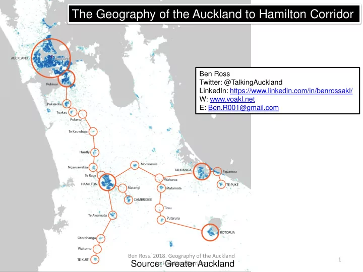
The Geography of the Auckland to Hamilton Corridor
Ben Ross Twitter: @TalkingAuckland LinkedIn: https://www.linkedin.com/in/benrossakl/ W: www.voakl.net E: Ben.R001@gmail.com
Source: Greater Auckland
Ben Ross. 2018. Geography of the Auckland to Hamilton Corridor 1