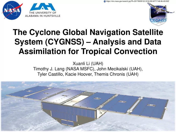
SLIDE 1 The Cyclone Global Navigation Satellite System (CYGNSS) – Analysis and Data Assimilation for Tropical Convection
Xuanli Li (UAH) Timothy J. Lang (NASA MSFC), John Mecikalski (UAH), Tyler Castillo, Kacie Hoover, Themis Chronis (UAH)
https://ntrs.nasa.gov/search.jsp?R=20170009132 2018-09-04T17:48:48+00:00Z
SLIDE 2
CYGNSS
Cyclone Global Navigation Satellite System (CYGNSS): a constellation of 8 micro- satellite observatories launched in November 2016, to measure near-surface oceanic wind speed. Main goal: To monitor surface wind fields of the Tropical Cyclones’ inner core, including regions beneath the intense eye wall and rain bands that could not previously be measured from space; Cover 38°S – 38°N with unprecedented temporal resolution and spatial coverage, under all precipitating conditions Low flying satellite: Pass over ocean surface more frequently than one large satellite. A median(mean) revisit time of 2.8(7.2) hrs. Orbits at an inclination of 35° 4 specular acquisitions per second 2
SLIDE 3
CYGNSS
Ground tracks for 90 minutes from the eight satellites Ground tracks for 24 hours from the eight satellites Sampling capacity: the percentages of TC inner core measurement in 3-hour 3
SLIDE 4
CYGNSS Instrument Definition
Zenith Antenna: Collect GPS direct signal Nadir Antennas: Collect GPS scattered signal DMR: Delay Mapping Receiver – Create Delay Doppler Map (DDM) DDM Wind Speed Retrieval 4
SLIDE 5 Two NASA Projects
Research goals: To analyze and utilize the high spatial coverage and temporal resolution simulated and real CYGNSS data. NASA Project #1: Exploring the utility of the planned CYGNSS mission for investigating the initiation and development of the Madden- Julian Oscillation
- Investigate MJO onset using DYNAMO field campaign
- bservations
- Examine how CYGNSS observe tropical convection under
heavy precipitation condition
- Assimilate CYGNSS observation with Observing system
simulation experiments (OSSEs)
5
SLIDE 6 MJO
- Eastward propagation of regions of
enhanced/suppressed precipitation.
- Distinct patterns in low-level and upper
level atmospheric anomalies: OLR, upper level velocity potential, upper and lower level wind, 500-hPa height.
- Planetary-scale over equatorial tropical
- Intraseasonal, a period of 30-90 days.
- Modulation of tropical and extratropical
precipitation, monsoon systems, ENSO cycle, tropical cyclone activities, and other meteorological and oceanographic phenomena.
- Challenge: Lack of high-resolution
- bservations of the many facets of the
equatorial tropical atmosphere and ocean
- DYNAMO and CYGNSS: To characterize
the key feature in wind field anomaly during the MJO
6
SLIDE 7 DYNAMO Campaign
Dynamics of the Madden-Julian Oscillation (DYNAMO)
- Goal: To observe the cloud population and evaluate the
effects of the air-sea interactions, on both the small and large scale, during a MJO event
- 2011 October, November, and December MJO events.
Intensive instruments:
- Indian Ocean - West Pacific
- Sounding array
- Air-sea fluxes
- Ships and buoys
- Satellite and aircraft data
- Radar network
7
SLIDE 8 CYGNSS E2ES
CYGNSS End-to-End Simulator (E2ES): Developed by CYGNSS science team, duplicating the satellites’ path patterns and configurations Generate DDM's ocean scattering using a fine grid around the specular point Scattering cross-section, combined with the antenna gains, ranges, and transmitted power are used to compute the total scattered power and mapped into delay- Doppler space Input: Gridded time, location, surface wind, precipitation, ocean conditions (SST, salinity, etc) Output: L1 DDM L2 retrieved wind speed 25 km grid.
8
O’Brien (2014): CYGNSS End-to-End Simulator Technical Memo
SLIDE 9
E2ES Case Studies: How CYGNSS Views Convection
1 Specular Point 4 Specular Points
9-km resolution WRF simulation Tropical convection during DYNAMO campaign 1-s sampling 12 – 14 UTC 26 October 2011
Reflectivity and surface wind 9
SLIDE 10
How CYGNSS Views Tropical Convection
4 specular point 12 UTC 21 to 00 UTC 22 December 2011 ASCAT/OSCAT wind 15 – 17 UTC 21 December 2011 1
SLIDE 11
CYGNSS Observation: WWBs
1 Westerly Wind Burst (WWB): sustained zonal wind over 5m/s for a few days MJO: Eastward propagation of convective clusters associated with WWB
SLIDE 12 CYGNSS vs. WRF truth wind for WWBs
Noise: Reduced RCG
12
SLIDE 13 Convection Along Specular Point Track
Before CYGNSS overpass CYGNSS overpass After CYGNSS overpass
Sharp Gradient
13
SLIDE 14
WWB event 30 min WRF input 1730 – 1930 UTC 21 December 2011
14
SLIDE 15 Strong Wind Gradient
Good Good Poor Poor
Application
wind: Latent Heat Flux Estimate
15
SLIDE 16
Normalized Root Mean Square Error: 25.4% Centered Smoothing: 13.9% Forward-Back Smoothing: 12.4% 16
SLIDE 17 Research Result on CYGNSS data for NASA Project #1
- 1. CYGNSS is able to characterize the mesoscale convective variability, such
as WWBs and gust fronts, associated with tropical convection during the MJO.
- 2. CYGNSS has the ability to observe convectively driven winds in heavy
precipitation Indicated by the fast-mode E2ES generated data.
- 3. E2ES was able to produce realistic tracks of CYGNSS specular points using
the WRF-based input atmosphere, that demonstrated tradeoffs between RCG and retrieval accuracy.
- 4. CYGNSS data has natural spatial sparseness in successive specular point
tracks do not line up in a spatially contiguous swath like traditional
- scatterometers. However, counteracting this data sparseness is the more
frequent revisit times at a particular location as compared to ASCAT, OSCAT and QuikSCAT.
- 5. Filtering and/or high RCG(>10 m-4), CYGNSS data be used for air-sea flux
estimates within and near convection. For low RCG (<10 m-4), filtering can reduce wind errors by as much as a factor of 2. In general, aggressive filters (forward-back method) perform better than less aggressive ones (centered method) in low-RCG situations. Hoover et al. 2017: “Use of an End-to-End-Simulator to analyze CYGNSS” submitted to J. Atmos. Ocean. Tech.
17
SLIDE 18
CYGNSS Data Application: Data Assimilation
18
Northern Indian Ocean TS 05A: Vortex formed on 2011-11-25 Severe damage along coast of Sri Lanka Sustained onshore wind >10m/s Loss of 33 lives 18 UTC 2011-11-25 Tropical Depression 1000 hPa 30 kts 06 UTC 2011-11-28 Tropical Storm 996 hPa 35 kts 00 UTC 2011-11-29 Tropical Depression 1000 hPa 30 kts
SLIDE 19
CYGNSS E2ES wind 11/25 11/26 11/27 11/28 11/29 12Z 00Z 05Z 15Z 00Z 05Z 15Z 00Z 05Z 00Z
CYGNSS Data Application: Data Assimilation
3 Experiments: Nature run: WRF model simulation (9-km resolution) starts at 00 UTC 25 Nov 2011, initialized by ERA Interim analysis CYGNSS E2ES wind: Generated from E2ES with WRF nature run files CTRL: WRF model starts at 12 UTC 25 Nov 2011, initialized by GFS analysis DA: Cycled assimilation of E2ES wind using CTRL as first guess OSSE: Cycled Data Assimilation for TS 05A 2011-11-25 – 2011-11-29 19
SLIDE 20 Analysis: 10-m Wind Speed at 15 UTC 2011-11-26
Min Aver RMSE Max CTRL – NAT -19.20 0.0197 1.97 12.93 NAT – NAT
0.0021 1.93 11.93 20
SLIDE 21 Analysis: 10-m Wind Speed at 05 UTC 2011-11-27
Min Aver RMSE Max CTRL – NAT -17.49 0.224 2.08 14.48 NAT – NAT
0.219 2.04 14.07 21
SLIDE 22 Forecast: 10-m Wind Speed at 15 UTC 2011-11-28
Min Aver RMSE Max CTRL – NAT -19.87 0.296 4.618 26.16 NAT – NAT
0.0956 1.982 15.46 22
SLIDE 23
Analysis: SLP and wind vector at 18 UTC 2011-11-26
NAT DA CTRL Min SLP (hPa) 995 996 998 Max WSPD (m/s) 24.8 22.2 19.2 23
SLIDE 24
Analysis: SLP and wind vector at 06 UTC 2011-11-27
NAT DA CTRL Min SLP (hPa) 995 995 996 Max WSPD (m/s) 25.0 21.5 20.3 24
SLIDE 25
Forecast: SLP and wind vector at 18 UTC 2011-11-28
NAT DA CTRL Min SLP (hPa) 996 990 985 Max WSPD (m/s) 23.9 23.9 32.8 25
SLIDE 26 Storm Track 00 UTC 2011-11-27 to 00 UTC 2011-11-29
00UTC 11/27 06UTC 11/27 12UTC 11/27 18UTC 11/27 00UTC 11/28 06UTC 11/28 12UTC 11/2 18UTC 11/2 00UTC 11/29 DA – NAT 243.1 216.2 176.3 152.9 265.5 214.7 263.3 326.5 353.4 CTRL – NAT 223.9 319.1 171.5 196.3 315.8 304.4 360.3 368.5 466.8
26
SLIDE 27
Forecast: 6-h Accumulate Rainfall 18 UTC 2011-11-28
Control DA 2011-11-25 1800 UTC Better Location and Intensity of Rainfall 27
SLIDE 28
Forecast: East-West Vertical Cross-section across Storm Center
T – T0 T0: average over the domain Water Vapor Mixing Ratio 28 18 UTC 2011-11-28
SLIDE 29 NASA Project #2:
Demonstrating the value of CYGNSS for investigating relationships between wind-driven surface fluxes and tropical oceanic convection
- Utilize CYGNSS data to study wind-precipitation-
evaporation feedbacks
- Improve estimate of surface flux estimates in and
near heavy convection
- Study the influence of wind-driven fluxes on
convective development with assimilation of CYGNSS observation
2
SLIDE 30 Assimilation of Real CYGNSS Wind Speed
Data: CYGNSS L3 windspeed data between 00 and 02 UTC 1 May 2017 Control: WRF control simulation starts at 12 UTC 30 April 2017 2-nested domains (27 + 9 km) 20 ensemble members with different physics options and initial conditions DA: Hybrid 3DVAR data assimilation analysis time: 01 UTC 1 May 2017 assimilated into both domains
- bservational error: 2 m/s for windspeed < 20 m/s
10% for windspeed > 20 m/s
30
SLIDE 31
Tropical Convection In Central Indian Ocean 01 UTC 2017-05-01
WRF CTRL Simulation IMERG rain rate (mm/hr) 31
SLIDE 32 CYGNSS L3 WindSpeed 00-02 UTC 2017-05-01
High Wind Speed 32 CYGNSS L2 wind:
- Baseline product
- Time and location – measurement space (sensor-specific latitude, longitude,
and time coordinates) CYGNSS L3 wind:
- Gridded wind in uniform latitude, longitude, and time
- Combines all 8 observatories x 4 bistatic radar channels = 32 measurements
- Statistics of each bin (number, mean value) and quality flags
SLIDE 33
10-m Wind Speed at 01 UTC 2017-05-01
Wind Speed Increase 33
SLIDE 34
10-m Wind Speed at 03 UTC 2017-05-01
Impact of wind speed assimilation is still apparent in 2 h forecast field 34
SLIDE 35 Discussion and Future Works
- Positive Impact has been found with hybrid 3DVAR assimilation
- f CYGNSS simulated for tropical storm, helping create an
improved initial condition and better forecast – intensity, track, and precipitation
- Impact has been found in surface wind field with assimilation of
real CYGNSS, which can last 6-12 hours
- Highlight the needs for improved quality of CYGNSS
- bservation: Influence of CYGNSS data is greatly influenced by
the data quality.
- CYGNSS DDM (magnitude and shape) is a function of ocean
- roughness. Further understanding on CYGNSS L1 DDM and its
relationship with ocean surface roughness and how to obtain more accurate near-surface wind speed retrievals.
35