SLIDE 1
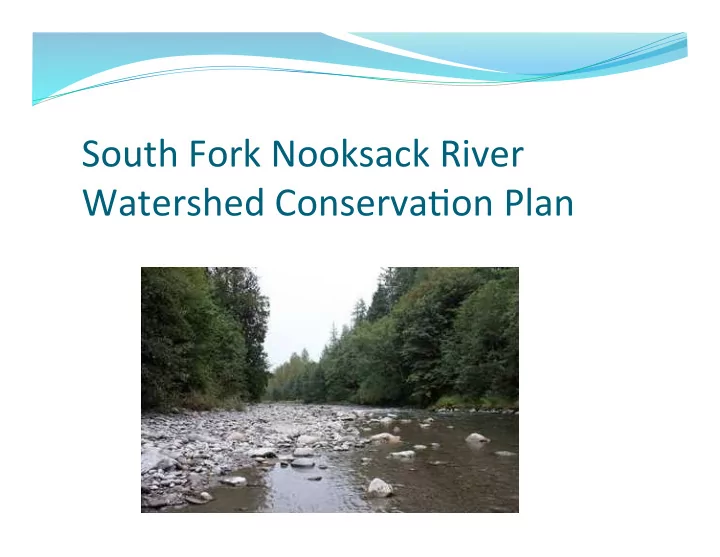
South Fork Nooksack River Watershed Conserva6on Plan
SLIDE 2 Why are we developing this Plan?
Create a common understanding of
watershed conditions, legacy impacts, and predicted climate change impacts on our watershed.
Enable better coordination and prioritization
Provide a foundation for dialogue and
planning around watershed restoration in the South Fork Nooksack River Watershed.
SLIDE 3 Dra? Outline of the Conserva6on Plan
- 1. Executive Summary
- 2. Introduction
- 3. Watershed Characterization
- 4. Protection and Restoration Strategies
(primary focus on water quality, quantity, fish, and habitat)
Ø Families, Farms, Forests, Recreation, etc.
SLIDE 4
This is a dra? for Watershed Group feedback!
We want to know what you think of these ideas and
strategies
Your feedback will help us develop and refine this plan. Tonight, we will focus on specific areas of the Plan, and
then finish writing it up
We will send the whole document out when it is finished
(hopefully) at the end of April
Before another Watershed Group meeting, there will be
plenty of time for your in-depth review – at least two weeks.
SLIDE 5 Watershed Characteriza6on
Changes over time:
Geology Legacy Impacts Climate Change
Ø This is where we are going to focus most of our
discussion tonight
SLIDE 6
Climate Change
Projected future changes to the global climate system
bring substantial risk to the watershed resources of the South Fork Nooksack River Watershed.
Climate modeling studies are in general agreement
that annual average surface air temperatures will likely rise on the order of 1 – 5 °C (about 2 – 9 °F) by 2100
SLIDE 7 Forecasted reduc6on of snowpack
Average historical simulations indicate that winter snow dominates regions above 500-600 meters in the South Fork River basin, about 50% of the basin. As temperatures increase into the century, the average winter snowpack and snow-water equivalent will decrease and will be restricted to regions above 1000-1300 meters and cover about 20% or less of the basin.
Bob Mitchell
SLIDE 8 Reduction of snow-water equivalent (SWE) in the South Fork basin due to future climate change
historical basin average forecasted future basin average Bob Mitchell
SLIDE 9 Forecasted steamflow response in the South Fork due to future climate change
higher winter flows due to rain rather than snow lower spring runoff due to less snow lower summer flows
Wickersham gauge
historical average flow Bob Mitchell
SLIDE 10 With more snow-free basin area exposed to rainfall, winter runoff increases, thus increasing the flood and mass-wasting risk during the wetter winter months. The projected decrease in snowpack also significantly reduces the spring runoff in the Nooksack River, meaning less water and warmer stream temperatures in the spring and summer.
What does this mean for us?
Bob Mitchell
SLIDE 11
The goals in this plan will align with the WRIA 1 Salmon Recovery Plan, Local Integrating Organization Plan, and the Watershed Management Plan
Goals and Objec6ves
SLIDE 12
Community Long Range Goals
For economic
and ecological health of the watershed: families, farms, fish, forests, and recreation
SLIDE 13 Watershed Conserva6on Plan Summary of Watershed Resource Goals:
Water quality:
reduce temperature and sediment in streams
Water quantity:
meet instream flow requirements store water in the winter for release in summer
Habitat restoration
rebuild natural processes
Salmon Recovery
restore fish to harvestable levels
SLIDE 14 Salmon Recovery: EDT Habitat Model Results
2,723 1,215 27,680 16,227 5000 10000 15000 20000 25000 30000 North/Middle Fork Nooksack Early Chinook South Fork Nooksack Early Chinook Current Historic Target: 10,550* Target: 7,604* *Assumes a population growth rate of 3.1 (returning spawners per spawning fish)
SLIDE 15 Strategies
Floodplain Restoration 1.
Continue instream restoration projects in high priority reaches of the South Fork that create cold- water refuges and habitat.
- 2. Work with landowners to explore lower-cost
instream projects along the river channel
- 3. Examine feasibility of improving passage in
constricted areas (i.e. railroad/road constriction)
- 4. Work with landowners to identify opportunities for
floodwater storage and floodplain reconnection
SLIDE 16
Strategies
Riparian Restoration
Continue to implement and expand the Conservation
Reserve Enhancement (CREP) program through the lower South Fork and seek funding to extend 15-year lease terms and/or otherwise work to protect existing CREP buffers over the long-term.
Support willing landowners to do more riparian
protection and restoration along the lower South Fork, and focus funding resources on areas of greatest ecological lift.
SLIDE 17
Strategies
Uplands Restoration
Work with forest landowners to study and explore the
feasibility of silvicultural practices that optimize snow storage duration and maximize soil moisture. Practices could include:
Retain and protect forests in wind-exposed areas Gap cutting or thinning Extend harvest rotations to allow maturation of
selected stands
SLIDE 18 Strategies
Wetlands Restoration Work with willing landowners to protect and restore high priority wetlands along the lower South Fork, with the goal of maximizing:
Temperature maintenance, Base flow maintenance, Sediment retention/transformation, and Flood flow storage and desynchronization.
SLIDE 19 Strategies
Beaver re-introduction and re-location Rationale:
Beaver ponds can have profound impacts on a watershed’s
potential for water retention. Active dams retain water in the dry season, metering it out downstream through gaps in the semi- permeable dam wall.
Beaver dams can substantially reduce stream temperatures, trap
sediment, and provide habitat for salmon
Strategy:
Work with landowners to identify locations where it would be
beneficial to introduce or relocate beaver dams
SLIDE 20
Strategies
Water Banking
Develop a groundwater-flow model coupled with a
watershed model for the South Fork basin to prioritize habitat restoration projects.
Assess water rights, incentivize water conservation,
identify opportunities to restore stream flow as well as utilizing tools to address water needs (change/ transfer of water rights, water banking, etc.) in voluntary projects.
SLIDE 21 Next Steps
- Watershed Conservation Plan to be completed
- Draft will be released to everyone at the same time
- Deadlines for comments - @2 weeks after release (is this
enough time?)
- Within the next few months (depending on how much
feedback) the Tribe would then have a final draft ready to share (through email to stakeholders and via website)
- In addition to a Watershed Group Meeting - should we
have a Community Meeting to present the final document?
SLIDE 22
Thank you!