
SLIDE 1
S A R S A T
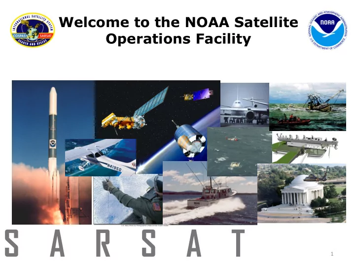
Welcome to the NOAA Satellite Operations Facility
1
S A R S A T 1 US SARSAT Program Partners United - - PowerPoint PPT Presentation
Welcome to the NOAA Satellite Operations Facility S A R S A T 1 US SARSAT Program Partners United States Cospas-Sarsat Program Administration Inland Maritime Research & System SAR SAR Development Operation
Welcome to the NOAA Satellite Operations Facility
1
United States Cospas-Sarsat Program Administration
Inland SAR Maritime SAR Research & Development System Operation Representative to Cospas-Sarsat Program
US SARSAT Program Partners
2
COSPAS = Cosmicheskaya Systyema Poiska Aariynyich Sudov
Which loosely translates into: “The Space System for the Search of Vessels in Distress”
SARSAT = Search And Rescue Satellite Aided Tracking
What is Cospas-Sarsat???
In short, COSPAS-SARSAT takes the “search” out of Search & Rescue
COSPAS-SARSAT
3
International Cospas-Sarsat Partners: 40 member nations
Who makes up COSPAS-SARSAT?
4
How does it work?
5
Emergency Beacons
channels currently open
Radio Beacons (EPIRB) for Maritime Distress
(ELT) for Aviation Distress
Remote Recreational Distress
(SSAS) for Maritime Security (Piracy and Terrorism) SARSAT System Update
6
LEOLUT (Ground Station) Status
44 LEOLUTs in 27 countries U.S. operates 5 LEOLUTs:
7
Earth Station Longitude Latitude Altitude [m] Deg Min Sec E/W Deg Min Sec N/S LUT 1 (GEO) 76 55 52 W 38 51 04 N 43 LUT 2 (GEO) 76 55 48 W 38 51 04 N 39 LUT 3 (GEO) 76 55 W 38 51 N LUT 4 (LEO) 76 55 W 38 51 N Goddard LUT 76 51 05 W 38 59 44 N 105 LUT 1 80 22 59 W 25 36 58 N 138 LUT 2 80 22 59 W 25 36 58 N 138 LUT 1 147 31 26 W 64 58 37 N 292 LUT 2 147 31 34 W 64 58 41 N 292 LUT 1 157 59 46 W 21 31 16 N 425 LUT 2 157 59 46 W 21 31 16 N 425 LUT 1 144 56 20 E 13 34 41 N 184 LUT 2 144 56 20 E 13 34 41 N 184
GUAM FL* HI* AK MD
8
Cospas Sarsat Interference
Historical and reference documents Cospas/Sarsat space segment providers have developed a protection criteria for the Cospas-Sarsat search and rescue instruments and local user terminals, respectively, in the 406.0-406.1 MHz (uplink) and 1544-1545 MHz (downlink) bands in order to protect them against broadband out-of-band emissions and against narrow-band spurious emissions. These protection criteria have been recognized at ITU level through two specific documents: ITU-R M.1478-1 for the protection of the 406.0-406.1 MHz band and ITU-R M.1731-1 for the protection of the 1544-1545 MHz band. Protection criteria from adjacent band emissions While the protection criteria developed in documents ITU-R M.1478-1 and M.1731-1 provide allowable power flux- density requirements against broadband out-of band and narrow band spurious emissions for the frequency bands used by the Cospas-Sarsat systems, they do not provide protection against “strong” emissions in adjacent bands. Emissions in adjacent bands, if not adequately controlled, could raise the level of noise captured by the Cospas- Sarsat systems and hinder their abilities to detect and/or relay signal from beacons. Mitigation and resolution of in-band interferers While the 406-406.1 MHz band used for SARSAT uplink has discrete narrowband channels allowed for operational use, interference sources are present worldwide, in the band. The accurate detection, location and elimination of these interference sources is critical to maintaining the functionality of the SARSAT space segment in detecting actual distress beacons. The 1544-1545 MHz band used for SARSAT downlink is managed effectively at the International Cospas Sarsat level, but, any user outside of the SARSAT community needs to be identified and rectified.
9
How Doppler Processing works
An important point to note is that the Doppler-localization process actually yields two possible locations, one on each side of the ground track, referred to as the “A” side and “B” side geo-locations. This creates an ambiguity which requires additional information to resolve, such as a second satellite pass which provides a second Doppler solution and resolves the ambiguity. 10
Automated Interference Monitoring System (AIMS)
Two other interfering signals can be seen beginning about 80 seconds after AOS at about 14 kHz and 60 kHz. Doppler localizations could be made for both of these interfering signals. Doppler localizations can be determined for each of the interfering signals which make up the broad-band spectrum shown (approximately 40 signals spread across the band (resulting in 40 pairs of estimated locations) using the AIMS. Eight (8) countries have LUTs monitoring the LEO satellites which have proprietary software that allow the LUT to maintain a database of interfering signals which is sent to its associated Mission Control Center. On a monthly basis, each participating country uses the interference data bases from its LUTs to prepare a Monthly 406 MHz Interference Report for the ITU.
Interferers
11
US Interferer Location and Reporting
Background In the United States, interfering signals in the 406.0 – 406.1 MHz band are detected and processed by the USA
which analyzes the data to determine if a persistent interferer is present. When enough data of sufficient quality is collected so that the interference source is statistically within 12 km of the estimated position, the latitude and longitude of the estimated position are provided, automatically via AIMS, to the FCC’s Centralizing Office (the FCC Operations Center). Although radio interference in all three frequency bands has been a continuing problem for the Cospas - Sarsat System, only interference in the 406.0 - 406.1 MHz band is analyzed by the AIMS. At present, all AIMS location communication is via Fax. AIMS – FCC Reporting Procedure (internal to US)
The AIMS monitors the interference site database solution files for interferers which are estimated to lie within the FCC area of responsibility. The AIMS computes an estimated search area radius, which is updated in near real time as new solutions are added to the database. When at least eight satellite overflights have detected interference, and the estimated search area radius is less than 12 km, the AIMS sends its automated message to the FCC. Note: Both of these parameters (number of satellite overflights, and search area radius) are readily changed 12
406 MHz Monthly Report Format
Site ID Number2 Location Search Area8 (probable search radius from mean location) Mean Latitude (degr. & decimal parts
degree) Mean Longitud e (degr. & decimal parts
degree) Median Detected Freq. (MHz) Modula- tion Charact.3 Impact
System4 Monthly Detection Ratio5, 6 (number/ total number of passes in visibility) Monitoring Period Times and Days of Week
Number
Observations (number since last report and total) Other Details Coun try Neare st City Directio n Distanc e (km) (km) First Date of Occur- rence Last Date of Occur- rence Date Day of Week Start Time End Time Current Period Total 1 2 3 4 5 6 7 8 9 10 11 12 13 14 15 16 17 18 19 20 21 MID1234 56 Text Text NE,W, SW, etc. nn nn ±nn.nn ±nn.nn 406.nnn N/ME/PE H/M/L 0.nn DDMont hYY DDMont hYY DDMo nthYY Sn,M, Tu,etc HH: MM HH:M M nn nnnn Text MID1234 57 etc.
406 MHz ITU Monthly Report Format
Reporting Period (DD Month - DD Month YY)
13
Final thoughts
Future The current operational LEO satellites have filtering that didn’t account for adjacent band power levels of 2015 and beyond. Implementing new payloads with sufficient filtering is not possible for US until 2026 (US SAR/GPS). In the interim, interference monitoring, reporting and elimination is critical to the operational Cospas-Sarsat system. The current MEOLUTs utilizing the DASS payloads allow for temporary monitoring of the bands adjacent to 406-406.1 MHz as the experimental payloads have a “wider” bandwidth that covers the 50 KHz on the upper and lower sides of the band.
Questions? Mickey.Fitzmaurice@NOAA.gov , 301-817-4434, Sarsat Satellite Systems Engineer
14