rouge park trail master plan
play

Rouge Park Trail Master Plan Markham Development Services Committee - PowerPoint PPT Presentation

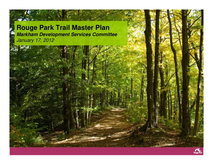
Rouge Park Trail Master Plan Markham Development Services Committee January 17, 2012 Background - Rouge Park Components Rouge Park Boundary 4 Overview of the Process Initiated in Autumn of 2009, Trail Advisory Committee meets regularly


  1. Rouge Park Trail Master Plan Markham Development Services Committee January 17, 2012

  2. Background - Rouge Park Components Rouge Park Boundary 4

  3. Overview of the Process • Initiated in Autumn of 2009, Trail Advisory Committee meets regularly • Public meetings held in October 2010, February 2011 and June 2011 • Master Plan process was extended to enable additional consultation • Focus group sessions held January 2011 – May 2011 - Agricultural Community/ Tenants - First Nations Representatives - Member organizations e.g. TRCA, Markham Sustainability - Natural Heritage Committee - Naturalist/ Environmental Groups • Planning process has addressed issues raised at the public and focus group meetings • Rouge Park Alliance presentations May and October 2011

  4. Proposed Draft Vision The vision for the Rouge Park Trails System was determined through the consultation process. This vision is set out below: The Rouge Park trail system will serve as a means to understand and appreciate the unique natural and cultural attributes of the park through heightened visitor experiences and immersion in the landscape. The system will offer a range of experiences and recreational opportunities to assist in meeting the needs of users of all ages and physical abilities. The trail system will support the protection of the outstanding natural features, agricultural landscapes and diverse cultural heritage of the park by managing appropriate public access and patterns of use while providing a rewarding experience of nature.

  5. Key Goals of the Trails Master Plan 1. Protect important natural heritage features • Protect natural heritage features and functions • Enhance habitat connectivity, diversity and function where possible • Avoid fragmentation of natural habitats • Avoid steep slopes and areas prone to flooding or erosion where ever possible 2. Provide a continuous north-south and east-west linkage • Provide for a multi-use trail connection from the Waterfront to the Oak Ridges Moraine • Provide key linkages to connect neighbourhoods adjacent Rouge Park • Provide a multi-modal trail network that maximizes accessibility and is integrated with public transit 3. Protect, respect and celebrate significant cultural, agricultural heritage resources • Capitalize on interpretive opportunities • Avoid sensitive cultural heritage features and landscapes

  6. Trail Alignment Principles – Natural Heritage Where possible trails will be aligned to: Minimize disturbance to areas of ‘high ecological sensitivity’ • Allow for the expansion of the natural heritage system • • Utilize existing trails where deemed appropriate from an ecological perspective • Minimize fragmentation of existing woodlands and habitats • Minimize interference with: - Natural hazards: steep slopes, floodplains, wetlands, seepage areas - Habitats for Species of Concern and Species at Risk 5

  7. Trail Alignment Principles - Recreation Where possible trails will be aligned to: • Trails will offer a range of experiences and challenges for passive recreation • Trails within the park will be primarily used for hiking, snow-shoeing, cross-country skiing and nature appreciation • Bicycle routes will be located predominantly along road rights-of- way, multi-use pathways • Motorized vehicles will be prohibited on all trails (with the exception of maintenance/service vehicles) 6

  8. Sensitivity Zones Areas of High Sensitivity • High concentrations of rare, area sensitive, and ground nesting species • Provincially Significant Wetlands • Large native interior forest areas Areas of Moderately Sensitivity • Medium concentrations of rare, area sensitive, and ground nesting species • Less disturbed forested valley system • Restoration areas Areas of Low Sensitivity • All other areas within Rouge Park * This map was used to inform trail types

  9. Overall Plan

  10. Markham Highlights Neighbourhood connections: Cornell, Box Grove, Locust Hill Kilometres of trail (including Steeles Av.): • Primary trail – 13.6 • Secondary/Low Impact trail – 13.23 • Multi-use path – 16.55 • Cycling route – 9.24 • Total: 52.62 Parking areas/number of cars • BHMP Visitor Centre, paved, 40 • Cedar Grove Community Centre, granular, 18 • Reesor Monument, granular, 15 • ‘Little Rouge Trail’/14 th Av. between Reesor and 11 th Con., 12 • Locust Hill, 10 • Cornell, where Reesor Road/Don Cousens PW align, 25 • Upper Cornell, 10,000 Trees for the Rouge Site, 10

  11. Celebrating Cultural, Agricultural and Natural Heritage: • Bob Hunter Memorial Park • Interior forest and valley forest • Little Rouge Creek Corridor; valley top walking overlooking Creek • Whittamore’s Farm • Cedar Grove heritage community; Lapp’s Cider Mill, Rouge Valley Mennonite Church, Reesor properties, Cedarena, Cedar Grove Labyrinth • Working farms • Locust Hill heritage community • Heritage wooden bridge deck at 16th/Reesor • Bob Hunter Memorial Park • Restoration sites • 10,000 Trees for the Rouge Valley site • Christ the King Cemetery • Reesor Family Cemetery • Historic church on 11th concession north of Steeles

  12. Next Steps: Feedback to Michelle_Holmes@rougepark.com (905) 713-6021

Download Presentation
Download Policy: The content available on the website is offered to you 'AS IS' for your personal information and use only. It cannot be commercialized, licensed, or distributed on other websites without prior consent from the author. To download a presentation, simply click this link. If you encounter any difficulties during the download process, it's possible that the publisher has removed the file from their server.

Recommend


More recommend