
SLIDE 1
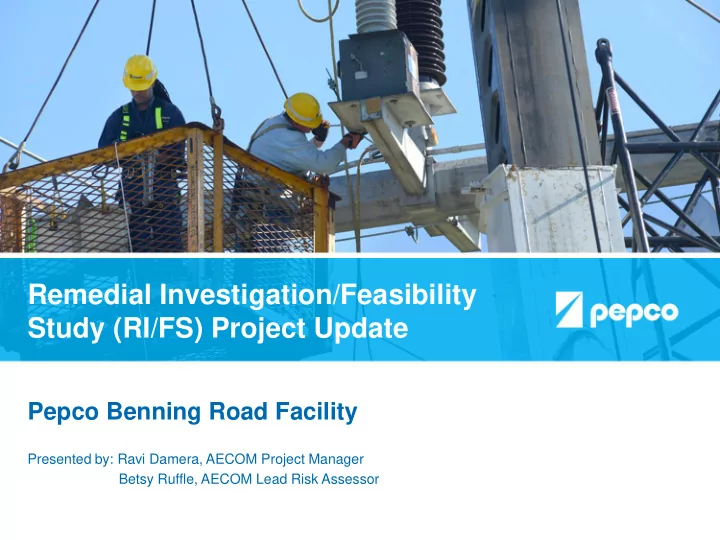
Remedial Investigation/Feasibility Study (RI/FS) Project Update
Pepco Benning Road Facility
Presented by: Ravi Damera, AECOM Project Manager Betsy Ruffle, AECOM Lead Risk Assessor
Remedial Investigation/Feasibility Study (RI/FS) Project Update - - PowerPoint PPT Presentation
Remedial Investigation/Feasibility Study (RI/FS) Project Update Pepco Benning Road Facility Presented by: Ravi Damera, AECOM Project Manager Betsy Ruffle, AECOM Lead Risk Assessor Introduction Pepco has recently completed an evaluation of
Presented by: Ravi Damera, AECOM Project Manager Betsy Ruffle, AECOM Lead Risk Assessor
2
3
RI/FS Work Plan approved by DOEE (Dec 2012) Phase 1 Field Investigation (Jan 2013 – Dec 2014) Draft RI Report (Feb 2016) Phase 2 Field Investigation (Dec 2016 – July 2018) Draft Final RI Report (September 2019) Treatability Study Feasibility Study Remedy Selection
Comment Period: 8/17/12 – 9/28/12 Public Meeting: 9/15/12 Today’s Meeting 11/2/19
Comment Period: 3/1/16 – 4/18/16 Public Meeting: 4/2/16 Update Meeting: 3/2/13
4
DOEE has released the Draft Final RI Report for public
These documents are also available on Benning Service Center
Hard copies are available for review at five public libraries
Purpose of today’s meeting is to discuss findings from:
Public comment period: October 04 – November 18, 2019
5
Outfall 013 Outfall 101
DC DPW Solid Waste Transfer Facility NPS Maintenance Yard
Parkside Community
6
The purpose of the RI/FS is to answer the following:
RI/FS is a phased process requiring regulatory review and approvals each step of the way.
7
8
9
10
Upstream Sampling Extent Downstream Sampling Extent
Waterside Investigation Area Landside Investigation Area
DC DPW Solid Waste Transfer Facility NPS Maintenance Yard
Pepco Benning Road Facility Parkside Community River Terrace Community
Outfall 013 Outfall 101
11
12
13
14
15
LEGEND STORM WATER UTILITY AST ABOVE GROUND STORAGE TANK UST UNDERGROUND STORAGE TANK CT COOLING TOWER
DC DPW Solid Waste Transfer Facility NPS Maintenance Yard
FORMER POWER PLANT
Pepco Benning Road Facility
Outfall 013 Outfall 101
16
CURRENT AND FORMER SITE OPERATIONAL AREAS LEGEND
DC DPW Solid Waste Transfer Facility NPS Maintenance Yard
Pepco Benning Road Facility
Former Equipment Laydown Area Utility Pole Storage Vehicle Servicing Vehicle Servicing Former Solvent Storage Transformer Operations Transformer Operations Transformer Operations Former Equipment Laydown Area Former Oil Storage Former Oil Tank Former Coal Pile Area Former Solvent Storage
Outfall 013 Outfall 101
17 PCBS, Dioxins MTBE PCBS, TPH PCBS, PAHs PCE Vanadium, PCBs, PAHs, Dioxins PCBs, PAHs, TPH PAHs Former PCB Excavation Area
Outfall 101
5
① ② ③ ④ ⑤ ⑥ ⑦ ⑧ ⑨ ⑩ ⑪ ⑫ ⑬ ⑭ ⑮ ⑯ ⑰ ⑱ ⑲ ⑳
⑪ BUILDING #68 (PCB BUILDING) ⑫ BUILDING #57 (TRANSFORMER SHOPS) ⑱ KENILWORTH FUELING ISLAND MTBE PLUME ⑲ PCE IN GROUNDWATER ⑳ PAHs IN SOIL – FORMER EQUIPMENT LAYDOWN
AREA TARGET AREA KEY:
① FORMER SLUDGE DEWATERING AREA ④ 2003 SALVAGE YARD INVESTIGATION ⑤ FORMER COOLING TOWERS - 1995 & 2017
CLEANUP AREA
⑩ RED TAG STORAGE AREA
LEGEND
STORM WATER UTILITY
PCE
18
Free or floating oil was not detected in any of the soil borings or
Metals, PCBs, PAHs, Dioxins, and Petroleum Hydrocarbons were
With the exception of vanadium in soils, metals in soil and groundwater
MTBE (a gasoline additive) and PCE (a common dry cleaning fluid and
Neither current nor historical groundwater discharges from the site to
Storm drain residues sampled during the RI reflect accumulated
These detections and the CSM framework are further subjected to a risk
19
20
Fish and Invertebrate Consumption by Wildlife Kayaker Swimmer Direct contact (incidental ingestion and dermal contact) with fringe surface sediment and surface water Off-Site Sources and Upstream Discharges
Potential Historic Site Contributions
Pepco and Non-Pepco Stormwater Outfalls Tidal Exchange Fish Surface Water Pore Water Benthic Invertebrates Groundwater Discharge Bedded Sediment Bioactive Zone Net Sediment Deposition Recreational/Subsistence Angler:
and dermal contact) with fringe surface sediment and surface water
21
22
PCB Distribution in the Waterside Investigation Area Elevated PCB levels were detected in the Cove
23
Surface water concentrations generally below screening levels and
Concentrations of several metals, pesticides, PAHs, and PCBs
Concentrations of most chemicals in surface sediment are consistent
Waterside Investigation Area including the Cove is net depositional. These detections and the CSM framework are further subjected to a risk
The Anacostia River is an urban waterway with numerous off- site and upstream contaminant sources.
24
25
Two types of risk assessments: Baseline Human Health Risk
Objective: To evaluate exposure to chemicals in –
Conducted in accordance with guidance issued by the U.S.
26
27
Media Potential Exposure Pathways Current On-Site Worker Current/ Future Construction Worker Current/ Future Recreational Visitor Future On-Site Worker Soil Ingestion, Skin Contact, Inhalation of Outdoor Air
l l
Ingestion, Skin Contact, Inhalation of Outdoor Air
Media Potential Exposure Pathways Current/ Future Swimmer Current/ Future Wader Current/ Future Angler Current/ Future Shoreline Worker Surface Sediment Ingestion and Skin Contact
l l l l
Surface Water Ingestion and Skin Contact
l l l l
Fish Tissue Ingestion
(a)
There are no current exposures. A screening level evaluation of the potential for vapors in groundwater to enter the indoor air of a hypothetical future building was conducted. Potentially complete exposure pathway Exposure Pathway considered to be incomplete or insignificant
Groundwater
LANDSIDE
Potential Human Receptors/Exposure Pathways
WATERSIDE
Potential Human Receptors/Exposure Pathways
28
29
Notes: Upper Potomac River: Upstream of the 14th Street bridge Lower Potomac River: Downstream of the 14th Street bridge Upper Anacostia River: Upstream of the CSX bridge Lower Anacostia River: Downstream of the CSX bridge Non-Tidal Anacostia: Upstream of the Maryland state line
30
31
Direct contact with sediment and pore water by benthic
Ingestion of contaminated food sources and exposure to
Ingestion of contaminated prey items (fish) and sediment by
32
No receptors evaluated in the BERA exhibited a high
For the majority of receptors, the BERA found no potential
For benthic macroinvertebrates, the BERA found a low
No potential risk was identified to fish. No potential risk was identified to wildlife.
33
34
Closed-circuit television (CCTV) inspection of the facility storm drain
Installed various stormwater treatment measures (biofilters, physical
Cooling Tower concrete basins and impacted soil removal (completed in
35
Hold a public meeting to update the community on Draft Final RI Report
Address public comments and finalize the RI Report (Pepco and DOEE,
Conduct Treatability Studies and submit Treatability Study Report to
Submit Draft Feasibility Study Report to DOEE per Consent Decree
Submit the Final FS report after DOEE review of and public comment on
Select remedy and prepare Record of Decision (DOEE)
Detailed schedule is available on the Benning Service Center website (http://benningservicecenter.com/benning-consent-decree/documents.aspx)
36
37