Reiner Neighborhood Development Plan November 18, 2019 Reiner - - PowerPoint PPT Presentation

reiner neighborhood development plan
SMART_READER_LITE
LIVE PREVIEW

Reiner Neighborhood Development Plan November 18, 2019 Reiner - - PowerPoint PPT Presentation

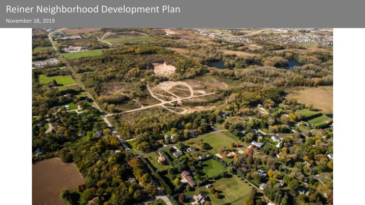
Reiner Neighborhood Development Plan November 18, 2019 Reiner Neighborhood Development Plan Trivia question: The Town of Burke is named after? A. Mary Burke B. Edmund Burke C. Richard Burke D. Edward Burke Reiner Neighborhood Development Plan


slide-1
SLIDE 1

Reiner Neighborhood Development Plan

November 18, 2019

slide-2
SLIDE 2

Reiner Neighborhood Development Plan Trivia question: The Town of Burke is named after?

  • A. Mary Burke
  • B. Edmund Burke
  • C. Richard Burke
  • D. Edward Burke
slide-3
SLIDE 3

Reiner Neighborhood Development Plan

Agenda

  • What is an NDP?
  • Background Information
  • Project Scope
  • Planning Process/Timeline
  • Reaction/Comments/Questions
slide-4
SLIDE 4

Reiner Neighborhood Development Plan

Neighborhood Development Plan?

  • Guide future development
  • Created for largely undeveloped

areas

  • Land use, transportation, utilities,

phasing

  • Must be adopted before

development can occur

slide-5
SLIDE 5

Reiner Neighborhood Development Plan

Comprehensive Plan

City-Wide Recommendations Adopted by City

Neighborhood Development Plan

Neighborhood Recommendations Adopted by City

Development Plans

Site Specific Proposals Proposed by developers/landowners

slide-6
SLIDE 6

Reiner Neighborhood Development Plan Example: Elderberry – Pioneer – Junction NDP

slide-7
SLIDE 7

Reiner Neighborhood Development Plan

Background

  • Town of Burke boundary on the east
  • Railroad Tracks and Felland Rd on the

west/north

  • Thorson Road and Northeast NDP boundary
  • n the south
  • Approx. 1,480 acres
  • Residential 230 Acres, 226 homes
  • Sun Prairie School District
slide-8
SLIDE 8

Reiner Neighborhood Development Plan

Nelson Neighborhood Development Plan (2019) Northeast Neighborhood Development Plan (2009) Felland Neighborhood Development Plan (2002)

slide-9
SLIDE 9

Reiner Neighborhood Development Plan

Plan will focus on:

  • Evaluate and recommend:
  • Land Uses/housing types
  • Street layout
  • Parks
  • Identify potential stormwater

management, drainage locations

  • Transit and bike facilities
  • Public utilities and services
slide-10
SLIDE 10

Reiner Neighborhood Development Plan

Elevation

~850 Feet ~1070 Feet

slide-11
SLIDE 11

Reiner Neighborhood Development Plan

Environmental Features

  • Rolling hills
  • Topography
  • Watersheds
  • Woodlands
  • Wetlands and Floodplains
  • Soils
slide-12
SLIDE 12

Reiner Neighborhood Development Plan

Burke Cooperative Plan

slide-13
SLIDE 13

Reiner Neighborhood Development Plan

How should the neighborhood grow

Rank the following amenities in order of preference?

More park spaces Added neighborhood retail and services

(ie grocery store, coffee shop)

Walkability and a connected street pattern Diversity of housing options Bike facilities (paths, bike lanes)

slide-14
SLIDE 14

Reiner Neighborhood Development Plan

Compile Background Information (Oct-Nov)

Staff Team Mtg 1 Issues/Ops

Initial Meetings (Nov-Dec)

Public Open House # 1 Plan Commission

Staff drafts plan (Jan-Feb)

Staff Team Mtg 2 Concept Dev

Meetings to Review Draft plan (March-Apr)

Public Open House # 2 Plan Commission TPPB

Revise Draft plan (Apr) Board, Commission, Committee Review (May-July)

Parks Commission TPPB Plan Commission Common Council

Potential Process

slide-15
SLIDE 15
slide-16
SLIDE 16

Reiner Neighborhood Development Plan Questions? Comments?

Project Website www.cityofmadison.com/ReinerNDP Project Contacts

Urvashi Martin Planning Division 608-267-8735 umartin@cityofmadison.com Colin Punt Planning Division 608-243-0455 cpunt@cityofmadison.com Jeff Greger Planning Division 608-243-0181 jgreger@cityofmadison.com