
SLIDE 1
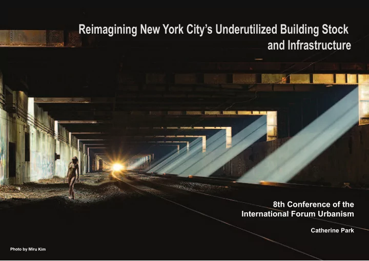
Reimagining New York City’s Underutilized Building Stock and Infrastructure
8th Conference of the International Forum Urbanism
Catherine Park
Photo by Miru Kim
Reimagining New York Citys Underutilized Building Stock and - - PowerPoint PPT Presentation
Reimagining New York Citys Underutilized Building Stock and Infrastructure 8th Conference of the International Forum Urbanism Catherine Park Photo by Miru Kim THE UNEMPLOYMENT RATE IN THE U.S. DURING 1910 ~ 1960 (Estimatd) NEW YORK
Catherine Park
Photo by Miru Kim
1M 2M 0% 5% 10% 15% 20% 25% 30% 3M 4M 5M 6M 7M 8M 9M
1 6 9 8 1 7 1 2 1 7 2 3 1 7 3 7 1 7 4 6 1 7 5 6 1 7 7 1 1 7 9 1 8 1 8 1 1 8 2 1 8 3 1 8 4 1 8 5 1 8 6 1 8 7 1 8 8 1 8 9 1 9 1 9 1 1 9 2 1 9 3 1 9 4 1 9 5 1 9 6 1 9 7 1 9 8 1 9 9 2 2 1 2 1 4
WORLD WAR I 1914 ~ 1918 GREAT DEPRESSION 1929 ~ 1939 WORLD WAR II 1939 ~ 1945
Data Sources: United State Census Bureau. Retrieved March 30, 2015
NEW YORK CITY’S HISTORICAL POPULATION THE UNEMPLOYMENT RATE IN THE U.S. DURING 1910 ~ 1960 (Estimatd)
Growing of Population 1900
Unemployment Rate Great Depression
7 M
1.5 M
3.4 M
Loss of Population 1960
Loss of Population 1980
U.S. REGION RAILROAD I RAILROAD II RAILROAD III
Data Source : U.S. Department of Transportation
NEW YORK STATE MANUFACTURING FACILITIES RAW-MATERIAL ROUTES
RAILROAD EXPANSION 1920s
OIL INDUSTRY CLEVELAND, OHIO
STANDARD OIL U.S. STEEL
RAW-SUGAR CANE
COTTON, WOOL
GARMENT INDUSTRY ENGLAND
STEEL INDUSTRY PITTSBURGH, PA SUGAR REFINING CARIBBEAN REGION
U.S. REGION 3RD INTERSTATE INTERSTATE HIGHWAY
Data Source : U.S. Department of Transportation
NEW YORK STATE SUBURBIA 2ND INTERSTATE
INTERSTATE HIGHWAY EXPANSION 1950s
U.S. REGION 3RD INTERSTATE INTERSTATE HIGHWAY
Data Source : U.S. Department of Transportation
NEW YORK STATE SUBURBIA 2ND INTERSTATE
INTERSTATE HIGHWAY EXPANSION 1950s
FREEWAY SYSTEM
AUTOMIBILE DETROIT, MICHIGAN
NORTHEAST CORRIDOR INTERSTATE 95 PHILADELPHIA, PA
SUBURBIA
LEVITTOWN TOWN NASSAU, NEW YORK
Source: Department of City Planning City of New York
High Way Road Open Space Transportation / Utility Vacant Lot No Data 5 Boroughs Industrial / Manufacturing
Identifying Under-utilized Structure, Abandoned Lots, and dormant Infrastructure in the Five Boroughs
Industrial / Manufacturing 5,498 Acres
Source: Department of City Planning City of New York
High Way Road Open Space Transportation / Utility Vacant Lot No Data 5 Boroughs Industrial / Manufacturing
Identifying Under-utilized Structure, Abandoned Lots, and dormant Infrastructure in the Five Boroughs
Transportation / Utility 10,907 Acres
Open Space Lot Area 41,466 Acres
Industrial / Manufacturing 5,498 Acres
Land Area
INDUSTRIAL Manhattan 10,877 Acres
Source: Department of City Planning City of New York
High Way Road Open Space Transportation / Utility Vacant Lot No Data 5 Boroughs Industrial / Manufacturing
Identifying Under-utilized Structure, Abandoned Lots, and dormant Infrastructure in the Five Boroughs
Vacant Lot 8,902 Acres
Source: Department of City Planning City of New York
High Way Road Open Space Transportation / Utility Vacant Lot No Data 5 Boroughs Industrial / Manufacturing
Identifying Under-utilized Structure, Abandoned Lots, and dormant Infrastructure in the Five Boroughs
Vacant Lot 8,902 Acres
5 Borough Land Area 153,605 Acres
Land Area
VACANT LOT + NO DATA
Manhattan 10,877 Acres
No Data 2,745 Acres
1.8%
Source: Department of City Planning City of New York
High Way Road Open Space Transportation / Utility Vacant Lot No Data 5 Boroughs Industrial / Manufacturing
Identifying Under-utilized Structure, Abandoned Lots, and dormant Infrastructure in the Five Boroughs
Transportation / Utility 10,907 Acres
Industrial / Manufacturing 5,498 Acres
Vacant Lot 8,902 Acres
5 Borough Land Area 153,605 Acres
Land Area
INDUSTRIAL Manhattan 10,877 Acres
Land Area
VACANT LOT + NO DATA
Manhattan 10,877 Acres
No Data 2,745 Acres
1.8%
Source: Department of City Planning City of New York
High Way Road Open Space Transportation / Utility Vacant Lot No Data 5 Boroughs Industrial / Manufacturing
Identifying Under-utilized Structure, Abandoned Lots, and dormant Infrastructure in the Five Boroughs
Transportation / Utility 10,907 Acres
Open Space Lot Area 41,466 Acres
Industrial / Manufacturing 5,498 Acres
Vacant Lot 8,902 Acres
5 Borough Land Area 153,605 Acres
Land Area
INDUSTRIAL Manhattan 10,877 Acres
Land Area
VACANT LOT + NO DATA
Manhattan 10,877 Acres
No Data 2,745 Acres
1.8%
Subway (8 Track) Unused Track Transportation / Utility Abandoned Space 5 Boroughs Subway Interstate Highway
Source: Department of City Planning City of New York, Abandoned NYC, New York MTA
New York City’s Potential Repurposing of Selected Underutilized Resources
Subway (8 Track) Unused Track Transportation / Utility Abandoned Space 5 Boroughs Subway Interstate Highway
Source: Department of City Planning City of New York, Abandoned NYC, New York MTA
New York City’s Potential Repurposing of Selected Underutilized Resources
1
24 23 22 21 20 19 18 17 16 15 14 13 12 11
10
9 8 7 6 5 4 3 2
Subway (8 Track) Unused Track Transportation / Utility Abandoned Space 5 Boroughs Subway Interstate Highway
Source: Department of City Planning City of New York, Abandoned NYC, New York MTA
New York City’s Potential Repurposing of Selected Underutilized Resources
CITY HALL STATION TURNING LOOP UN-USED FROM, DEC 1945 WORTH ST STATION 2 PLATFORMS UN-USED FROM, 1962 18 ST STATION 2 PLATFORMS UN-USED FROM, 1948 TROLLEYS TERMINAL WILLIAMSBURG, 8 LOOP TRACKS UN-USED FROM, 1948 LEXINGTON AVE 2 PLATFORMS, NEVER COMPLETED UN-USED FROM, 1976 JEROME STATION 1 PLATFORM UN-USED FROM, 1958 76 ST STATION 2 PLATFORMS, 4 TRACKWAYS UN-USED FROM, 1946 MYRTLE AVE STATION 1 PLATFORM UN-USED FROM, 1956 91 ST STATION 2 PLATFORMS UN-USED FROM, 1959 96 ST STATION 2 PLATFORMS UN-USED FROM, 1956 SEDGWICK STATION 2 PLATFORMS UN-USED FROM, 1958 COURT ST STATION 2 PLATFORMS, TRANSIT MUSEUM UN-USED FROM, 1946
1
24 23 22 21 20 19 18 17 16 15 14 13 12 11
10
9 8 7 6 5 4 3 2
Subway (8 Track) Unused Track Transportation / Utility Abandoned Space 5 Boroughs Subway Interstate Highway
Source: Department of City Planning City of New York, Abandoned NYC, New York MTA
New York City’s Potential Repurposing of Selected Underutilized Resources
1
24 23 22 21 20 19 18 17 16 15 14 13 12 11
10
9 8 7 6 5 4 3 2 QUEENS
STATEN ISLAND
MANHATTAN
BALLROOM
.S.186
BROOKLYN
BRONX
ISLAND