Proposed Response to Environmental Impact Assessment Scoping - - PowerPoint PPT Presentation
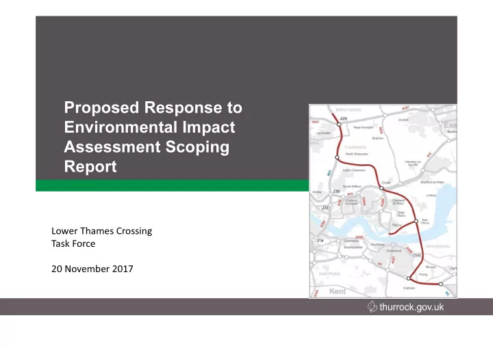
Proposed Response to Environmental Impact Assessment Scoping Report Lower Thames Crossing Task Force 20 November 2017 Background and Introduction On 12 th April 2017 the Secretary of State announced the preferred route for the Lower
SLIDE 1
SLIDE 2
Background and Introduction
- On 12th April 2017 the Secretary of State announced the
preferred route for the Lower Thames Crossing.
- On 2nd November 2017 Thurrock Council received the Lower
Thames Crossing Environmental Impact Assessment (EIA) Scoping Report from the Planning Inspectorate.
- The Planning Inspectorate has invited Thurrock Council, as a
statutory consultee, to provide comment on the EIA Scoping Report.
SLIDE 3
Lower Thames Crossing Preferred Route
SLIDE 4
Development Consent – for Nationally Significant Infrastructure Schemes (NSIP)
- The DCO process was introduced by the Planning Act 2008 to
streamline the decision-making process for nationally significant infrastructure projects (NSIPs), with the intention of making the consenting process fairer and faster for communities and developers alike
- It replaces the public inquiry with a more written process and issue
specific hearings – called examination in public
- Managed by the Planning Inspectorate (PINS)
- All environmental assessment needs to be completed, as well as all
- design. Nothing left to be discharged as a “condition”.
SLIDE 5
SLIDE 6
Lower Thames Crossing Project Timeline
- Pre-application (Now until mid-2019)
- Environmental Impact Assessment Scoping
Report
- Statement of Community Consultation
- Pre- Application Statutory Consultation
- Application Submission – Mid 2019
SLIDE 7
Aim of Environmental Impact Assessment Scoping Report
- To identify and report the baseline conditions
- f the existing environment.
- To determine which (if any) environmental
topics are to be further examined in the EIA.
- To outline the methodology proposed for
further assessment.
SLIDE 8
Purpose of Environmental Impact Assessment Scoping Report
- To give the applicant the opportunity to ask the
Secretary of State for a formal written opinion on the information to be included within the EIA.
– This is known as the Scoping Opinion.
- The Secretary of State must consult with the
prescribed consultation bodies (which includes Thurrock Council as the Local Planning Authority) and incorporate their responses within their Scoping Opinion.
SLIDE 9
EIA Scoping Report Chapters
- Introduction
- The Project
- Consultation
- The Reasonable Alternatives Considered
- Environmental Impact Assessment Method
- Air Quality
- Cultural Heritage
- Landscape
- Biodiversity
- Geology and Soils
- Materials
- Noise and Vibration
- People and Communities
- Road Drainage and the Water Environment
- Climate
- Cumulative Effects
- Proposed Structure of the Environmental Statement
- Transboundary Screening
- References
- Abbreviations
- Appendices
SLIDE 10
Review
- Specialists within Thurrock Council and third
parties, on behalf of Thurrock, have reviewed and provided comments.
- Independent Technical Advisors have also
reviewed and commented.
- Schedule of Comments/Observations has
been produced.
SLIDE 11
Overview
Topic Baseline Information Study Area Methodology Scope of Assessment Air Quality Cultural Heritage Landscape Biodiversity Geology and Soils Materials Noise and Vibration People and Communities Road Drainage and the Water Environment Climate Cumulative Effects
SLIDE 12
Key Comments
- The scoping report sets out all the expected topics that should be
included in the final EIA
- Thurrock require a Full Health Impact Assessment (HIA).
- Full justification should be provided within the EIA regarding the
decision on the preferred route
- Sensitivity testing should be undertaken to assess impact of
uncommon traffic scenarios due to major accidents, e.g. closure
- f both crossings and the impact this would have on traffic, noise,
air quality, people and communities
- The proposed scheme is continuing to evolve and it is essential
the Council understand the reasoning for changes and be genuinely consulted on change to the Scheme design
SLIDE 13
Key Comments Continued
- The Council has major
concerns regarding the proposed junction with the A13 and A1089
– Will be significantly elevated, therefore will be prominent in the landscape and likely to also cause adverse visual effects – Likely to worsen air quality and increase noise for receptors close by – Located on a nationally significant Scheduled Monument (Cropmark Complex, Orsett)
SLIDE 14
Key Comments Continued
- The Council would like to see 3D visualisation for the Scheme to ascertain
the visual impact
- Additional air quality baseline monitoring should be set up along the new
proposed link road to Tilbury, just off the A1031 along Heath Road, and along Baker Street
- The additional air quality monitoring has been set up by Thurrock Council
in November 2017 should be used to establish the baseline for the air quality assessment
- PM2.5 should be included within the air quality assessment
- Consideration needs to be given for the appropriate recording of the
Scheduled Monument (Cropmark Complex, Orsett) due to extensive damage that will be caused – total excavation of the scheduled area and associated elements should be undertaken
- Tilbury Fort and Coalhouse Fort should be considered as Very High value
resources (rather than High Value) within the cultural heritage assessment
SLIDE 15
Key Comments Continued
- No justification for the decision to adopt a 2km Zone of Visual Influence
(ZVI) for the landscape and visual impact assessment has been given, this should follow standard best practice and should cover a larger area
- Photomontages of the key views of the route should be produced for Year
1 and Year 15, e.g. the proposed tunnel, A13 and Tilbury junctions, and where the route crosses the Mardyke Valley
- The Council will need to agree any proposed viewpoints in advance of the
assessment commencing
- Barn owls need to be considered in the assessment
- The Ground Investigation (GI) needs to fully determine if significant
contamination is present within the historic landfill (Goshems Farm) where the tunnel portal would be located
- Methodology for the materials assessment needs to be clearly outlined in
the EIA
SLIDE 16
Key Comments Continued
- Noise monitoring locations need to be agreed with the Council
– A long-term monitor should be set up in Baker Street – Further monitoring in the south of Tilbury may also be necessary
- Severance should also be considered in the context of dividing the
borough and creating two separate sets of communities
- Clarification is required regarding how the impacts on public rights of way
will be mitigated.
- The use of green bridges and underpasses should be considered to replace
any public rights of way that are permanently affected by the development
- The red line boundary only takes account of the road area itself – it does
not consider the space that will be required for attenuation storage and flood zone compensation, it is critical to consider this as early as possible to ensure there are no space issues further down the line
SLIDE 17
Key Comments Continued
- Embodied carbon from the use of materials within the construction needs
to be considered, as this makes up approx. 70-80% of the construction carbon footprint
- Ensuring a low carbon design should be considered throughout the project
- Tilbury Energy Centre needs to be included within the assessment of
cumulative effects (as well as Tilbury2)
These few slides have only highlighted the key comments on the Scoping
- Report. A more detailed summary is provided in the report, and the full
suite of comments is provided in the Schedule of Comments/Observations which is contained in Appendix A of the report.
SLIDE 18
Next Steps and Timescales
- Additional comments/observations from LTC
Task Force to be incorporated in response
- Response to go to the Planning Inspectorate