MAIN ST RESILIENCE PLAN Community Workshops O.C. Haley Blvd. Meeting - - PowerPoint PPT Presentation

main st resilience plan
SMART_READER_LITE
LIVE PREVIEW

MAIN ST RESILIENCE PLAN Community Workshops O.C. Haley Blvd. Meeting - - PowerPoint PPT Presentation

MAIN ST RESILIENCE PLAN Community Workshops O.C. Haley Blvd. Meeting #1 CITY OF NEW ORLEANS June 16, 2015 AGENDA Welcome & Introductions Project Overview Defining resilience Coordination with other planning efforts What


slide-1
SLIDE 1

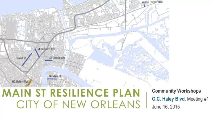
MAIN ST RESILIENCE PLAN CITY OF NEW ORLEANS

Community Workshops O.C. Haley Blvd. Meeting #1 June 16, 2015

slide-2
SLIDE 2

AGENDA

  • Welcome & Introductions
  • Project Overview
  • Defining resilience
  • Coordination with other planning efforts
  • What We’ve Learned (so far)
  • Residential and Commercial Market
  • Infrastructure / Built Environment
  • Risk and Other Resilience Elements
  • Discussion on Corridor Vulnerability

2

slide-3
SLIDE 3

MEETING #1 OBJECTIVES:

  • Introduce this project and understand relationships between related activities
  • Understand resilience as applied to commercial corridors
  • Review key indicators and input gathered so far on OC Haley
  • Understand priority concerns and opportunities for improving corridor and

business resilience

3

slide-4
SLIDE 4

PROJECT OVERVIEW

Goals Schedule Community Engagement

4

slide-5
SLIDE 5

PROJECT GOALS

1. Developed a shared definition of resilient commercial corridors for New Orleans 2. Create a measurable and actionable methodology for assessing the resilience of commercial corridors or Main Streets. 3. Apply methodology to 6 corridors (5 State-designated Main Streets), in the city and develop individualized recommendations for each to address resiliency gaps 4. Develop how-to guides for businesses for improving resiliency as applied to business operations and for businesses/property-owners for improving building resiliency

5

City Planning Commission Metro-So Source, urce, llc llc

slide-6
SLIDE 6

PAC Meeting #3

OVERVIEW OF PLANNING PROCESS

6

Initialization

  • Defining Resilience for Main Streets
  • Review Previous Efforts

Assessment

  • Develop standardized assessment
  • Data collection (primary)
  • Business occupant survey

Analysis & Recommendations

  • Commercial and residential market analysis
  • Resilience gap analysis
  • Infrastructure improvements and revitalization strategies

Final Plan

  • Technical guides: business operations & building hardening
  • Draft and final plan; public presentations

PAC Meeting #1 PAC Meeting #2 PAC Meeting #4

March / April May / June July / August August / September Corridor workshops 1 Business workshops Community meetings Corridor workshops 2 Public presentations

slide-7
SLIDE 7

DEFINING RESILIENCE:

CITY RESILIENCE FRAMEWORK

“Capacity of cities to function so that the people living and working in the cities – particularly the poor and vulnerable – survive and thrive no matter what stresses or shocks they encounter”

drawn from the Rockefeller Foundation 100 Resilient Cities

7

MASTER PLAN: RESILIENCE (Chapter 12)

  • Capacity to anticipate significant multi-hazard threats, to reduce overall the community’s

vulnerability to hazard events, and to respond to and recover from specific hazard events when they occur

  • Capacity to cope with and recover from present-day risks
  • Capacity to adapt to changing conditions, including uncertain, unknown, or unpredictable

risks

drawn from the Community and Regional Resilience Institute (CARRI)

slide-8
SLIDE 8

ASSESSING A RESILIENT COMMERCIAL CORRIDOR

  • How vulnerable are corridor businesses, buildings and infrastructure to shock events?
  • What infrastructure investments are required to facilitate economic prosperity and mitigate

risks/hazards?

  • Are corridor businesses able to weather and reduce stresses, particularly economic

forces?

  • Does the corridor provide local (adjacent) community…

…essential services on an ongoing basis & immediately following a shock event? …emergency shelter? …social & community gathering spaces?

  • Do corridor businesses have access, availability, and the capacity to engage resources

needed to weather shocks & stresses?

  • Are adequate social networks in place to support corridor businesses during shocks and

stresses?

8

slide-9
SLIDE 9

COORDINATING WITH OTHER EFFORTS

  • HUD NDRC Application
  • Rockefeller 100 Resilient Cities
  • OC Haley Streetscape (nearly designed – DPW)
  • NORA Commercial Corridor Market Value Analysis
  • OC Haley Merchants Association

9

slide-10
SLIDE 10

WHAT WE’VE LEARNED (SO FAR…)

Residential and Commercial Market Infrastructure / Built Environment Risk and Other Resilience Elements

10

slide-11
SLIDE 11

CORRIDOR PROFILE: BUSINESSES

11

  • 55 Businesses
  • 36 Non business organizations
slide-12
SLIDE 12

CORRIDOR PROFILE: ESSENTIAL SERVICES

12

slide-13
SLIDE 13

CORRIDOR PROFILE: BUSINESSES

Number Industry Examples 17 Social Services Youth, arts, environmental, homeless, community services 12 Membership Organizations Churches, leadership associations, advocacy groups 7 Eating And Drinking Places Restaurants, cafes, bars 7 Professional Services Architects, engineers, accountants 5 Automotive Repair, Services, And Parking Mechanics, car rentals 5 Miscellaneous Retail Gifts, crafts, alcohol 3 Food and kindred products Caterers, bottling/distribution centers 3 Amusement/Recreation Performance arts, athletic centers 2 Food stores Groceries, convenience stores

13

  • Business profile is diverse
  • Heavy representation of nonprofit and member organizations

Sources: InfoUSA, 2015; City of New Orleans

  • ccupancy licenses, 2015
slide-14
SLIDE 14

CORRIDOR PROFILE: BUSINESSES

14

  • Nonprofit organizations have comprised nearly half of post-Katrina entities

10 20 30 40 50 60

before 1990 1990 to 1994 1995 to 1999 2000 to 2004 2005 to 2009 2010 to 2015

Entities by Year Started - OCH

Business Non-Business

50 100 150 200 250 300 350 400 450

before 1990 1990 to 1994 1995 to 1999 2000 to 2004 2005 to 2009 2010 to 2015

Entities by Year Started - All Corridors

Business Non-Business

Sources: InfoUSA, 2015; City of New Orleans

  • ccupancy licenses, 2015
slide-15
SLIDE 15

CORRIDOR PROFILE: PEOPLE

Population immediately surrounding OCH has grown at a slightly faster pace than the rest of the City

15

0.0% 2.0% 4.0% 6.0% 8.0% 10.0% 12.0% 14.0% OCH 0.1 Mile Radius OCH 0.25 Mile Radius OCH 0.5 Mile Radius New Orleans

Population Change, 2010-2015

slide-16
SLIDE 16

CORRIDOR PROFILE: PEOPLE

  • Median Age is higher

near OCH than rest of City

  • Corridor area is getting

slightly younger while city is getting older

  • Has seen greater

growth among younger age groups than the rest of the city

16

32 34 36 38 40 42 2010 Median Age (U.S. Census) 2015 Median Age (Esri)

Median Age 2010-2015

Orleans Parish OCH 0.25 Mile Radius

0.0% 10.0% 20.0% 30.0% 40.0% 50.0% Age 0-19 Age 20-34 Age 35-49 Age 50-64 Age 65-79 Age 80+

Rate of Change in Age Groups, 2010-2015

OCH 0.25 City

slide-17
SLIDE 17
  • Median household income is significantly lower near corridor than in rest of

city ($22,444 vs. $37146, 40% lower)

  • Significantly more households in lower income groups than rest of city

17

CORRIDOR PROFILE: PEOPLE

$- $5,000 $10,000 $15,000 $20,000 $25,000 $30,000 $35,000 $40,000 OCH 2013 New Orleans 2013

Median Houshold Income, 2013

0% 10% 20% 30% 40% 50% Over $100,000 $50,000-$99,999 $35,000-$49,999 $20,000-$34,999 Under $20,000

Houshold Income Groups, 2013

New Orleans OCH 0.25 Mile

slide-18
SLIDE 18

CORRIDOR PROFILE: AFFORDABILITY

  • Median rent is lower near OCH than

rest of city ($635 vs. $765)

  • Rent is a higher percentage of

household income near OCH than in the rest of the city (34% vs. 24%)

18

0% 5% 10% 15% 20% 25% 30% 35% 40% OCH 0.25 Mile Radius New Orleans

Rent as a Percentage of Income

slide-19
SLIDE 19

AFFORDABILITY: HOUSING + TRANSPORTATION

  • Median Income Family
  • 4 People
  • 2 Commuters
  • $47,429 annual income

19

¼ mile

slide-20
SLIDE 20

AFFORDABILITY: HOUSING + TRANSPORTATION

  • Moderate Income Family
  • 3 People
  • 1 Commuter
  • $37,943 annual income

20

¼ mile

slide-21
SLIDE 21

AFFORDABILITY: HOUSING + TRANSPORTATION

  • Very Low Income

Individual

  • 1 Person
  • 1 Commuter
  • $11,720 annual income

21

¼ mile

slide-22
SLIDE 22

MARKET ASSESSMENT

22

  • Examined three markets:
  • Neighborhood: 1-mile radius
  • The “convenience” market

(groceries, take-out food, pharmacy)

  • Community: 5-mile radius
  • Comparison shopping

(restaurants, clothing, furniture, electronics, hobby goods)

  • Region: 10-mile radius
  • Destination retail and

entertainment (cultural institutions, specialty items)

Source: Esri 2015

slide-23
SLIDE 23

MARKET ASSESSMENT

. 23

Raw SUPPLY and DEMAND indicators suggest that within 1 mile of OC Haley:

  • There is High unmet demand for:
  • General merchandise store: $40 million leakage
  • Auto dealers: $33 million leakage
  • There is Modest unmet demand for:
  • Gasoline station: $15 million leakage
  • Small grocery: $9 million leakage
  • Clothing/accessories store: $7.5 million leakage

Source: Esri and Dun & Bradstreet, 2015

slide-24
SLIDE 24

MARKET ASSESSMENT

24

BUT….

  • What kind of Corridor does the OC Haley community want to be?
  • What space is available for business growth?
  • How will the market change?
  • New jobs and residents
  • Evolution of OC Haley Blvd as a destination corridor
slide-25
SLIDE 25

FLOOD ZONES

25

PRELIMINARY FEMA DFIRM OCH is in the “X” or Lower Risk Zone:

slide-26
SLIDE 26

INFRASTRUCTURE: SEWER & DRAINAGE

26

slide-27
SLIDE 27

CORRIDOR ELEVATION

27

slide-28
SLIDE 28

CORRIDOR BUILDINGS

  • Appear occupied: 70%
  • In ‘average’ or better condition: 80%
  • Elevated foundations: 72%
  • ADA accessible entrance: 53%
  • Elevated Mechanical, Electrical, or Plumbing systems (usually HVAC): 42%
  • Protection for windows or doors: 33%
  • Appendages, such as signs, awnings, or overhangs: 48%

28

slide-29
SLIDE 29

BUSINESS SURVEY

  • 33 of 54 listed business surveyed

29

slide-30
SLIDE 30

OTHER FACTORS: CRIME & SAFETY

  • Overall calls to NOPD have decreased
  • Property and Violent crime calls have

increased, especially compared to city

30

  • 30%
  • 20%
  • 10%

0% 10% 20% 30% Property Traffic Vice Violent Other All Calls

Change in NOPD 911 Calls, 2012-2014

OCH City

Highest concentration of 911 call in 2014

slide-31
SLIDE 31

OTHER FACTORS: SOCIAL NETWORKS

31

slide-32
SLIDE 32

DISCUSSION: CORRIDOR VULNERABILITY

32

slide-33
SLIDE 33

TOPICS OF DISCUSSION:

  • What weather, economic, demographic, or social events have/can impact the

corridor?

  • What were/are the impacts to the corridor?
  • For past events, what was the recovery time?
  • What infrastructure investments would facilitate the capacity of the corridor to

withstand and recover?

  • What non-infrastructure public investments would facilitate the capacity of the

corridor to withstand and recover? (i.e. police patrols, Main Streets funding, etc.)

  • What social services or social places are needed on the corridor?

33

slide-34
SLIDE 34

DISCUSSION: BUSINESS VULNERABILITY

34

slide-35
SLIDE 35

TOPICS OF DISCUSSION:

  • What individual, business and private investments

would facilitate the capacity of the corridor to withstand and recover?

  • How can/do businesses on the corridor work

together to withstand and recover?

  • What are essential services are currently lacking

from the corridor?

35

Photo credit: Robert Morris, Uptown Messenger

slide-36
SLIDE 36

NEXT STEPS

  • Complete resilience assessments (June 30)
  • Business Continuity Workshops (June 29 – July 1)
  • Develop preliminary strategies for each corridor (July)
  • Corridor Workshop #2 (OCH: July 13)
  • Prioritize and refine

36

slide-37
SLIDE 37

THANK YOU

Dwight Norton – GCR dnorton@gcrincorporated.com Judith Dangerfield – Metro Source judithdangerfield@metro-source.com

37