
SLIDE 1
JOHNS ISLAND MAYBANK HIGHWAY AND MAIN ROAD ZONING PUBLIC WORKSHOP - - PowerPoint PPT Presentation
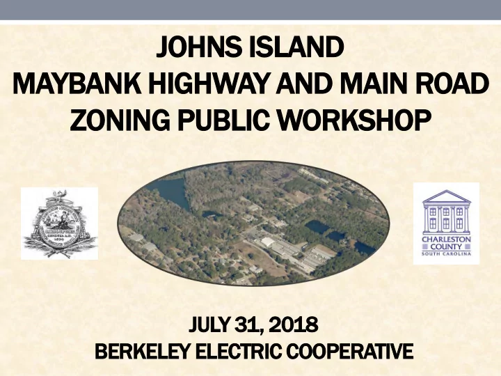
JOHNS ISLAND MAYBANK HIGHWAY AND MAIN ROAD ZONING PUBLIC WORKSHOP JULY 31, 2018 BERKELEY ELECTRIC COOPERATIVE Maybank Highway and Main Road Zoning Public Workshop Co-hosted by The City of Charleston and Charleston County Berkeley Electric
Co-hosted by The City of Charleston and Charleston County Berkeley Electric Cooperative July 31, 2018 6:00 P.M.
ncilmember lmember Anna a Johnson, nson, Charl rlest eston
nty
ncilm lmember ember Will lliam am Moody
ty of Charl rlest eston
ncilmember lmember Will lliam am Grego egorie rie, City y of Charl rlest eston
lt Small alls, Deputy uty Adm Admini nistrat trator
rlest eston
nty
el Evans, vans, Planni anning ng Direc rector
rlest eston
nty
rea Pietras etras, Deputy uty Planni anning ng Direc rector
rlest eston County nty
c Ada Adams ms, Deputy uty Direct rector
r Engineeri neering, ng, Charl rlest eston
nty
zier, Planner anner, Charl rlest eston
nty
ki Gri rimbal mball, Planner nner, Charl rles eston
nty
ndse sey, Planni anning ng Direc rector
ty of Charl rles eston
er Morgan, rgan, Planni nning ng Manager ager, City ty of Charl rles eston
lly, Planner nner, City ty of Charle rlest ston
s Islan land d Mayban ank k High ighway y and Main Road d Zoning ng Proje
ct Presen esentation tation
e Purp urpose of the e Project ject and the e Project ect Sche hedule dule
e Cur urrent rent Maybank bank Highway y Corrido ridor Overla lay y Zonin ning g Distri rict ct
e Ur Urban an Growth wth Boun undar dary
e 2007 7 Jo Johns hns Isl sland and Plan
e Propos posed ed Overla lay y Boun undar dary y and Ex Existin ting g Land nd Uses
tus of Transp nspor
tation Impr mproveme ement nt Projects ects
ank k High ighway y Comm mmun unit ity y Needs s Survey
Annual Work program approved by County Council.
Maybank Highway Corridor Overlay Zoning District in coordination with the City of Charleston” and “Create an Overlay Zoning District for Main Road”.
y of Charl rlest eston
rlest eston
unty ty Plannin ning g Depar artme tments nts have begun this collaborative planning effort to create consistent land use, zoning, and development requirements for both the Maybank Highway Corridor and the Main Road Corridor.
public input through a community survey and public comment cards.
Council as part of the Zoning and Land Development Regulations Ordinance adopted on November 20, 2001.
well planned and attractive through the implementation of traffic safety measures and consistent and coordinated design standards between the County and the City of Charleston.
affecting the Maybank Highway Corridor have taken place, including the City of Charleston adopting the Johns Island Community Plan in 2007.
historically the Charleston County Government, City of Charleston, and SCDOT have worked together to improve safety and traffic flow along the corridor.
Comprehensive Plan is the Urban Growth Boundary (UGB), which clearly defines two distinct Growth Management Areas - the Rural Area and the Urban/Suburban Area.
higher intensity growth in the Urban/Suburban Area where adequate infrastructure and services are in place, at the same time allowing for preservation of the rural character of the majority of the County.
review of the County’s Comprehensive Plan the County revised its UGB to match the City of Charleston's UGB on Johns Island.
through the County Council adoption process and the Plan reflects no change in the UGB, as mutually agreed upon by the City and County.
Plan in November 2007.
stakeholders, including residents, property owners, business owners, government officials, and utility representatives, met to plan for the future
corridor through Johns Island, carrying large traffic volumes and acting as a gateway for motorists coming from the east.
with considerations related to function, aesthetics and environmental concerns, the Plan recommends configuring Maybank Highway as a sequence of Town and Country Sections.
nodes by developed along Maybank Highway, and that Maybank Highway reflects a town-like geometry along these nodes. Design elements include buildings closer to the road, wide sidewalks, curb & gutter, street trees, and a center turn lane providing better access to increased points of ingress/egress.
a configuration appropriate for a country road designed to reflect the Johns Island character. Here, there are large buffers between buildings and the road, paths and open ditches replace sidewalks and curb & gutter, and street trees are supplemented with larger shade trees and a landscaped median.
Maybank Highway “Town Section” Maybank Highway “Country Section”
a small section of the Main Road Corridor close to the intersection with Maybank Highway is within the UGB.
between the jurisdictions of the City of Charleston and Charleston County
Charleston County, with the exclusion of several parcels near the Maybank Highway intersection that are in the City of Charleston and contained within the UGB.
Government, City of Charleston, and SCDOT have worked together to improve safety and traffic flow along the corridor.
Johns Island differs in several locations from the current overlay zoning boundary.
exclude some areas that are already developed, or in the case of the Angel Oak Preserve, protected by a conservation easement.
two “nodes” that contain commercial and industrial zoned
zoning, which is predominantly the Rural Residential Zoning (RR-3) District on the east side of the corridor and the Agricultural/ Residential Zoning (AGR) District on the west side of the corridor.
a third potential node to be included in the Main Road Overlay Boundary.
the only other parcels adjacent to Main Road that are currently zoned commercial.
Island, there are many undeveloped and vacant parcels fronting Maybank Highway on Johns Island.
single family detached homes as well as formal entrances to subdivisions and apartment complexes set back from the corridor.
to James Island, and ranges from regional shopping and trendy restaurants and bars to multiple mom and pop shops, and professional and medical office space.
from rural and agricultural residential uses to commercial and light industrial development.
locations, including multi-family residential and additional commercial development.
experience continued development pressure and increased traffic volumes.
ank k High ighway y Addit ition ional al Westbou tbound nd Lane
thern Pit itchf hfor
er Road at Maybank nk Highw ghway y Inter ersection ction Improvem emen ents ts
at Main Road d and Main Road d Widening ning
lowing wing the two Zoning ing Public lic Worksh rkshops
sing date e for the commu munit nity survey, , staf aff f will l compile ile and revie iew all public lic input ut data receiv eived. ed.
ing the month th of August ust staff will l conduct ct stak akehold eholder er meeti ting ngs s with h vario ious us groups, ups, includin uding g SCDO DOT, , busin iness ess
s, James es Islan land d and Johns ns Islan and d Comm mmun unit ity y Associat
ions, and other er inter erest ested ed parti ties. es.
inning g in Sept ptem ember er, , staf aff f will l use public ic and stak akeh eholder
ut as a guide e in the prepara parati tion
t
rlay y zoning ing dist strict rict document. ment.
s draft t documen ent t will l be present sented ed at future ure community munity meeti ting ngs s to gath ther er additi tional
ic feedbac ack.
County’s Zoning and Planning Homepage until Friday, August 17: https://www.charlestoncounty.org/departments/zoning-planning/
complete the survey this evening.
s Island nd Maybank Highway Community Survey
Johns Island nd Maybank Highway Community Survey
https://www.charlestoncounty.org/departments/zoning-planning/
ious met ethods hods were used d to provid vide e notif ificati ication
James es Islan land d and Johns s Islan land d Zoning ng Public lic Work rkshop shop Meetings: etings:
r 2,500 500 noti
cati tion
ers s were re sent t by email ail or mail to all proper perty ty own wner ers s with thin n the e propos posed ed
rlay y bound ndaries ries and all indi dividuals viduals listed ed on the e James es Island, and, Johns hns Island and and d ZLDR DR/ / Com
rehen ensiv sive e Plan Intere erest sted ed Par Parties ies List; t;
Over r 60 Commu mmunity nity Meetin ting g si signs ns were re post sted ed along ng Maybank ank Highw hway y and Main Road; d;
y of Charl rlest eston
d Charl rlest eston
nty Press ss Releas eases; es;
e City y of Charl rlest eston
eighb ghbor
hood
wslett tter; r; and
All attende endees es of the e two
hns Island and Growth wth Managem gemen ent t Comm mmitt ttee ee mee eeti ting ngs s that took
e earlier ier this year ear.