Island First Nation 1 Indigenous and Northern Affairs Canada - - PowerPoint PPT Presentation

island first nation
SMART_READER_LITE
LIVE PREVIEW

Island First Nation 1 Indigenous and Northern Affairs Canada - - PowerPoint PPT Presentation

Climate Change Adaptation Planning within The Chippewas of Georgina Island First Nation 1 Indigenous and Northern Affairs Canada December 14 th 2016 Thunder Bay, Ontario This presentation delivered by: Kerry-Ann Charles Chippewas of Georgina


slide-1
SLIDE 1

Indigenous and Northern Affairs Canada December 14th 2016 Thunder Bay, Ontario This presentation delivered by: Kerry-Ann Charles Chippewas of Georgina Island First Nation Environment Co-ordinator

Climate Change Adaptation Planning within The Chippewas of Georgina Island First Nation

1

slide-2
SLIDE 2

Our Partners

 Indigenous and Northern Affairs

Canada

 OCCIAR  CEC  US EPA  MOECC  Georgian College  MNRF  Turtle Island Conservation  Lake Simcoe Region

Conservation Authority

2

slide-3
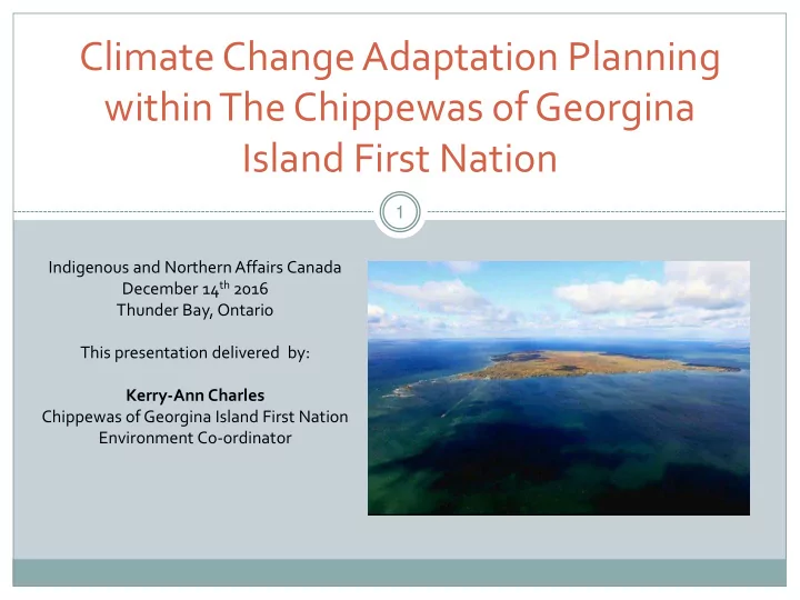
SLIDE 3

The Chippewas of Georgina Island First Nation At A Glimpse

  • Located approximately100 km north of the Greater Toronto Area

(GTA).

  • Consisting of 3 separate Islands, Georgina, Snake and Fox with 2

mainland access points, Virginia Beach and Island Grove.

  • Georgina is the largest of the Islands with a land mass of

approximately 15 km2 which is 4.5 km long and 3.2 km wide, an area of 1,416 ha/4,399 acres.

  • Infrastructure consists of an Administration building, Health Centre,

Police Station, Fire Hall, Landfill site, Sewage lagoon, Water Treatment Facility, Community Centre, Church, Trails System, an Outdoor Rink, Childcare facility for infants and toddlers and a two-classroom school that accommodates the children of the First Nation until Grade 5.

  • There are a few Member operated businesses on the First Nation

which include but are not limited to Bed and Breakfasts, Cabin and Cottage Rentals, Restaurants and a Campground.

  • The second largest Island is Snake covering an area of approximately

135ha/333acres and has 227 cottages. Fox Island is the smallest at 20ha/49acres with 52 cottages. Neither Snake Island or Fox Island have year round member residents or major Infrastructure.

  • The forest on Georgina Island is one of the largest remaining in the

GTA, covering 70% of the island. It includes 39 species of mixed wood, hardwood and conifer supporting over 400 species of flora, including several locally, regionally and provincially rare species, and approximately 180 species of birds. Rabbits, beaver, racoon, grouse, wood frogs, salamanders, foxes, wolf , wild turkey and deer also make their home in the forest and in the four adjacent wetlands.

slide-4
SLIDE 4

Background and Link to Climate Change

 Georgina Island First Nation is progressive on environmental issues and often

leaders in the implementation of such with the premise that all of the work that is being undertaken is all linked in one way or another.

 Species at Risk Mapping  Ash Tree Monitoring and Management  Invasive Species Management  Shoreline and wetland restoration/rehabilitation  Climate Change Adaptation

 Since Initiation of the Climate Change Project in 2011 with funding

through INAC the First Nation has been incorporating the Climate Change Lens to all of our Projects.

4

slide-5
SLIDE 5

Framework

 Step 1: Let’s get started  Step 2: Gather data  Step 3: Current vulnerability  Step 4: Prioritize future risk  Step 5: Identify adaptation

  • ptions

 Step 6: Implement adaptation

actions

 Step 7: Monitor progress

5

slide-6
SLIDE 6

Community Engagement Critical

Community Engagement was a critical component of this project and continues to be.

6

Information sessions (with bingo) and interactive workshops were hosted within the community to:

  • Inform the community of

the project

  • Encourage participation
  • Ensure feedback
slide-7
SLIDE 7

Building the Georgina Island Team

Advisory Committee

a group of ten consisting of community members including youth, adults and elders.

Tasks of Advisory Committee:

Helped customize Traditional Ecological Knowledge survey specifically towards Climate Impacts/Changes within Georgina Island

Also suggested a list of potential interviewees 7

Community Adaptation Liaison

to foster relationships with the Georgina Island First Nation community

slide-8
SLIDE 8

TEK Gathering

Inspired by Dr. Dave Pearson’s Survey “Adaptation Planning in the Far North” modified to reflect Georgina Island living:  Changes in the “bush”  Changes in wet areas  Changes in fish  Changes in birds, animals and insects  Weather changes in the different seasons, Changes in air/clouds  Changes in Winter Weather  Effects of Climate Change on Community Infrastructure  Weather Emergencies and Health 8 Weather changes in the different seasons, Changes in air/clouds: early spring, long hot summers Changes in Winter Weather: winters are warmer, ice quality, less snow

slide-9
SLIDE 9

Current Vulnerabilities

9

Impact trees help visualize how changes in weather and climate impacted the community

slide-10
SLIDE 10

Prioritized Impacts

Climate Hazard Impacted Areas Impact (taken directly from TEK survey responses) Changes in Winter Transportation Road deteriorates faster Can’t travel as much No road, struggle to get around Ice pile-up Damage to ice road landings Pressure cracks Using the Scoots more Stress on ferry due to breaking through the ice 10

slide-11
SLIDE 11

Historical and Projected Climate

Historical climate for Shanty Bay

Historical Temperature

Warming observed in all seasons

More warming observed in winter than

  • ther seasons

Winter minimum temperature warmed more than maximum temperature Historical Precipitation

Increases in precipitation observed in all seasons

Environment Canada’s Canadian Climate Change Senarios Network Ensemble Projections

Future projections

Mean temperature projected to increase into the 2050s for all seasons

Greatest warming projected to occur in the winter

Projected change in precipitation is variable 11

slide-12
SLIDE 12

Risk is defined by the likelihood and consequences of impacts associated with climate change

  • n vulnerable systems

12

Risk Assessment

slide-13
SLIDE 13

Climate Event: Changes in winter (warmer, shorter, more rain, less snow) Risk Scenario: Transportation - damage to ice road landings Time Horizon (planning period): 2050s

Consequence= Moderate (3) Likelihood = Virtually certain to occur (5)

Social Economic Environmental Cultural

Consequence Health & Safety Displacement Loss of Livelihood Property Damage Financial Impact Impact on Community Finances Air Water Land Ecosystem Traditional Food Traditional Medicine Traditional Lifestyle Very Low (1)

    

Low (2)

Moderate (3)

 

High (4)

  

Very High (5)

 

Risk Assessment

13

slide-14
SLIDE 14

Risk Matrix

Consequence Very High High Mod- erate Transportation:

  • Pressure

cracks

  • Stress on

ferry due to break through ice Transportati

  • n:
  • Road

deteriorat ing faster

  • Damage

to ice road landings Low Ice Quality:

  • Freeze-up

getting later and breaking up earlier Very Low Very Unlikely to happen Occasional Occurrence Moderately Frequent Occurs Often Virtually Uncertain to Occur Likelihood Very high risk: immediate controls required High risk: high priority control measure required Moderate risk: some controls required to reduce risk to lower levels Low risk: controls not likely Very low risk: does not require further consideration

14

slide-15
SLIDE 15

 Changes in Winter  Changes in Summer  Extreme Precipitation  Wind  Drought

Interactive Workshop

15

slide-16
SLIDE 16

O

  • Ended up with a table of prioritized risks

which was a combination of the results

  • f the project team estimating risk, the

advisory committee comments, and the community estimating consequence.

  • Highest priority risks (very high and

high) were moved into Year Three of the project. Objective 2: Conduct Band policy review to find opportunities to mainstream climate change into existing policies for the Georgina Island First Nation

16

Prioritized Risks

slide-17
SLIDE 17

17

Recommended Adaptation Measures

Risk Scenario: Changes in winter – Transportation – Damage to ice road landings Damage to ice road landings ranked as a “very high risk” due the changes in winter

  • temperatures. In addition, damage to ice road landings ranked as a “moderate risk”

due to wind. The following adaptations measures could be implemented to reduce the risks associated with ice road landings. Action: Amend or update Transportation Manual to ensure scheduled and documented monitoring and maintenance of ice road landings is occurring, and how it may need to be adjusted to correspond to milder winters Action: Develop a communication plan to notify community, on a regular basis, of ice conditions Risk Adaptation Action Very High Risk The following adaptation measures address the highest priority risks. The “very high risks” were associated with 3 of the 5 climate hazards: · Changes in Summer · Extreme Rainfall · Changes in Winter

slide-18
SLIDE 18

Adaptation Plan

18

Adaptation recommendations to respond to risks associated with current and future climate change

slide-19
SLIDE 19

Emergency Plan Health and Safety Manual/Policy Forest Management Plan Pandemic Influenza Contingency Plan Transportation Manual Operations and Maintenance Manual

Policy Review

19

BARRIERS AND DRIVERS

Barrier refers to elements of policies or plans

that hinder, or act as a barrier to, climate change adaptation actions.

Driver refers to elements of polices or plans

that support, or ‘drive’, climate change adaptation action.

slide-20
SLIDE 20

Title Emergency Plan Date 01/01/2005 Purpose To lay down a plan of action for the most efficient employment of all services required in order that the following may be assured: a) The earliest possible response to an emergency… (see page 1 of plan) Who does it apply to? Band Administration, Health Centre, Fire Department, Emergency Response Volunteers and GI Police Policy type Plan Location (URL) Emergency Plan sits with the Georgina Island First Nation Associated Policies Influenza Pandemic Plan, Health and Safety Plan, Transportation Manual Author Organization Chippewas of Georgina Island First Nation

20

General recommendations:

 An emergency plan should be proactive, as much as possible when dealing with the impacts

  • f climate change

 Update the plan to include a list of what would constitute an emergency (e.g. extreme or severe weather, flooding, drought, blow-down, wildfire, etc; all of which may become more frequent or intense with climate change).  Update the plan to specify that adaptive measures such as debris clearing and removal from culverts and ditches should also be conducted before extreme weather is expected.  In addition to providing information

  • n rising flood waters, plan should be

amended to include monitoring ice conditions, ice road (including landings), and ice jams/pile-up  Encourage households to have a ’72 hour’ emergency preparedness kit

EMERGENCY MANAGEMENT PLAN

slide-21
SLIDE 21

Hazard Mapping

 Translating identified Climate Impacts into GIS Maps  (Geographic Information System)

21

slide-22
SLIDE 22

WORKING TOGETHER AND SHARING KNOWLEDGE

22

Participating Communities

Moose Deer Point First Nation Beausoleil First Nation

Williams Treaty Territory

slide-23
SLIDE 23

CHALLENGES

23

Funding Funding Funding

slide-24
SLIDE 24

24

Chi Miigwetch!

Kerry-Ann Charles Chippewas of Georgina Island First Nation Environment Co-ordinator kerry.charles@georginaisland.com

“The sensitivity of the natural environment to changes in weather and climate affect the ecosystems and socioeconomic aspects of every community, especially Indigenous communities”