
SLIDE 1
ICT AND CLIMATE CHANGE MONITORING OF CLIMATE CHANGE AND MICROWAVE - - PowerPoint PPT Presentation
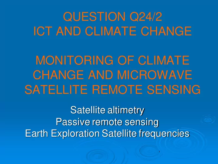
QUESTION Q24/2 ICT AND CLIMATE CHANGE MONITORING OF CLIMATE CHANGE AND MICROWAVE SATELLITE REMOTE SENSING Satellite altimetry Passive remote sensing Earth Exploration Satellite frequencies Monitoring of climate change Today, climatology
ITU-D SG2 13 September 2011 Jean PLA Q24/2 ICT and climate change
precise, global measurements matching the scale of planetary climate phenomena.
without touch or contact.
spectrum and of Earth Observation satellites to monitor some aspects of climate change.
ITU-D SG2 13 September 2011 Jean PLA Q24/2 ICT and climate change
covered by water: key parameter for understanding the forces
behind changing weather patterns.
forecasts on both a short- and long-term basis.
needed to take the mesoscale (medium- distance) dynamics of the oceans weather forecasting beyond two weeks.
change: rise in sea levels all over the world is widely recognized as potentially one of the most devastating consequences of global warming.
ITU-D SG2 13 September 2011 Jean PLA Q24/2 ICT and climate change
(enclosed seas, lakes, rivers, flooding areas...) or even flat surfaces
enabling systematic monitoring to be carried out over several years), unhindered by clouds, night or even vegetation. Measured surface heights referenced to the same frame.
specific land re-tracking can be applied): measurements only at the nadir (i.e. just under below the satellite), with a rather narrow footprint -- and averaging everything in that footprint.
altimetry measurements can be degraded to by several centimetres or tens of centimetres, mainly because of the heterogeneity of the reflecting surface (a mix of water and emerged land surfaces).
ITU-D SG2 13 September 2011 Jean PLA Q24/2 ICT and climate change
JASON 1, 2 SATELLITES: CNES, NASA, NOAA and EUMETSAT Measurements:
Satellite and the sea
Accuracy:
corrected) : 2.3
ITU-D SG2 13 September 2011 Jean PLA Q24/2 ICT and climate change
Altitude 1336 km, circular, non-sun-synchronous 66° inclination, global data coverage between 66°N
and 66°S latitude
10-day repeat of ground track (±1-km accuracy) coverage of 95% of ice-free oceans every 10-days
ITU-D SG2 13 September 2011 Jean PLA Q24/2 ICT and climate change
Estimates of wind and waves from altimeter: analysis of the return from the sea surface: peak backscattered power and shape of the waveforms.
Back scatter, σo, from the sea surface: sensitive to small scale
surface roughness (short ocean waves).
σo is the primary variable used in estimating wind speed. σo sensitive to much larger waves that are only related weakly to
the local wind recent algorithms for wind speed also include the altimeter estimate of significant wave height.
Significant wave height (SWH) can be estimated using the return
pulse by large waves, since the radar signal can be reflected from both the troughs and peaks of waves. The sea surface height is usually estimated from the centre point of the leading edge.
ITU-D SG2 13 September 2011 Jean PLA Q24/2 ICT and climate change
main issue in Environmental sciences of the 21st century.
the warming effects. The measurements of the mean sea levels are derived from a period of time of 19 years of satellite earth observation:
such a period of time is short. In addition to that, it is necessary to
indicate that human induced peturbation is added to the natural climate variability.
background natural variability. Detecting global climate change is much more demanding than monitoring regional impacts.
accurate.
The following figure shows that the rise is about 3,2 mm per year,
roughly 5.8 cm within 19 years.
ITU-D SG2 13 September 2011 Jean PLA Q24/2 ICT and climate change
ITU-D SG2 13 September 2011 Jean PLA Q24/2 ICT and climate change
ITU-D SG2 13 September 2011 Jean PLA Q24/2 ICT and climate change
ITU-D SG2 13 September 2011 Jean PLA Q24/2 ICT and climate change
tool for continuous, precise and nearly-global mean sea level monitoring, with moreover regular measurements (every 10 or 35 days). However, other techniques existing a long time before, new ones have appeared that enable to validate altimetry results, and above all to better understand why mean sea level is varying.
gauges (« Marégraphes »). Some of them (not many) measured the sea level for more than a century. However, they support the effects of the movements of continents, and are very unevenly distributed around the globe: necessarily close to shore, but many more, and the oldest in Europe and the United States
ITU-D SG2 13 September 2011 Jean PLA Q24/2 ICT and climate change
ITU-D SG2 13 September 2011 Jean PLA Q24/2 ICT and climate change
Sources of error in the Error in the MSL calculation slope of MSL Orbit determination +/-0.15 mm/year Wet troposphere +/-0.30 mm/year Corrections from weather data fields +/-0.10 mm/year Altimetry parameters +/-0.10 mm/year Sea Surface Height bias model +/-0.25 mm/year
Total error +/-0.6 mm/year
Confidence interval= 90%
ITU-D SG2 13 September 2011 Jean PLA Q24/2 ICT and climate change
water can be added to the ocean, either by increased rain over the ocean,
Increased evaporation can also decrease the water mass (as well as glaciation, as it happened during last Ice age, when sea level was about 100 m below the nowadays level)
water dilates when it warms, which leads to higher sea level. Among other things, it leads to sea level seasonal variations, and also year-to-year variations linked to climate events (e.g. El Niño).
the saltier the water, the denser it is; thus saltier water will have a lower
evaporation, or by glaciation, which increase salinity.
changes in sea level can be due to changes in the ocean circulation.
ITU-D SG2 13 September 2011 Jean PLA Q24/2 ICT and climate change
Thermal expansion 1.6 +/- 0.5 mm/yr Glaciers and ice caps 0.77 +/- 0.22 mm/yr Greenland ice sheet 0.21 +/- 0.07 mm/yr Antarctic ice sheet 0.21 +/- 0.35 mm/yr Sum 2.8 +/- 0.7 mm/yr Observed 3.2 +/- 0.6 mm/yr
ITU-D SG2 13 September 2011 Jean PLA Q24/2 ICT and climate change
http://www.aviso.oceanobs.com/en/newsstand/altimetry-and-doris-applications- in-videos/el-nino/index.html
ITU-D SG2 13 September 2011 Jean PLA Q24/2 ICT and climate change
ITU-D SG2 13 September 2011 Jean PLA Q24/2 ICT and climate change
La Niña may be back again this year: temperatures in the Pacific are hinting at a continued pattern
ITU-D SG2 13 September 2011 Jean PLA Q24/2 ICT and climate change
Monitoring the rising of the lake levels in East Africa in late 1997: consequence of heavy rainfall caused by El Niño conditions over the Pacific on the watershed
ITU-D SG2 13 September 2011 Jean PLA Q24/2 ICT and climate change
sensors, the operating frequency range is linked to the geophysical parameters to be observed. For instance, to enable measurement of clouds and precipitation, the wavelength needs to be small enough to reach the required sensitivity.
used are at 5.3 GHz, 13.65 GHz and also at 35.4-36 GHz. It is essential to keep protecting these frequencies which are shared with other radio services.
frequencies are needed for an accurate estimate of all the
ITU-D SG2 13 September 2011 Jean PLA Q24/2 ICT and climate change
crucial variables for modelling our weather and climate.
thermohaline circulation. SMOS instrument launched 2 November 2009: to provide temperature brightness (TB) data for 3–5 years. First time that salinity is measured from space.
space.
every 10 days at 200 km spatial resolution.
ITU-D SG2 13 September 2011 Jean PLA Q24/2 ICT and climate change
ITU-D SG2 13 September 2011 Jean PLA Q24/2 ICT and climate change
ITU-D SG2 13 September 2011 Jean PLA Q24/2 ICT and climate change
SMOS satellite: Mean altitude of 758 km and inclination of 98.44°; low-Earth, polar, Sun- synchronous, quasi-circular, 23-day repeat cycle
ITU-D SG2 13 September 2011 Jean PLA Q24/2 ICT and climate change
ITU-D SG2 13 September 2011 Jean PLA Q24/2 ICT and climate change
ITU-D SG2 13 September 2011 Jean PLA Q24/2 ICT and climate change
ITU-D SG2 13 September 2011 Jean PLA Q24/2 ICT and climate change
The strong salinity (psu) gradient of the Amazon plume measured by SMOS in August 2010
ITU-D SG2 13 September 2011 Jean PLA Q24/2 ICT and climate change
Field of SMOS SSS anomaly (psu) with respect to World Ocean Atlas 2005 climatology for the period 6 to 16 February 2011
ITU-D SG2 13 September 2011 Jean PLA Q24/2 ICT and climate change
NASA Credits, see http://aquarius.nasa.gov/index.html
ITU-D SG2 13 September 2011 Jean PLA Q24/2 ICT and climate change
famous redshift).
November 2007) to protect the frequency band 1400- 1427 MHz from out of band emission derived from adjacent frequency bands below 1400 MHz and above 1427 MHz: mainly radars (Radiolocation), fixed, mobile.
since March 2011
ITU-D SG2 13 September 2011 Jean PLA Q24/2 ICT and climate change
Areas affected more than 10 % of the time by strong RFI for ascending orbits (CESBIO Credits)
ITU-D SG2 13 September 2011 Jean PLA Q24/2 ICT and climate change
Map of Europe showing the probability of SMOS sustained RFI occurrences beginning 2010 (Credits CESBIO)
ITU-D SG2 13 September 2011 Jean PLA Q24/2 ICT and climate change
Map of Europe showing the probability of SMOS sustained RFI occurrences from 14th October to 14th December 2010 (Credits CESBIO)
ITU-D SG2 13 September 2011 Jean PLA Q24/2 ICT and climate change