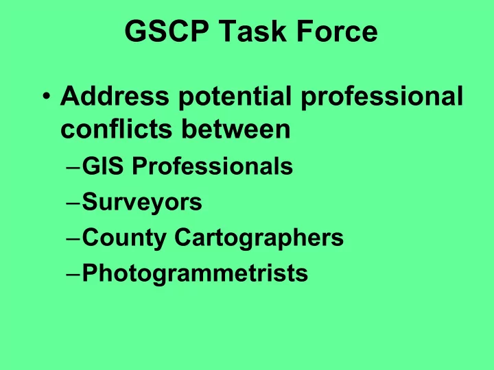
gscp task force
play

GSCP Task Force Address potential professional conflicts between - PowerPoint PPT Presentation

GSCP Task Force Address potential professional conflicts between GIS Professionals Surveyors County Cartographers Photogrammetrists GSCP Task Force 2001 Spring - Legislature considers new legislation regarding


  1. GSCP Task Force • Address potential professional conflicts between – GIS Professionals – Surveyors – County Cartographers – Photogrammetrists

  2. GSCP Task Force • 2001 – Spring - Legislature considers new legislation regarding definition of surveying. • 2001 – Summer - Summer OGISA meeting members identify the issue and elect to address it by committee. • 2001 - Fall - Joint Task Force created & examine issues • 2002 - Make recommendations to addressing issues.

  3. GSCP Task Force • GIS, Survey, Cartography, Photogrammetry, professionals – Dean Anderson Polk County (OGISA, URISA) – Bob Haas Deschutes County (URISA, OGISA) – Eric Bohard Clackamas County (URISA, OGISA) – Shelby Griggs Orbitech, LLC (Private Surveyor) – Ed Graham & Bob Neathamer OSBEELS – John Waffenschmidt Lincoln County (GIS/Surveyor) – Ronda Halverson - High Desert GeoTechnologies, Inc. – Roger Livingston Washington County (A&T) – Dan Linscheid Yamhill County (Surveyor/OSBEELS) – John Minor Menasha Surveyor - PLSO – Chuck Pearson Clackamas County- OACES – George Cathey Private Practice / PLSO – Margo Blosser ASPRS, Private Practice – Doug Smith ASPRS (local), MAPPS – Oshel Assoc. of Oregon Counties – Jim Manary ORMAP – Cy Smith OGIG / DAS

  4. ISSUES & CONCERNS • Data: Data is more accessible • Tools : New tools exist for collection, use, integration, and accessibility. • Definitions : Poor definitions exist • Communication : Historically poor between professions • Activities : Disparate but overlapping • Focus : Not well defined problem • Responsibility : No lines of responsibility when public is at risk.

  5. Recommendations • Metadata & Disclaimers - Work with state framework committees to ensure adequate disclaimers and metadata exist for GIS products and data. • Certification - Explore certification process with the Oregon Geographic Information Council. • Definitions - Adopt NCEES recommendations to model law to clarify difference between professions (Statutes or Administrative Rule modification)

  6. MetaData & Disclaimers • MetaData Standards • Disclaimer being worked on as part of “framework” efforts - working with State AG Office

  7. OGIC Disclaimer Policy This product is for informational purposes and may not have been prepared for, or be suitable for legal, engineering, or surveying purposes. Users of this information should review or consult the primary data and information sources to ascertain the usability of the information. Furthermore, it is the official policy of the Council: • that the adopted disclaimer be used on all hard copy maps produced from geospatial data, and that the date and source of the data be included on the map; • that spatial data producers be allowed to extend the adopted disclaimer with additional language further defining the limits of their liability; • that a more robust disclaimer may be used in conjunction with any and all geospatial data published on the Internet, on a separate page preceding access to the data, with an accept/reject option for users; and • that standardized metadata be included with any distribution of all geospatial data. • that the disclaimer above may be used as a blanket disclaimer for documents containing a number of small maps.

  8. Certification • Currently developing a model for certification as a sub-committee to OGIC – Strongly looking at URISA process • GITA, URISA, ASPRS involved – Developing draft plan this fall/winter – Subcommittee - GIS & Cartographers – Draft plan will go back to OGIC

  9. Model Law • NCEES in cooperation with many other organizations is looking at modifying their model law as it relates to surveying. – Took a long time to do – Had a lot of thought put into it – Involved GIS community • Clarifies a number of survey issues • Clarifies what is surveying and what is not

  10. What is Surveying ? 1. The creation of maps and geo-referenced databases representing authoritative locations for boundaries, the location of fixed works, or topography. 2. Original data acquisition, or the resolution of conflicts between multiple data sources, when used for the authoritative location of features within the following data themes: geodetic control, orthoimagery, elevation and hydrographic, fixed works, private and public boundaries, and cadastral information. 3. Certification of positional accuracy of maps or measured survey data.

  11. What is Surveying ? 4. Adjustment or authoritative interpretation of raw survey data. 5. Geographic Information System (GIS)-based parcel or cadastral mapping used for authoritative boundary definition purposes wherein land title or development rights for individual parcels are, or may be, affected. 6. Authoritative interpretation of maps, deeds, or other land title documents to resolve conflicting data elements.

  12. What is Surveying ? 7. Acquisition of field data required to authoritatively position fixed works or cadastral data relative to geodetic control. 8. Analysis, adjustment or transformation of cadastral data of the layer(s) with respect to the geodetic control layer within a GIS resulting in the affirmation of positional accuracy.

  13. What is Not Surveying ? 1. Creation of general maps including guides, reference atlas, education, illustrative guide to a location of an event, nonsurvey works for illustrative purposes. 2. The transcription of previously geo-referenced data into a GIS or LIS by manual or electronic means, and the maintenance thereof, provided the data are clearly not intended to indicate the authoritative location of property, contours, and fixed works.

  14. What is Not Surveying ? 3. The transcription of public record data, without modification except for graphical purposes, into a GIS- or LIS-based cadastre (tax maps and associated records) by manual or electronic means, and the maintenance of that cadastre, provided the data are clearly not intended to authoritatively represent property boundaries. This includes tax maps and zoning maps. 4-5. Federal mapping including but not limited to, federal census and demographic data, quadrangle topographic maps and military maps.

  15. What is Not Surveying ? 6. Inventory maps and databases created by any organization, in either hardcopy or electronic form, of physical features, facilities or infrastructure that are wholly contained within properties to which they have rights or for which they have management responsibility. The distribution of these maps and/or data bases outside the organization must contain appropriate metadata describing, at a minimum, the accuracy, method of compilation, data source(s) and date(s), and disclaimers of use clearly indicating that the data are not intended to be used as a survey product.

  16. What is Not Surveying ? 7. Maps and databases depicting the distribution of natural resources or phenomena prepared by foresters, geologists, soil scientists, geophysicists, biologists, archeologists, historians, or other persons qualified to document such data 8. Maps and geo-referenced databases depicting physical features and events prepared by any government agency where the access to that data is restricted by statute. This includes geo-referenced data generated by law enforcement agencies involving crime statistics and criminal activities.

  17. Outstanding Questions • What does “ authoritative ” mean? – A filed survey • How will the model law recommendations effect specific actions? – Need examples & understand implications • How are we going to get this done? – Need a plan

  18. For More Information • NCEES Report and Slides http://www.asprs.org/asprs/news/NCEES_frame.html • Oregon Task Force Report and Slides www.gis.state.or.us/coord/task_force.html

  19. What is next ? • Continue with education & obtain feedback • GIS professionals developing certification plan • GIS professionals developing disclaimers • Email me: – anderson.dean@co.polk.or.us

Download Presentation
Download Policy: The content available on the website is offered to you 'AS IS' for your personal information and use only. It cannot be commercialized, licensed, or distributed on other websites without prior consent from the author. To download a presentation, simply click this link. If you encounter any difficulties during the download process, it's possible that the publisher has removed the file from their server.

Recommend


More recommend