
SLIDE 1
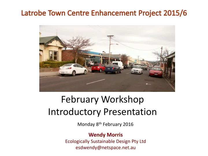
February Workshop Introductory Presentation
Monday 8th February 2016
Wendy Morris
Ecologically Sustainable Design Pty Ltd esdwendy@netspace.net.au
February Workshop Introductory Presentation Monday 8 th February - - PowerPoint PPT Presentation
February Workshop Introductory Presentation Monday 8 th February 2016 Wendy Morris Ecologically Sustainable Design Pty Ltd esdwendy@netspace.net.au Focus of this Project: A Town Centre Action Plan for the Community Parking Traffic.
Monday 8th February 2016
Ecologically Sustainable Design Pty Ltd esdwendy@netspace.net.au
About 30 people attended Introduction to Project Community ideas and concerns sought A number of key issues raised
Existing on-street and off-street public parking areas were divided up into 28 segments, and counts done first of the total number of spaces available. A total of 405 spaces are available. Then the number of spaces vacant were counted at 10am, 1pm and 4pm every day for a week, and at 7pm for Thursday and Friday evenings.
Parking areas defined
Parking Survey and Results October 2015
Occupancy in Summary (Weekday working hours % / Weekend working hours %) In general, the survey shows there are usually spaces available in each segment at all times. So how much extra parking should be provided? And where? 72%/72? 73%/51% 39%/58% Barclay 52%/38% Station Square 50%/23% 47%/19% Victor St CP 39%/25% 64%/49% Kings CP 28%/14% 58%/62% 60%/41% 10%/56%
Hamilton 53%/50%
Potential Future Parking Areas – should we further expand Station Square car park beyond toilet block? Or at least retain this key site for future parking? Or is it too much in a single area? Current occupancy 50%/23%
Potential Future Parking Areas – Kobie’s Lane (or is it Kobie Street?)
Most of current lane is within paddock. Total width is about 25m. Opportunity to create a through street link and addition of a parking lot or a street. How to interface with future development
Can we encourage some new retail development to front the lane? And/or to front Barclay St and Station Square? And/or can we encourage some rears of Gilbert St properties to contribute more public parking?
Should Kings (Reisz’s) Car Park be removed or reduced? Or Enhanced? Currently there are 43 spaces… occupied on average during the day 60% on weekdays and 41% on weekends.
Possible retention plus enhancement. Wider re-paved walkway with greened edge; seats under trees at front; more trees throughout; re-design to enable grass and trees to be added around playground. Maps to walking
Proposed Baptist Car Park – was planned in 2012 for 60 spaces including land in King’s Park Currently leased to Council till 2018 Should it be constructed? Slope challenges and cost? If so, for all 60 spaces, or for less? Men’s Shed meets on Friday mornings only and use about 20 spaces
Potential Future Parking Areas – Land off James St, behind Belly’s etc, linked to Reject Car park using
Should we replace the first space with a tree and seat to improve the streetscape?
Potential Future Parking Areas – Land off James St, behind Belly’s etc, linked to Reject Car park using old lane
By combining available areas at rear of properties, up to 42 spaces could be created. And the currently difficult exit out of the Reject car park would be solved by exiting via James St. Should we put a tree into the first parking bay and move the disabled space south? Are landholders willing to contribute land at a nominal price in return for Council constructing the car park?
Potential Future Parking Areas – Hamilton Lane Should the lane be widened? Which back yards might be willing to participate?
Potential Future Parking Areas – Expand parking at Council Offices Remove the now empty Arts Building? And/or remove the house on Lewis St?
Existing traffic volumes Potential roundabout locations and designs Pedestrian crossing enhancement Improving and reducing opportunities for traffic turning right into Gilbert St Heavy vehicles Establishing a parallel street network
Existing traffic volumes, traffic speeds and % of trucks… Survey done in August 2015 Average daily traffic is around 6400 vehicles per day… well within the street’s capacity Vehicle speeds - 50% within 40-50kph
Latrobe Town Centre – A panhandle, relatively remote from the bulk of the township
Preliminary Traffic Management Proposals – LMC July 2015 – western section
Add additional roundabouts to help traffic management and slow traffic Add extra off street parking areas (eg. Kobies Lane, Hamilton Lane, James St) Create Cotton St link as parallel route to Gilbert St Identify future town centre development areas
James St
Bradshaw St George St
Potential roundabout locations and designs Victor St roundabout paving concept developed
The roundabouts will help slow traffic somewhat, but won’t create breaks as lights do The roundabouts will incorporate pedestrian crossing refuges What about adding a painted median? This works in many busier streets of similar width… even with trams!
Improving and/or reducing opportunities for traffic turning right into Gilbert St
Stop line has been brought out into Gilbert Street using kerb extensions to improve turning and crossing visibility at James St and other side streets Can it be used for some key car park exits? Eg Kings Car Park?
Heavy vehicles – a lot seem to use Gilbert St, despite the parallel highway. Can some be diverted?
Survey of Heavy Vehicles in Gilbert St was done in November 2015 – showed almost all were to or from local destinations
Elizabethtown to Railton link has some bridge load limit problems, but even if improved would not attract many of the trucks.
Establishing a parallel street network to improve town centre circulation Cotton St is key. But Kobie Lane linked through will also help. Need to use development to help catalyse the missing links.
Station Square Kings Park/King’s Car Park Tree planting in and around Gilbert St Improving King’s Creek Presentation of buildings/town’s heritage image Garden Club opportunities in town centre
What works well? What doesn’t? Can we better activate the edges? Review the edge uses
South side - Dentist coming… and Vinnies Western edge – side
Eastern edge – Hill St Grocer… but not an ‘active’ edge
What about the square itself? Seats? Trees? The shelter? The paving? The chequerboard? The access points What’s missing?
Seats? Trees? The shelter? What’s missing?
Kings Park/King’s car park Should the car park go…. Or be enhanced? Can the edges be improved? Extend and upgrade the path network and park furniture
Kings Park/King’s car park Extend and upgrade the path network and park furniture Can we strengthen its role as a walking trailhead? Improve the maps to suit visitors.
Kings Park/King’s car park Can the edges be improved? Currently there are only back fences and backs of buildings abutting it. Rear of Gilbert St properties Can the Museum open
The Men’s Shed? Add a café?
Kings Park
Review of tree planting in Gilbert St Other greening opportunities – Especially fronts of private car parks
Ross Town Centre – magnificent elms
Street furniture in Gilbert St… some of the semi-circular seats not very suitable for shorter people… and it’s a bit hard to talk to someone next to you. And a modern style… is this appropriate to the town’s heritage story? Footpath paving – should the program of the grey pavers shown above and
town centre footpaths?
Enhancing King’s Creek
Building façade presentation to emphasise heritage theme
Latrobe is Tasmania’s major Victorian era town centre streetscape Most buildings are looking good. Potential for more parapet signage? Is there a need to review boundaries of Heritage Overlay?
Mitre 10 shopfront was recently upgraded….. But do the blue corporate colours contribute well?
King’s car park greening King’s Creek planting Station Square floral baskets or garden beds
Suggestion to Council re maintenance of Sheean Walk. Currently, along the walk, there are growing spaces where shrubs and trees have died or been blown
doing fine in the dry weather. My request is that suitable plants be purchased and planted to bring back the walk to a shady walk in summer and a protective walk in winter (from the winds and rain). I’m sure a request to the Garden Club, the service organisations involved in the Walk and general citizens would bring forward a team prepared to help with the planting to bring this walk back to its former pleasant environment. Thanks, Bronwyn Gardner, Latrobe resident
Commercial and retail Residential Visitor Accommodation Key sites
Possible residential sites Cotton St Special area
Mixed use – Cotton St land Future retail expansion land? When and how should this be developed Future of the free camping land?
West end land between the Creeks.. And create a Cotton St extension? Can the flooding be dealt with? Where should the Pigeon Club be relocated to?
Residential – west of Victor St and flanking Last St
Sites identified in 2009 Report
As part of a development, can a street link be provided to connect Victor to Last St?
Reliquaire site – the streetscape east of Hamilton St is diminished without it. Can there be replacement of this iconic building with a new larger scale building… three storeys? Character in keeping with the traditional streetscape… What uses?
Development Opportunities in and around the Town Centre 93 Gilbert St
To catalyse further improvements To get the businesses to work together better To facilitate interaction with Council What structure should it have? Early 1990’s
Collation of all material from this evening Further follow up with key stakeholders Preparation of a report with recommendations by ESD, by end of April Concurrent work by LMC on the Latrobe Township Structure Plan, to be completed by end of June, to inform zoning adjustments for the Statewide Planning Scheme