
SLIDE 1
D4D extracts - Data Revolution
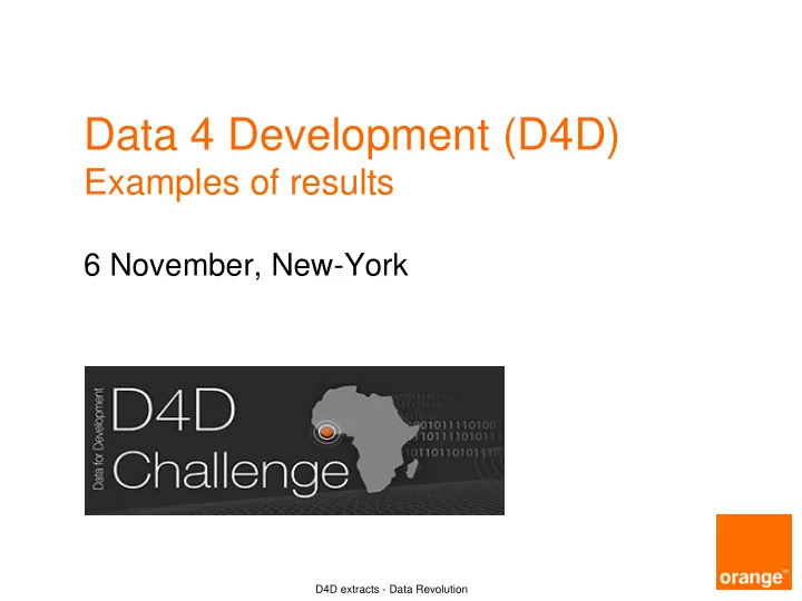
Data 4 Development (D4D)
Examples of results
6 November, New-York
Data 4 Development (D4D) Examples of results 6 November, New-York - - PowerPoint PPT Presentation
Data 4 Development (D4D) Examples of results 6 November, New-York D4D extracts - Data Revolution Data for Development in Ivory Coast, 2012-2013 An Open innovation challenge in Big Mobile Data 4 strongy anonymised mobile data
D4D extracts - Data Revolution
6 November, New-York
2 D4D extracts
An Open innovation challenge in « Big Mobile Data »
4 strongy anonymised mobile data sets samples, released to the research community
Data analysis aimed at helping the development of the country
260 universities and research labs registered, more than 80 submissions received at the end
Data for Development in Ivory Coast, 2012-2013
3
Exploiting cellular data for disease containment and information campaigns strategies in country-wide epidemics
Human mobility and the underlying social structure of a population are important factors for the spreading of diseases in a population. By exploiting mobility patterns and social ties of people extracted from the available data, a model describing how diseases spread across the country can be built to identify optimal strategies
School of Computer Science, University of Birmingham, UK
Geographic network obtained from call logs (a) and mobility traces (b).Color is used to indicate the community structure: nodes within the same community are represented with the same color.
HEALTH AND EPIDEMICS
#62
Use of Mobile Data for Disease containment
4
HEALTH AND EPIDEMICS
the prevalence of malaria estimated by Raso et al, for clarity,
#67
Use of Mobile Data for Malaria Control
Human mobility and communication patterns in Côte d’Ivoire: A network perspective for malaria control
Human mobility patterns play an important role in regional transmission of malaria
assess the importance of mobility and communication patterns for malaria control efforts based on telephone usage behavior.
University of Minnesota School of Public Health
5
Linking the Human Mobility and Connectivity Patterns with Spatial HIV distribution
With geo-referenced mobile phone data and regional HIV prevalence rates, this project enables us to identify key elements that impact the rate of HIV infections and could explain the spatial structure of epidemics.
Faculty of Technical Sciences Novi Sad, Serbia
3NN migration graph: The nodes represent Ivory Coast regions, arranged in geographical order and colored according to HIV prevalence rates. Links are inferred from inter–region migration flows during six months. Their color and width are proportional to normalized flow between regions.
HEALTH AND EPIDEMICS
#63
Use of Mobile Data for HIV distribution analysis
6
Using Mobile Phone Data to supercharge Epidemic Models of Cholera Transmission in Africa : a case study of Côte d'Ivoire
This project combines mobile phone records with detailed environmental data to drive a cholera transmission model. The results from this model (and extensions of it) can help improve
understanding
cholera transmission and guide targeted prevention and control efforts.
Johns Hopkins Bloomberg School of Public Health, Johns Hopkins University
Log population density and Voronoi tessellation of country by cell phone towers
HEALTH AND EPIDEMICS
Use of Mobile Data for Cholera analysis
7
Use of Mobile Data for Population sizing proxies
Egocentric and population-density patterns of cellphone communication in Ivory Coast
The number of phone calls can be used with appropriate correction factors (double SIM, penetration of Mobile on certain populations, activities, …) to approximate the densities of populations at a antenna granular level. New metrics like these could be used more frequently as proxies between proper statistical census
Department of Computer Science University of California, Santa Barbara
8
Poverty map in finer granularity estimated based on the diversity of connections between antenna
Ubiquitous sensing for mapping poverty in developing countries
In developing countries, census data may be collected infrequently, thus failing to accurately reflect the changes associated with a growing economy. To overcome this problem, this research team mined aggregated mobile phone communication data to estimate socioeconomic indicators in Côte d’Ivoire and discovered a number of features that have a strong correlation with poverty indicators. Thanks to this data which could be updated frequently or continuously, poverty estimates at a spatial resolution finer than previously available could be provided.
University College London, Bell Labs Dublin
Use of Mobile Data for Poverty index approximations
9
Understanding the differing tribal and infrastructural influences on mobility in developing and industrialized regions
This study leverages mobile phone to analyze mobility patterns—such as differences in likelihood to travel, the time required to travel etc.—that are relevant to considerations on policy, infrastructure and economic development in developing regions, and compares it to more developed regions. Moreover, this study illustrates how cultural and lingual diversity can present challenges to mobility models that perform well for less culturally diverse regions.
SENSEable Citylab - MIT Cambridge
MOBILITY AND TRANSPORTATION
Intra (a) and Inter (b) tribal migrations over the entire dataset. The color of the edges is logarithmically mapped based on the total flux of migrations between the two nodes
Use of Mobile Data for new development metrics
10
All Aboard : a system for exploring urban mobility and optimizing public transport using cellphone data
Mobile phone location data is used to infer
converted to ridership on existing transit
for travel with their service offerings and improve the fluidity of the cities, hence impacting cultural or economic development
IBM Research, Dublin
Geographic networks obtained from mobility traces (left) and the call logs (right). Stronger links are more opaque.
Use of Mobile Data for Urban Planning
11
Crowdsourcing physical package delivery using the existing routine mobility of a local population
In Ivory Coast, delivering essential items to remote area is usually difficult with conventional methods such as road network. This project proposed an alternative method of delivery, observing that distance between any two arbitrary points is covered by individuals who would visit these locations in daily life. Using a large location database of Ivorians, we can find the optimal route of distributing crowdsourcing aid by taking into consideration the daily life location behavior of individuals.
University of Southampton
Minimum spanning tree between cell towers in Ivory Coast, where connections are defined by common visitors in the Orange dataset, and the size of node represents betweenness centrality
Use of Mobile Data to model innovative ideas
12
An Energy-Efficient Mobile Crowdsensing Mechanism (EEMC) by Reusing Call/SMS Connections
Mobile crowdsensing outsources the sensing tasks to mobile phone users. During the process, the cost to make a connection consumes the most of energy on mobile phone. By reusing the connections
call/SMS, EEMC mechanism promises to cut
the energy consumption
data transmission and sensing result collection. It also explores how to minimize the total energy cost by assigning tasks only to those users who have the highest probability of reusing connections. Haoyi Xiong, Leye Wang, Daqing Zhang Institut Mines-Telecom Télécom SudParis CNRS SAMOVAR UMR 5157 EDITE, Université Pierre et Marie Curie - Paris VI
Spatial Patterns of Call/SMS in Abidjan City
Use of Mobile Data for (crowd sensing) energy reduction
13
Different coherent components of the visual analytics solution for the exploration and analysis of Massive Mobile Phone Data in the context of the Orange Data for Development D4D-challenge
Exploration and analysis of massive mobile phone data : a layered visual analytics approach
Here researchers present a system for the exploration and analysis of massive mobile phone data, using a visual analytics approach. It also enables early detections of different events by looking at the number of calls over locally concentrated communication channels, since the number of calls is strongly correlated with the occurrence of events.
Eindhoven University of Technology SynerScope BV Prince of Wales Fellowship at MIT
New tools to help making sense of Massive Data sets
14
New D4D Senegal: results on 10 April 2015
250 registered projects from all over the world:
in Senegal alone
Agriculture, Energy, others
Ethic Panel
www.d4d.orange.com #data4dev
contact: Nicolas de Cordes, Orange