1 ISDA 2019, Kobe
Assimilating visible satellite images for convective scale numerical - - PowerPoint PPT Presentation
Assimilating visible satellite images for convective scale numerical weather prediction Leonhard Scheck 1,2 , Lilo Bach 2 , Bernhard Mayer 3 , Martin Weissmann 1,2 1) Hans-Ertl-Center for Weather Research / Ludwig-Maximilians-Universitt, Munich,
SLIDE 1
SLIDE 2
2 ISDA 2019, Kobe
MODIS 11μm thermal (window) channel, 1km resolution
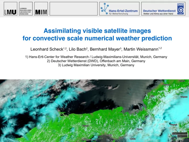
images from NASA WorldView
180K 340K
MODIS 0.6μm / 0.8μm / 1.6μm solar channels, 250m / 250m / 500m resolution
SLIDE 3
3 ISDA 2019, Kobe
- multiple scattering dominates, 3D effects important
→ radiative transfer (RT) is much more complicated and computationally expensive than for thermal infrared channels → forward operators based on standard RT methods too slow / inaccurate for operational purposes Solution: MFASIS (method for fast satellite image synthesis)
- fast 1D RT method based on a compressed look-up
table for reflectances computed with standard methods for strongly simplified vertical profiles
- 104 times faster than standard 1D RT methods
- integrated into RTTOV 12.2
by DWD (+MetOffice, LMU) in the framework of
- extensions to account for 3D effects have been
developed and will be further improved
- observations may be problematic to assimilate
- very nonlinear (RH=99%→ nothing, RH=100%→cloud)
- how to perform vertical localization?
~
Why are we not assimilating solar channels?
SLIDE 4
4 ISDA 2019, Kobe
LETKF (Local Ensemble Transform Kalman Filter) Assimilation experiments
- DWD Codes: KENDA
+ COSMO-DE (2.8km)
- Case: 29 May & 5 June 2016
- Ensemble: 40 members
- Assimilation window: 1h
- Covariance inflation:
Additive + multiplicat. + RTPP
- Conventional obs.:
SYNOP, TEMP, Profiler, AMDAR (no MODE-S, LHN) ~5000 observations/hour
- Reference runs: Conventional obs. only, cycling 21UTC – 18UTC next day
- Run with conv. obs. + visible sat. images: Branched from ref. run at 5UTC
- Visible reflectances: 0.6μm SEVIRI, superobbed to (18km)2, optionally thinned
SLIDE 5
9 ISDA 2019, Kobe
P(R>0.5) only conventional obs. P(R>0.5) conventional + SEVIRI 0.6mu P(PRECIP>1mm/h) only conv. obs. P(PRECIP>1mm/h) conv. + 0.6mu
Cloud cover and precipitation forecast improvements
Fraction of ens. members exceeding reflectance>0.5 (top) or precip. >1mm/h (bottom).
1h fcst valid at 5 June, 10UTC cloud & precipitation band missing cloud & precipitation band present blue contours:
- bserved R>0.5
blue contours: precip>1mm/h
SLIDE 6
10 ISDA 2019, Kobe
Refmectance RMSE and bias for 3h forecasts
Black: Forecasts started from reference experiment (only conventional obs.) Red: Additionally SEVIRI 0.6µm reflectance assimilated RMSE reflectance error (solid) of ensemble mean is strongly reduced in every
- analysis. Impact is visible for >3 hours in highly convective situation.
Reflectance bias (dashed) is also improved (domain cloud fraction improved). MAY 29 JUNE 5
SLIDE 7
11 ISDA 2019, Kobe
Fractions Skill Score for Refmectance and Precipitation
Mean FSS of ens. members for ← Reflectance >0.5
- n 24km scale
← Precip. > 1mm/h
- n 30km scale
Both improved by assimilation of 0.6 µm SEVIRI in almost all cases MAY 29 REFL>0.5 PRECIP>1mm/h MAY 29 JUNE 5 REFL>0.5 PRECIP>1mm/h JUNE 5
SLIDE 8
12 ISDA 2019, Kobe
Results for a 6-day test period (Lilo Bach, DWD)
Can we improve moisture?
→ RMSE and moist bias improved.
relative humidity
ΔRMSE
Difference to the setup used so far: reference run contains now also MODE-S and radar (LHN) data! VIS run = reference+VIS
relative humidity relative humidity
better better better 26 – 31 May 2018
SLIDE 9
13 ISDA 2019, Kobe
- Analysis model equiv.: linear LETKF estimates differ from exact nonlinear operator results
- Ambiguity: Reflectance depends on LWC, IWC, RH and cloud fraction. Which should be
modified? → resolve using additional channels? → Poster p1-22 by Weißmann et al.
- No vertical localization → we can get increments related to spurious correlations...
Use cloud top height retrievals for localization? → Poster p1-21 by Bach et al.
Single observation experiments
1) too cloudy 2) not cloudy enough less cloud water & ice more cloud ice
shading=spread shading=spread
ANA LIN ANA NL FG NL ANA LIN ANA NL FG NL
dashed = FG solid = analysis dashed = FG solid = analysis mixing ratios mixing ratios
B A A* B A* A O O
SLIDE 10
15 ISDA 2019, Kobe
|A*-O| > |B-O|
For which cases is operator nonlinearity most problematic?
Does NL error depend on B-O? A : linear estimates (incl. inflation) A* : nonlinear values (incl. inflation) < … > = mean value in B-O bin Small |B-O| does not mean small nonlinearity error |A-A*| ! Interpretation: Not only large increments, but also large spread values can cause high errors. In general: small |B-O| → even smaller |A-O| → |B-O| - |A-O| small and positive Non-small |A-A*| → non-small |A*-O| - |A-O| → |B-O| - |A*-O| can become negative! Nonlinearity → For small |B-O| analysis is pushed away from observations About 50% of the observations have small |B-O| (< 0.05) “mean departure reduction”
SLIDE 11
16 ISDA 2019, Kobe
Nonlinearity makes assimilating small |B-O| cases useless or even harmful? Test: Exclude cases with |B-O|<0.05 from assimilation (~50% of the observations) → Result are slightly improved, both for reflectance and precipitation... FSS 1mm/h 25 cells
FSS for PRECIP>1mm/h, 25 cells
5 JUNE 2016
Black: reference run, blue: all VIS observations, red: only |B-O|>0.05 VIS obs.
For which cases is operator nonlinearity most problematic?
SLIDE 12
19 ISDA 2019, Kobe
Summary
- A sufficiently fast and accurate forward operator for visible reflectances
based on the MFASIS RT method is available
- Experiments with the LETKF implemented in DWD’s KENDA system for two
convective summer days show that cloud cover and precipitation can be improved for several hours by the assimilation of visible 0.6μm SEVIRI images
- Longer test periods are being investigated at DWD, first results show a
beneficial impact on the moisture fields
- Operator nonlinearity makes assimilating cases with small |B-O| useless and
assimilating cases with larger |B-O| less efficient than it could be
Publications: Scheck, Frerebeau, Buras-Schnell, Mayer (2016): A fast radiative transfer method for the simulation of visible satellite imagery, Journal of Quantitative Spectroscopy and Radiative Transfer, 175, p. 54-67. Scheck, Hocking, Saunders (2016): A comparison of MFASIS and RTTOV-DOM, NWP-SAF visiting scientist report, http://www.nwpsaf.eu/vs_reports/nwpsaf-mo-vs-054.pdf Scheck, Weissmann, Mayer (2018): Efficient methods to account for cloud top inclination and cloud overlap in synthetic visible satellite images, JTECH, Vol. 35, Issue: 3, p. 665-685 Schraff, C. , Reich, H. , Rhodin, A. , Schomburg, A. , Stephan, K. , Periáñez, A. and Potthast, R. (2016): Kilometre scale ensemble data assimilation for the COSMO model (KENDA)
- . Q.J.R. Meteorol. Soc., 142: 1453pp