Annual Planning Meeting Rawlins, Wyoming December 10, 2008 Forward - - PowerPoint PPT Presentation

annual planning meeting
SMART_READER_LITE
LIVE PREVIEW

Annual Planning Meeting Rawlins, Wyoming December 10, 2008 Forward - - PowerPoint PPT Presentation

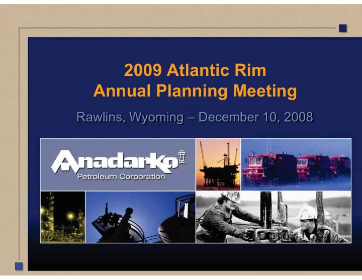
2009 Atlantic Rim Annual Planning Meeting Rawlins, Wyoming December 10, 2008 Forward Looking Statement This presentation contains forward-looking statements within the meaning of Section 27A of the Securities Act of 1933 and Section 21E


slide-1
SLIDE 1

2009 Atlantic Rim Annual Planning Meeting

Rawlins, Wyoming – December 10, 2008

slide-2
SLIDE 2

Forward Looking Statement

  • This presentation contains forward-looking statements within the meaning of Section 27A
  • f the Securities Act of 1933 and Section 21E of the Securities Exchange Act of 1934.

Anadarko believes that its expectations are based on reasonable assumptions. No assurance, however, can be given that such expectations will prove to have been correct. A number of factors could cause actual results to differ materially from the projections, anticipated results or other expectations expressed in this presentation. Anadarko cannot guarantee that it will successfully execute on its drilling and development plans, meet its revised production guidance, meet its debt reduction goals, or successfully create and market an initial public offering of a midstream Master Limited Partnership. See “Risk Factors” in the company’s 2006 Annual Report on Form 10-K and other public filings and press releases. Anadarko undertakes no obligation to publicly update or revise any forward-looking statements.

  • Cautionary Note to U.S. Investors — The United States Securities and Exchange

Commission permits oil and gas companies, in their filings with the SEC, to disclose only proved reserves that a company has demonstrated by actual production or conclusive formation tests to be economically and legally producible under existing economic and

  • perating conditions. We use certain terms in this presentation, such as “net unbooked,

captured resources”, “net risked captured resources” or “unbooked resource potential”, that the SEC’s guidelines strictly prohibit us from including in filings with the SEC. U.S. Investors are urged to consider closely the disclosure in our Form 10-K for the year ended December 31, 2006, File No. 001-08968, available from us at www.anadarko.com or by writing us at: Anadarko Petroleum Corporation, 1201 Lake Robbins Drive, The Woodlands, Texas 77380 Attn: Investor Relations. You can also obtain this form from the SEC by calling 1-800-SEC-0330.

slide-3
SLIDE 3

Introduction – Presentation Agenda

Introductions 2008 Activity (Permitting, Drilling, Infrastructure) 2009/10 Development Plans 2008-09 Innovations Surface Disturbance/Reclamation Update ROD Implementation Requirements

slide-4
SLIDE 4

D

  • t

y B D

  • t

y C S u n D

  • g

F J a c k S p a r r

  • w

2008 Permitting and Drilling Activity

10 20 30 40 50 60 Approved APDs Wells Drilled

slide-5
SLIDE 5

2009/2010 Development Plans

POD/NOS Sun Dog G Doty D Jolly Roger A Doty A SJB Jack Sparrow B Brown Cow A Totals Federal Wells/Fee Wells 16/0 12/1 12/2 55/0 54/0 59/0 64/0 275 (272/3) NRS Assigned H. Hurla H. Hurla E. Norelius E. Norelius J. Ahlbrandt 5 of 7 Surveying X X X X X X X 6 of 7 Archeology Surveys X X X X X 5 of 7 Biology Surveys X X X X X X 6 0f 7 On-sites X X 2 of 7

slide-6
SLIDE 6

2008 Activity

Infrastructure 2008 Build Out Gathering / Electrical Distribution

– Sun Dog 13.6 miles 20.4 miles – Doty Mtn 21.2 31.8 – Jack Sparrow 32.8 49.2 Cum Total 67.6 miles 101.4 miles

Roads

  • Sun Dog

8 miles

  • Doty Mtn

16

  • Jack Sparrow

8 Cum Total 32 miles

slide-7
SLIDE 7

Midstream Build Out

– Sun Dog - Aztec Gold 8” X 13.8 mile Pipeline – Set Sun Dog #4 & #5 Compressors – Install Sun Dog Facility 30 MMCFD Gas Dehydrator

2008 Activity

slide-8
SLIDE 8

2009 Plans

Infrastructure 2009 Build Out Gathering / Electrical Distribution

– Sun Dog G 56 miles 84 miles – SJB 70 105 – Jolly Roger 60 89 – Dotty D 49 73.5 – Jack Sparrow A 52.5 78.8 Cum Total 287 miles 430.5 miles Roads

  • Sun Dog G

28 miles

  • SJB

35

  • Jolly Roger

30

  • Doty D

24.5

  • Jack Sparrow A 26

Cum Total 143.5 miles

slide-9
SLIDE 9

Midstream Build Out

– Remove Unit #1 3516 Compressor and Install #6 & #7 3608 Compressors at Sun Dog – Upgrade Sun Dog Facility to handle 50 MMcfd Capacity – Install Doty Mtn Unit #3 3608 Compressor – Upgrade Doty Mtn Facility to handle 30 MMcfd Capacity – Install Jack Sparrow Unit #2 3608 Compressor – Construct Fillmore Creek Inter-Connect to WIC – Construct 12 mile 16” Fillmore Creek JV Pipeline (Southern Star North to I-80). Parallel’s Williams Westtrans Pipeline. – Collaborating with adjacent operator’s “Double Eagle and Warren” to not duplicate sales pipeline construction

2009 Plans

slide-10
SLIDE 10

2008-2009 Innovations

Minimize Surface Disturbance

– Bury Pipelines under road, 50’ to 35’ width footprint – Sump Wells – improve view shed – Co Producers and Injection Wells on same pad – Constructed 5 Bores for Pipeline Gathering under stream at Jack Sparrow

Water Injection Treatment

– Continuous Sodium Hypochlorite Injection to treat sulphur reducing bacteria and iron fixing bacteria. – Elimination of above ground water storage tanks reduces potential for Coliform Bacteria

slide-11
SLIDE 11

2008-2009 Innovations Continued

Drilling

– Centralized Cement System

  • reduced cycle time by 6-8 hours; less trucking time for mud and water; quicker

response time reacting to loss circulation occurrences; capacity to increase mud weight for well control; amine based mud system for clay stabilization reducing mud rings, decreasing cycle time, increasing production and increasing cement bond quality.

  • applied right angle set cement program with weighted spacer to maximize cement

bonding to casing; yielded no annular pressure at surface and zonal isolation; and reduced road traffic.

– Drilling Program completed before winter minimizing surface

  • damage. Also allowed early surface pit closures.

– Employed Drilling Clerk to facilitate timely Regulatory Notices for spud, BOPE testing, cement jobs and deepening well depths. – Regulatory Improved on tracking and Filing Notice of Intents

slide-12
SLIDE 12

2008-2009 Innovations Continued

Production

– Implement portable trailer mounted generators to minimize surface disturbance – Install Well Site Telemetry for production monitoring and to limit road travel – Created compliance officer position for construction, drilling and production operations.

slide-13
SLIDE 13

Surface Disturbance: E&P and midstream -APC

Area Name 2007 Disturbance acres 2008 Approximate * Disturbance acres Acre Cap value: Projected* Red Rim 116 116 Jolly Roger 208 4 212 Doty Mountain 463 127 590 Sun Dog 477 78 555 Jack Sparrow 135 30 165 Brown Cow 117 117 Midstream (WGR) 143 155 298 Dad Yard 20 20 TOTAL 1679 394 2073

slide-14
SLIDE 14

Storm Water - SWPPP

APC has six permits with DEQ covering entire Atlantic Rim area Full-time contract employee devoted to storm water compliance All necessary inspections conducted, documented and retained at the field office All storm water controls and ground coverage digitally maintained through GIS work

slide-15
SLIDE 15
  • Storm Water

Control Points:

  • Rock Armor
  • Silt fence
  • Culvert
  • Hydro-seeded
slide-16
SLIDE 16

Reclamation

Review of 2008 Reclamation efforts:

– 980 acres seeded in Atlantic Rim (45 acres hydro- seeded)

  • -Working cooperatively with private land owners to provide diversity of vegetation

species on fee lands

  • Best Management Practices- implemented by trial study:
  • Weed Control:
  • pre-emergence of reduced rate of Telar for Alyssum and halogeton target
  • Soil and vegetation growth amendment testing in progress:
  • incorporating mycorrihizal fungi on Doty Mountain pipeline
  • Rizobium bacteria utilized in Fillmore allotment
  • 2,000 cubic yards of wood chips acquired from Battle Mountain
  • Snow fencing:
  • experiment to detour wind / gather moisture/ stability in sandy soil
slide-17
SLIDE 17

Weed Control Pilot Trial –Pre-emergence Study

Sun Dog/ Doty Mountain/ Williams Tee End of treatment area: Sun Dog Pipeline Yellow Desert Alyssum and Russian Thistle Doty Mountain Pipeline Doty Mountain/Sun Dog to Williams Sales Pipeline 20 acre plot / target invasive weeds

slide-18
SLIDE 18

» » » » »

Soil amendment pilot trial

Doty Mountain

Mycorrohizal Fungi

  • enhance growth in sterile soils
  • drill seed to avoid UV damage
  • promote moisture gathering
  • free of weed growth at present
  • 35 acre plot
slide-19
SLIDE 19

Snow Fencing

Engineering controls:

  • Strategic in placement and angles
  • diversity in structure construction & material
  • Detour wind
  • gather moisture
slide-20
SLIDE 20

Vegetation Monitoring

  • Brown Cow Pod
  • Brown Cow Fed 1491 14-13 (00722533)
  • Modified point-line intercept monitoring method
  • Pad has reclaimed 113% of canopy cover compared to reference

Reference Pad

slide-21
SLIDE 21

Vegetation Monitoring

  • Jolly Rodger POD
  • AR Fed 1890 SW-4 (00722699)
  • Modified point-line intercept monitoring method
  • Pad has reclaimed 87% of canopy cover compared to reference

Well Pad View of reference area to pad

slide-22
SLIDE 22

Reclamation

2009 Program Plans:

– Expansion of internal geo-database to include reclamation – Process and evaluate the latest satellite imagery (infrared) – Test a micorrihizal plot utilizing a coated seed application – Hot wire fence applications until vegetation established – Utilize livestock in seeding applications in strategic areas – Continuous improvement emphasis in all restoration efforts

slide-23
SLIDE 23
  • units require this to happen

all unit areas, resulting in m

  • f impact to natural

– – ” “ ”

  • BEST MANAGEMENT PRACTICES

Expanding Unit Boundaries

Rawlins Field Office

www.blm.gov/wy/st/en/field_offices/Rawlins.html

INTRODUCTION

The Atlantic Rim Coalbed Natural Gas (CBNG) Project is within a highly diverse ecosystem that will require complex mitigation of sensitive resources. Standard Wyoming CGNG unit size is limited to less than 25,000 acres based on historical development in other areas of the state. Normal CBNG unit development requires 5 wells per year be drilled in

  • rder to maintain leasehold with the unit boundary. Associated with the

wells is the disturbance resulting from the necessary roads and infrastructure necessary for unit development. Throughout the project area there exists a wide spectrum of critical surface resources (cultural, wildlife, vegetation, water, range, soil, etc.) that require special consideration for development drilling to take place. Due to the high production potential in the central portion of the project area, the heart of initial CBNG development is occurring in the Catalina and Sun Dog Unit areas (center of the project). Development should

  • ccur concentrically.

in ultiple Multi areas resources.

ISSUES

Operator is being asked to control drilling and minimize surface disturbance for compliance with the Atlantic Rim Environmental Impact Statement Record of Decision, while at the same time extend the drilling program with the associated disturbance far from exiting development in order to maintain unit continuity and integrity.

ATLANTIC RIM UNITS - NOW PROPOSED ATLANTIC RIM UNITS

SOLUTIONS, BENEFITS, CONCLUSIONS

Creation of two larger than standard coalbed natural gas units would allow for logical and systematic development within a centralized area for maintenance

  • f unit continuity and integrity, while at the same time

minimizing disturbance and allow for planning and protection of other surface resources. Same drilling obligations just concentrated. Better utilization of infrastructure i.e., pipeline, utility, and road corridors. Minimize impacts to wildlife, trails, Muddy Creek, soils, etc., by systematic development from the middle “sweet spot” out. Provide refuge for wildlife by concentrating development impact in “stages. Interim reclamation will restore habitats, accelerate restoration, and visual impacts. Limiting surface disturbance to concentrated area in stages allows for stabilization of soils, minimizing erosion. Better utilization of Bureau resources/work efforts as on sites, approval

  • f APDs, subsequent inspections, and follow-up.

Continuity and protection of correlative rights.

ACKNOWLEDGEMENTS

Anadarko Petroleum Corporation

FOR FURTHER INFORMATION

Jerry Dickinson, Petroleum Engineer Jon Dull, Petroleum Engineer rawlins_wymail@BLM.GOV

slide-24
SLIDE 24

9/16/2008

Vegetation Wildlife Livestock Management

Performance Goals

Monitoring of Air/Groundwater/ Methane Seeps

ROD Implementation Requirements

Tracking of Surface Disturbance and Reclamation Success Historic Trails: Mitigation for Visual Impacts

slide-25
SLIDE 25

ROD Requirements: Historic Trails

Record of Decision requirements:

– “…mitigation measures will be incorporated into an agreement or agreements to be established under the Wyoming state cultural resources protocol between the BLM, the State Historic Preservation Officer (SHPO), project proponents, and interested parties to address site-specific impacts and mitigation measures for all sites where setting contributes to National Register of Historic Places (NRHP) eligibility.” (AR ROD, p. B -19)

Status Update:

– Programmatic Agreement (PA) for Adverse Impacts to the trails’ “setting” was signed on July 31, 2007 – PA mitigations included defined transportation corridors across contributing segments of trails, NSO within ¼ miles either side of contributing segments, and the need for compensatory mitigation – Compensatory Mitigation status:

  • Contracts w/Cloud Peak Production for documentary in March of 2008
  • Contract w/ Interpretive Graphics for interpretive signage in July of 2008
  • Draft Documentary script completed in October 2008
  • 2009 Activities: Expect completion of documentary film and interpretive signs
slide-26
SLIDE 26

ROD Requirements: Air Monitoring

Record of Decision requirements:

– “In cooperation with WDEQ, the Operators will finance and operate additional air quality concentration monitoring, including O3 monitoring, in the Rawlins Field Office (RFO) management area.” (AR ROD, p. 7)

Status Update:

– Anadarko installed an 80-foot meteorological tower and air quality monitoring shelter in the fall of 2007 one mile southeast of the Jolly Roger Compressor station near the Continental Divide – The station continuously monitors O3, NOX and dispersion meteorology including winds, turbulence, temperature, solar radiation, barometric pressure, and atmospheric stability – Exceedances of the ambient ozone standard (75 ppb) were measured in June/July of 2008. Golder and Associates were hired to analyze the data. Their report suggests the event was possibly triggered by California fires and unique meteorological conditions in SW Wyoming during this time period. There is no indication that the exceedances were caused by emissions in Atlantic Rim. Anadarko and WDEQ are continuing to investigate this event.

slide-27
SLIDE 27

ROD Requirements: Methane Seeps

Record of Decision requirements:

– No requirements specifically discussed in the ROD. – “Methane seeps could possibly develop in the outcrop region of the Mesaverde Group as a result of this project. These seeps could contaminate shallow groundwater sources and may also cause the death of vegetation in limited areas. The number or location of these seeps is impossible to predict, therefore monitoring would be established to evaluate this impact...” (FEIS @ 4-32)

Status Update:

– Anadarko has taken the lead in Methane Seep monitoring and has hired a contractor to conduct monitoring – A workgroup including WOGCC, WGS, WDEQ and BLM has agreed:

  • Methane Seeps are naturally occurring and have likely existed for millions of years
  • Early travelers thru the area in the late 1800s noted the presence of seeps
  • Aerial photography analyses suggest no changes over last decade in seep expressions
  • Agreement that water injection is not causing seeps
  • 2009 Activities: Workgroup meeting first quarter to update on 2008 monitoring
slide-28
SLIDE 28

Methane Springs and Seeps

METHANE SPRING DRY SCOUR HARDPAN SEEP METHANE SPRING

slide-29
SLIDE 29

1994 2006

Methane Springs: Aerial photography analyses

Aerial photography analyses

slide-30
SLIDE 30

ROD Requirements: Groundwater Monitoring

Record of Decision requirements:

– “ The operator shall be responsible for drilling, completing, and equipping one set of three shallow groundwater-monitoring wells …” (AR ROD, p. B-10)

Status Update:

– Agreed to well locations in Sun Dog, Doty Mountain, and Jack Sparrow units – Agreed to cores, geophysical well logs, and pressure monitoring – All three well locations have been drilled and are being equipped with pressure transducers

slide-31
SLIDE 31

9/16/2008

ROD Implementation Requirements

Vegetation Wildlife Livestock Management

Performance Goals

Tracking of Surface Disturbance and Reclamation Success

slide-32
SLIDE 32

ROD Requirements: Performance Goals

Record of Decision requirements:

– “The BLM will use a performance-based management approach as part of the adaptive management process… (AR ROD, p. 19) – “…Performance Goals: describes the conditions that BLM and Operators will attempt to achieve…” (AR ROD, p. 19) – “Operators are responsible for demonstrating successful achievement

  • f Performance Goals.” (AR ROD, p. 20 and again on p. 21)

Status Update:

– Over 20 work group meetings have occurred in 2008 to discuss Performance Goal monitoring programs and to share results from monitoring – Specific Atlantic Rim Monitoring programs are in place for sage grouse, mule deer, Muddy Creek, and shrub-dependent song birds

slide-33
SLIDE 33

Performance Goal: Sage Grouse

Performance Goal: “Provide well-dispersed sage-grouse breeding, nesting, brood rearing, and winter habitat.”

9/16/2008

slide-34
SLIDE 34

Performance Goal: Sage Grouse

Status Update:

– Work Group Meetings to discuss monitoring approaches and results: 12/8/06, 5/8/07, 7/18/07, 8/29/07. 9/18/07, 10/24/07, 11/9/07, 11/15/07, 1/11/08, 2/21/08, 03/03/08, 08/21/08, 12/03/08. – Anadarko/Warren spent $75,000 in 2007 to collar birds and nearly $150,000 in 2008 for continuation of a University of Wyoming-led study. Monthly flights to track 125+/- collared grouse took place both years and UW study provides ground-validated locations at more frequent intervals. Funding has been committed for continuation of the study in 2009. – UW study is yielding detailed data on locations used for nesting and brood-

  • rearing. Analysis of vegetation plots associated with these locations will be

used to produce a tool to describe quality of other habitats and to predict probability of use by successful nesting and brood-rearing sage-grouse hens (sources) as well as areas that are not associated with reproductive success (sinks). – Activities in 2009: Continue to identify source/sink habitats and monitor for West Nile Virus

slide-35
SLIDE 35

Performance Goal: Sage Grouse

Adaptive approaches to development and reclamation??

Preliminary results on frequency of use during nesting and brood-rearing periods introduces questions

  • f whether we can design

implementation or reclamation to recognize higher use habitats even if we don’t yet understand what makes them more attractive to sage- grouse hens.

slide-36
SLIDE 36

– – – –

Performance Goal: Sage Grouse

Nesting and Brood- rearing Mitigation:

Adaptive Approaches to Infrastructure & Activities??

– Jolly Roger POD A? SJB POD? Brown Cow POD A?

Different Approaches and Methods for Reclamation??

Doty D POD? Sundog POD F?

slide-37
SLIDE 37

Performance Goal: Mule Deer

Performance Goals: Maintain functional migration routes through or around development areas and provide an adequate amount of suitable, undisturbed crucial winter range for big game animals.

9/16/2008 /16/20 08

slide-38
SLIDE 38

Performance Goal: Mule Deer

Status Update:

– EIS Companies funded a baseline Mule Deer Study during 2005 and 2006 that collared deer to “identify seasonal ranges, document migration routes, and estimate survival rates prior to development…” – Anadarko/Warren have funded an extension of the study during 2008 and 2009 for $150,000. 35+/- deer currently collared and followed to map year-round locations and movement patterns.

  • WGF is funding $31,700 of the extended study.
  • BLM received $75,000 of internal monies to expand the scope of the study.

– Work Group Meetings to discuss monitoring approaches and results have focused on migration to date – upcoming work on winter range – Activities in 2009: Continue to track and collar additional deer. Refine data display and analysis techniques. Compare Phase I and Phase II study results in 2010.

slide-39
SLIDE 39

Population-level Migration Route for the Dad Winter Range

Hall Sawyer, Research Biologist Western EcoSystems Technology, Inc. (WEST)

High use (Foraging/Resting) Moderate-high use (Movement) Moderate-low use (Movement) Moderate-low use (Movement)

slide-40
SLIDE 40

High use (Foraging/Resting) Moderate-high use (Movement) Moderate-low use (Movement) Moderate-low use (Movement)

Population-level Migration Route for the Wild Horse Winter Range

slide-41
SLIDE 41

Performance Goal: “Maintain adequate water quality, water quantity, species distribution, and aquatic habitat components.”

9/16/2008 Native bluehead sucker

Performance Goal: Muddy Creek Sensitive Fish

slide-42
SLIDE 42

Performance Goal: Muddy Creek Sensitive Fish Status Update:

– Consensus reached last year that Muddy Creek monitoring program needed to be implemented in 2008

– CDM was contracted to assist in developing the monitoring plan for field geomorphic and aquatic habitat assessment. The first phase of the study was completed in August:

  • Rosgen Level II geomorphic assessment
  • Monumented cross-section for resurvey at each site
  • Bank pins to measure bank erosion precisely
  • Photo points at each monumented section

– Activities in 2009: Repeat monumented cross-sections annually and compare to baseline results.

slide-43
SLIDE 43

Muddy Creek Study Area

Six locations within the reach of stream designated “Upper Muddy Creek” within the EIS Study Area

slide-44
SLIDE 44

Muddy Creek Sensitive Fish Habitat

UMC1 – Collapsing Bank UMC2 - Overview UMC3 – Riffle at XS-3 UMC4 - Upstream View UMC5 – Downstream View UMC6 - Overview

slide-45
SLIDE 45

9/16/2008

Performance Goal: Shrub-Dependent Song Birds

Performance Goal: “Assure occupied habitat for shrub-dependent song birds is well distributed throughout the project area” Loggerhead shrike Brewer’s sparrow Sage sparrow Sage thrasher

slide-46
SLIDE 46

9/16/2008

Performance Goal: Shrub-Dependent Song Birds

Status Update:

  • Work Group Meetings to

discuss monitoring approaches and results during Winter/Spring 2008

  • Breeding Bird Surveys (BBS)

identified as most consistent baseline

  • Four additional survey routes

identified and added in 2008

  • Activities in 2009: BBS will be

completed each spring to establish baseline and trends. 20-Mile Route Dad-Junipers Route Sand Hills Route Muddy Mtn. Route

slide-47
SLIDE 47

Performance Goal: Shrub-Dependent Song Birds

Number observed per 24.5 mile route

2008 Atlantic Rim survey results compared to established routes in surrounding areas indicate strikingly different abundances. Additional information will be necessary to determine if there are Observer differences? Different vegetation and habitat types? Other explanations?

slide-48
SLIDE 48

9/16/2008

Vegetation Wildlife Livestock Management

Performance Goals

ROD Implementation Requirements

Tracking of Surface Disturbance and Reclamation Success

slide-49
SLIDE 49

9/16/2008

Performance Goals: Riparian, Vegetation, and Range Management

Status Update:

Vegetation (addressed in Reclamation work group)

Performance Goals: – Sites: maintain viable, site- stabilizing native plant growth – Species Composition: maintain a range of species composition, diversity, cover, and production equal to pre-disturbance levels – Weeds: maintain weed-free sites – Riparian: Ensure no net loss of native riparian habitat/vegetation (also overlaps with Wildlife and Muddy Creek performance goals and monitoring efforts).

Work Group Meetings to discuss monitoring approaches and results have identified efficiencies with

  • ther monitoring programs;

Continue involvement in 2009.

slide-50
SLIDE 50

9/16/2008

Vegetation Wildlife Livestock Management

Performance Goals

ROD Implementation Requirements

Tracking of Surface Disturbance and Reclamation Success

slide-51
SLIDE 51

C

9/16/2008

Performance Goals: Riparian, Vegetation, and Range Management

Status Update:

Range Management (address with existing BLM programs)

Performance Goals: – Grazing: maintain adequate and sustainable food habitat for domestic animals – Range Condition: maintain range condition or improve range condition towards potential for the ecological site – Standards and Guidelines: manage to meet Wyoming Healthy Rangeland Standards

Work Group meetings to discuss monitoring approaches and results have identified efficiencies with

  • ther monitoring programs;

Continue involvement in 2009. C

slide-52
SLIDE 52
  • 9/16/2008

Performance Goals: Riparian, Vegetation, and Range Management

Status Update:

Livestock Industry Operations (address with operational practices)

Performance Goals: – Range Improvements: minimize damage to range improvements , gates, cattle guards, water sources, and other livestock grazing management improvements – Livestock Safety: minimize deaths and injuries of livestock due to development and operational activities

Work Group Meetings to discuss monitoring approaches and results have identified efficiencies with

  • ther monitoring programs;

Continue involvement in 2009.

  • C
slide-53
SLIDE 53

9/16/2008

Vegetation Wildlife Livestock Management

Performance Goals

ROD Implementation Requirements

Tracking of Surface Disturbance and Reclamation Success

slide-54
SLIDE 54

9/16/2008

Reclamation Requirements

Record of Decision requirements:

– Disturbance cap of 7600 acres – Interim reclamation standards to roll acres back into the “bank”

Status Update:

– BLM is finalizing allocation of the disturbance cap – BLM has identified the database requirements to track reclamation progress – Great reclamation this past spring and summer due to moisture and cool June temperatures – Activities in 2009: Implement roll-over process for sites meeting interim reclamation success

16/20 8

Brown Cow Fed 1491 14-13 (00722533)

Pad