a partnership between local governments and land trusts
play

A Partnership between Local Governments and Land Trusts to Protect - PowerPoint PPT Presentation

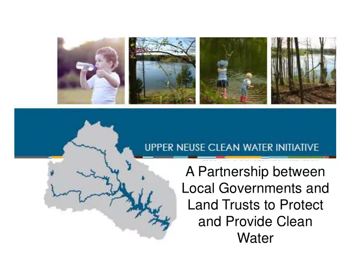
A Partnership between Local Governments and Land Trusts to Protect and Provide Clean Water Agenda Program overview Conservation plan update Land cover data Model core Goals & objectives 2015-2045 Conservation strategy


  1. A Partnership between Local Governments and Land Trusts to Protect and Provide Clean Water

  2. Agenda  Program overview  Conservation plan update  Land cover data  Model core Goals & objectives  2015-2045 Conservation strategy  Water quality impacts  Quantifying nutrient avoidance Project proposal  Questions/Next Steps

  3. Partnership to protect clean water  Conservation Trust for North Carolina and 6 local land trusts  Local governments  Natural resource professionals

  4. Mission Protect and enhance drinking water resources though land acquisitions, planning, and innovative water quality improvement activities which:  Have long term, lasting, measurable, and beneficial impacts  Are non-regulatory and voluntary  Address impacts from a variety of sources including agricultural and forestry activities  Leverage additional partners and funding resources  Are located in an active drinking water supply watershed including the Upper Neuse River Basin and the Upper Swift Creek Watershed

  5. Percent of watershed The Upper Neuse Wake 13% 17% 1% Franklin Durham 17% Orange 27% Granville Person 25%  770 square miles  6 counties  8 municipalities  6 public drinking water systems  9 water supply reservoirs  Raleigh has 1100 acres (less than 1% of the area) in the Basin

  6. Source: Barrett Kays, PHD, Landis PLLC 5 th Annual Water Symposium 2015

  7. Funding  Raleigh watershed protection fee • $0.15 per 1000 gallons, volumetric fee • Generates ~$2.25 million a year • Adopted as part of rate ordinance in 2011 • Supports outreach, project negotiation, transaction and project costs, monitoring, and administration  Upstream local governments • Durham, Granville, Orange and Wake counties • Cities of Creedmoor, Durham • Towns of Butner, Hillsborough • Durham Soil and Water Conservation District  Clean Water Management Trust Fund, Environmental Enhancement Grants  US Endowment For Forestry And Communities  Landowners

  8. Program Accomplishments 90 Properties conserved 7,698 Acres protected 85 Miles of stream buffered ~$72,720,000 Value of property protected ~$21,276,000 Value donated by landowners ~$5,800,000 Invested by Raleigh $13 : $1 Raleigh leverage ratio

  9. Conservation Plan Update Ori riginal Model:  Developed by Trust for Public Land with support from Triangle J Council of Governments  Water Quality Focused  Raster Based  Only ranked water features  Weighted Average Score

  10. Process Inputs Data Data TAT Partners TAT Public Partners Stakeholders layers layers Comment Plan / Goal Model Stakeholder Data Collection Development engagement Development Outputs Stakeholder Technical GIS based Meeting/ Conservation Summary Tool Priority Plan weighting April/May 2015 Jan-March 2015 June 2015 Fall- October 2015

  11. TAT Technical Advisory Team  Ed Buchan, Raleigh Public Utilities  Carl Stearns, Raleigh Public Utilities GIS  Corey White, Raleigh Public Utilities GIS  David Jones, Geospatial Services Branch Head at N.C. Forest Service  Silvia Terziotti, GIS Specialist, USGS, South Atlantic Water Science Center  Leigh Ann Hammerbacher, Raleigh Public Utilities  Caitlin Burke, Conservation Trust for North Carolina  Will Allen, The Conservation Fund  Andrew Birch, NC State University

  12. Data Land Use Layer layers -Crops -Deciduous Forest -Evergreen Forest -Grassland/Pasture -Mixed Forest -Open Water -Wetlands -Developed/ High intensity (80-100% impervious) -Developed/ Medium Intensity (50-79% impervious) -Developed/ Low Intensity (20-49% impervious) -Developed/Open Space (<20% impervious)

  13. Land Use Accuracy Assessment QC Block Accuracy % by Area Accuracy % by Polygons QC1 99.1 85 QC2 94.4 99 QC3 97.9 96.9 QC4 98.9 94.6 Mean 97.575 93.875 After Before

  14. Model Model Update Goals Development Develop a model that identifies priorities for water quality and quantity protection in the Upper Neuse and Swift Creek Drinking Water Supply Watersheds  Consider both riparian areas and uplands  Develop a model for both watersheds  Develop a model that could be used by various partners across the watershed  Look at future scenarios and water quality impacts  Set clear goals  Incorporate stakeholders and partners in the development  Create a model that can be updated with new data resources

  15. Model Core Objectives Development Protect Water Sources and Conveyances Conserve Upland Areas Promote Infiltration and Retention Protect Vulnerable Areas

  16. Parameters for Core Objectives Water Sources and Infiltration and Uplands Vulnerable Areas Conveyances Retention • Protect • Protect uplands • Promote • Protect Headwater and pervious infiltration and wet/hydric areas Streams areas retention • Protect steep through wetland • Support • Protect areas slopes protection connected high with minimal • Protect highly quality water impervious • Promote erodible soils features surface filtration through floodplain • Protect Riparian • Protect uplands protection areas with forest cover • Protect groundwater recharge areas

  17. Parameter Characteristics  Meets primary goal of water quality and quantity  Comes from a reliable source  Has continuous coverage for entire watershed area  Can be updated  Has scientific basis for scale  Was screened by the Technical Advisory Team

  18. The Model Model Development

  19. Priority parcels = Score 4.2 (mean) or above, within 50’ of waterbody Priority area = 17,000 parcels (15% of total), 260,000 acres (56% of total) Goal = Protect 30,000 acres over the next 30 years

  20. Water Quality Impacts 90 Properties conserved 7,698 Acres protected Miles of stream 85 buffered ~7,970 lb/yr Nitrogen avoided ~1,415 lb/yr Phosphorous avoided

  21. Potential Avoidance Sum acres total 262,102 Sum acres eligible 232,270 N 166,793 lb/yr 27,787 lb/yr 30,000 acres ~13%

  22. Water Quality Benefits

  23. Proposed Project Quantifying Nutrient Avoidance  Project Goal: Develop additional methods to quantify the water quality impact of conservation projects  Potential types of analysis  Statistical analysis of existing data and paper  Automated sampling during high flow events (2-4 sites, 4 events annually)  Grab samples (instantaneous values) 2-4 sites, 4-8 events  Letter of support

  24. Next steps/ questions?

Download Presentation
Download Policy: The content available on the website is offered to you 'AS IS' for your personal information and use only. It cannot be commercialized, licensed, or distributed on other websites without prior consent from the author. To download a presentation, simply click this link. If you encounter any difficulties during the download process, it's possible that the publisher has removed the file from their server.

Recommend


More recommend