
SLIDE 1
1
ARF Disaster Relief Mapping Service ARF DirEX 2011 ARF DirEX 2011 Manado, Sulawesi
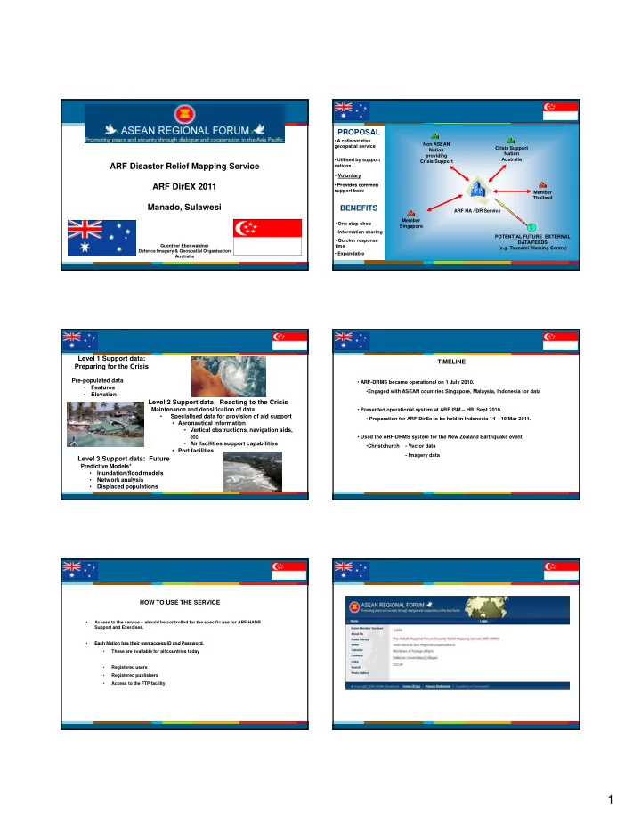
Guenther Ebenwaldner Defence Imagery & Geospatial Organisation Australia Crisis Support Nation Australia Non ASEAN Nation providing Crisis Support
- A collaborative
geospatial service
PROPOSAL
- Provides common
- Utilised by support
nations.
- Voluntary
ARF HA / DR Service Member Singapore POTENTIAL FUTURE EXTERNAL DATA FEEDS (e.g. Tsunami Warning Centre) Member Thailand
- Provides common
support base
BENEFITS
- One stop shop
- Quicker response
time
- Information sharing
- Expandable
Level 1 Support data: Preparing for the Crisis
Pre-populated data
- Features
- Elevation
Level 2 Support data: Reacting to the Crisis
Maintenance and densification of data S i li d d t f i i f id t
- Specialised data for provision of aid support
- Aeronautical information
- Vertical obstructions, navigation aids,
etc
- Air facilities support capabilities
- Port facilities
Level 3 Support data: Future
Predictive Models*
- Inundation/flood models
- Network analysis
- Displaced populations
TIMELINE
- ARF-DRMS became operational on 1 July 2010.
- Engaged with ASEAN countries Singapore, Malaysia, Indonesia for data
- Presented operational system at ARF ISM – HR Sept 2010.
- Preparation for ARF DirEx to be held in Indonesia 14 – 19 Mar 2011.
- Used the ARF-DRMS system for the New Zealand Earthquake event
- Christchurch
- Vector data
- Imagery data
HOW TO USE THE SERVICE
- Access to the service – should be controlled for the specific use for ARF HADR
Support and Exercises.
- Each Nation has their own access ID and Password.
Each Nation has their own access ID and Password.
- These are available for all countries today
- Registered users
- Registered publishers
- Access to the FTP facility