SLIDE 1 101245 Bibliotheca Alexandrina Compiled by Basma El-Massry & Shaymaa Ali
1
1 “GIS Day”, ESRI, http://blogs.esri.com/Info/photos/gis_day/picture4951.aspx
[accessed 12 Dec 2010]
SLIDE 2 101245 Bibliotheca Alexandrina Compiled by Basma El-Massry & Shaymaa Ali
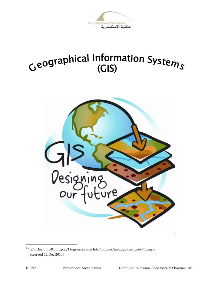
What is GIS?
GIS means "geographic information systems". GIS is a computer system capable of capturing, storing, analyzing, and displaying geographically referenced information; that is, data identified according to location.1 It's a combination of hardware, software and data that allows you to view and analyze places, and to communicate with others about them.2 GIS has four interactive components: an input subsystem for converting into digital form (digitizing) maps and other spatial data; a storage and retrieval subsystem; an analysis subsystem; and an output subsystem for producing maps, tables, and answers to geographic queries. In general, GIS is applied for: Mapmaking: Maps are generally easy to make using a GIS and they are often the most effective means of communicating the results of the GIS process Site selection: Maps are generally easy to make using a GIS and they are often the most effective means of communicating the results of the GIS process Emergency response planning: A GIS was used to combine road network and earth science information to analyze the effect of an earthquake on the response time of fire and rescue squads3
1 “Geographic Information Systems”, U.S. Geological Survey, Eastern Geographic Science Center,
http://egsc.usgs.gov/isb/pubs/gis_poster/
2 “What is GIS?”, Land Trust GIS, http://landtrustgis.org/technology/what-is-gis 3 “Geographic Information Systems”, U.S. Geological Survey, Eastern Geographic Science Center,
http://egsc.usgs.gov/isb/pubs/gis_poster/
SLIDE 3 101245 Bibliotheca Alexandrina Compiled by Basma El-Massry & Shaymaa Ali
GIS is frequently used by environmental and urban planners, marketing researchers, retail site analysts, water resource specialists, and other professionals whose work relies
- n maps.1 It is often used in the following industries:
Banking: Financial analysts employ GIS for targeting their markets by visualizing service needs. Insurance: Many insurance companies have made GIS a central component of their business, using it to visualize, analyze, and distribute risk. Logistics: Logistics management requires planning the distribution fleet's activities, route locations, and schedules. the GIS logistics routing solution shown to the right to increase the number of daily deliveries without increasing resources. Media: GIS is used by media bureaus for everything from analyzing circulation and attracting advertisers to creating the maps used in the material itself. GIS maps can help the media keep the public informed about street closures or openings and other emergency services, as in this map of lower Manhattan from the AP.2 Forestry: Inventory and management of resources Police: Crime mapping to target resources Epidemiology: To link clusters of disease to sources Transport: Monitoring routes Utilities: Managing pipe networks Oil: Monitoring ships and managing pipelines Central and local government: Evidence for funding and policy e.g. deprivation Health: Planning services and health impact assessments Environment agencies: Identifying areas of risk from e.g. flood
1 “GIS ”, Encyclopædia Britannica Online,
www.britannica.com/EBchecked/topic/1033394/GIS
2 “Business”, GIS.com, www.gis.com/content/business
SLIDE 4 101245 Bibliotheca Alexandrina Compiled by Basma El-Massry & Shaymaa Ali
Emergency departments e.g. ambulance: Planning quickest routes Retail: Store location Marketing: Locating target customers Military: Troop movement Mobile phone companies: Locating masts Land Registry: Recording and managing land and property Estate agents: Locating properties that match certain criteria Agriculture: Analyzing crop yields1 In 1963, the English-born Canadian geographer Roger Tomlinson began developing what would eventually become the first true GIS in order to assist the Canadian government with monitoring and managing the country’s natural resources. Because of the importance of his contribution, Tomlinson became known as the “Father of GIS.”2
1 “Who Uses GIS and Why?”, Royal Geographical Society (with IBG), www.gis.rgs.org/10.html 2 “GIS ”, Encyclopædia Britannica Online, www.britannica.com/EBchecked/topic/1033394/GIS
SLIDE 5
101245 Bibliotheca Alexandrina Compiled by Basma El-Massry & Shaymaa Ali
Selected Materials Available at the Bibliotheca Alexandrina
Books
Aldenderfer, Mark S., and Herbert D. G. Maschner, eds. Anthropology, Space, and Geographic Information Systems. Spatial Information Systems. New York: Oxford University Press, 1996. BA Call Number: 301.0285 A (B2) Allen, Kathleen M. S., Stanton W. Green, and Esra B. W. Zubrow, eds. Interpreting Space: GIS and Archaeology. Applications of Geographic Information Systems. London: Taylor and Francis, 1990. BA Call Number: 910.10285 I (F1) Amdahl, Gary. Disaster Response: GIS for Public Safety. Redlands, CA: ESRI Press, 2001. BA Call Number: 363.3480285 Amd D (B2) Audet, Richard H., and Gail Ludwig. GIS in Schools. Redlands, CA: ESRI Press, 2000. BA Call Number: 910.285 Aud G (F1) Campbell, Heather J., and lan Masser. GIS and Organizations. London: Taylor & Francis, 1995. BA Call Number: 910.285 Cam G (F1) Conolly, James, and Mark Lake W. Geographical Information Systems in Archeology. Cambridge Manuals in Archaeology. Cambridge, UK: Cambridge University Press, 2006. BA Call Number: 930.10285 C753 (F1) Davis, Bruce Ellsworth. GIS: A Visual Approach. Santa Fe, NM: ONWord Press, 1996. BA Call Number: 910.285 Dav G (F1) Davis, David E. GIS for Everyone: Exploring your Neighborhood and your World with a Geographic Information System. 2nd ed. Redlands, CA: ESRI Press, 2000. BA Call Number: 910.285 Dav G (B4 -- Closed Stacks) DeMers, Michael N. Fundamentals of Geographic Information Systems. 2nd ed. New York: John Wiley, 2000. BA Call Number: 910.285 D3765 2000 (F1)
SLIDE 6 101245 Bibliotheca Alexandrina Compiled by Basma El-Massry & Shaymaa Ali
Douglas, William J. Environmental GIS Applications to Industrial Facilities. Mapping Sciences Series. Boca Raton: Lewis, 1995. BA Call Number: 658.408 Dou E (B1) Fotheringham, Stewart, and Peter Rogerson, eds. Spatial Analysis and GIS. Technical Issues in Geographic Information Systems. London: Taylor & Francis, 1995. BA Call Number: 910.285 S (F1) Haines-Young, Roy, David R. Green, and Steven Cousins, eds. Landscape Ecology and Geographic Information Systems. London: Taylor and Francis, 1996. BA Call Number: 577.520285 L (B1) Hanna, Karen Calhoon. GIS for Landscape Architects. Redlands, CA: ESRI Press, 1999. BA Call Number: 712.028 H2431 (B3 -- Arts & Multimedia Library) Lang, Laura. Transportation GIS. Redlands, CA: ESRI Press, 1999. BA Call Number: 910.285 Lan T (F1) Langran, Gail. Time in Geographic Information Systems. London: Taylor & Francis, 1992. BA Call Number: 910.285 Lan T (F1) Malczewski, Jacek. GIS and Multicriteria Decision Analysis. New York: John Wiley, 1999. BA Call Number: 910.285 Mal G (F1) Mitchell, Andy. The ESRI Guide to GIS Analysis. Vol. 1. Geographic Patterns &
- Relationships. Redlands, CA: ESRI, 1999.
BA Call Number: 910.285 M6811 1999 (F1) Raper, Jonathan, ed. Three Dimensional Applications in Geographical Information
- Systems. London: Taylor & Francis, 1993.
BA Call Number: 550 T (B1) Quattrochi, Dale A., and Michael F. Goodchild, eds. Scale in Remote Sensing and GIS. Boca Raton, FL: Lewis, 1997. BA Call Number: 621.3678 S (B1) Shamsi, U. M. GIS Applications for Water, Wastewater, and Stormwater Systems. Boca Raton, FL: Taylor & Francis, 2005. BA Call Number: 628.1 S5282 (B1)
SLIDE 7 101245 Bibliotheca Alexandrina Compiled by Basma El-Massry & Shaymaa Ali
Sharakas, Othman, et al. Land Degradation Risk Assessment in the Palestinian Central Mountains Utilizing Remote Sensing and GIS Techniques. The Lower Jordan River Basin Programme Publications 14. Bergen: University of Bergen. Centre for Development Studies, 2007. BA Call Number: 333.73 L2531 (B2) Skidmore, Andrew, ed. Environmental Modelling with GIS and Remote Sensing. London: Taylor & Francis, 2002. BA Call Number: 363.702 E (B2) Wang, Fahui. Quantitative Methods and Applications in GIS. Boca Raton, FL: CRC/ Taylor and Francis, 2006. BA Call Number: 910.285 W2461 (B4 -- Closed Stacks) United Nations. Economic and Social Commission for Western Asia (ESCWA). Water Resources Assessment in the ESCWA Region Using Remote Sensing and GIS Techniques: Final Report, Economic and Social Commission for Western Asia. [Amman]: United Nations. Economic and Social Commission for Western Asia; United Nations Environment Programme; Islamic Development Bank, 1996. BA Call Number: 333.9100956 W32425 (F2 -- ESCWA) Williams, Jonathan. GIS Processing of Geocoded Satellite Data. Springer-Praxis Books in Geophysical Sciences. London: Springer, 2001. BA Call Number: 526 W7211 (B1) Wise, Stephen. GIS Basics. London: Taylor & Francis, 2002. BA Call Number: 910.285 Wis G (F1) Wolf, Paul R., and Bon A. Dewitt. Elements of Photogrammetry: With Applications in
- GIS. 3rd ed. Boston: McGraw-Hill, 2000.
BA Call Number: 526.982 Wol E (B1) Worboys, Michael F. GIS: A Computing Perspective. London: Taylor & Francis, 1995. BA Call Number: 910.285 Wor G (F1) Wright, Dawn J., ed. Undersea with GIS. Redlands, CA: ESRI Press, 2002. BA Call Number: 551.4600284 U (B4 –- Closed Stacks) Wulder, Michael A. Forest Disturbance and Spatial Pattern: Remote Sensing and GIS
- Approaches. Edited by Steven E. Franklin. London: Taylor & Francis, 2007.
BA Call Number: 634.9 W961 (B1)
SLIDE 8
101245 Bibliotheca Alexandrina Compiled by Basma El-Massry & Shaymaa Ali
GIS 2007 BA Call Number: 910.285 Z397 2007 (F1 -- Young People's Library) ARCGIS 2009 BA Call Number: 910.285 K451 (F1) 2000 BA Call Number: 910.285 (F1) 1998 BA Call Number: 910.285 (F1) 2001 BA Call Number: 910.285 A3981 (F1) 2005 BA Call Number: 910.285 A966 (F1) ] 199 [ BA Call Number: 910.285 (F1) 2006 BA Call Number: 526.982 S6256 (B1)
SLIDE 9 101245 Bibliotheca Alexandrina Compiled by Basma El-Massry & Shaymaa Ali
E-Books
Abdul-Rahman, Alias and Morakot Pilouk. Spatial Data Modelling for 3D GIS. Berlin: Springer, 2008. e-book. SpringerLink (database). Atkinson, Peter, and David Martin, eds. GIS and Geocomputation. Innovations in GIS
- 7. London: Taylor & Francis, 2000. e-book. ebrary (database).
Baker, John C., et al. Mapping the Risks: Assessing the Homeland Security Implications of Publicly Available Geospatial Information. Santa Monica, CA: RAND National Defense Research Institute, 2004. e-book. ebrary (database). Durr, P. A., and Anthony C. Gatrell, eds. GIS and Spatial Analysis in Veterinary
- Science. Wallingford, Oxfordshire, UK: CABI, 2007. e-book. ebrary (database).
Fazal, Shahab. GIS Basics. New Delhi: New Age International, 2008. e-book. ebrary (database). Galati, Stephen R. Geographic Information Systems Demystified. Boston: Artech House, 2006. e-book. ebrary (database). Gatrell, Anthony C. , and Markku Löytönen, eds. GIS and Health. GISDATA 6. London: Taylor & Francis, 1998. e-book. ebrary (database). Green, David R., and Stephen D. King, eds. Coastal and Marine Geo-Information Systems: Applying the Technology to the Environment. Costal Systems and Continental Margins. Dordrecht: Kluwer Academic, 2003. e-book. ebrary (database). Green, David R., ed. GIS: A Sourcebook for Schools. London: Taylor & Francis, 2001. e-book. ebrary (database). Lai, Poh C., and Ann S. H. Mak, eds. GIS for Health and the Environment: Development in the Asia-Pacific Region. Lecture Notes in Geoinformation and
- Cartography. Berlin: SpringerLink, 2007.
Köhl, Michael, Steen S. Magnussen, and Marco Marchetti. Sampling Methods, Remote Sensing and GIS Multiresource Forest Inventory. Tropical Forestry. Berlin: Springer,
- 2006. e-book. SpringerLink (database).
National Research Council. Division on Earth and Life Sciences. Board on Earth Sciences and Resources. Committee on Geography. Committee on Review of Geographic Information Systems Research and Applications at HUD: Current Programs and Future Prospects. GIS for Housing and Urban Development. Washington, DC: National Academies Press, 2003. e-book. ebrary (database).
SLIDE 10 101245 Bibliotheca Alexandrina Compiled by Basma El-Massry & Shaymaa Ali
National Research Council. Division on Earth and Life Sciences. Board on Earth Sciences and Resources. Committee on Licensing Geographic Data and Services. Licensing Geographic Data and Services. Washington, DC: National Academies Press,
- 2004. e-book. ebrary (database).
Nayak, Shailesh, and Sisi Zlatanova, eds. Remote Sensing and GIS Technologies for Monitoring and Prediction of Disasters. Environmental Science and Engineering. Environmental Science. Berlin: Springer, 2008. e-book. SpringerLink (database). Neteler, Markus, and Helena Mitasova. Open Source GIS: A GRASS GIS Approach. 2nd ed. New York: Kluwer Academic, 2004. e-book. SpringerLink (database). Pilz, Jürgen, ed. Interfacing Geostatistics and GIS. Berlin: Springer, 2009. e-book. SpringerLink (database). Sarikaya, Behcet, ed. Geographic Location in the Internet. The Kluwer International Series in Engineering and Computer Science. Dordrecht: Kluwer Academic, 2002. e-book. ebrary (database). Shekhar, Shashi, and Hui Xiong, eds. Encyclopedia of GIS. Springer Reference. New York, NY: Springer, 2008. e-book. SpringerLink (database). Vieux, Baxter E. Distributed Hydrologic Modeling Using GIS. 2nd ed. Water Science and Technology Library 48. Dordrecht: Kluwer Academic, 2004. e-book. SpringerLink (database). Wachowicz, Monica. Object-Oriented Design for Temporal GIS. London: Taylor & Francis, 1999. e-book. ebrary (database).
SLIDE 11 101245 Bibliotheca Alexandrina Compiled by Basma El-Massry & Shaymaa Ali
Conference Proceedings (Print)
Coast GIS ’01 Conference. GIS For Coastal Zone Management. Edited by Darius Bartlett, and Jennifer L. Smith. Boca Raton: CRC Press, 2005. BA Call Number: 333.9170285 C6526 (B2) International Symposium on Spatial Data Handling. Advances in GIS Research Proceeding of the Sixth International Symposium on Spatial Data Handling. Edited by Tomas C. Waugh, and Richard G. Healey. Sponsored by International Geographical Union Commission on GIS, Association of Geographic Information. London: Taylor & Francis,1994. BA Call Number: 025.0691 INT A (B4)
Conference Proceedings (Electronic)
Information Fusion and Geographic Information Systems: Proceedings of the Fourth International Workshop, 17-20 May 2009. Edited by Vasily V. Popovich et al. Lecture Notes in Geoinformation and Cartography. Berlin: Springer, 2009. e-book. SpringerLink (database). Information Fusion and Geographic Information Systems: Proceedings of the Third International Workshop. Edited by Vasily V. Popovich, Manfred Schrenk and Kyrill V.
- Korolenko. Lecture Notes in Geoinformation and Cartography. Berlin: Springer, 2007.
e-book. SpringerLink (database).
SLIDE 12
101245 Bibliotheca Alexandrina Compiled by Basma El-Massry & Shaymaa Ali
Print Theses
2005 BA Call Number: Thesis 8908 (B4 -- Closed Stacks) 2006 BA Call Number: Thesis 17779 (B4 -- Closed Stacks) 2007 BA Call Number: Thesis 16353 (B4 -- Closed Stacks) 2007 BA Call Number: Thesis 18063 (B4 -- Closed Stacks) Digital Analysis for Residential Map of Kafr El – Dawar Town. 2008 BA Call Number: Thesis 21563 (B4 -- Closed Stacks) 2007 BA Call Number: Thesis 19420 (B4 -- Closed Stacks) 2007 BA Call Number: Thesis 20815 (B4 -- Closed Stacks) GIS 2005 BA Call Number: Thesis 8665 (B4 -- Closed Stacks)
SLIDE 13
101245 Bibliotheca Alexandrina Compiled by Basma El-Massry & Shaymaa Ali
2006 BA Call Number: Thesis 19489 (B4 -- Closed Stacks) 2005 BA Call Number: Thesis 10623 (B4 -- Closed Stacks) 2005 BA Call Number: Thesis 12272 (B4 -- Closed Stacks) 2008 BA Call Number: Thesis 21652 (B4 -- Closed Stacks) 2006 BA Call Number: Thesis 13200 (B4 -- Closed Stacks) 2007 BA Call Number: Thesis 20928 (B4 -- Closed Stacks) 2006 BA Call Number: Thesis 2006 (B4 -- Closed Stacks) 2005 BA Call Number: Thesis 14381 (B4 -- Closed Stacks) 2005 BA Call Number: Thesis 9438 (B4 -- Closed Stacks)
SLIDE 14 101245 Bibliotheca Alexandrina Compiled by Basma El-Massry & Shaymaa Ali
Electronic Theses
Acquavita, Shauna P. “A Social Ecology Inquiry of Pregnant Women Who Smoke: Application of Geographic Information Systems”. PhD diss., University of Maryland,
- 2009. e-thesis. ProQuest Dissertations and Theses (database).
Bhogenahally Lakshminarayanappa, Anurag Babu. “Applications of GIS for Mapping and Tracking Underground Infrastructure”. Master’s thesis, The University of Texas,
- 2009. e-thesis. ProQuest Dissertations and Theses (database).
Bryant, Lara M. P. “A Phenomenological Study of a Collaborative Inquiry Model for Teaching Educators Using Geographic Information Systems”. PhD diss., Texas State University, 2010. e-thesis. ProQuest Dissertations and Theses (database). Davis, Amelie Y. “Assessing Sustainable Land-Use Practices Using Geographic Systems”. PhD diss., Purdue University, 2009. e-thesis. ProQuest Dissertations and Theses (database). Dunbar, Matthew D. “Mobile Geographic Information Systems (GIS) for Humanitarian Demining”. PhD diss., University of Kansas, 2010. e-thesis. ProQuest Dissertations and Theses (database). Dunsford, Harold A. “Design and Development of an Extensible, Interchangeable Component Architecture for Open Source Geographic Information Systems”. PhD diss., Idaho State University, 2010. e-thesis. ProQuest Dissertations and Theses (database). Fairfield Payton, Kariann. “GIS-Based Market Analysis: A Model for Implementing a Geographic Information System as a Market Analysis Tool”. Master’s thesis, The College of St. Scholastica, 2010. e-thesis. ProQuest Dissertations and Theses (database). Gemesi, Hafize Gunsu. “Food Traceability Information Modeling and Data Exchange and GIS based Farm Traceability Model Design and Application”. Master’s thesis, Lowa State University, 2010. e-thesis. ProQuest Dissertations and Theses (database). Hass, Kara. “Measuring Accessibility of Regional Parks: A Comparison of Three GIS Techniques”. Master’s thesis, San Jose State University, 2009. e-thesis. ProQuest Dissertations and Theses (database). Hirabayashi, Satoshi. “Coupling of Environmental Models and Geographic Information Systems”. PhD diss., State University of New York, 2009. e-thesis. ProQuest Dissertations and Theses (database).
SLIDE 15
101245 Bibliotheca Alexandrina Compiled by Basma El-Massry & Shaymaa Ali
Hossain, Jubair. “Development of Brownfield Database Using GIS”. Master’s thesis, The University of Texas at Arlington, 2009. e-thesis. ProQuest Dissertations and Theses (database). Huynh, Niem Tu. “The Role of Geospatial Thinking and Geographic Skills in Effective Problem Solving with GIS: K-16 Education”. PhD diss., Wilfrid Laurier University, 2009. e-thesis. ProQuest Dissertations and Theses (database). Intarakosit, Eakalak. “GIS-Based Odor Impact Assessment from Biosolids Land Application Sites”. PhD diss., University of Maryland, 2010. e-thesis. ProQuest Dissertations and Theses (database). Jackson, Jacqueline Florette. “A GIS Analysis of the Environmental Variables Related to Rift Valley Fever Outbreaks”. PhD diss., Old Dominion University, 2010. e-thesis. ProQuest Dissertations and Theses (database). Jones, Jeanne M. “Use of Multi-Criteria Decision Analysis with Fuzzy Measures in Historical GIS”. Master’s thesis, San Jose State University, 2010. e-thesis. ProQuest Dissertations and Theses (database). Kapo, Katherine E. “Eco-Epidemiological Analysis for Screening Level Ecological Risk Assessment: A Geographic Information Systems Approach”. PhD diss., Wright State University, 2009. e-thesis. ProQuest Dissertations and Theses (database). Kennard, Dylan. “A Methodology to Assess the Feasibility for Light Rail Transit in a Low to Medium Density Environment via Geographic Information Systems and Image Interpretation”. Master’s thesis, Florida Atlantic University, 2009. e-thesis. ProQuest Dissertations and Theses (database). McNamee, Rachel Suzanne. “Assessing Ecological Functions of Bottomland Hardwood Wetlands Using Remote Sensing and Geographic Information Systems”. Master’s thesis, Stephen F. Austin State University, 2009. e-thesis. ProQuest Dissertations and Theses (database). Msengi, Israel Gabriel. “Application of Health Promotion Theoretical Approaches to Changing Recycling Behaviors and Assessing Participation Rates Augmented with GIS/GPS among Targeted Populations”. PhD diss., University of Northern Iowa, 2009. e-thesis. ProQuest Dissertations and Theses (database). Mukherjee, Falguni S. “GIS and Spatial Technologies in Urban Governance”. PhD diss., The University of Wisconsin-Milwaukee, 2009. e-thesis. ProQuest Dissertations and Theses (database).
SLIDE 16 101245 Bibliotheca Alexandrina Compiled by Basma El-Massry & Shaymaa Ali
Mulrooney, Timothy J. “Turning Data into Information: Assessing and Reporting GIS Metadata Integrity Using Integrated Computing Technologies”. PhD diss., The University of North Carolina, 2009. e-thesis. ProQuest Dissertations and Theses (database). Ousley, Chris. “A Geographic Information Systems Based Approach to Analysis of Characteristics Predicting Student Persistence and Graduation”. PhD diss., The University of Arizona, 2010. e-thesis. ProQuest Dissertations and Theses (database). Panayotov, Apostol Panayotov. “High Resolution Airport Airspace Model Using Geographic Information System”. PhD diss., University of Colorado, 2009. e-thesis. ProQuest Dissertations and Theses (database). Parrish, Jason S. “Geographic Information Systems and Spatial Analysis of Market Segmentation for Community Banks”. Master’s thesis, The University of North Carolina, 2009. e-thesis. ProQuest Dissertations and Theses (database). Reynolds, Thomas F. “Using Small Area Estimation and Geographic Information Systems Technology to Target Health Services for the Uninsured”. PhD diss., The University of Texas School of Public Health, 2009. e-thesis. ProQuest Dissertations and Theses (database). Robinson, Jonnell Allen. “Syracuse Community Geography: Evaluating a New Approach to Public Participation Geographic Information Systems”. PhD diss., The University of North Carolina, 2010. e-thesis. ProQuest Dissertations and Theses (database). Smith, Gregory E. “Development of a Flash Flood Potential Index Using Physiographic Data Sets within a Geographic Information System”. Master’s thesis, The University of Utah, 2010. e-thesis. ProQuest Dissertations and Theses (database). Yeletaysi, Sarp. “A Risk Analysis on the Continuity of the Petroleum Supply Chain Using GIS and Systems Simulation”. PhD diss., The George Washington University,
- 2009. e-thesis. ProQuest Dissertations and Theses (database).
Yi, Jiehua. “A Ubiquitous GIS: Framework, Services and Algorithms Development”. PhD diss., Carleton University, 2009. e-thesis. ProQuest Dissertations and Theses (database). Zargar, Amin. “An Operation-Based Approach to the Communication of Spatial Data Quality in GIS”. Master’s thesis, Memorial University of Newfoundland, 2009. e-thesis. ProQuest Dissertations and Theses (database).
SLIDE 17 101245 Bibliotheca Alexandrina Compiled by Basma El-Massry & Shaymaa Ali
E- Journals
Annals of GIS. 2009. Academic Search Complete (database). Applied GIS. 2005-2009. Directory of Open Access Journals; Academic Search Complete (databases). Transactions in GIS. 1999-2009. Academic Search Complete (database).
E-Articles:
Abdella, Yisak, and Knut Alfredsen. “A GIS Toolset for Automated Processing and Analysis of Radar Precipitation Data”. Computers & Geosciences 36, no. 4 (Apr 2010): 422-429. e-article. ScienceDirect (database). Ahmadi, Farshid Farnood, and Hamid Ebadi. “Design and Implementation of an Expert Interface System for Integration of Photogrammetric and Geographic Information Systems for Intelligent Preparation and Structuring of Spatial Data”. Expert Systems with Applications 37, no. 12 (Dec 2010): 8006-8013. e-article. ScienceDirect (database). Assilzadeh, Hamid, Jason K. Levy, and Xin Wang. “Landslide Catastrophes and Disaster Risk Reduction: A GIS Framework for Landslide Prevention and Management”. Remote Sensing 2, no. 9 (Sep 2010): 2259-2273. e-article. Academic Search Complete (database). Aydöner, C., and D. Maktav. “The Role of the Integration of Remote Sensing and GIS in Land Use/Land Cover Analysis after an Earthquake”. International Journal of Remote Sensing 30, no. 7 (Apr 2009): 1697-1717. e-article. Academic Search Complete (database). Bansal, V. K. “Application of Geographic Information Systems in Construction Safety Planning”. International Journal of Project Management 29, no. 1 (Jan 2011): 66-77. e-article. ScienceDirect (database). Bioret, Nicolas, Guillaume Moreau, and Myriam Servières. “Pose Computation Based
- n Correspondence between 2D GIS and Street Images”. AIP Conference Proceedings
1107, no. 1 (May 2009): 169-174. e-article. Academic Search Complete (database). Bodurow, Constance C. “Multivariable Value Densification Modeling Using GIS”. Transactions in GIS 13, no. 1 (Jun 2009): 147-175. e-article. Academic Search Complete (database).
SLIDE 18 101245 Bibliotheca Alexandrina Compiled by Basma El-Massry & Shaymaa Ali
Boulos, Maged N. Kamel, Jeffrey Warren, and Peng Yue Jianya Gong. “Web GIS in Practice VIII: HTML5 and the Canvas Element for Interactive Online Mapping”. International Journal of Health Geographics 9 (2010): 14-26. e-article. Academic Search Complete (database). Caldwell, Barrett S. “A Community-Based Information Technology Services Determination of GIS User Information Needs”. Journal of Terrestrial Observation 1,
- no. 2 (2009): 53-68. e-article. Academic Search Complete (database).
Chen, Daoyi, et al. “Assessment of Open Source GIS Software for Water Resources Management in Developing Countries”. Journal of Hydro-Environment Research 4,
- no. 3 (October 2010): 253-264. e-article. ScienceDirect (database).
Cindy Gotz, Janice Frates, and Suzanne Weschler. “Geographic Information Systems (GIS) In Health Organizations: Emerging Trends for Professional Education”. California Geographer 49 (2009): 87-106. e-article. Academic Search Complete (database). Durduran, S. Savaş. “A Decision Making System to Automatic Recognize of Traffic Accidents on the Basis of a GIS Platform”. Expert Systems with Applications 37, no. 12 (Dec 2010): 7729-7736. e-article. ScienceDirect (database). Elwood, Sarah. “Integrating Participatory Action Research and GIS Education: Negotiating Methodologies, Politics and Technologies”. Journal of Geography in Higher Education 33, no. 1 (Jan 2009): 51-65. e-article. Academic Search Complete (database). Favier, Tim, and Joop van der Schee. “Learning Geography by Combining Fieldwork with GIS”. International Research in Geographical & Environmental Education 18,
- no. 4 (2009): 261-274. e-article. Academic Search Complete (database).
Goodchild, Michael F. “Geographic Information Systems and Science: Today and Tomorrow”. Annals of GIS 15, no. 1 (Jun 2009): 3-9. e-article. Academic Search Complete (database). Greene, Randal, et al. “An Approach to GIS-Based Multiple Criteria Decision Analysis that Integrates Exploration and Evaluation Phases: Case Study in a Forest-Dominated Landscape”. Forest Ecology and Management 260, no. 12 (Dec 2010): 2102-2114. e-article. ScienceDirect (database). Guo, Lingling, Man Yuan, and Shaobin Hu. “Oilfield GIS Service Based on Mobile Platform”. Engineering 2, no. 4 (Apr 2010): 402-405. e-article. Academic Search Complete (database).
SLIDE 19 101245 Bibliotheca Alexandrina Compiled by Basma El-Massry & Shaymaa Ali
Gurrutxaga, Mikel, Pedro J. Lozano, and Gabriel del Barrio. “GIS-Based Approach for Incorporating the Connectivity of Ecological Networks into Regional Planning”. Journal for Nature Conservation 18, no. 4, (Dec 2010): 318-326. e-article. ScienceDirect (database). Haidu, I., et al. “Using GIS in Order to Detect the Optimal Areas for Dedicated Advertising”. Geographia Technica 7, no. 1 (2009): 40-49. e-article. Academic Search Complete (database). Hoch, Shawn, and James J. Hayes. “Geolinguistics: The Incorporation of Geographic Information Systems and Science”. Geographical Bulletin 51, no. 1 (May 2010): 23-36. e-article. Academic Search Complete (database). Hodza, Paddington. “Evaluating User Experience of Experiential GIS”. Transactions in GIS 13, no. 5-6 (Oct 2009): 503-525. e-article. Academic Search Complete (database). Jat, M. K., et al. “Remote Sensing and GIS-Based Assessment of Urbanization and Degradation of Watershed Health”. Urban Water Journal 6, no. 3 (Jun 2009): 251-263. e-article. Academic Search Complete (database). Kaushal, Ashok, and Sandeep K. Srivastava. “Managing of GIS Projects in Infrastructure Development”. Current Science 96, no. 2 (Jan 2009): 211-218. e-article. Academic Search Complete (database). Khadr, Zeinab, Mohamed Nour el Dein, and Ramadan Hamed. “Using GIS in Constructing Area-Based Physical Deprivation Index in Cairo Governorate, Egypt”. Habitat International 34, no. 2 (Apr 2010): 264-272. e-article. ScienceDirect (database). Kulawiak, M., et al. “Interactive Visualization of Marine Pollution Monitoring and Forecasting Data via a Web-Based GIS”. Computers & Geosciences 36, no. 8 (Aug 2010): 1069-1080. e-article. ScienceDirect (database). López-Ornelas, Erick. “High Resolution Images: Segmenting, Extracting Information and GIS Integration”. Proceedings of World Academy of Science: Engineering & Technology 54 (Jun 2009): 172-177. e-article. Academic Search Complete (database). Lwin, K. K., and Y. Murayama. “Development of GIS Tool for Dasymetric Mapping”. International Journal of Geoinformatics 6, no. 1 (Mar 2010): 11-18. e-article. Academic Search Complete (database). Mac Aoidh, E. “Personalization in Adaptive and Interactive GIS”. Annals of GIS 15,
- no. 1 (Jun 2009): 23-33. e-article. Academic Search Complete (database).
SLIDE 20 101245 Bibliotheca Alexandrina Compiled by Basma El-Massry & Shaymaa Ali
Maktav, D., et al. “Integration of Remote Sensing and GIS for Archaeological Investigations”. International Journal of Remote Sensing 30, no. 7 (Apr 2009): 1663-1673. e-article. Academic Search Complete (database). Mandel, Lauren H. “Geographic Information Systems: Tools for Displaying In-Library Use Data”. Information Technology & Libraries 29, no. 1 (Mar 2010): 47-52. e-article. Academic Search Complete (database). Michaelis, Christopher D., and Daniel P. Ames. “Evaluation and Implementation of the OGC Web Processing Service for Use in Client-Side GIS”. GeoInformatica 13, no. 1 (May 2009): 109-120. e-article. Academic Search Complete (database). Neutens, Tijs, Mathias Versichele, and Tim Schwanen. “Arranging Place and Time: A GIS Toolkit to Assess Person-based Accessibility of Urban Opportunities”. Applied Geography 30, no. 4 (Dec 2010): 561-575. e-article. ScienceDirect (database). Oñate-Valdivieso, F., Joaquín Bosque Sendra. “Application of GIS and Remote Sensing Techniques in Generation of Land Use Scenarios for Hydrological Modeling”. Journal
- f Hydrology 95, no. 3-4 (Dec 2010): 256-263. e-article. ScienceDirect (database).
Özgen, Nurettin. “The Functionality of a Geography Information System (GIS) Technology in Geography Teaching: Application of a Sample Lesson”. Educational Sciences: Theory & Practice 9, no. 4 (Autumn 2009): 1879-1894. e-article. Academic Search Complete (database). Panahi, S., and M. R. Delavar. “Dynamic Shortest Path in Ambulance Routing Based on GIS”. International Journal of Geoinformatics 5, no. 1 (May 2009): 13-19. e-article. Academic Search Complete (database). Poizot, E., and Y. Méar. “Using a GIS to Enhance Grain Size Trend Analysis”. Environmental Modeling & Software 25, no. 4 (Apr 2010): 513-525. e-article. ScienceDirect (database). Pultar, Edward. “Dynamic GIS Case Studies: Wildfire Evacuation and Volunteered Geographic Information”. Transactions in GIS 13, no. 1 (Jun 2009): 85-104. e-article. Academic Search Complete (database). Rogalsky, Jennifer. “The Working Poor and What GIS Reveals about the Possibilities of Public Transit”. Journal of Transport Geography 18, no. 2 (Mar 2010): 226-237. e-article. ScienceDirect (database).
SLIDE 21 101245 Bibliotheca Alexandrina Compiled by Basma El-Massry & Shaymaa Ali
Russomanno, David J., and Yury Tritenko. “A Geographic Information System Framework for the Management of Sensor Deployments”. Sensors 10, no. 5 (2010): 4281-4295. e-article. Academic Search Complete (database). Saraiji, Riad, et al. “Geographic Information System Mapping of Roadway Lighting and Traffic Accidents”. Proceedings of World Academy of Science: Engineering & Technology 54 (Jun 2009): 522-528. e-article. Academic Search Complete (database). Shaban, M. “Detection and Mapping of Water Pollution Variation in the Nile Delta Using Multivariate Clustering and GIS Techniques”. Journal of Environmental Management 91, no. 8 (Aug 2010): 1785-1793. e-article. ScienceDirect (database). Sposito, Victor. “Application of GIS-Based Computer Modeling to Planning for Adaption to Climate Change in Rural Areas”. Applied GIS 5, no. 4 (Oct 2009): 1-25. e-article. Academic Search Complete (database). Stephenne, Nathalie, Clementine Burnley, and Daniele Ehrlich. “Analyzing Spatial Drivers in Quantitative Conflict Studies: The Potential and Challenges of Geographic Information Systems”. International Studies Review 11, no. 3 (Sep 2009): 502-522. e-article. Academic Search Complete (database). Strager, Michael P. “Watershed Analysis with GIS: The Watershed Characterization and Modeling System Software Application”. Computers & Geosciences 36, no. 7 (July 2010): 970-976. e-article. ScienceDirect (database). Tate, Nicholas J., and David J. Unwin. “Teaching GIS & T”. Journal of Geography in Higher Education 33, no. 1 (Oct 2009): 1-6. e-article. Academic Search Complete (database). Vahidnia, Mohammad H., et al. “A GIS-Based Neuro-Fuzzy Procedure for Integrating Knowledge and Data in Landslide Susceptibility Mapping”. Computers & Geosciences 36, no. 9 (Sep 2010): 1101-1114. e-article. ScienceDirect (database). Wong, Man Sing, Janet E. Nichol, and Kwon Ho Lee. “Modeling of Aerosol Vertical Profiles Using GIS and Remote Sensing”. Sensors 9, no. 6 (2009): 4380-4389. e-article. Academic Search Complete (database). Wright, Dawn J., Sally L Duncan, and Denise Lach. “Social Power and GIS Technology: A Review and Assessment of Approaches for Natural Resource Management”. Annals
- f the Association of American Geographers 99, no. 2 (Apr 2009): 254-272. e-article.
Academic Search Complete (database).
SLIDE 22
101245 Bibliotheca Alexandrina Compiled by Basma El-Massry & Shaymaa Ali
Yagoub, M. M., and Bernard Engel. “Remote Sensing and Geographic Information Systems in Developing Countries: Case of the United Arab Emirates (UAE)”. Journal of Terrestrial Observation 1, no. 2 (2009): 69-88. e-article. Academic Search Complete (database). Zeichner, Brian C., and Sheila Denice Adams. “Using Geographic Information Systems to Maximize Environmental Surveillance Efforts and Impact”. U.S. Army Medical Department Journal (Apr-Jun 2010): 29-35. e-article. Academic Search Complete (database). Zhang, Z. X., H. Y. Zhang, and D. W. Zhou. “Using GIS Spatial Analysis and Logistic Regression to Predict the Probabilities of Human-Caused Grassland Fires”. Journal of Arid Environments 74, no. 3 (Mar 2010): 386-393. e-article. ScienceDirect (database).
SLIDE 23 101245 Bibliotheca Alexandrina Compiled by Basma El-Massry & Shaymaa Ali
Web Resources
ArcGIS Online. www.arcgis.com “Geographic Information Systems in Health (GIS-EPI)”. Pan American Health Organization. http://ais.paho.org/sigepi/ [accessed 16 Dec 2010] GIS.com www.gis.com [accessed 15 Dec 2010] “GIS: Geographic Information Systems”. National Cancer Institute. http://gis.cancer.gov/ [accessed 16 Dec 2010] Hoehn, Philip, and Mary Lynette Larsgaard. “Dictionary of Abbreviations and Acronyms in Geographic Information Systems, Cartography, and Remote Sensing”. University of California. Berkeley Library. www.lib.berkeley.edu/EART/abbrev.html [accessed 16 Dec 2010] Royal Geographical Society (with IBG). Getting Started with GIS: Geographic Information Systems. www.gis.rgs.org [accessed 15 Dec 2010] Land Trust GIS. http://landtrustgis.org/ [accessed on 15 Dec 2010] Lee, Y. C. GIS for the Curious: A Hands-On Guide to Geographic Information
- Systems. N.p., n.d. Online e-book. University of New Brunswick. Geodesy and
Geomatics Engineering. http://gge.unb.ca/Resources/GISForTheCurious [accessed 16 Dec 2010] Quantum GIS. www.qgis.org [accessed 16 Dec 2010] “What Is GIS?: Geographic Information Systems”. Esri. www.esri.com [accessed 15 Dec 2010]