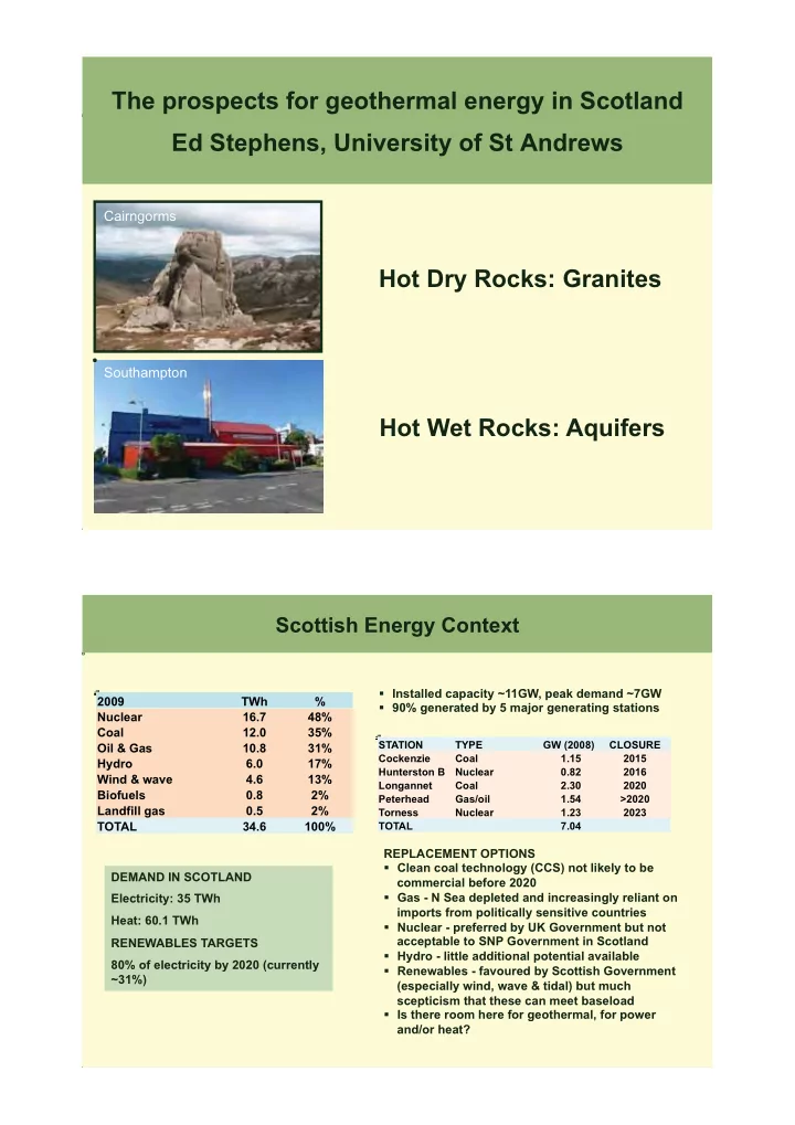

The prospects for geothermal energy in Scotland Ed Stephens, University of St Andrews Hot Dry Rocks: Granites Hot Wet Rocks: Aquifers
Cairngorms Southampton
Scottish Energy Context
DEMAND IN SCOTLAND Electricity: 35 TWh Heat: 60.1 TWh RENEWABLES TARGETS 80% of electricity by 2020 (currently ~31%) Installed capacity ~11GW, peak demand ~7GW 90% generated by 5 major generating stations REPLACEMENT OPTIONS Clean coal technology (CCS) not likely to be commercial before 2020 Gas - N Sea depleted and increasingly reliant on imports from politically sensitive countries Nuclear - preferred by UK Government but not acceptable to SNP Government in Scotland Hydro - little additional potential available Renewables - favoured by Scottish Government (especially wind, wave & tidal) but much scepticism that these can meet baseload Is there room here for geothermal, for power and/or heat?
STATION TYPE GW (2008) CLOSURE Cockenzie Coal 1.15 2015 Hunterston B Nuclear 0.82 2016 Longannet Coal 2.30 2020 Peterhead Gas/oil 1.54 >2020 Torness Nuclear 1.23 2023 TOTAL 7.04
2009 TWh % Nuclear 16.7 48% Coal 12.0 35% Oil & Gas 10.8 31% Hydro 6.0 17% Wind & wave 4.6 13% Biofuels 0.8 2% Landfill gas 0.5 2% TOTAL 34.6 100%