
SLIDE 1
… Africa is our home www.sapetro.com
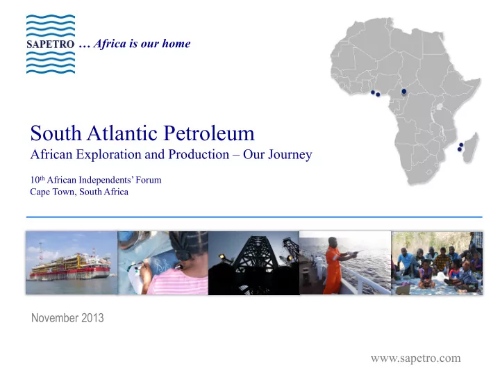
South Atlantic Petroleum
African Exploration and Production – Our Journey
10th African Independents’ Forum Cape Town, South Africa
South Atlantic Petroleum African Exploration and Production Our - - PowerPoint PPT Presentation
Africa is our home South Atlantic Petroleum African Exploration and Production Our Journey 10 th African Independents Forum Cape Town, South Africa November 2013 www.sapetro.com South Atlantic Petroleum: Overview South Atlantic
10th African Independents’ Forum Cape Town, South Africa
2
South Atlantic Petroleum (SAPETRO) is a privately held Nigerian oil & gas exploration and production company with a portfolio of high-quality assets in West, Central and East Africa in:
We are focused on creating value for our stakeholders through the pursuit of rewarding exploration, development and appraisal opportunities in developed and under-explored territories in Africa
3
with 6 different assets across sub-Saharan Africa spanning across:
largely unexplored areas with relatively low entrance costs and large available ‘footprints’ which are
driven opportunities
conventional resources in excess of a billion barrels, and are
in Nigeria within our existing and yet to be acquired acreages
Net Acreage Position 2 4 6 8 10 12 14 16 2013 2014 2015 2016 2017 2018 2019 2020 2021 2022 MMBBLS 10 Year Production Profile on Existing Assets 551 13,280 1,940 47,690 12,390 5,000 10,000 15,000 20,000 25,000 30,000 35,000 40,000 45,000 50,000 Benin CAR Nigeria Juan De Nova Madagascar Km²
5
Jurisdiction Federal Republic of Nigeria Licence Type Production Sharing Agreement (PSA) & Production Sharing Contract (PSC) Participating Interest OML 130 - 10% PSA; 5% PSC OPL 246 – 60% in PSA Acreage / Water Depth Size: 2,590km2 Water Depth: 1,100 – 1,800 m Operatorship Undertaken by Total under Technical Services Agreement Permit Tenor Initial 20 year period from 2005
Source: Wood Mackenzie
OML -130 OPL-246
6
OML Area 1,295 km2
EGINA-MAIN (548MB) AKPO FIELD (574 MB) EGINA SOUTH (41 MB) PREOWEI-1B DISCOVERY (176 MB)
7
The outstanding Akpo condensate field is the block’s first development and has produced over 200 million barrels of condensate to date.
22 Producers, 20 Water Injectors 2 Gas Injectors
22 Producers; 13 Water Injectors 2 Gas Injectors
March 2009
8
The Egina oil field is the block’s second multi-billion dollar deep-water project with Field Development Programme sanctioned in May 2013
19 Water Injectors
208,000 bopd
10
Jurisdiction Republic of Benin Licence Type Production Sharing Contract (PSC) Participating Interest 100% Acreage Size: 551km2; Water Depth: 0 – 750 m Operatorship YES Permit Tenor Sèmè Field expires 30 Nov 2030 Remaining Work Obligation 1 exploration well Rig currently drilling
= Perle-C Exploration well spudded Nov. 4, 2013
11
Sèmè is a brownfield development with a long and proven production history stretching back 30 years.
Supported Platform transporting crude to shore via a 14 km long pipeline
incorporating a two-stage separation process with treated produced water disposed of via an outfall pipeline
existing 250,000 bbl capacity tanks
to Pipeline End Manifold (PLEM) and Conventional Buoy Mooring (CBM) for tanker offloading
N S W E
H3 H4 H6 H6.5 H7 H8 H9
E W S N
1:10000
dip closure
100MMstb
14
Licence Juan de Nova Belo Profond Jurisdiction France – Terres Australes et Antarctiques Françaises (TAAF) Madagascar Licence Type Exploration Permit PSC Participating Interest 90% SAPETRO 10% Marex 90% SAPETRO 10% Marex Acreage Size: 52,990km2; Water Depth: 600 – 3,200m Size: 13,770km2; Water Depth: 1,800 – 3,000m Operatorship Yes Yes Licence Tenor 5 years wef 30/12/08 Awaiting approval for Renewal through 30 Dec 2018 8 years (4 Phases) ending 29 July 2015 with two (2) year extension to 2017 Remaining Work 3D Seismic (Ongoing) 3D Seismic (Ongoing); 1 well $50m
15
Continental Crust A large sunken continental fragment (the size of the North Sea) with continuous sedimentation for more than 200 million years and which is up to 8,000 meters in thickness Source Rocks Three proven, productive oil source rock intervals (USGS 2012 Assessment), including a massive Marine Type II Jurassic section present nearly everywhere in the acreage and mature for oil Oil Seeps Multiple recovered C-25 peaked oil samples from a small number
Many Structural & Stratigraphic Plays A wide variety of both structural and stratigraphic plays; 4-way and fault closed anticlines, toe thrusts, basin slope and basin floor turbidite fans, extensive Paleogene channels, possible salt sheets Excellent Tertiary Shale Seals Thick, deep water Neogene shales are widely present, salt sheets are also believed to be present as seen on the new 2012 seismic Geologic History The heart of the East African Transform Margin with mature source rocks, reservoirs, traps and seals, all on continental crust Large Acreage Position Over 80% of the entire continental fragment sub-province is contained on SAPETRO’s nearly 70,000 km2 acreage position
16
Work 2D Seismic 3D Seismic Date Dec 2011 – April 2012 Sept 2013 - Date Volume 12,525 km >9,000km2 Contractor / Technology PGS Geophysical using Nordic Explorer with broadband Geostreamer / GeoSource PGS Geophysical using Ramform Sterling Interpretation Completed 2013 interpretation w/Robertson CGG and EMR. Identified >70 leads across the two acreages N/A Other Works Historically recurrent slick sampling with +40 samples collected. Multiple, recovered C-25 peaked oil samples from a small number of oil slicks, were found in both Juan de Nova and Belo Profond. Results indicate the presence of
discovery more than 500km away. Acquired two 30m cores and over eight 5m cores within identified slick areas. These showed evidence
thermogenic hydrocarbons associated in one case with a major 4-way dip closed structure Remaining Work 3D Seismic (Ongoing) Seismic Acquisition and Processing to define drilling prospects; 1 exploration well in each asset
17
PGS Nordic Explorer PGS Ramform Sterling
18
petroleum system further supporting the conclusions of a 2012 USGS Assessment of Recoverable Resources
slick/seep area awaiting sea bed imaging and coring as well as 3-D seismic survey definition
19
X ing Horizons Time Depth (m)
490-1160 Sea Bottom 2900 2185 Top Eocene 3300 2579 Turonian Volcanics 4200 3497 L.Jura/Tri assic 4900 4810 Synrift Sequence 5800 6730
20
21
STRATIGRAPHIC PINCH-OUTS
TOP SEAL: THICK MARINE SHALE SECTIONS
HYDROCARBON GENERATION WINDOW (HGW) WITHIN DEEP SEATED MARINE SOURCE SHALES
22
23
24
they representing a wide variety of both structural and stratigraphic plays including 4- way and fault closed anticlines, major stratigraphic pinch outs, hanging wall traps, toe thrusts, basin slope and basin floor turbidite fans, and extensive Paleogene channels. Thick, deep water Neogene shales are almost universally present to act as seals, and salt sheets may also be present.
Ramform Sterling is now underway (Q4, 2013 through Q1, 2014) in four areas to bring more than 97% of the defined leads and plays under 3-D coverage. Many of these leads and plays are expected to be elevated to drillable prospects as a result of these new, detailed 3-D seismic survey and coring /geochemical data.
Marine Type-II Kerogen) are present nearly everywhere in the acreage and at various maturities centering on early mature to peak mature for oil. Multiple, recovered, C-25 peaked oil samples from a small number of oil slicks, persistent over many years, were found in both Juan de Nova and Belo Profond. Initial results from an October 2013 MBES and Seabed Coring campaign on the R/V Marion Dufresne suggests thermogenic hydrocarbons.
26
Licence Belo Profond Jurisdiction Central African Republic Licence Type PSC Participating Interest 45% SAPETRO 35% DIGOil 20% State Acreage Size: 29,000km2; Land Operatorship Yes Licence Tenor 8 years – 2 Phases of 4 years each wef 5 April 2012) Remaining Work Phase 1: 800km 2D Seismic ; Phase 2: 300km2 3D + 3 wells
27
basement map of the central portion of CAR Permit-C based on a 2012 airborne gravity and magnetic survey.
7,000 meters of sedimentary section in a series
suggests they may have formed like other Central African Rift System grabens in Sudan, Niger, and Chad in response to the breakup of Gondwana in the late Mesozoic.
are evident in the data; these could be logical first choices for investigation of hydrocarbon bearing structural traps.
28
Production Our production growth will come from:
and 2017 respectively
reserves through IOC divestments in Nigeria and farm in opportunities
exploration assets
$11m $35m $94m
Exploration Expenditure
2011 2012 2013
Key Statistics
2006 2011 2016 2021 # of Assets 3 5 7 10 WI Reserves 2P (mmboe) 216 176 300 600 WI Production (bpd)
Operated Assets 1 3 3 5
29
We continue to incorporate social initiatives in
several faces through
infrastructure
initiatives
30
Nigeria (Head Office)
South Atlantic Petroleum Limited 2nd, 11th and 12th Floors South Atlantic Petroleum Towers 1, Adeola Odeku Street Victoria Island, Lagos Tel: +234 (0) 1 270 1906, +234 (0) 903 2750, +234 (0) 462 3100 Fax: +234 (0) 1 270 1907
Benin Republic
South Atlantic Petroleum Benin SA Lot H27, Les Cocotiers, 01 B. P. 327, Cotonou, Republique du Benin Tel: +229 21 30 5039, +229 21 30 5055, +229 21 30 5090 Fax: +229 21 30 5044
France
South Atlantic Petroleum JDN SAS 9 Rue du Faubourg Saint Honore, 75008 Paris Tel: +33 1 42 66 02 20
Madagascar
South Atlantic Petroleum BP SAS 26 Avenue Général Ramanantsoa, Isoraka BP 3788, Antaninarenina, Antananarivo Tel: +261 20 22 5 4920