Presentation Outline 1. Introduction 2. Resilience to Climate - - PDF document

presentation outline
SMART_READER_LITE
LIVE PREVIEW

Presentation Outline 1. Introduction 2. Resilience to Climate - - PDF document


slide-1
SLIDE 1

Malaysia Experience

  • n Floods With

Climate Change Impacts

National Disaster Management Agency (NADMA), Malaysia ment A & & Department of Irrigation and Drainage (DID), Malaysia

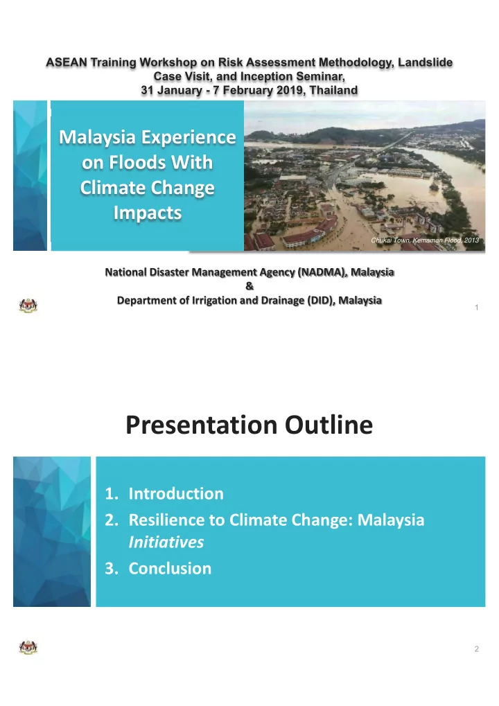
  • Chukai Town, Kemaman Flood, 2013
  • 1. Introduction
  • 2. Resilience to Climate Change: Malaysia

Initiatives

  • 3. Conclusion
  • Presentation Outline
slide-2
SLIDE 2
  • 1. Introduction
  • Kuala Lumpur (2014)

Natural Disasters in Malaysia

Disaster Types

Flood Land- slide Tropical Storm Earth- quake Tsunami Forest Fire Haze Drought

Kajang Town (2014) Selangor (2013)

Peat Forest Fire

Source: Malaysia: Disaster Management Reference Handbook, 2016

Droughts

Chuping, Perlis (2016) Kuala Lumpur (2008) Kuala Lumpur (2014)

Source: Malaysia: Disaster Man er Man

D Haze

Kuala Muda, Kedah (2004)

Tsunami

Kajang Town (2014) Pendang (2014)

Floods Tropical Storm Earthquake

Ranau, Sabah (2015) Kuala Lumpur (2008)

Landslide

slide-3
SLIDE 3
  • Source: Updating of Condition of Flooding, 2012

Flood Prone Area – Hotspots for Vulnerability

  • Segamat Town - Dec 2006 / Jan 2007

East Coast Floods, Dec 2013 g Chukai Town, Dec 2013 Kelantan, 2014 , Kelantan, 2014

Excess Water Floods

slide-4
SLIDE 4

Year Flood Event Death Victims Evacuated

1993 Sabah 27 22,000 1995 Shah Alam / Klang Valley, Klang, Selangor, 8 23,870 1996 Keningau, Sabah (Tropical Cyclone Greg) 238 39,687 1998 Pos Dipang, Perak; Kuala Lumpur 49 > 100 1999 Penampang, & Sandakan, Sabah 9 4,481 2000

  • Kg. La, Terengganu

6

  • 2001

Kelantan, Pahang, Terengganu; Gunung Pulai, Johor; Besut, Marang, Terengganu 14 > 11,000 2006/07 Johor & Kelantan 18 110,000 2008 Johor 28 34,000 2010 Kedah & Perlis 4 50,000 2013 Kemaman, Terengganu, Kuantan Pahang, Johor, Kelantan 3 >34,000 2014 Kelantan, Terengganu, and Pahang 25 500,000 2015 Kota Belud, Sabah

  • > 1,800

2017 Pulau Pinang 7 > 2,000

Last 20 Years Water Related Disaster in Malaysia

  • Sources: Department of Irrigation and Drainage Malaysia, Malaysian National Security Council and Chan (2012)
  • Mal

lays aysian an National Security Council and Chan (2012)

  • El Nino & La Nina Pattern

Source:

slide-5
SLIDE 5
  • Increasing Trend

2 4 6 8 10 12 14 16

  • No. of Occurrences

Decade

  • No. of Wet Spells (Rainfall > 100mm/day) for 3

Consecutive Days

Rainfall Event Trend More Extreme Wet Spells

  • Source: Disaster and Climate Change Projection for Malaysia, 2016

40 Years

1978-2017

Mean Annual Rainfall - Trend

  • 0 Years

40

1978 1

  • 2017
  • Chuping

Larut Matang Hulu Terengganu Kuala Pilah Baram Padas Tawau

  • Source: Kajian Penyediaan Perubahan dan Taburan Hujan Di Malaysia (JPS-NAHRIM, 2018)
slide-6
SLIDE 6

10 Years

1988 – 1997 1998 - 2007 2008 - 2017 1978 - 1987

Temporal and Spatial Distribution of Rainfall

  • Source: Kajian Penyediaan Perubahan dan Taburan Hujan Di Malaysia (JPS-NAHRIM, 2018)
  • 10 Years

1988 – 1997 1998 - 2007 2008 - 2017 1978 - 1987

  • Temporal and Spatial Distribution of Rainfall

Source: Kajian Penyediaan Perubahan dan Taburan Hujan Di Malaysia (JPS-NAHRIM, 2018)

slide-7
SLIDE 7
  • Source: NAHRIM, 2006

Regions / Sub-regions / States

Projected change* in maximum monthly value

Temperature (°C) Rainfall (%)

North East Region Terengganu, Kelantan, Northeast-coast

+1.88 +32.8

North West Region Perlis (west coast), Perak, Kedah

+1.80 +6.2

Central Region KL, Selangor, Pahang

+1.38 +8.0

Southern Region Johor, Southern Peninsula

+1.74 +2.9

  • Possible Future Climate Projection

Average Annual Rainfall & Mean Temperature (1984-93 vs 2025-34 & 2041-50)

  • *Change In Maximum Monthly Value
  • Average Annual Rainfall & Mean Temperature (1984-93 vs 2025-34 & 2041-50)
  • Climate

Parameter Peninsular Malaysia Sabah Sarawak

Annual Mean Surface Temperature 1.0-1.5°C [2050] 1.3-1.7°C [2050] 2.9 - 3.5°C [2100] 1.0-1.5°C [2050] 3.0 - 3.3°C [2100] Maximum Monthly Rainfall +113mm (12%) [2050] +59mm (5.1%) [2050] +111mm (9%) [2100] +150mm (8%) [2050] +282mm (32%) [2100]

Possible Future Climate Projection

Source: NAHRIM, 2006

slide-8
SLIDE 8
  • 2. Resilience to Climate Change:

Malaysia Initiatives

  • Enhance the resilience of

water-related infrastructures Improve the resilience of communities in context of climate change adaptation g p

slide-9
SLIDE 9
  • Resilience to Climate Change:

Malaysia Initiatives

Integration of climate change adaptation on policy & guidelines; Improvement of hydrometric network coverage Improvement of technologies in engineering practices Improvement of warning system

  • future flood

& drought

  • Integration of Climate Change Adaptation on Policy &

Guidelines

  • Integration
slide-10
SLIDE 10

Technology Guidance – GEF UNEP

  • Source: http://www.tech-action.org/Publications/TNA-Guidebooks
  • Climate Change Study
slide-11
SLIDE 11

Improvement of Hydrometric Network Coverage

*RF Station Coverage Ratio; Malaysia - 1 in 220km2; Bangladesh - 1 in 68 km2; Japan - 1 in 42km2

Source: DID, Malaysia (2018)

  • Hydrological Procedure No. 1 & No. 26

http://h2o.water.gov.my

slide-12
SLIDE 12

Permanent structures (culverts, control gate, bridge, etc.) to apply CCF in the estimation of design rainstorm ; Non-permanent structures (flood levees, bunds, etc.) to check freeboard adequacy based on CCF.

  • DID Circular on CCF

Design of Water Related Structures

Bertam Valley, Cameron Highland

  • Climate Change Factor (CCF)

Source: JPS, 2015

slide-13
SLIDE 13

0.5 1 3 6 12 24 48 72 2 99.20 68.83 33.24 19.83 11.57 6.67 3.82 2.75 5 123.48 85.68 41.38 24.69 14.40 8.30 4.76 3.43 10 145.73 101.12 48.83 29.14 17.00 9.80 5.61 4.05 20 171.99 119.34 57.63 34.39 20.06 11.56 6.62 4.77 50 214.10 148.56 71.74 42.81 24.97 14.39 8.25 5.94 100 252.67 175.32 84.67 50.52 29.47 16.99 9.73 7.01 Design Rainfall Intensity (mm/hr) ARI (years) Storm Duration t (hours)

  • Climate Change Factor
  • 73

. 239 .

381 . 826 . 75

  • d

T I

I50

  • I50 =
  • Source: DID Malaysia, 2015

Flood Hazard Map (50 yrs ARI): Existing Condition

  • Source: DID Malaysia, 2018
slide-14
SLIDE 14
  • Flood Hazard Map (50 yrs ARI): Flood Mitigation Condition

Source: DID Malaysia, 2018

  • Flood Hazard Map (50 yrs ARI + CCF): Flood Mitigation Condition
  • Source: DID Malaysia, 2018
slide-15
SLIDE 15

Improvement of Technology

  • Improvement of Technology
slide-16
SLIDE 16
  • 3. Conclusion
  • The benefits of the integration of flood risk management

into wider development management, urban planning and climate change adaptation are clear;

  • The most successful long-term flood risk management

strategies will balance the implementation of short-run, quick gain, non- structural measures with a vision of the best suite of structural and non- structural measures to be implemented for the longer term;

  • Understanding the required resources, the best and worst

case scenarios and the tipping points at which action becomes imperative, rather than justified, can lead to better decisions.

  • The benefits of the integration of flood risk management

Conclusion

slide-17
SLIDE 17

For the material used in this presentation..

Dato’ Ir. Hj. Nor Hisham Bin Mohd. Ghazali (DID) Dato’ Ir. Sabri bin Abdul Mulok (DID) Mohamad Hafiz Bin Hassan (DID) Thayalam a/l Sekaran (DID) Wan Hazdy Azad bin Wan Abdul Majid (DID)

  • Acknowledgement

Thank You

  • National Disaster Management Agency

(NADMA), Malaysia & Department of Irrigation and Drainage (DID), Malaysia