
SLIDE 1
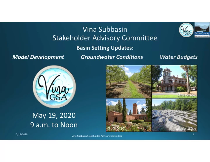
Vina Subbasin Stakeholder Advisory Committee
May 19, 2020 9 a.m. to Noon
parks.ca.gov wildlife.ca.gov csuchico.edu
5/19/2020
May 19, 2020 9 a.m. to Noon csuchico.edu wildlife.ca.gov - - PowerPoint PPT Presentation
parks.ca.gov May 19, 2020 9 a.m. to Noon csuchico.edu wildlife.ca.gov 5/19/2020 Vina Subbasin Stakeholder Advisory Committee Vina Subbasin Stakeholder Advisory 5/19/2020 Committee Vina Subbasin Stakeholder Advisory 5/19/2020 Committee
Vina Subbasin Stakeholder Advisory Committee
5/19/2020
Vina Subbasin Stakeholder Advisory Committee 5/19/2020
5/19/2020 Vina Subbasin Stakeholder Advisory Committee
DATE TBD Vina Subbasin Stakeholder Advisory Committee
Precipitation ET Diversions Urban Use Rimflows Qin Qin Pumping Stream-GW Interaction Interbasin Flow
5/19/2020 Vina Subbasin Stakeholder Advisory Committee
Vina Subbasin Stakeholder Advisory Committee 5/19/2020
Vina Subbasin Stakeholder Advisory Committee
Level by the model
5/19/2020
Vina Subbasin Stakeholder Advisory Committee 5/19/2020
8 5/19/2020 Vina Subbasin Stakeholder Advisory Committee
Vina Subbasin Stakeholder Advisory Committee 5/19/2020
Vina Subbasin Stakeholder Advisory Committee 10 5/19/2020
Vina Subbasin Stakeholder Advisory Committee 11 5/19/2020
Multi-Completion Well: Screened 740-800 ft
Multi-Completion Well: Screened 336-377 ft
Vina Subbasin Stakeholder Advisory Committee 12 5/19/2020
13 5/19/2020 Vina Subbasin Stakeholder Advisory Committee
Vina Subbasin Stakeholder Advisory Committee 14 5/19/2020
Vina Subbasin Stakeholder Advisory Committee 5/19/2020
Vina Subbasin Stakeholder Advisory Committee 5/19/2020
Vina Subbasin Stakeholder Advisory Committee 5/19/2020
Vina Subbasin Stakeholder Advisory Committee 5/19/2020
Vina Subbasin Stakeholder Advisory Committee 5/19/2020
Vina Subbasin Stakeholder Advisory Committee 5/19/2020
Vina Subbasin Stakeholder Advisory Committee 5/19/2020
Vina Subbasin Stakeholder Advisory Committee 22 5/19/2020
Vina Subbasin Stakeholder Advisory Committee 23 5/19/2020
Vina Subbasin Stakeholder Advisory Committee 5/19/2020
Vina Subbasin Stakeholder Advisory Committee 5/19/2020
Groundwater Pumping Stream Accretions Basin Boundary Subsurface Outflows Subsurface Inflows Change in Storage Groundwater System Western Boundary (net) Surface Water Outflows Change in Storage Stream Losses Deep Percolation Precipitation Evapotranspiration Surface Water Inflows Land and Surface Water System
Vina Subbasin Stakeholder Advisory Committee
5/19/2020
Vina Subbasin Stakeholder Advisory Committee 5/19/2020
Vina Subbasin Stakeholder Advisory Committee
5/19/2020
Vina Subbasin Stakeholder Advisory Committee
5/19/2020
Vina Subbasin Stakeholder Advisory Committee
5/19/2020
Vina Subbasin Stakeholder Advisory Committee
5/19/2020
Vina Subbasin Stakeholder Advisory Committee
5/19/2020
Vina Subbasin Stakeholder Advisory Committee
5/19/2020
Vina Subbasin Stakeholder Advisory Committee
5/19/2020
Vina Subbasin Stakeholder Advisory Committee
5/19/2020
Vina Subbasin Stakeholder Advisory Committee
5/19/2020
Vina Subbasin Stakeholder Advisory Committee
5/19/2020
Vina Subbasin Stakeholder Advisory Committee
5/19/2020
Vina Subbasin Stakeholder Advisory Committee
5/19/2020
Vina Subbasin Stakeholder Advisory Committee
5/19/2020
Vina Subbasin Stakeholder Advisory Committee
5/19/2020
Vina Subbasin Stakeholder Advisory Committee
5/19/2020
Vina Subbasin Stakeholder Advisory Committee 5/19/2020
Vina Subbasin Stakeholder Advisory Committee
5/19/2020
Vina Subbasin Stakeholder Advisory Committee
5/19/2020
Vina Subbasin Stakeholder Advisory Committee
Land Use Acres Agricultural 83,276 Developed 24,819 Native 77,210 Land Use Acres Agricultural 82,766 Developed 31,459 Native 71,081
5/19/2020
Vina Subbasin Stakeholder Advisory Committee
5/19/2020
Vina Subbasin Stakeholder Advisory Committee
5/19/2020
Vina Subbasin Stakeholder Advisory Committee
50 100 150 200 250 300 350 400 Rock Creek Mud Creek Big Chico Creek Little Chico Creek Butte Creek Others
Acre-Feet (thousands)
CC 2030CT 2070CT 10 20 30 40 50 60 70 Jan Feb Mar Apr May Jun Jul Aug Sep Oct Nov Dec
Acre-Feet (thousands)
CC 2030CT 2070CT 5 10 15 20 25 30 Jan Feb Mar Apr May Jun Jul Aug Sep Oct Nov Dec
Acre-Feet (thousands)
CC 2030CT 2070CT 0.0 0.5 1.0 1.5 2.0 2.5 3.0 3.5 4.0 Jan Feb Mar Apr May Jun Jul Aug Sep Oct Nov Dec
Acre-Feet (thousands)
CC 2030CT 2070CT 0.0 0.5 1.0 1.5 2.0 2.5 3.0 Jan Feb Mar Apr May Jun Jul Aug Sep Oct Nov Dec
Acre-Feet (thousands)
CC 2030CT 2070CT 0.0 0.5 1.0 1.5 2.0 2.5 3.0 Jan Feb Mar Apr May Jun Jul Aug Sep Oct Nov Dec
Acre-Feet (thousands)
CC 2030CT 2070CT
5/19/2020