Kitsilano Beach Park Proposed Concept Park Board Committee Meeting - - PowerPoint PPT Presentation

kitsilano beach park
SMART_READER_LITE
LIVE PREVIEW

Kitsilano Beach Park Proposed Concept Park Board Committee Meeting - - PowerPoint PPT Presentation

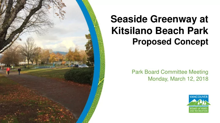
Seaside Greenway at Kitsilano Beach Park Proposed Concept Park Board Committee Meeting Monday, March 12, 2018 Purpose of Presentation To present background information regarding challenges associated with current path alignments at


slide-1
SLIDE 1

Park Board Committee Meeting

Seaside Greenway at Kitsilano Beach Park

Proposed Concept

Monday, March 12, 2018

slide-2
SLIDE 2
  • To present background information regarding challenges

associated with current path alignments at Kitsilano Beach Park; and

  • To present a staff recommended alignment that aims to

reduce conflicts between various active transportation modes.

17

Purpose of Presentation

slide-3
SLIDE 3

18

Kitsilano Beach Park: A World Class Destination

slide-4
SLIDE 4
  • Vancouver has pursued the creation of a public waterfront for over a

century

  • 1992: Seaside Cycling Route approved by Council
  • 1995: Seaside Greenway approved by Council
  • 2012: Transportation 2040 Plan adopted - identifies seawall as important

areas of focus for active transportation and for people of all ages and abilities

  • July 29, 2013: City Council approved the Point Grey Cornwall Active

Transportation Corridor and requested “that the Board of Parks and Recreation proceed with upgrading of the Seaside Greenway in Kitsilano Beach and Hadden Parks as a priority project funded by the City’s capital budget”.

19

Background

slide-5
SLIDE 5
  • October 7, 2013: Board of Parks and Recreation approved a Board

report proposing active transportation improvements within street right-of-ways affecting the following parks:

  • Seaforth Park;
  • Tatlow Park;
  • Volunteer Park;
  • Jean Beaty Park;
  • Margaret Piggot Park;

20

Background

  • Hastings Mill Park;
  • 3-unnamed parks on Point Grey Road

at Trafalger, Stephens and Trutch;

  • Kitsilano Beach Park; and
  • Hadden Park
slide-6
SLIDE 6
  • 2013: User intercept surveys engaged > 370 park users: separated

pedestrian and cyclist pathways strongly supported. Subsequent significant concerns from residents resulted in a paused process.

  • 2016: Public engagement about conflicts at the west edge of Park near

Balsam Street - 100 residents attended, 2000 online survey responses (majority preferred to formalize the diagonal path).

  • 2017: Staff sought input from stakeholders including KPRA, HUB, the

Boathouse Restaurant and tennis, basketball, and volleyball communities representatives – all share desire to reduce cyclist, pedestrian and motor-vehicle conflicts and prioritize safety, but some differences of opinion exist related to path alignment around the south parking lot and Arbutus Street.

21

Engagement

slide-7
SLIDE 7
  • Minimize impacts on greenspace;
  • Create safe environment for pedestrians, cyclists and other modes;
  • Maintain open spaces, destinations, pedestrian gathering areas;
  • Consider intensity of use of greenspaces within park, now and for the future;
  • Prioritize routes that take cyclists “to” and not “through” destinations and spaces;
  • Improve pedestrian connections along Cornwall Street and into the park;
  • Re-imagine the park entry at Yew Street;
  • Enhance opportunities for bike parking adjacent to the bikeway and allow

walking access from these points to key destinations;

22

Planning Principles

slide-8
SLIDE 8
  • Employ results of further studies to explore opportunities for bikes to access the

beach and Boathouse via service entrance from Arbutus Street;

  • Create separate paths for bikes and pedestrians;
  • Maintain “park-like” experience and visual connections to the water for bikes;
  • Minimize loss of parking within/adjacent to park & replace parking when feasible;
  • Reconfigure southern parking lot and reduce the number of entrances;
  • Provide clear linkages to existing seaside greenway bike routes;
  • Replace unsafe trees and enhance the urban forest within park; and
  • Connect to Balsam Street and Ogden Avenue at west and east extents of park.

23

Planning Principles

slide-9
SLIDE 9

24

Options Discussed

Kitsilano Beach Park Bike Path – Options Discussed

slide-10
SLIDE 10

25 Balsam Street Connection Shared Path on Cornwall

Cornwall Street

slide-11
SLIDE 11

26

Balsam Street Connection

  • View southeast

along diagonal path on west park edge

slide-12
SLIDE 12

27

Balsam Street Connection

  • View eastward from west edge of park at Cornwall and Balsam (Point Grey

Rd)

slide-13
SLIDE 13

28

Shared Path on Cornwall

  • View east along

shared path on south park edge

  • Note the chain-link

fence

slide-14
SLIDE 14

29

Shared Path on Cornwall

  • View west along path
  • n south park edge
  • Note the worn path

along edge of Cornwall from pedestrians exiting parked cars

slide-15
SLIDE 15

30

Kitsilano Beach Park Bike Path – Staff Proposed Conceptual Alignment Cornwall Street

slide-16
SLIDE 16

31 South Parking Lot Restaurant / Lifeguard Station Service Entrance Pump-station / EV-Stations Yew Street Crossing

Cornwall Street Option 3

slide-17
SLIDE 17

32

Yew Street Crossing

  • View eastward along

shared path toward Yew Street park entrance

  • Note the overgrown

horticulture specimens

slide-18
SLIDE 18

33

Yew Street Crossing

  • View north along path

extending along Yew Street alignment

  • Note the parking lot,

tennis courts and bike share in distance

slide-19
SLIDE 19

34

Yew Street Crossing

  • View eastward from

path at Yew Street

slide-20
SLIDE 20

35

South Parking Lot

  • View eastward to green-

space between Cornwall and south parking lot

  • Note the cluster of

mature trees at corner of Arbutus and Cornwall

slide-21
SLIDE 21

36

South Parking Lot

  • View north to east

side of tennis courts

  • Note the three

entrances from Arbutus to the south parking lot

slide-22
SLIDE 22

37

Pump-station / EV-Stations

  • View north along

Arbutus

  • Note the narrow

corridor between street and pump- station

slide-23
SLIDE 23

38

Pump-station / EV-Stations

  • View of pump station

adjacent to Arbutus

slide-24
SLIDE 24

39

Pump-station / EV-Stations

  • View north along

Arbutus

  • Note the EV charging

stations

slide-25
SLIDE 25

40

Kitsilano Beach Park Bike Path – Staff Proposed Conceptual Alignment Cornwall Street Option 3

slide-26
SLIDE 26

41

Options Discussed

Playground Connection at Creelman Arbutus Street (North of Creelman Avenue)

Creelman Street McNicoll Street

slide-27
SLIDE 27

42

Playground Connection at Creelman

  • View north along

Arbutus to Creelman path connection to playground

slide-28
SLIDE 28

43

Arbutus Street (North of Creelman Avenue)

  • View north along

Arbutus

  • Note the distance

between sidewalk and trees

  • Trees (Black Locust)

are in decline

  • Opportunity to modify

street right-of-way including a one-way street

slide-29
SLIDE 29

44

Arbutus Street (North of Creelman Avenue)

  • View north along

Arbutus

  • Maple trees shown

adjacent to sidewalk will be removed in short-term

slide-30
SLIDE 30

45

Kitsilano Beach Park Bike Path – Staff Proposed Conceptual Alignment Creelman Street

slide-31
SLIDE 31

46

Options Discussed

McNicoll Avenue Parking Lot Entrance North Picnic Area Ogden Avenue Connection

Option 6 McNicoll Street

slide-32
SLIDE 32

47

McNicoll Avenue Parking Lot Entrance

  • View west along

Creelman Avenue to north parking lot entrance

slide-33
SLIDE 33

48

North Picnic Area

  • View northeast

through wooded glade from corner of Arbutus and Creelman

slide-34
SLIDE 34

49

Ogden Avenue Connection

  • View east along

Ogden where path exits park

slide-35
SLIDE 35

50

Kitsilano Beach Park Bike Path – Staff Proposed Conceptual Alignment McNicoll Street

slide-36
SLIDE 36

51

Kitsilano Beach Park Bike Path – Staff Proposed Conceptual Alignment

slide-37
SLIDE 37
  • Work collaboratively with CoV Engineering to develop detailed

designs along approved alignment, especially where street right of ways are incorporated

  • Engage community and share detailed design options
  • Refine design options
  • Report back to Park Board for final approval
  • Prepare construction drawings and specifications
  • Construct approved design, subject to funding in the 2019-22 Capital

Plan

52

Next Steps

slide-38
SLIDE 38

A. THAT the Vancouver Park Board approve the proposed conceptual alignment of a new separated cycling path through Kitsilano Beach Park as described in this report and as illustrated in Appendix C; B. THAT the Board support collaboration with the City of Vancouver Engineering Department to coordinate and prepare detailed designs for the path, in particular where the path interfaces with City streets; and

  • C. FURTHER THAT staff report back with the detailed design of

proposed pedestrian and cycling improvements in Kitsilano Beach Park when public engagement is complete.

53

Recommendation

slide-39
SLIDE 39