
SLIDE 1
Cayuga Lake Modeling Project Major Findings and Management - - PowerPoint PPT Presentation
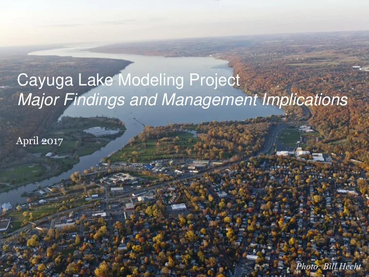
Cayuga Lake Modeling Project Major Findings and Management Implications April 2017 Photo: Bill Hecht Permit requirements and deliverables REQUIREMENT DATE (S) COMPLIANCE MODELING PROJECT Workplan and QAPP- monitoring March 2013
April 2017 2
MODELING PROJECT
March 2013
OUTFALL REDESIGN
May 2014
BIOMONITORING
Feb .2014
April 2015 Permit Modification CAMPUS BMPS
SUPPORT DEC WITH OUTREACH
May 2014, Nov. 2014, Oct. 2015
Multiple (30 +)
April 2017 3
April 2017 4
April 2017 5
6 April 2017
April 2017 7
April 2017 8
Photo: Bill Hecht
April 2017 9
April 2017 10
April 2017 11
2 4 6 8 10 12 1998 1999 2000 2001 2002 2003 2004 2005 2006 2007 2008 2009 2010 2011 2012 2013 2016
Summer Average Chlorophyll-a, ug/L Shelf Main Lake
5 10 15 20 25 30 1998 1999 2000 2001 2002 2003 2004 2005 2006 2007 2008 2009 2010 2011 2012 2013 2016
Summer Average TP, ug/L Shelf Main Lake
April 2017 12
April 2017 13
Water exchange with main lake Large southern tributaries Fall Creek, Cayuga Inlet
(Effler et al. 2010; Gelda et al. 2015a)
Lake Source Cooling return flow Wind-induced flow
10X LSC induced flow
April 2017 14
April 2017 15
23.3 11.6 24.1 11.6 5.6 4.8 5.7 4.8 5 10 15 20 25 30 Southern Shelf Main Lake Southern Shelf Main Lake Current Conditions No Lake Source Cooling
Source: UFI, Dec. 2016. Phase 2 Final Report. Table 7-17, page 7-88.
April 2017 16
April 2017 17
April 2017 18
April 2017 19
April 2017 20
April 2017 21
April 2017 22
Distance from downstream boundary (railroad bridge; km) 5 10 15 20 25 30 35 40 45 50 55 60 Elevation (m)
10 20 30 40 50 60 70 80 90 100 110 120
LSC discharge LSC intake Cayuga-AES power plant intake
23
Google Images
4
April 2017 24
April 2017 25
100% 100% 0% 0% 0.00 0.30
Lyon, Walter, et al. 2006. JAWRA. 42(3): 793-804
April 2017 26
April 2017 27
April 2017 28
April 2017 29