
SLIDE 1
OCTOBER 22, 2019
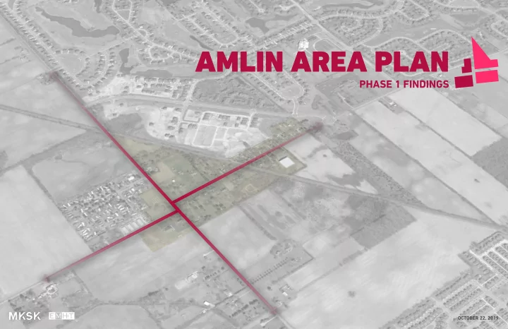
AMLIN AREA PLAN
PHASE 1 FINDINGS
AMLIN AREA PLAN PHASE 1 FINDINGS OCTOBER 22, 2019 INITIAL CONCEPT - - PowerPoint PPT Presentation
AMLIN AREA PLAN PHASE 1 FINDINGS OCTOBER 22, 2019 INITIAL CONCEPT REVIEW AGENDA PROJECT COORDINATION 1 Who Weve Talked to EXISTING CONDITIONS 2 Resident Concerns Stormwater Observations Stormwater Infrastructure and Encroachment Issues
OCTOBER 22, 2019
PHASE 1 FINDINGS
Who We’ve Talked to
Resident Concerns Stormwater Observations Stormwater Infrastructure and Encroachment Issues Railroad Alley Ownership Traffjc and Mobility Analysis
Rings Road Alley Rings Road and Cosgray Road Intersection Short-term Opportunities
AMLIN AREA PLAN WASHINGTON TOWNSHIP, OHIO
2
AMLIN AREA PLAN
Plans and Reports Roadway Information
Historical Drainage Information Drainage / Ditch Petition Transportation Information
On-Site Septic Information (Complaints)
Online Research
AMLIN AREA PLAN WASHINGTON TOWNSHIP, OHIO
4
AMLIN AREA PLAN
Rings Road east of the railroad tracks. The Rings and Cosgray intersection.
EXISTING CONDITIONS
N 400 800
RINGS RD CHURCHMAN RD COSGRAY RD PLEASANT RUN BLVD M A R M A I O N D R EDEN BRIDGE DRPARK IMPROVEMENTS DRAINAGE ISSUES PROPERTY UPKEEP STANDARDS
THE ALLEY RINGS RDDRAINAGE SYSTEM NOT WORKING
1ST AVE 2ND AVE 3RD AVE I N C H C A P E L N F O R E L A N D L NCITY OF DUBLIN CITY OF DUBLIN WASHINGTON TOWNSHIP WASHINGTON TOWNSHIP
AMLIN AREA PLAN WASHINGTON TOWNSHIP, OHIO
6
EXISTING CONDITIONS
Drainage tiles connecting to Ballantrae. This diagram depicts the concerns of residents pertaining to pooling water and drainage issues. Specifjcs on problem areas would need to be confjrmed with further investigation. Some of the drainage tiles need cleaning and upkeep.
N 200 400
RINGS RD CHURCHMAN RD RINGS RDPROPERTIES WITH DRAINAGE ISSUES
1ST AVE 2ND AVE 3RD AVEPOOLING WATER DRAINAGE SYSTEM NOT WORKING
THE ALLEY I N C H C A P E L N F O R E L A N D L NWASHINGTON TOWNSHIP CITY OF DUBLIN POOLING WATER
AMLIN AREA PLAN WASHINGTON TOWNSHIP, OHIO
7
N 160’ 320’
STORMWATER SYSTEM RIGHT OF WAY
AMLIN AREA PLAN WASHINGTON TOWNSHIP, OHIO
8
N 160’ 320’
STORMWATER SYSTEM RIGHT OF WAY ENCROACHMENT
AMLIN AREA PLAN WASHINGTON TOWNSHIP, OHIO
9
Approximate location of Railroad Ownership versus private property
PROPERTY BOUNDARY RAILROAD RIGHT OF WAY
AMLIN AREA PLAN WASHINGTON TOWNSHIP, OHIO
10
The alleys ofg of Rings Road provide connections and parking. Rings Road lacks a continuous sidewalk network.
TRAFFIC AND MOBILITY ANALYSIS
N 400 800
RINGS RD CHURCHMAN RD PLEASANT RUN BLVD M A R M A I O N D R 1ST AVE 2ND AVE EDEN BRIDGE DR 3RD AVE THE ALLEY RINGS RDPOSSIBLE ALLEY CONNECTION OPPORTUNITY FOR IMPROVED MOBILITY
COSGRAY RDEXISTING LOCAL TRAIL TRAFFIC AND SAFETY CONCERNS
I N C H C A P E L N F O R E L A N D L NCITY OF DUBLIN CITY OF DUBLIN WASHINGTON TOWNSHIP WASHINGTON TOWNSHIP
AMLIN AREA PLAN WASHINGTON TOWNSHIP, OHIO
11
AMLIN AREA PLAN
N 400 800
CHURCHMAN RD COSGRAY RD M A R M A I O N D R THE ALLEY RINGS RDLack of sidewalks disrupts the pedestrian connection; impacts safety. Above ground utilities disrupt the natural streetscape. Existing structures encroach into the right of way on Rings Road.
NO SIDEWALK INFRASTRUCTURE EXISTING UTILITIES NEED STREET IMPROVEMENTS ENCROACHMENT ISSUES PROPERTIES WITH DRAINAGE ISSUES
1ST AVE 2ND AVE 3RD AVE F O R E L A N D L N I N C H C A P E L NWASHINGTON TOWNSHIP WASHINGTON TOWNSHIP CITY OF DUBLIN CITY OF DUBLIN
AMLIN AREA PLAN WASHINGTON TOWNSHIP, OHIO
13
NO SIDEWALK INFRASTRUCTURE EXISTING UTILITIES NEED STREET IMPROVEMENTS ENCROACHMENT ISSUES PROPERTIES WITH DRAINAGE ISSUES
AMLIN AREA PLAN WASHINGTON TOWNSHIP, OHIO
14
Existing conditions of Rings Road SECTION PLAN 20’ 60’ R.O.W. 3.5’ 3.5’
EXISTING SHOULDER EXISTING ROADWAY EXISTING DRAINAGE DITCH AND STORM INLET EXISTING SHOULDER EXISTING DRAINAGE DITCH AND STORM INLET ON-LOT SEPTIC CONNECTIONS EXISTING STORM PIPE
SITE PHOTOS
AMLIN AREA PLAN WASHINGTON TOWNSHIP, OHIO
EXISTING STORM INLET ROAD SHOULDER EXITING UTILITY POLE EXISTING UTILITY POLE ROAD SHOULDER
15
20’ 3.5’ 3.5’
EXISTING SHOULDER EXISTING SHOULDER ADDED STORM INLETS TO ADDRESS YARD FLOODING STREET TREE ADDED STORM INLETS TO ADDRESS YARD FLOODING
60’ R.O.W.
EXISTING STORM PIPE
SECTION PLAN
COST ANALYSIS
is room.
signifjcant impact in addressing community concerns. Additional Street Trees: 20-30 Trees $10,000 - $15,000 CCTV of existing stormwater system: $8,000 - $15,000 Grading work cost would require further study in specifjc areas where new grading is needed and is achievable.
ON-LOT SEPTIC CONNECTIONS
AMLIN AREA PLAN WASHINGTON TOWNSHIP, OHIO
EXISTING MANHOLE ROAD SHOULDER PROPOSED PLANTING EXITING UTILITY POLE EXISTING UTILITY POLE PROPOSED LOW HEIGHT PLANTING ROAD SHOULDER
16
CURB ADJACENT SIDEWALK PROPOSED PLANTING EXITING UTILITY POLE
20’ 4’ 5’
SIDEWALK (4’) CURB ADJACENT SIDEWALK RECONSTRUCTED ROADWAY W/ CURB AND GUTTER ENHANCED DRAINAGE DITCH AND ADDED STORM INLETS NEW STORM PIPE
60’ R.O.W.
EXISTING STORM MANHOLE
SECTION PLAN
COST ANALYSIS Approximate Project Cost: $700 / LF ~1,300 Feet Including replacement of most of the existing drainage system; not including engineering/ design, permit, easement acquisition and construction phase services.
ON-LOT SEPTIC CONNECTIONS NEW STORM PIPE
AMLIN AREA PLAN WASHINGTON TOWNSHIP, OHIO
EXISTING UTILITY POLE PROPOSED LOW HEIGHT PLANTING CURB ADJACENT SIDEWALK
17
CURB AND GUTTER CURB ADJACENT SIDEWALK ENCROACHING BUILDING SIDEWALK NEW STORM MANHOLE
SECTION PLAN
COST ANALYSIS Approximate Project Cost: $1,500 / LF ~1,300 Feet Including burying existing overhead utilities and replacement of the existing drainage system; not including engineering/design, permit, easement acquisition and construction phase services.
lowering road height to help with drainage.
added to both sides.
Lowering the road is only feasible if a suitable drainage outlet exists at a low enough elevation. Further investigation is needed to ensure feasibility.
AMLIN AREA PLAN WASHINGTON TOWNSHIP, OHIO
TREE LAWN (4’) SIDEWALK (5’) SIDEWALK (5’) YARDS SLOPE TO ROADWAY UNDERGROUND UTILITIES SIDEWALK (5’) NEW DECORATIVE STREET LIGHT RECONSTRUCTED ROADWAY W/ CURB AND GUTTER NEW STORM PIPE
60’ R.O.W. 20’ 4’ 5’ 4’ 5’
ON-LOT SEPTIC CONNECTIONS NEW STREET TREE
18
CURB AND GUTTER ENCROACHING BUILDING MULTIPURPOSE PATH NEW STORM MANHOLE
AMLIN AREA PLAN WASHINGTON TOWNSHIP, OHIO
TREE LAWN (4’) SIDEWALK (5’) MULTIPURPOSE PATH SIDEWALK (5’) NEW STORM PIPE
60’ R.O.W. 20’ 4’ 8’ 4’ 5’ SECTION PLAN
COST ANALYSIS Approximate Project Cost: $1,500 / LF ~1,300 Feet Including burying existing overhead utilities and replacement of the existing drainage system; not including engineering/design, permit, easement acquisition and construction phase services.
a multi-purpose path for bicyclists and pedestrians. Lowering the road is only feasible if a suitable drainage outlet exists at a low enough elevation. Further investigation is needed to ensure feasibility.
NEW STREET TREE YARDS SLOPE TO ROADWAY UNDERGROUND UTILITIES NEW DECORATIVE STREET LIGHT ON-LOT SEPTIC CONNECTIONS RECONSTRUCTED ROADWAY W/ CURB AND GUTTER
19
N 400 800
CHURCHMAN RD COSGRAY RD M A R M A I O N D RWASHINGTON TOWNSHIP WASHINGTON TOWNSHIP
THE ALLEY RINGS RDCurrent trail and alley connection can be enhanced. Alleys all used as connector streets may not be necessary.
TRAIL CONNECTION ALLEY/RINGS RD CONNECTORS
1ST AVE 2ND AVE 3RD AVERAIL ROAD RIGHT OF WAY PROPERTIES WITH DRAINAGE ISSUES
F O R E L A N D L N I N C H C A P E L NCITY OF DUBLIN CITY OF DUBLIN
AMLIN AREA PLAN WASHINGTON TOWNSHIP, OHIO
20
EXISTING SCREENING VEGETATION EXISTING ALLEY RESIDENTIAL DRIVE + GARAGE
SECTION PLAN
RESIDENTIAL DRIVE + GARAGE EXISTING SCREENING VEGETATION
Existing conditions of the alley. SITE PHOTOS
RIGHT OF WAY VARIES FROM 15’ TO 18’AMLIN AREA PLAN WASHINGTON TOWNSHIP, OHIO
9’ 15’ R.O.W.
21
SECTION PLAN
AMLIN AREA PLAN WASHINGTON TOWNSHIP, OHIO
WIDENED ALLEY YARDS DRAIN TO ROAD CONVEYANCE STORM RUNOFF CONVEYANCE WIDENED ALLEY WITH RUNOFF CONVEYANCE PITCH YARD TO DRAINAGE
12’ 15’ R.O.W.
COST ANALYSIS Approximate Project Cost: $500 / LF ~1,420 Feet of Alley Including alley reconstruction drainage system; not including engineering/design, permit, easement acquisition and construction phase services.
and alignment.
structures in rear of property
aid in draining the rear of properties.
22
VACATED PORTION OF ALLEY ALLEY ACCESS FROM RINGS RD MAINTAIN DRIVEWAY ACCESS
Future vacated alley along 2nd Avenue. The alley with access to Rings Road at Friezell Avenue. The alley at 3rd Avenue.
CIRCULATION FOR TRAIL AND FIRE ACCESS
N 100 200
T H E A L L E Y
R I N G S R D 1 S T A V E 2 N D A V E 3 R D A V E
CITY OF DUBLIN
AMLIN AREA PLAN WASHINGTON TOWNSHIP, OHIO
23
Example of a new asphalt alley path
RUNOFF ENTERS BALLANTRAE ALLEY RUNOFF CONVEYANCE YARD RUN- OFF FLOW T H E A L L E Y
R I N G S R D 1 S T A V E 2 N D A V E 3 R D A V E
CITY OF DUBLIN
N 100 200 AMLIN AREA PLAN WASHINGTON TOWNSHIP, OHIO
issues in the rear of the properties on north side of Rings Road.
into the Ballantrae inlet and detention pond.
City of Dublin.
24
The trail coming from Ballantrae into Amlin
TRAIL MOBILITY AND CONNECTIONS
N 400 800
RINGS RD CHURCHMAN RD COSGRAY RD PLEASANT RUN BLVD M A R M A I O N D R I N C H C A P E L N EDEN BRIDGE DREXISTING LOCAL TRAIL ALLEY TRAIL POTENTIAL TRAIL CONNECTION POTENTIAL SW CONNECTION
1ST AVE 2ND AVE 3RD AVE F O R E L A N D L NWASHINGTON TOWNSHIP WASHINGTON TOWNSHIP CITY OF DUBLIN CITY OF DUBLIN
AMLIN AREA PLAN WASHINGTON TOWNSHIP, OHIO
pedestrian connection for Amlin.
Ballantrae that ends in Amlin behind the former Pizza shop.
connections to the east via the sidewalk network at Churchman Road or the planned bike connections south of Rings Road as a part
Dublin.
25
RINGS AND COSGRAY INTERSECTION
The ofgset intersections at Rings Road and Cosgray Road
N 400 800
HIGH SPEEDS
RINGS RD CHURCHMAN RD COSGRAY RD PLEASANT RUN BLVD M A R M A I O N D R I N C H C A P E L N EDEN BRIDGE DR 1ST AVE 2ND AVE 3RD AVE F O R E L A N D L NWASHINGTON TOWNSHIP WASHINGTON TOWNSHIP CITY OF DUBLIN CITY OF DUBLIN
AMLIN AREA PLAN WASHINGTON TOWNSHIP, OHIO
concern of residents in the area recently due to increased traffjc resulting from the nearby development.
higher speeds, and perception of a lack of safety.
26
N 200 400
POTENTIAL UTILITY IMPACTS POTENTIAL UTILITY IMPACTS POTENTIAL UTILITY IMPACTS POTENTIAL UTILITY IMPACTS POTENTIAL UTILITY IMPACTS ROAD CROSSINGS POTENTIAL FOR LANDSCAPING OR SMALL MONUMENT CURVE DESIGNED FOR 35 MPH. ADVANCED WARNING SIGNS RECOMMENDED.
AMLIN AREA PLAN WASHINGTON TOWNSHIP, OHIO
COST ANALYSIS Approximate Project Cost: $2 Million Not including engineering/design, permit, easement/land acquisition and construction phase services.
signalized 4-way intersection.
safety of this intersection while providing traffjc calming.
to minimize the impact on private properties, however, two residential properties east of Cosgray would be impacted.
roundabout design for the intersection. This design has not been approved and should be studied more in the future.
27
RIVER BIRCH ZELKOVA
STREET TREES
20-30 Trees
COMMUNITY SIGNS
TREE REMOVAL AND LANDSCAPING CLEAN-UP
would need to gather signed waivers from private property
TRIDENT MAPLE AMLIN AREA PLAN WASHINGTON TOWNSHIP, OHIO
28
REVIEW & REFINEMENT OF RECOMMENDATIONS SELECTION OF PREFERRED STRATEGY REFINED COST ESTIMATES DEVELOP ACTION STRATEGY FINALIZE PLAN
AMLIN AREA PLAN WASHINGTON TOWNSHIP, OHIO
29