Adaptation in a Sea of Uncertainty Sea-Level Rise Planning at the - - PowerPoint PPT Presentation

adaptation in a sea of uncertainty
SMART_READER_LITE
LIVE PREVIEW

Adaptation in a Sea of Uncertainty Sea-Level Rise Planning at the - - PowerPoint PPT Presentation

Adaptation in a Sea of Uncertainty Sea-Level Rise Planning at the Local Level Jason M. Evans, Ph.D. Assistant Professor of Environmental Science Stetson University November 16, 2016 Florida Water and Climate Alliance Arcadia, FL Stormwater


slide-1
SLIDE 1

Adaptation in a Sea of Uncertainty

Jason M. Evans, Ph.D. Assistant Professor of Environmental Science Stetson University November 16, 2016 Florida Water and Climate Alliance Arcadia, FL

Sea-Level Rise Planning at the Local Level

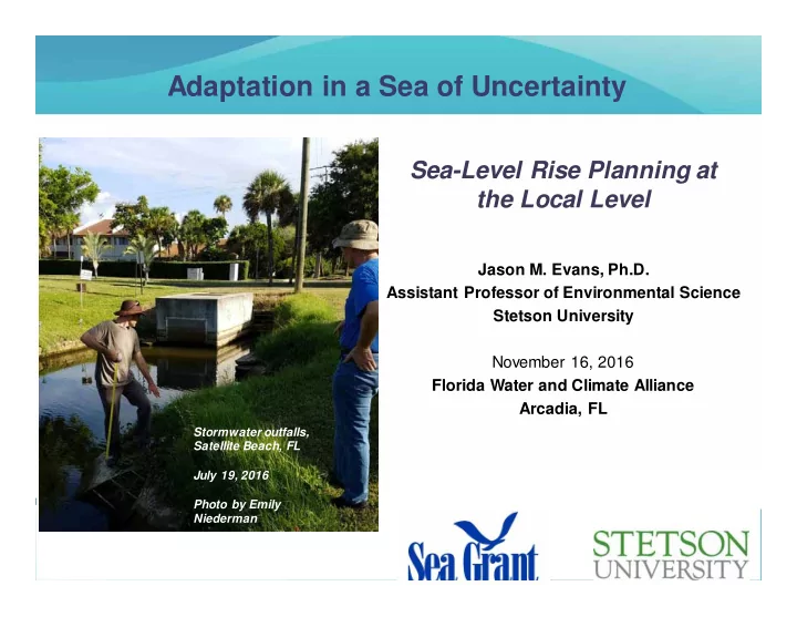
Stormwater outfalls, Satellite Beach, FL July 19, 2016 Photo by Emily Niederman

slide-2
SLIDE 2

2

My Past Few Years

Satellite Beach, FL Public Works

slide-3
SLIDE 3

3

Assertion #1

Climate change adaptation is one of the most complex and daunting challenges ever faced by human civilization.

slide-4
SLIDE 4

4

Sea Level Rise is a big deal for FL…

slide-5
SLIDE 5

5

News release on July 28, 2014

slide-6
SLIDE 6

6

Miami Beach

http://s13.thereal deal.com/trd/m/up/2013/07/Miami-flooding-4-13-13.jpg.jpg

slide-7
SLIDE 7

7

Tidal flooding on Tybee Island, GA US Highway 80 October 27, 2015

http://sav-cdn.com/sites/default/files/imagecache/superphoto/14845662.j pg

Third highest tide on record (since 1935) for this gauge Only exceeded by tropical storm surges

slide-8
SLIDE 8

8

5 10 15 20 25 30 35 1998 1999 2000 2001 2002 2003 2004 2005 2006 2007 2008 2009 2010 2011 2012 2013 2014 2015

Nuisance Floods Per Year at Key West

*Nuisance flooding threshold for Monroe County, as defined by Sweet et al. (2014) Sw eet, W., J. Park, J. Marra, C. Zervas, and C. Gill. 2014. Sea Level Rise and Nuisance Flood Frequency Changes around the United States. NOAA Technical Report NOS CO-OPS 073.

slide-9
SLIDE 9

9

5 10 15 20 25 30 35 1998 1999 2000 2001 2002 2003 2004 2005 2006 2007 2008 2009 2010 2011 2012 2013 2014 2015

Nuisance Floods Per Year at Vaca Key (Marathon, FL)

*Nuisance flooding threshold for Monroe County is 1.08 ft above MHHW, as defined by Sweet et al. (2014) Sw eet, W., J. Park, J. Marra, C. Zervas, and C. Gill. 2014. Sea Level Rise and Nuisance Flood Frequency Changes around the United States. NOAA Technical Report NOS CO-OPS 073.

slide-10
SLIDE 10

10

5 10 15 20 25

Nuisance Floods by Year at Tybee Island, GA (Ft. Pulaski Tide Gauge)

Data Source: https://tidesandcurrents.noaa.gov/stationhome.htm l ?id=8670870

NOAA nuisance flood threshold for Fort Pulaski: 9.2 feet above MLLW

slide-11
SLIDE 11

11

Assertion #2

Very few development decisions being made today in vulnerable coastal communities are considering the consequences in a worst- case scenario at 2100.

slide-12
SLIDE 12

12

For example…

slide-13
SLIDE 13

13

Population growth = Underestimation of problem

1,000,000 2,000,000 3,000,000 4,000,000 5,000,000 6,000,000 7,000,000 Projected Populations Current Populations

Scenario: ~2 meters of sea level rise at 2100

People displaced by sea level rise

slide-14
SLIDE 14

14

Credit: M.J. Hauer, J.M. Evans and D. Mishra

slide-15
SLIDE 15

15

Assertion #2

Very few development decisions being made today in vulnerable coastal communities are considering the consequences in a worst- case scenario at 2100. This is understandable – even appropriate – given uncertainty about the future over such a long time-horizon.

slide-16
SLIDE 16

16

slide-17
SLIDE 17

17

BIG difference between low and high scenario

~6.1 million people affected Statewide in FL ~1.2 million people affected

slide-18
SLIDE 18

18

Garden Shed or Nuclear Power Plant?

“Risk-based” scenario planning for sea-level rise…

http://www.homebase.co.uk/cmsresource/i mage/42 316/landscape_rati o3x2/440/300/563f6a641d71348 42bc93d991c4fa65a/zj/how-to-erect-a-shed--- header-image.jpg https://nuclear.gepower.com/content/dam/gepower- nuclear/global/en_US/images/her o-images/Nine-Mile- Point-Nuclear-Plant-cropped.jpg

slide-19
SLIDE 19

19

Assertion #3

Almost all coastal communities, even those not yet seeing dramatic direct saltwater flooding from king tides, are being impacted by various stormwater drainage failures.

slide-20
SLIDE 20

20

General Timeline of Sea Level Rise Impacts

  • n the Built Environment

Stormwater drainage issues Saltwater flooding of yards and roads Potential for saltwater corrosion and intrusion of underground pipes Flooding of ancillary structures (pavilions, sheds, etc.) Ground floor flooding of houses and commercial buildings Flooding of high value critical infrastructure such as wastewater facilities and electrical substations

slide-21
SLIDE 21

21

Figure by Emily Niederman

XXX

slide-22
SLIDE 22

22

SW Tybee Island, GA: November 14, 2012

slide-23
SLIDE 23

23

SW Tybee Island, GA: Local Government Action

Action: Stormwater backflow preventers and pipe enlargement ~$3 Million Investment

slide-24
SLIDE 24

24

  • St. Marys, GA: Mean Higher High Water, Today
slide-25
SLIDE 25

25

  • St. Marys, GA: Mean Higher High Water, 1 Foot SLR
slide-26
SLIDE 26

26

  • St. Marys, GA: Mean Higher High Water, 2 Foot SLR
slide-27
SLIDE 27

27

  • St. Marys, GA: Mean Higher High Water, 2 Foot SLR
slide-28
SLIDE 28

28

Osborne Waterfront Stormwater Drainage

  • St. Marys, GA
slide-29
SLIDE 29

29

Osborne Ave., St. Marys, GA (Facing North)

slide-30
SLIDE 30

30

Osborne Ave., St. Marys, GA (Facing South)

slide-31
SLIDE 31

31

What Happens When it Rains????

slide-32
SLIDE 32

32

Idealized Tidal Scenarios (24-Hour Rainfall Event)

  • 5
  • 4
  • 3
  • 2
  • 1

1 2 3 4 4 8 12 16 20 24 Elevation (Feet Above NAVD88) Time (Hours)

Sine Tide

  • 5
  • 4
  • 3
  • 2
  • 1

1 2 3 4 4 8 12 16 20 24 Elevation (Feet Above NAVD88) Time (Hours)

Negative Sine Tide

  • 5
  • 4
  • 3
  • 2
  • 1

1 2 3 4 4 8 12 16 20 24 Elevation (Feet Above NAVD88) Time (Hours)

Cosine Tide

  • 5
  • 4
  • 3
  • 2
  • 1

1 2 3 4 4 8 12 16 20 24 Elevation (Feet Above NAVD88) Time (Hours)

Negative Cosine Tide

slide-33
SLIDE 33

33

Osborne Waterfront Stormwater Drainage

  • St. Marys, GA

25-Year Rainfall with Peak Flow at High Tide (Cosine Scenario)

slide-34
SLIDE 34

34

  • *9.05" in 24-Hours
slide-35
SLIDE 35

35

Assertion #4

People start to really take notice when roads start flooding on a sunny day.

slide-36
SLIDE 36

36

General Timeline of Sea Level Rise Impacts

  • n the Built Environment

Stormwater drainage issues Saltwater flooding of yards and roads Potential for saltwater corrosion and intrusion of underground pipes Flooding of ancillary structures (pavilions, sheds, etc.) Ground floor flooding of houses and commercial buildings Flooding of high value critical infrastructure such as wastewater facilities and electrical substations

slide-37
SLIDE 37

37

Tidal flooding on Tybee Island, GA US Highway 80 October 27, 2015

http://sav-cdn.com/sites/default/files/imagecache/superphoto/14845662.j pg

Third highest tide on record (since 1935) for this gauge Only exceeded by tropical storm surges

slide-38
SLIDE 38

38

September 29, 2015 Photo credit: Greg Corning, provided by Monroe County staff

“Nuisance” flooding in Big Pine Key

slide-39
SLIDE 39

39

http://sls.geoplan.ufl.edu/documents-links/

*

*General planning assessment tool requires additional data for use in site-level decisions

slide-40
SLIDE 40

40

slide-41
SLIDE 41

41

slide-42
SLIDE 42

42

September 29, 2015 Photo credit: Greg Corning, provided by Monroe County staff

“Nuisance” flooding in Big Pine Key

slide-43
SLIDE 43

43

slide-44
SLIDE 44

44

Modeling: More Accurate by the Day Policy Framing: Much More Difficult

5 10 15 20 25 30 35 1998 1999 2000 2001 2002 2003 2004 2005 2006 2007 2008 2009 2010 2011 2012 2013 2014 2015

Tides Higher than 1.08 MHHW* at Vaca Key Tide Gauge What is an appropriate level of service for maintaining stormwater and roads under sea level rise? Cost of upgrades and maintenance for elevation of road bed, improved drainage, pumps, etc.? How much are citizens willing to pay for enhanced stormwater and road service? What thresholds may make a public road no longer viable from an economic and/or engineering perspective? When does retreat become the only option?

slide-45
SLIDE 45

45

Thanks and acknowledgments Monroe County BOCC and staff Tybee Island, GA City Council and staff

  • St. Marys City Council and staff

University of Florida GeoPlan: Crystal Goodison FL Sea Grant: Thomas Ruppert, J.D. Stetson University undergraduates: Emily Niederman, Justin Baumann, Zella Conyers, Alex Clark, Enric Cordoba, George Winsten